Table Mountain is a breathtaking natural wonder and hidden gem of Alberta, Canada. With its stunning panoramic views and rugged terrain, Table Mountain offers an unforgettable experience for those seeking adventure and a connection with nature. This 13km hike will take you through various terrains and showcase the little-known beauty of Castle Provincial Park, making the challenge even more worthwhile.
This comprehensive trail guide will provide you with all the information you need to navigate the trail of Table Mountain safely and confidently. From trailhead information to route overviews, this article will serve as your ultimate companion for exploring the wonders of this stunning hike.
Table Mountain Trail Information
- Distance: 10km roundtrip
- Elevation Gain: 832m
- Trail Type: Out & Back
- Difficulty: Moderate/Hard
- Facilities: Washrooms at Beaver Mines Lake Campground
- Best Time to Visit: June-September
- Permits Required: None
Is This Trail Suitable for Everyone?
Table Mountain is a moderately challenging trail. There are 4 distinct sections on this trail and 2 will require some previous experience with mountain hiking. Patience, confident footing, and a good pair of poles go a long way.
Section 2 and 3 have their challenges and are rocky, steep, and filled with loose scree and gravel. If you have experience with the above conditions, you will have little trouble navigating the mountain.
I would not recommend this hike for those new to mountain hiking, but it’s a fun challenge for those who want to push themselves and have had a few hikes under their belt.
A few easier introductory hikes to the Canadian Rockies include Moose Mountain, Ha Ling and Raspberry Ridge.
How To Reach Table Mountain Trailhead
Table Mountain is located in southwestern Alberta, in the beautiful Castle Provincial Park. Unlike most parks in Alberta, this area is free to explore and requires no daily or annual pass to enter. The closest town with amenities to Table Mountain is Pincher Creek, approximately 40km away.
The trailhead is located at the Beaver Mines Lake Campground. Check for directions here.

There are two parking areas. The lower lot is larger and has washrooms, and the upper lot is quite small but is where the trailhead is located. If you park at the lower lot, you can access the main trailhead via a small path through the forest that leads alongside the road.


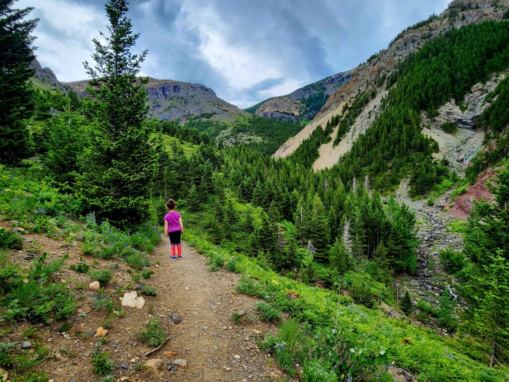
Section 1: The Forest
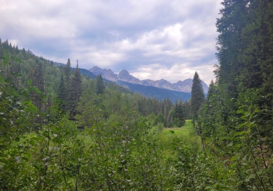
The trail begins along a narrow path through small meadow and proceeds into a dense forest. Being in southern Alberta, the terrain is significantly different than that around Calgary or Banff. The air is humid, and the flora is lush.

This section lasts around 1.5km through the forest and slowly climbs over tree roots and loose rock, before emerging between two mountains.

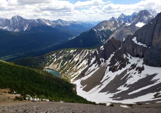
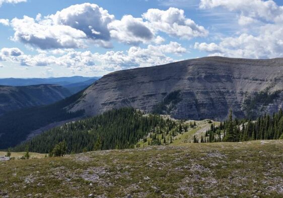
This valley is open and has a bench to sit on to catch your breath and admire the views. Along this area, it’s common to see mountain goats or sheep. I managed to see a family of 6 climbing up the mountainside.

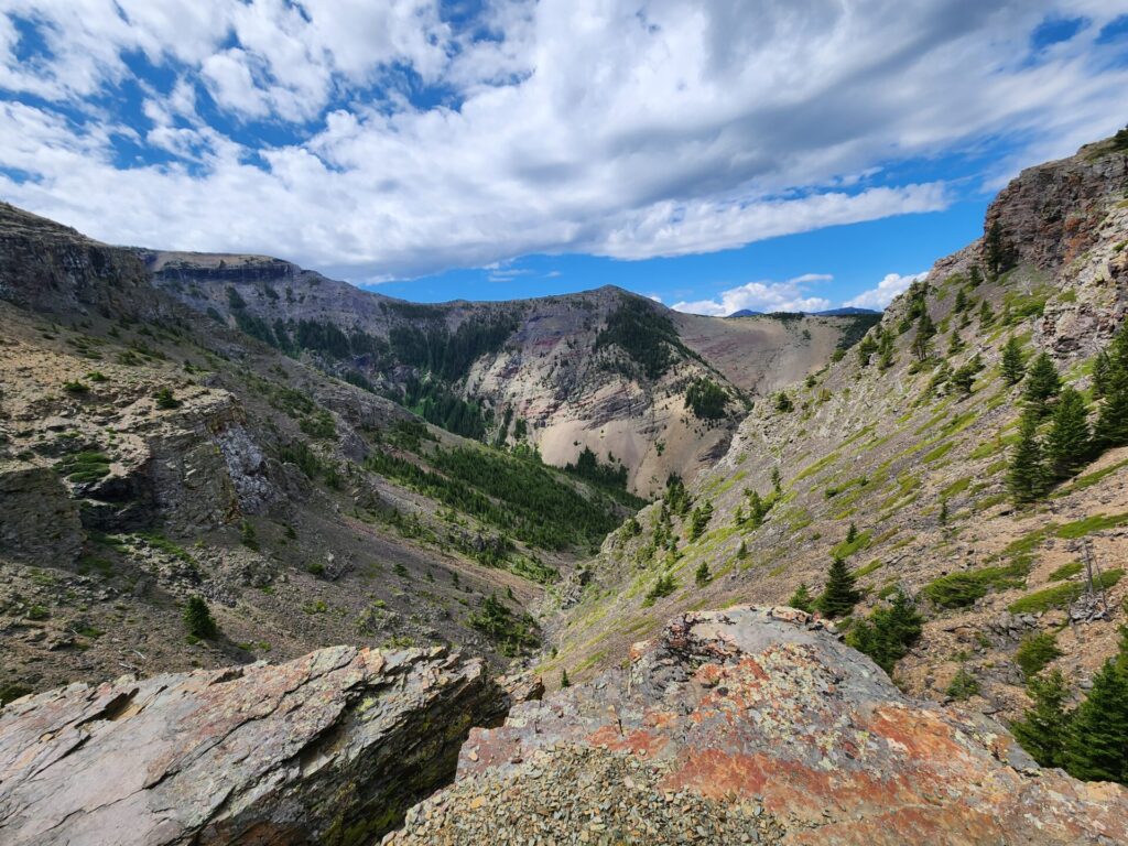
Section 2: Dried Riverbed
The second section of the trail is through a dried riverbed between the two mountains. This area is incredibly rocky and requires some minor scrambling over boulders. There is a smaller creek that runs alongside the rocky area, which can be used to refill water bottles.

Going up is a lot easier but will require the use of your hands in some areas.
Hot Tip: This is one of the more challenging sections on the return journey, especially if the rocks are wet. The loose rock can also move under your feet, causing mini rockslides.
This can be incredibly dangerous for the receiving person below. Many people underestimate the loose gravel and rocks and believe any footwear (i.e., VANS or flat-footed shoes) are acceptable on mountain passes. This is not something I recommend, as I have been hit by loose rock in the past.
If you see these sorts of people on the trail or any trail, just keep your distance or let them pass. It’s safer that way.

Once you are finished climbing the riverbed, the trail will lead to the left-hand side. There is a ledge that provides an excellent overview of the steep area you just ascended from. I would recommend having lunch here as the wind picks up significantly once you reach either of the 2 mountain summits.

Section 3: The Climb to the False Summit
The real climb begins in this next section, just past the 2.5km mark. This area is once again rocky, but mostly just loose gravel. I personally find gravel more hazardous than rocks, as I am more prone to slipping, regardless of what shoes I am wearing.


The climb up is slow and provides litter shade covering. Continuing following the red markers up towards another viewpoint for approximately half a kilometer.

The final climb to the false summit is steep and has several little paths you can take. Find the one that works best for you. Yield to those coming down, as it’s much harder for them to control the descent.

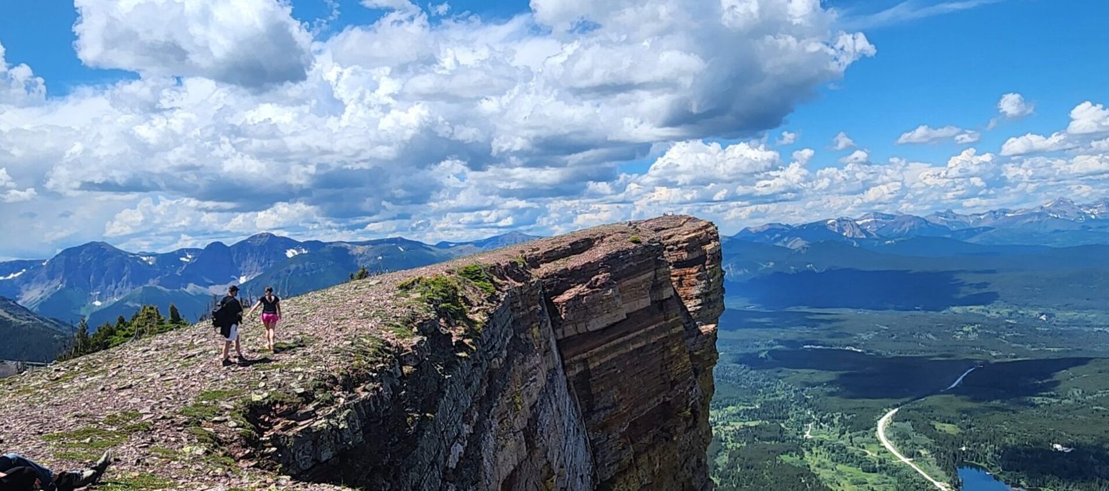
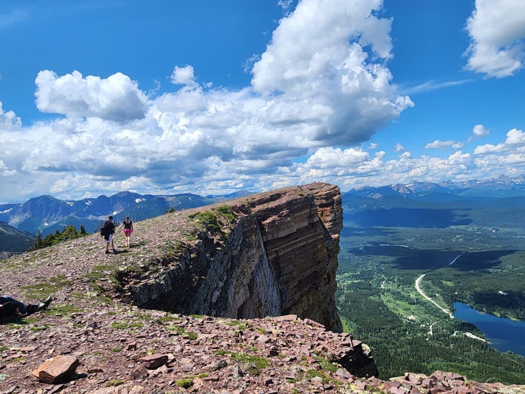
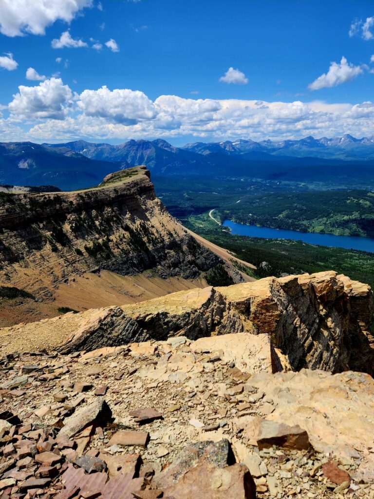
This beautiful false summit along the ridgeline is where most people stop their journey. While these views are similar to what you would see at either summit, it’s not the official end of the journey.

Section 4: Table Mountain Summit
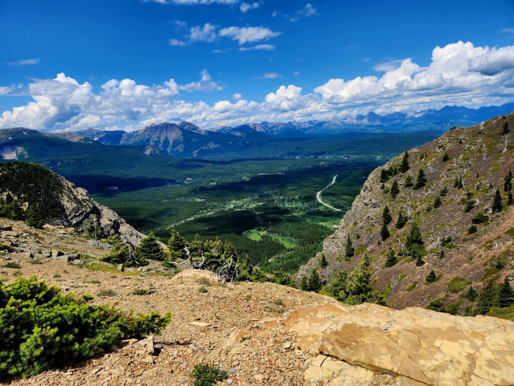
To reach the true summit, continue along the ridgeline towards the plateau for 1km. There will be a small trail that leads up a hill towards the back side of the mountain and connects to another forest.


Enter the sparse forest and continue up the trail for another half kilometer to the true summit.

While the hill appears to gradually climb, it stops very suddenly at the peak. Catch your breath, enjoy the views, and be very careful close to the edge.

The Descent down Table Mountain
There are two routes to make your way down the mountain. The first is going back the way you came, retracing your steps.
The second route is from the false summit and goes slightly “off path” down a steeper slope. This route is quicker than the original way but passes through a lot of loose rock. I wouldn’t really recommend this route as it poses more of a risk, especially with children.
I have taken both routes and would suggest the original route. While the route is longer, the path is more defined and consists of switch backs, allowing for a more gradual descent.
Interesting! The view from the top is so appealing. I rarely go for such hikes, but love reading about the experiences, and, of course, looking at the photos.
Wow! This hike looks incredible! I’d love to do it and bring my family with too. Also, don’t you hate a fake summit?! Glad you guys got some epic views 🙂