The Rota Vicentina is a series of hiking trails that covers the southwestern corner of Portugal. One of the more popular routes along this network is The Fishermen’s Trail.
This world-famous multi-day trek passes by remote beaches, jagged cliffs, and quaint seaside towns. While this trail can be broken anywhere between 4 to 13 stages, this hiking guide will outline details for the original 75km route from Porto Covo to Odeceixe.
For more details on completing the entire 13 stage trail, be sure to check out my complete my guide from S Torpes to Lagos.
Disclosure: I only recommend products I would use myself and all opinions expressed here are my own. This post may contain affiliate links that at no additional cost to you, I may earn a small commission.
table of contents
The Fishermen’s Trail Practical Information
- Where: 75km from Porto Covo to Odeceixe
- How Many Days: 4 days
- Type of Hike: Point to point
- Facilities on Route: None
- Accommodations: Guest houses and hostel available
- Fitness Level: Moderate
Best Time to Hike The Fishermen’s Trail
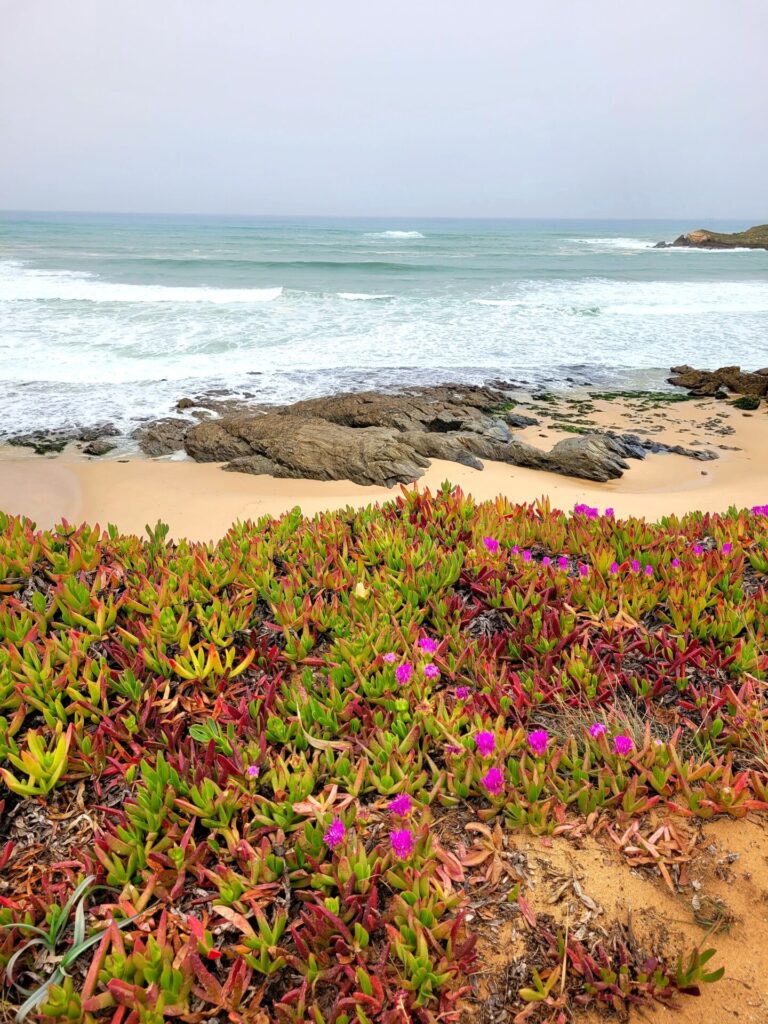
Spring (March- May) and autumn (September to October) are the ideal seasons to hike along the Fishermen’s Trail. Temperatures are getting warmer as the spring proceeds and wildflowers are in full bloom along the coast.
The trail is quite exposed at times and very little shade is provided. Hiking during the summer is possible but would be quite uncomfortable and hot, not to mention crowded with people.
Winter in Portugal is also mild but does bring rain. The route will be quieter, and you can benefit from lower rates for hotels and hostels.
I hiked the Fishermen’s Trail in late March. The weather was mild (t-shirt weather with pants) and I was fortunate enough to encounter only a single thunderstorm on the last 4km of my hike. Early spring is prone to mud slides on the coast, so don’t be surprised if there are detours along the route.
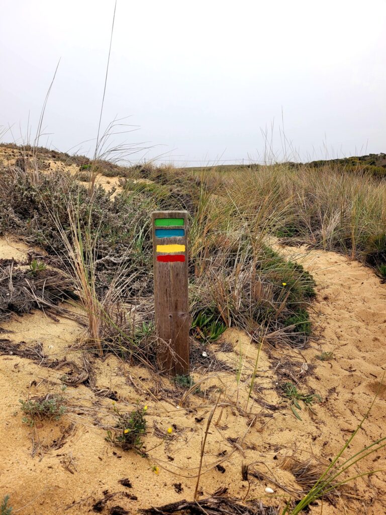
Trail Markers
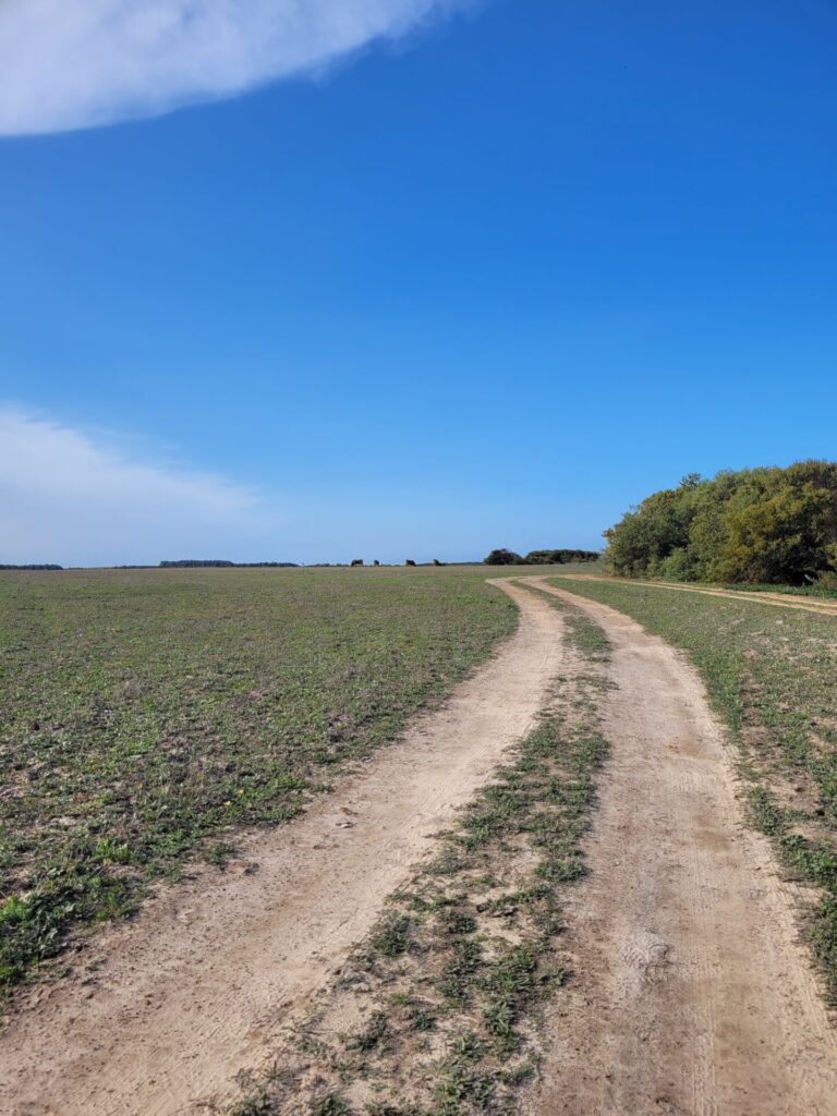
Blue and green trail markers can be found throughout the Fishermen’s Trail, making it easy to navigate the route. These markers can be found on fences, wooden posts, or rocks.
At the time of hiking, the original trail had a few detours for trail preservation and to avoid areas with a higher risk of mudslides. These deviations were clearly marked out and eventually met up with the main trail.
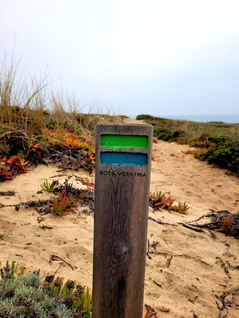
The markers will sometimes send the hiker away from the coastline area. This is apparent on day 1 from Porto Covo to Nova de Milfontes. I believe this is done to preserve delicate areas of the land. So, while you can technically follow the coast the entire way down, please respect the signage and follow the detours.
Other trail markers can be found throughout the journey along the Rota Vicentina. Red/white markers indicate the Historical Way, while yellow/red are for the Circular Routes. Some of these paths intertwine with the Fishermen’s Trail.
If you aren’t comfortable just following markers, I recommend using the AllTrails app. Routes and maps can be downloaded and used offline before your trek. It also has a feature where it notifies you anytime you go off route. As a directionally challenged individual, this app was a game changer for me.
Luggage Transfer Options
Vicentina Tranfers is a luggage transfer company that services routes along the Rota Vicentina. They will transfer oversized luggage to and from your accommodation for each stage of the journey.
Rates start at 15 EUR per section and include 2 bags. A representative will email you all the details regarding drop-offs. Typically, you will leave your tagged luggage at reception before 9am each morning. Luggage will be delivered to your accommodation each night before 4:40pm.
I used this service and was more than happy to give my back a break.
Alternatively, some local hostels can also arrange for luggage transfers (ex: Almograve Beach Hostel for 20 EUR).
Getting to The Trailhead at Porto Covo
Most people begin their journey to Porto Covo from Lisbon. The Rede Expressos bus runs anywhere from 3-6 times a day to the small seaside town, depending on the time of week.
Tickets can be bought in person on site, or online. To avoid lineups, I recommend buying the tickets online and getting to the bus station at least 20 minutes before your expected departure.
The buses are comfortable, and some even offer WIFI.
Bus Details
Rede Expressos: Bus #78
- Location: Praça Marechal Humberto Delgado, 1500-423 Lisboa, Portugal
- Route: Lisboa (Sete Rios) to Porto Covo
- Time: 2hr 10 mins
- Price: 16.5 EUR one way
I’d recommend staying at least one day or overnight in Porto Covo before starting the trek. This gives you plenty of time to stock up on supplies and rest before stage one. This first stage requires trekking over sand for 90 percent of the way and makes for a very tiring day.
Accommodations in Porto Covo
Stage One
- Route: Porto Covo to Nova de Milfontes
- Distance: 20km
- Time: 6-8 hours
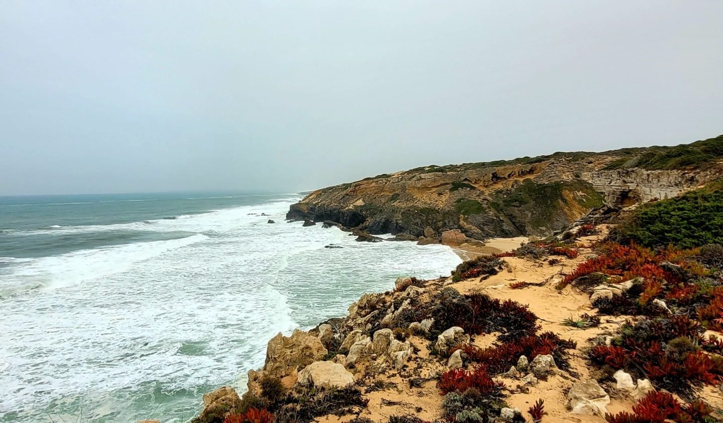
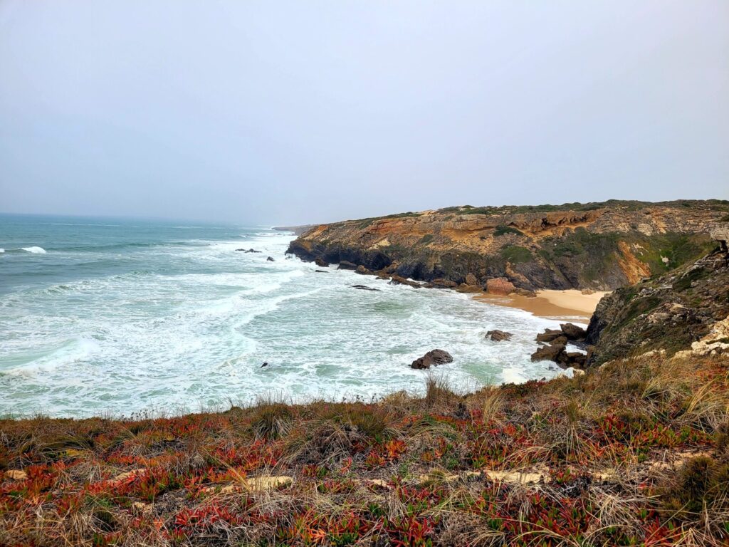
The trail begins in the southwest corner of Porto Covo, just past Praia da Baia de Porto Covo. The small trail will lead out of town and hug the coastline for the next 19.5km. Many trails (Historical and Circular) will intersect in this area, so make sure you are following the blue and green markers.
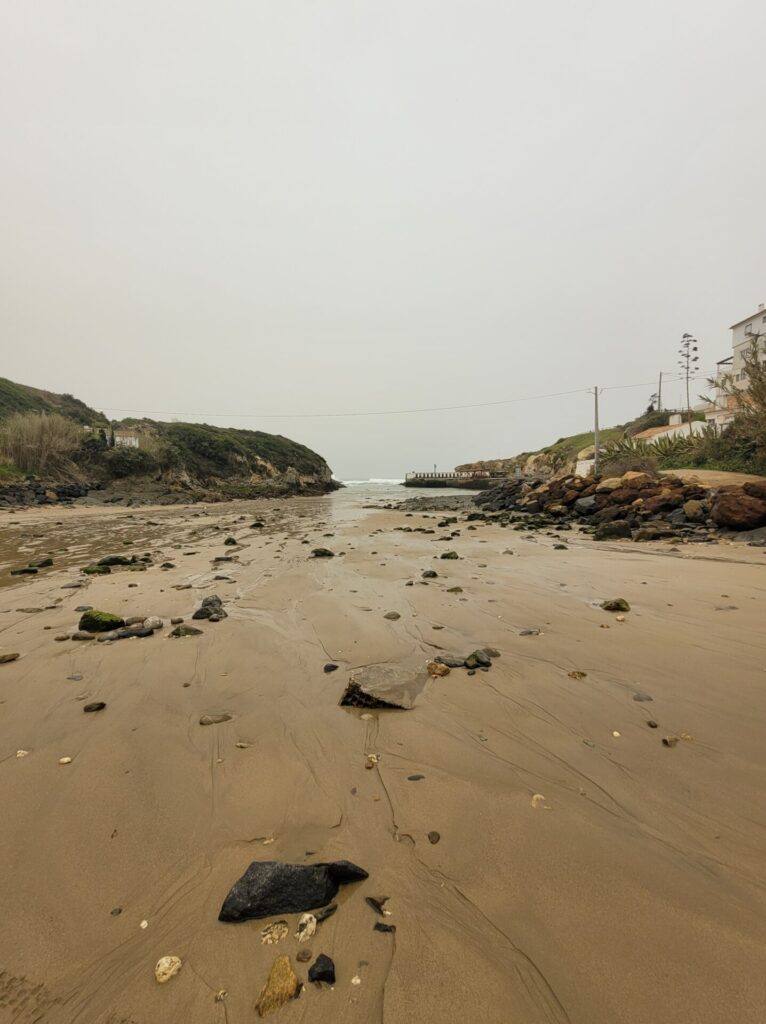
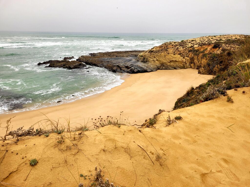
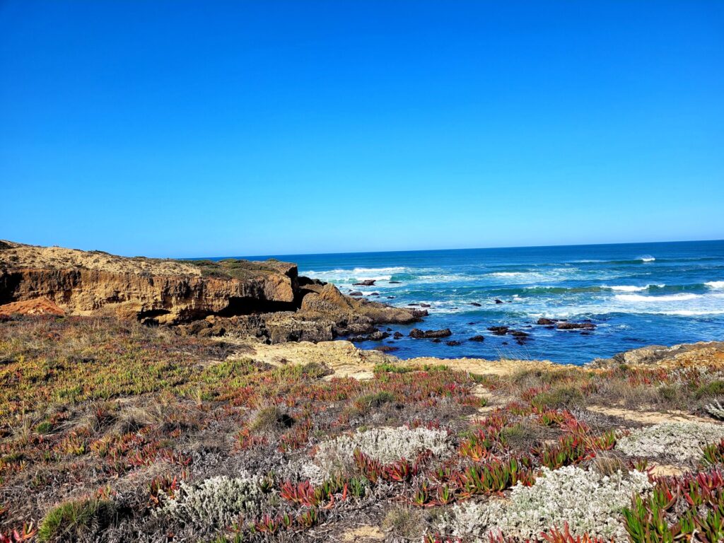
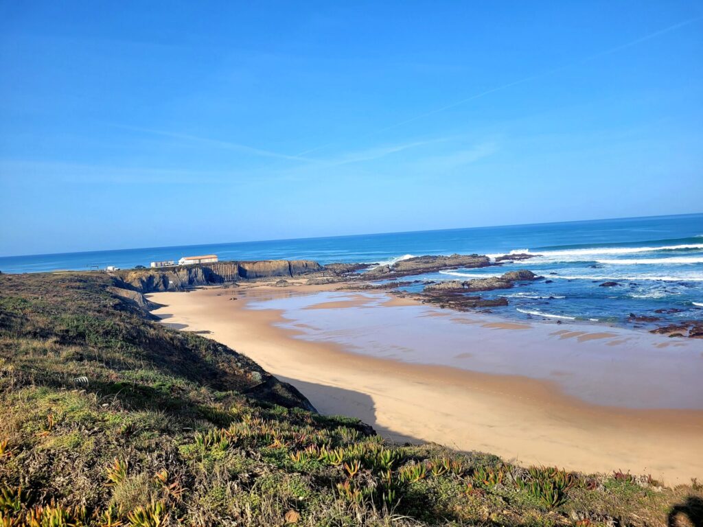
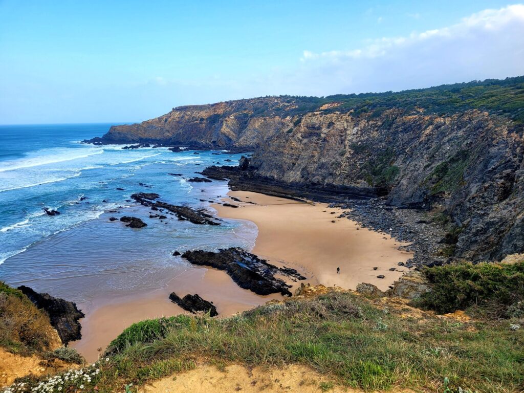
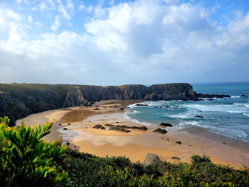
There are many beaches and hidden coves along with the first stage. Most notable is Praia da Ilha do Pessegueiro, located approximately 3.5km from Porto Covo. This 2km beach is the first of many potential beaches to walk across along the Fishermen’s Trail.
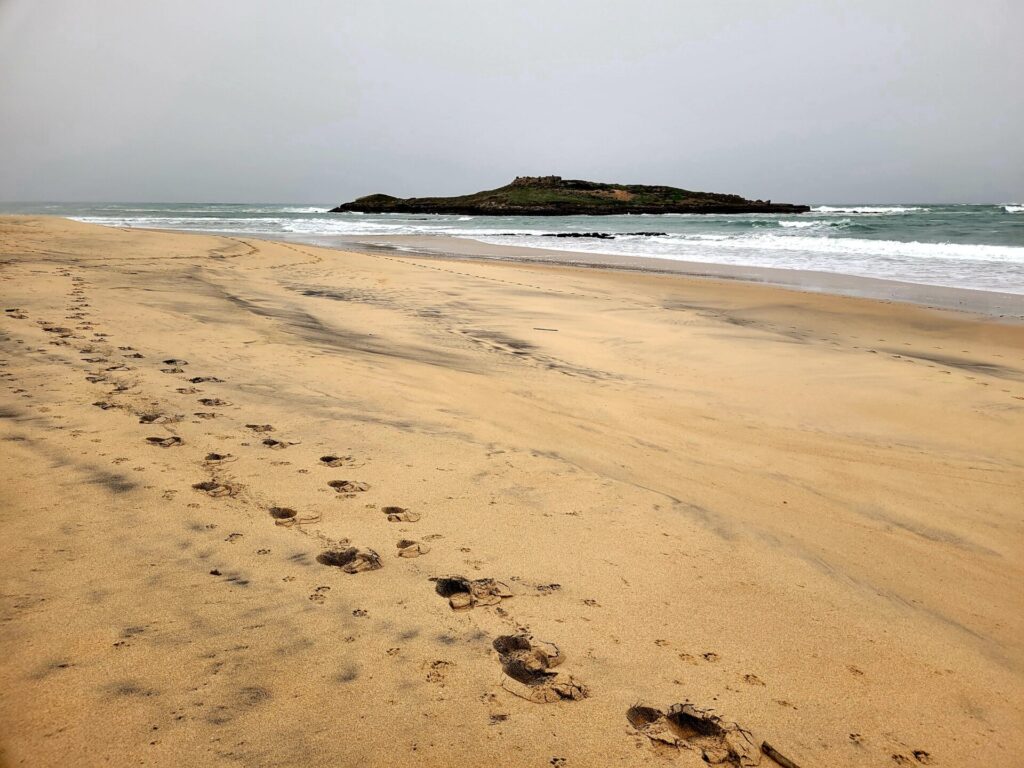
Several ruins can be seen across from the beach on a tiny island. There is also another fortress, Forte de Nossa Senhora da Queimada on the far end of the beach. This is a great place to catch your breath and rest your feet.
After passing by several other beaches, including Praia do Queimado and Praia dos Aivados, the trail will turn inland and venture into sand dunes for the next 2-3.5km. This path isn’t marked as frequently, but signs indicating the distance are noted.
I’d recommend having a lunch break at one of the beaches slightly off course. There are many little paths that venture out of the sand dunes towards the coast. Praia do Malhão is particularly beautiful and located half a kilometer from the sand dunes. This beach is around 2km long and will reconnect with the path in the parking lot.
The trail resumes along the coast, passing by 4 more smaller beaches. Around 16km, there is a small fishing harbor and restaurant, Porto das Barcas. This is a great place to grab lunch before completing the last 3-4kms towards Nova de Milfontes.
Follow the backcountry road into town where you will end your first day of hiking.
Accommodations in Nova de Milfontes
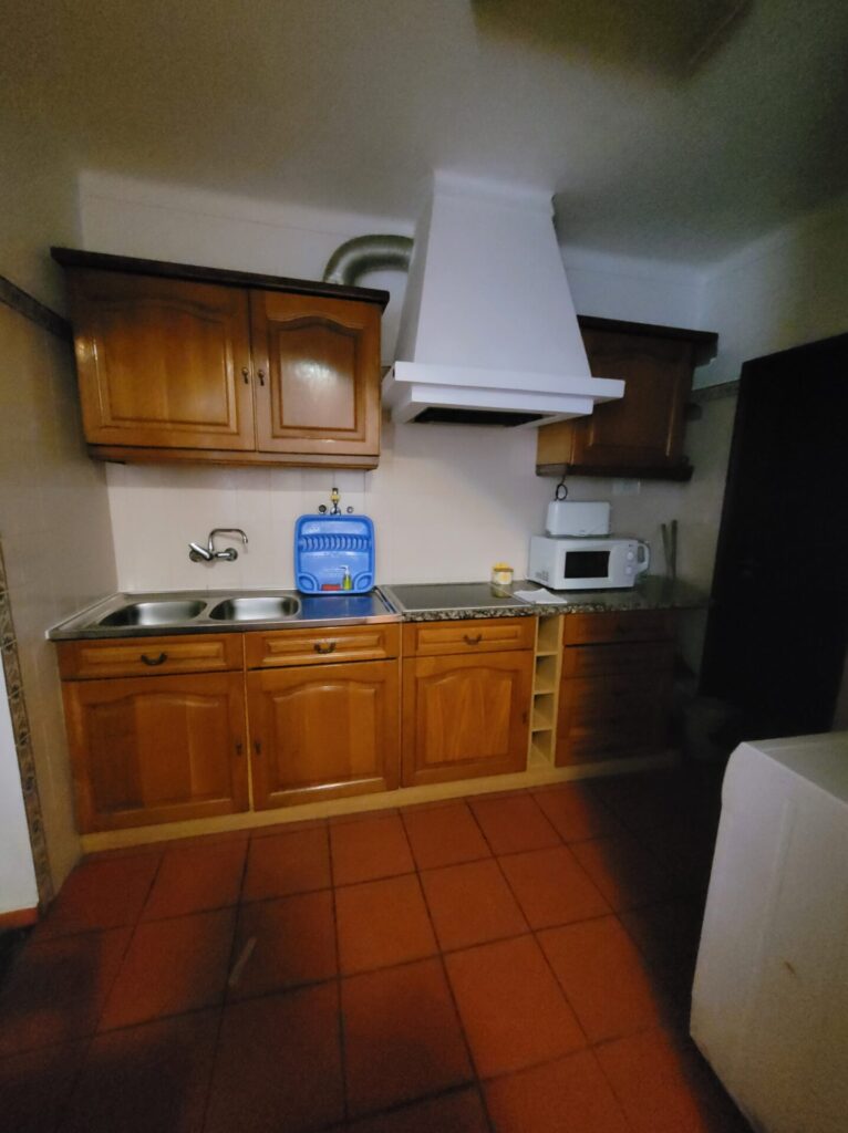
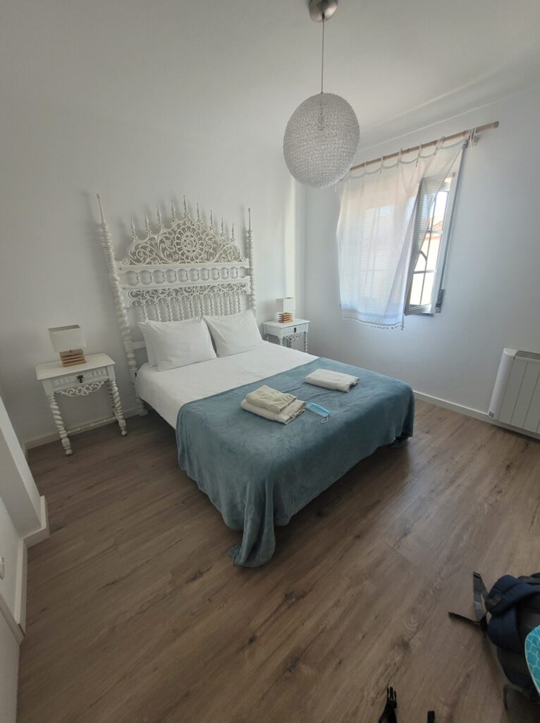
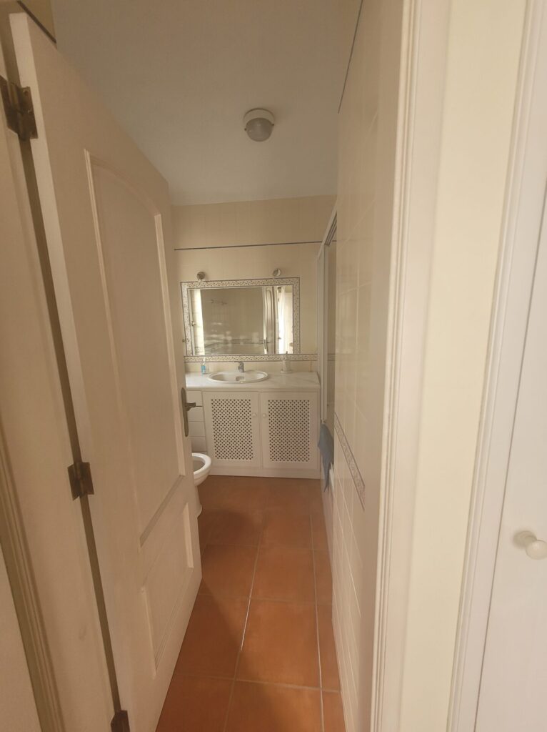
I stayed at Apartamentos Pátio Victória – by Portugalferias. This self-catering apartment was spacious, came fully stocked with kitchen utensils, cooking supplies and a fridge.
Stage Two
- Route: Nova de Milfontes to Almograve
- Distance: 15km or 11km (with ferry)
- Time: 4-5 hours
Stage 2 is the shortest of the days along the Fishermen’s Trail. There are two options to begin the day from Nova de Milfontes: take the ferry across Mira River (and save yourself 4-5km) or walk through town, taking the bridge across the river.
The Bridge: head northeast out of town along R. Custódio Brás Pacheco. At the traffic circle, turn right and walk down N393. After crossing the bridge, continue for around 1km before turning right onto the footpath. This route will lead towards Furnas Beach and continue onwards.
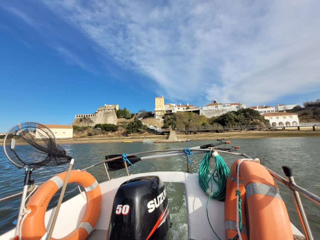
The Ferry: fromForte de São Clemente, take the stairs down towards the dock. There are usually signs before the fort indicating the ferry for Maresia Taxi Boat. The crossing takes approximately 10 minutes and costs 5 euros per person (4 euros in the high season). The only payment accepted is cash. You will be dropped off on the northeast corner of Fumas Beach. Services run from 9am-4pm during the low season and 9am until 7pm during the high season (June to September). I wanted to give my legs a break and opted for the ferry ride.
From the beach, the path travels slightly inland, walking Alongside farmers’ fields and small wooded areas. Please be respectful and stay in the designated areas. I witness some fellow hikers walking through the farmers’ fields, trampling over produce.
This stage requires less sand walking and follows more dirt paths, making for an easier journey. Weaving between the treeline and coast frequently.
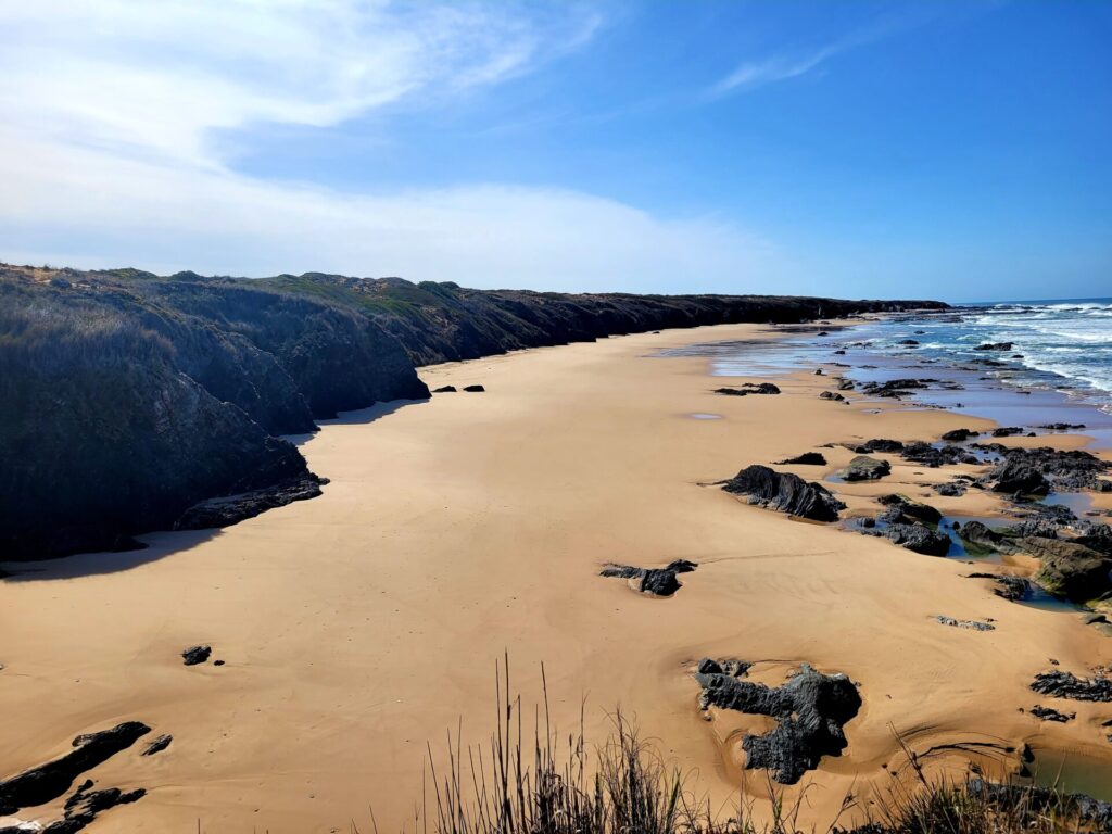
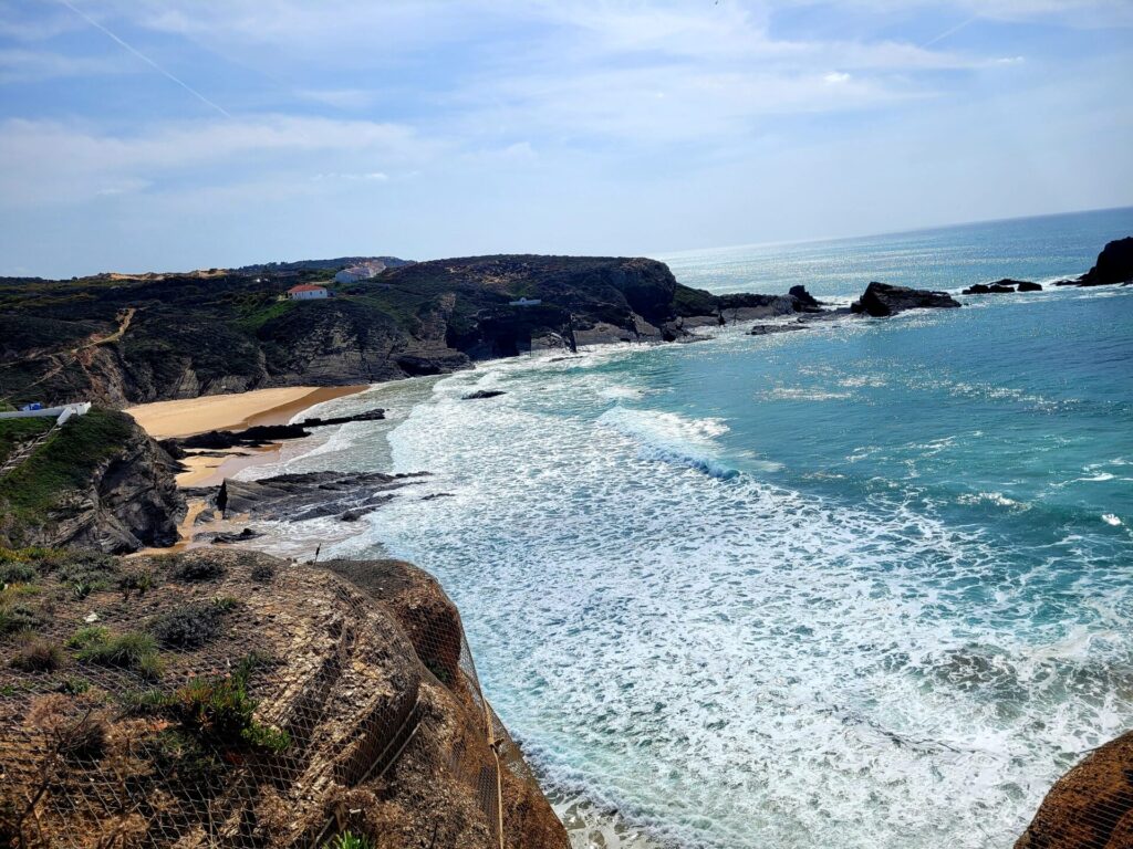
Around 11-12km from Vila Nova de Milfontes is a small detour to Praia do Brejo Largo. This beautiful beach is usually difficult to reach from neighbouring towns, making it ideal to relax in peace. Just be cautious near the water, as the waves can be extremely high during certain times.
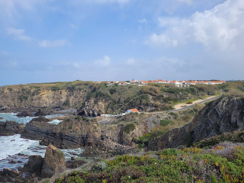
Continue inland along the back rounds, before connecting with Rua do Chafariz, which will take you into the beautiful town of Almograve. Rest your legs on Praia Grande de Almograve before calling it a night at your accommodation.
Accommodations in Almograve
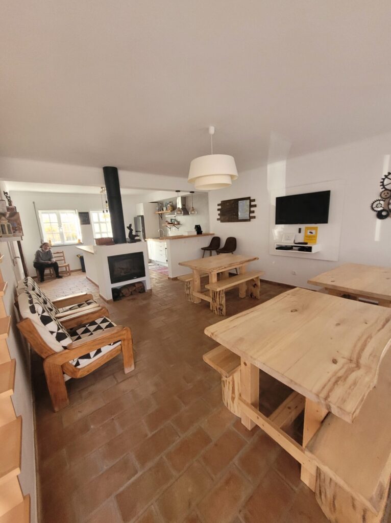
I stayed at the Almograve Beach Hostel. The entire place was warm and welcoming. The staff were friendly and provided a a warm cooked breakfast. The bedroom also came with an ensuite and it was located by restaurants and shops.
Stage Three
- Route: Almograve to Zambujeira do Mar
- Distance: 22km
- Time: 6-7hours
Leaving Almograve, head north along Rua dos Moinhos. This route will lead along the hidden bays and coves of the beautiful town. This path will head back south and proceed down Estrada do Porto das Lapas das Pombas for approximately 2km.This road is a mix of gravel and sand. Watch for cars, as they can bring up a lot of dust.
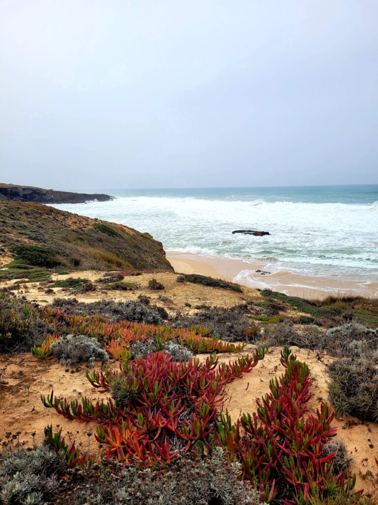
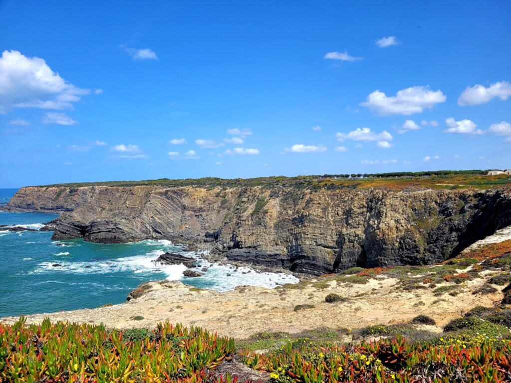
The trail leaves the road and continues hugging the coast for the next 2km, providing spectacular views of the rugged and wild coastline.
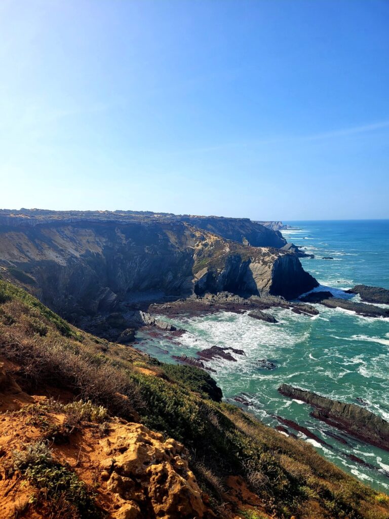
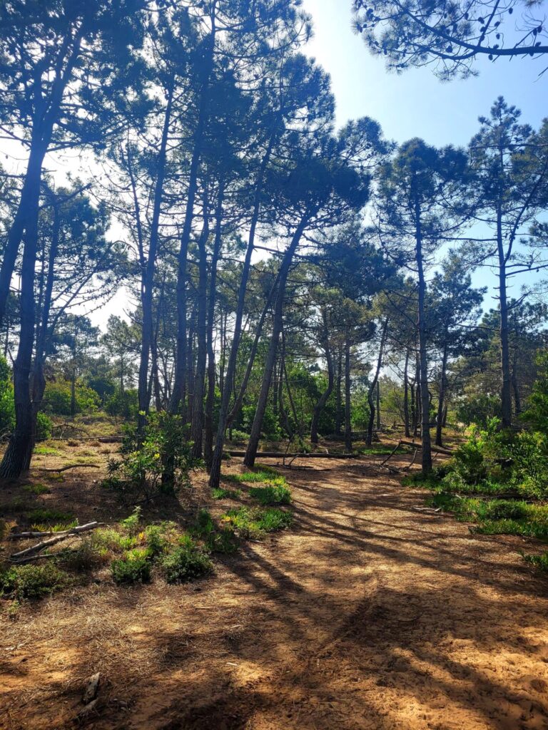
The path moves inland, through pine forests to avoid erosion along the coast. This forest is a nice change from the exposed, sun blistering coast. The trail is easy going, provides shade and a great place to stop to catch your breath.
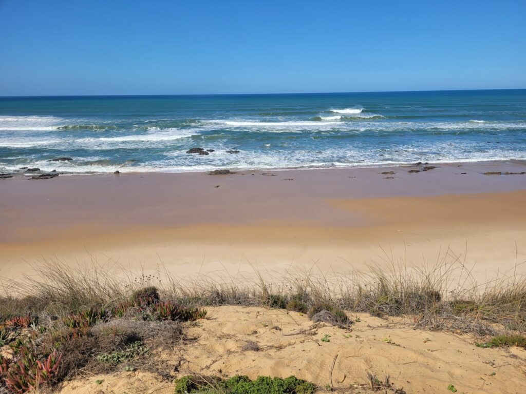
Before long, you will be back along the coast, before briefly moving inland through the small town of Cavaleiro. Follow the coast for the next 7km, passing by Praia da Lavaguiera and Praia do Tonel.
The next 2km is along CM1158, which can be very busy at times. This route is hard, as the road is asphalt and hot. It’s not very scenic either, making for a rather boring loud walk.
The trail will deviate from the road and turn towards the coast again, this time accessing Zambujeira do Mar from the west side.
Rest your feet on the main beach before heading to your accommodation.
Accommodations in Zambujeira do Mar
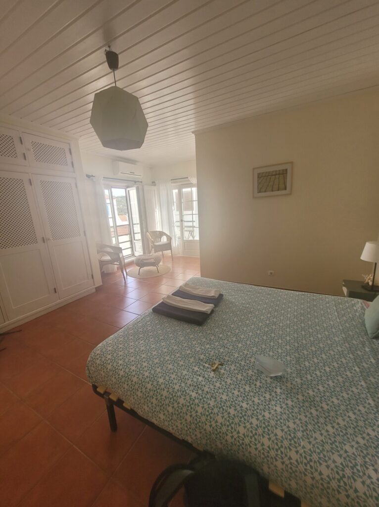
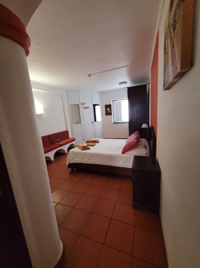
I stayed at Hakuna Matata Hostel. My room was massive and included a private bathroom, sitting area and balcony.
Stage Four
- Route: Zambujeira to Odeceixe
- Distance: 18km
- Time: 5-6hrs
This last stage of the hike has a healthy mix of roads, coast and treeline trails to follow. Some areas were closed off due to erosion and preservation on the coastline. Follow the detours along the roads.
Head south out of town and into the hills, walking along boardwalks and descending through beaches. Notworthy beaches include Praia dos , Alteirinhos, Praia dos Machados and Praia do Carvalhal.
There is one small town to pass through along this route, Azenha do Mar, located approximately 9-10km from Zambujeira. Stop off for snacks before proceeding on with the trail.
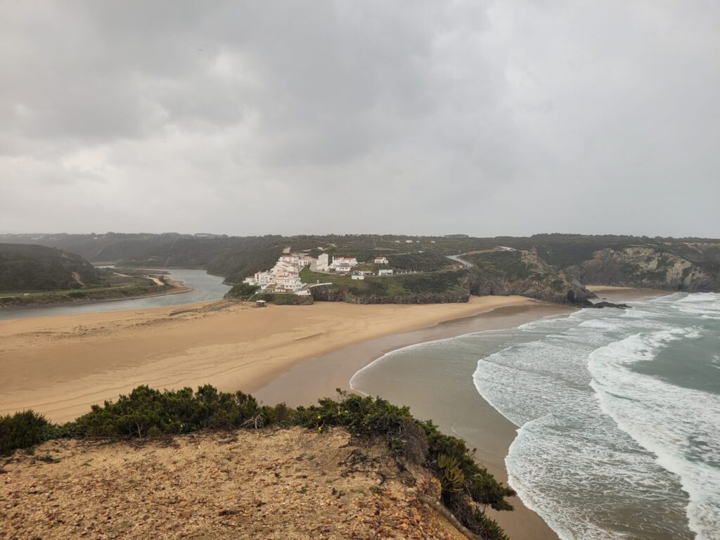
Once past Praia de Odeceixe, the final inland journey begins. This route is around 4km, along small roads to reach the town of Odeceixe.
I unfortunately encountered a thunderstorm during the last 4km and was exposed to the elements with little coverage. Plan for the unexpected, as there aren’t a lot of places to hide from the storms once you enter the last lag of the trip.
Odeceixe marks the end of the classic Fishermen’s Route.
Accommodations in Odeceixe
I stayed at the Sudoeste Guest House and also visited the Bohemian Antique Guesthouse. While Sudoeste had everything I needed (kitchen facilities, private bath, hair dryer), the Bohemian had a certain charm about it. I’d recommend either location.
Further Exploring
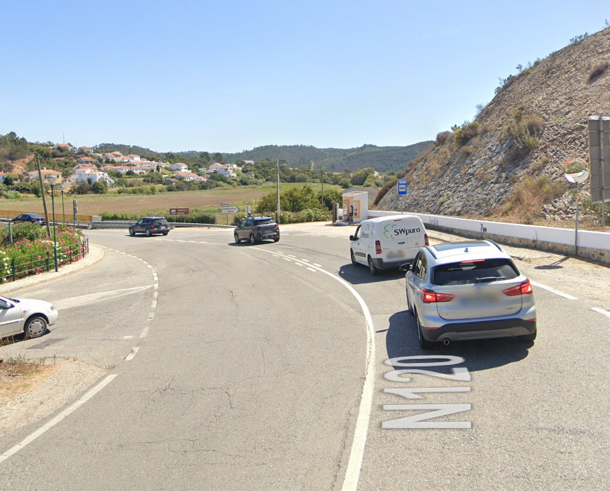
LAGOS: EVA Transportes and Rede Expressos both offer services to Lagos, which is about an hours drive south. EVA leaves from the main station inside Odeceixe.
LISBON: The bus stop for Rede Expressos is located on N120, right before the bridge leaving the village . The price to return to Lisbon is 18.5 EUR and takes around 3hrs 10 minutes.
Additional Resources
Rota Vicentina, the official site, is an excellent resource for maps, accommodations, trail tips, restaurants and general information about The Fishermen’s Trail and other trails along this amazing network.

Stunning photos.
Thank you!
Wow! What a great detailed guide! Makes me want to go visit!
Your pictures are so pretty. Thanks for the great tips!
So informative!! Thank you for sharing!! Adding to my bucketlist!!!
We just left the Algarve and are now very sorry we did not find time to hike the Rota Vincenta. We certainly would not have done the whole 75km. But it would have been fun to do some parts of this interesting hiking path. Great that you got to have this adventure.
I absolutely loved that part of the Portuguese Coast, Algarve gets mostly all the credits but the Costa Vicentina is an absolute gem to discover! It makes me happy to see an article about this! I loved Vila Nova de Milfontes!
Oh lovely! I enjoyed Almograve the best
Wow this looks stunning!! The photos are amazing too! Definitely added to my list
Seems like such a picturesque hike – and with such functional accommodation facilities as well! Definitely adding it to my ever growing bucket list of hikes around the world 🙂
Very picturesque indeed!
Wow! The coast is absolutely beautiful! The Hakuna Matata looks like a great stay as well!
I don’t normally stay at hostels, but this one was massive and the owner was very welcoming
You are so adventurous. That’s perfect for me though because I get to enjoy your beautiful pics all along the way.
I would absolutely love to hike this path with a friend after my knee recovers. It sounds zen.
Portugal has recently been on my radar for hiking, so this is greatly appreciated! It looks like a great coastal walk and the accommodation en route looks superb!
Beautiful photos, this looks like such an incredible hiking experience.