Arguably one of the most scenic hikes in Kananaskis, Tent Ridge Horseshoe is a moderately challenging adventure with 360 degrees of breathtaking panoramic views.
This complete hiking guide will go over the basics and logistics of hiking Tent Ridge Horseshoe, along with some tips and tricks along the way.
Tent Ridge Trail Information
- Distance: 10.1km
- Elevation Gain: 828m
- Trail Type: Loop
- Difficulty: Moderate/Hard
- Washroom Facilities: None
- Required Permits: Kananaskis Conservation Pass
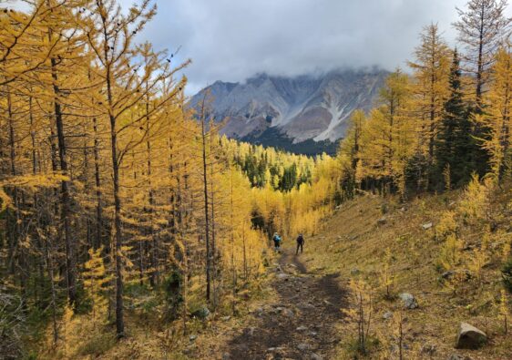
Best Season to Hike Tent Ridge
Tent Ridge is incredibly prone to avalanches on either side of the horseshoe. I visited in July and saw the destruction caused by a previous season’s snow slide. For safety concerns, I only recommend attempting this hike during the summer of months of late June to early September. The ridge is very exposed to the elements, so avoid hiking during rain.
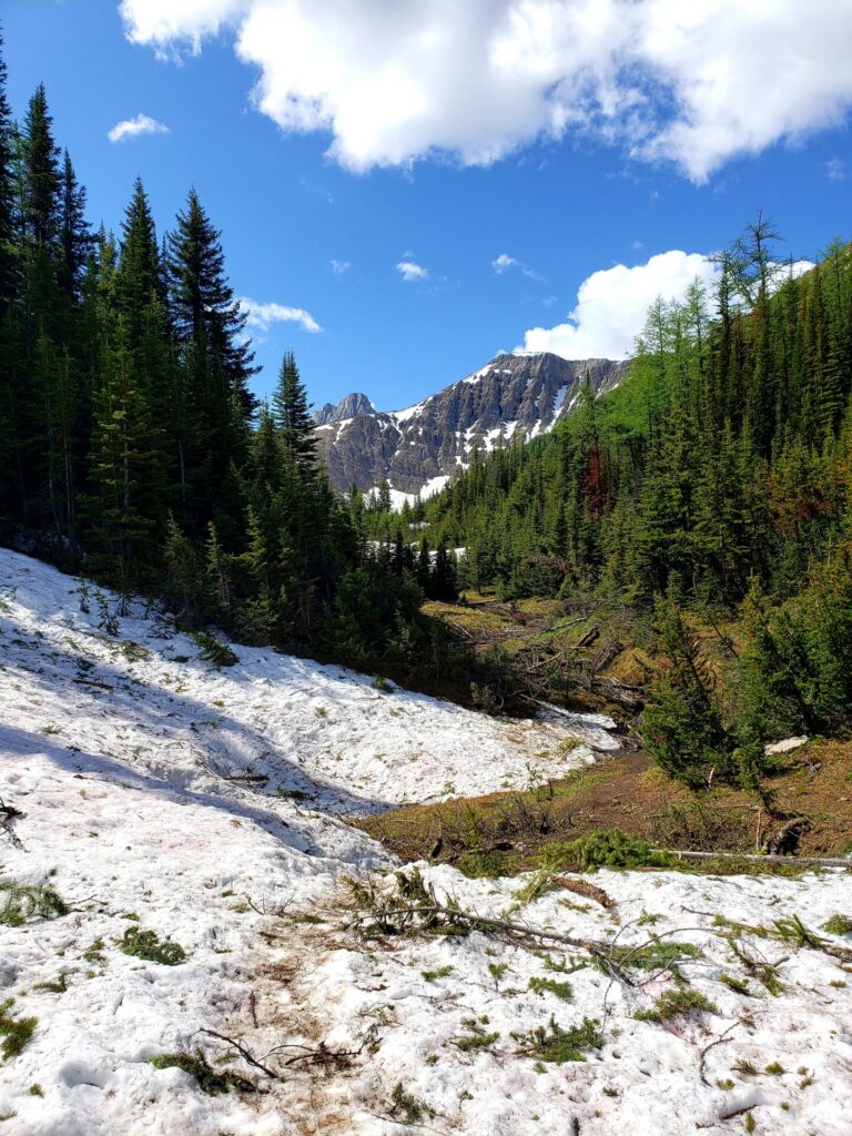
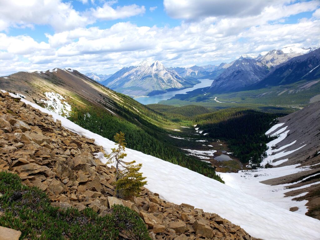
While the ridge itself should be clear of snow by late June, don’t be surprised to see deep snow in the forests and central meadow. We encountered snow up to our knees on the western ridge as we made our descent closer to the end of the trail.
Before heading to the trail, always check for avalanche reports.
Clockwise or Counterclockwise
One of the most asked questions regarding hiking Tent Ridge is which route you should hike: Clockwise or counterclockwise. At the start of the trailhead, I was advised by some seasoned travellers to take the clockwise route, and here’s why.
Clockwise will lead the hiker through a steep but manageable scramble up the east ridge. While this climb is a little tricky and exposed, the east ridge is safer to ascend rather than descend. This will, result in a descent down the west ridge, which is incredibly steep, often riddled with avalanche debris and can be covered in waist deep snow.
Ascending the west ridge is far more challenging than descending. The views will also be behind you the entire time, instead of in front, like the clockwise route.
To summarize:
Clockwise: Easier ascent up the east ridge and slow manageable descent down the west ridge.
Counterclockwise: Difficult ascent up the west ridge and a narrow unsafe descent down the east ridge.
Getting to the Trailhead
From the Canmore Nordic Centre, follow the AB-742 south, along the Smith Dorrien Trail. Turn right on Mt Shark Road and continue along for another 1.8km. Stay to the right past one more turn off and the Tent Ridge parking will be on the right hand side of the road. There is no official parking lot but plenty of roadside turns offs to choose from. This is a very popular route, so you shouldn’t have issues finding the parking.
To start on the clockwise trail, backtrack 250m down the road you drove.
There are no trailmarkers along the route, so ensure you have a map or GPS handy.
Plan your route here.
Tent Ridge Horseshoe Route
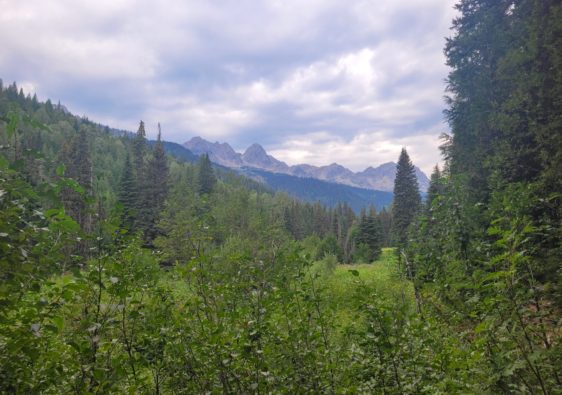
The trail begins through a slow ascend through the thick woods for the first 45 minutes. There are two intersections of trails along the way up. We missed the first one entirely and became unsure of which direction to take. There are no markers indicating which way to go, so one can easily find themselves on the wrong trail.
Both trail intersections lead to the main path as long as you stay to the right. The first intersection heads directly right and is the main path. If you miss this turnoff, you will continue heading left and come upon the second trail intersection.
Take a right, and the trail will take you north-west and meet up with the main trail. We lost about 30 minutes of time backtracking until another group of hikers set us in the right direction.
Taking the trail to the left will lead to the backside of Tent Ridge and towards Tryst Lake. This path does eventually climb up towards the main ridge, but it is very steep.
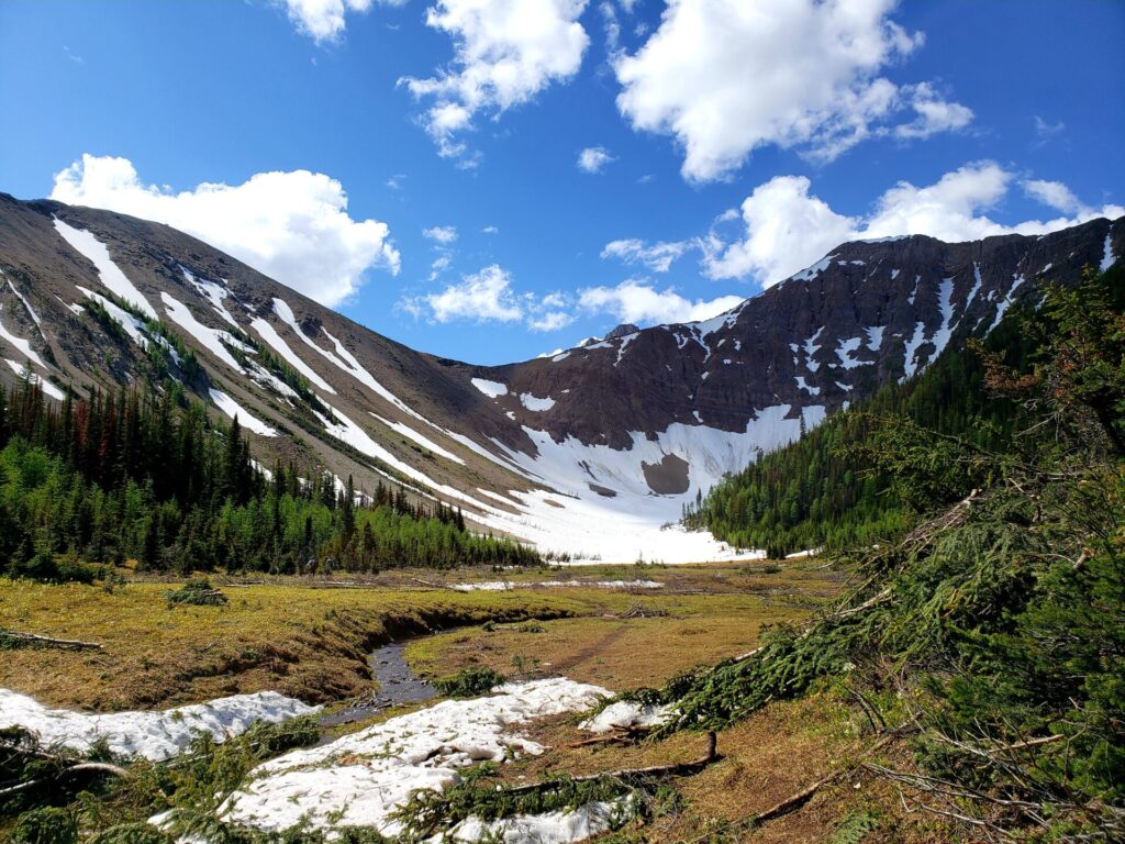
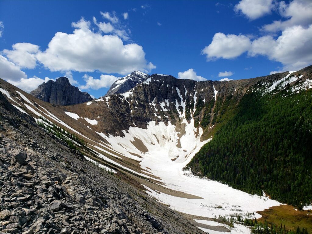
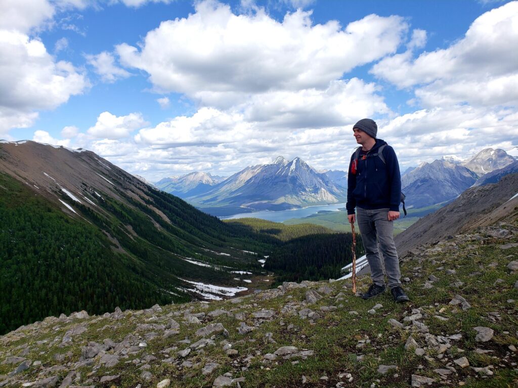
Breaking through the forest, the path will lead into a beautiful meadow and provides a hint of the spectacular views to come. This area (as seen in the pictures) was riddled with debris.
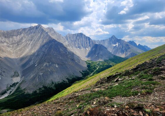
There is a small scrambling section after leaving the forest and meadow. While not a technical climb, this ascent does require some climbing and maneuvering around large boulders. The route is not clearly defined, but if you proceed up safety, all paths meet at the ridge.
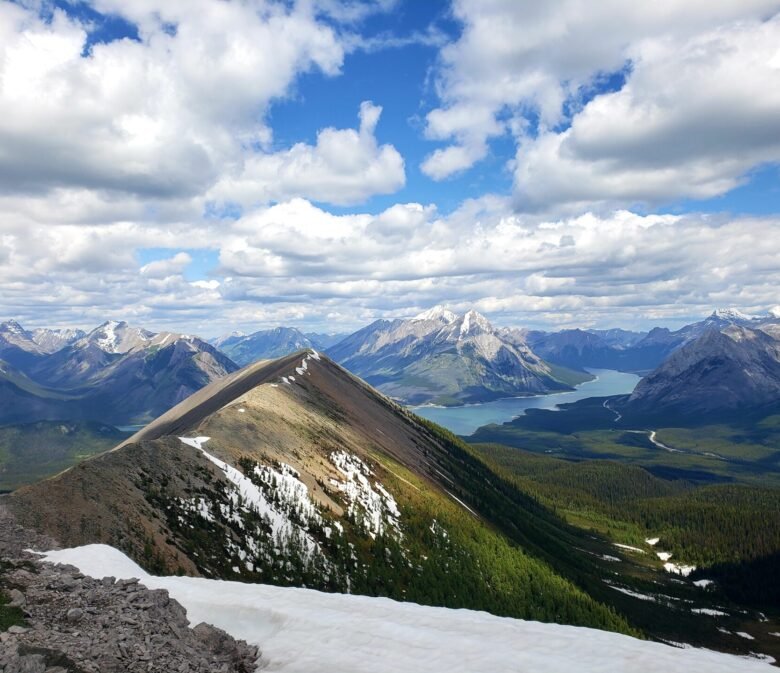
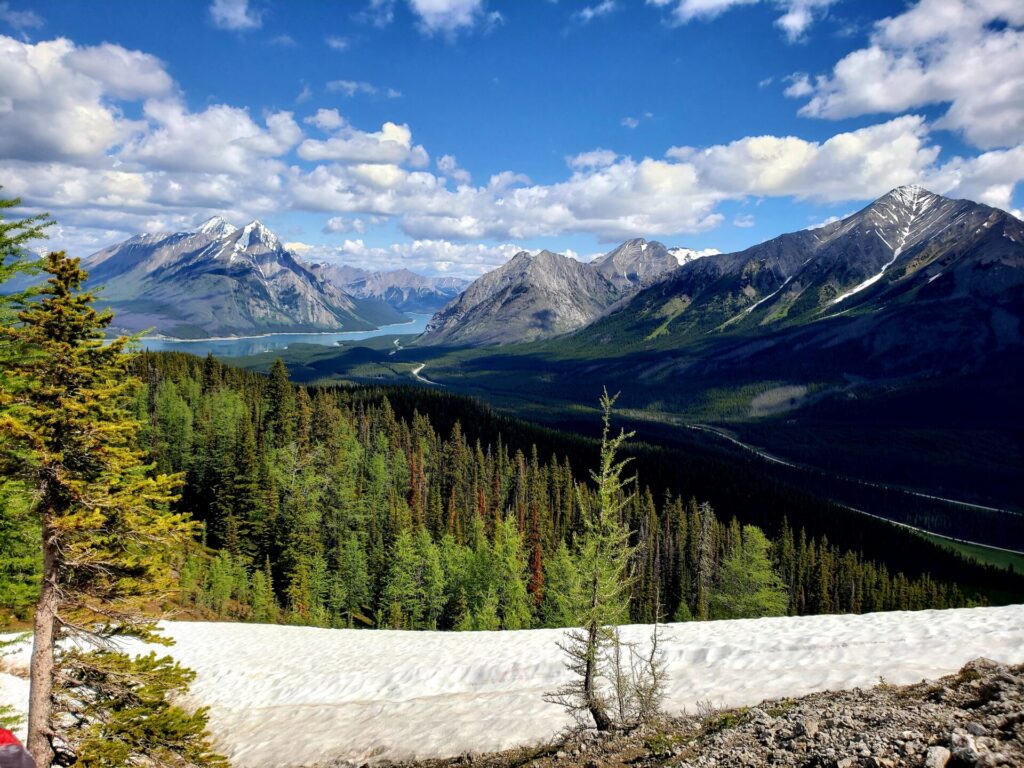
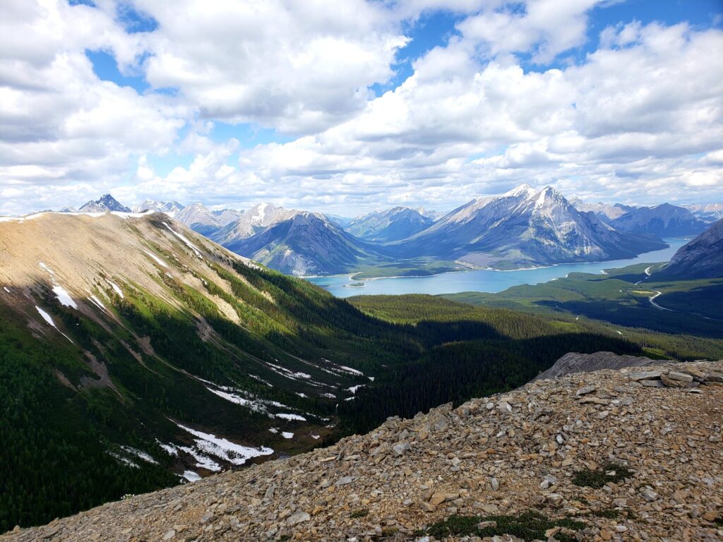
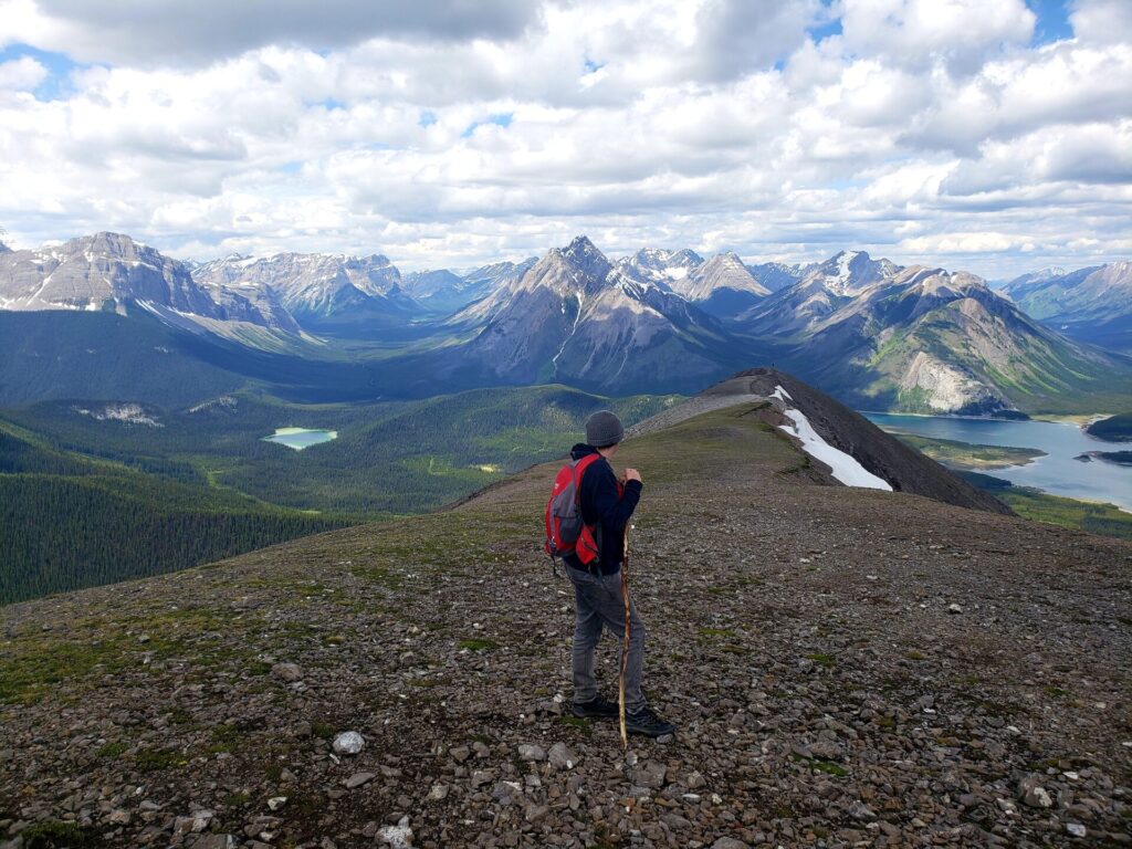
Once past the initial scramble, you will be greeted by 360 views of Spray Lakes Reservoir and surrounding mountains for the remainder of the trail on the ridge.
There are two peaks along the route. The first leads to a small weather station. Most people stop for lunch around the station before continuing. This portion of the ridge is quite wide, so there is plenty of space to stop safely for breaks or pass hikers.
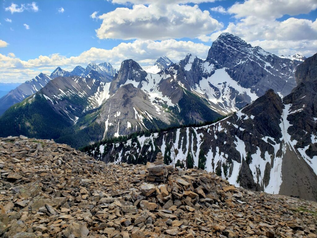
The trail continues along the ridge, towards the second peak and summit. This is probably the most intimidating portion of the hike. From afar, the path looks impossibly steep and narrow. Up close, well it’s also steep and narrow.
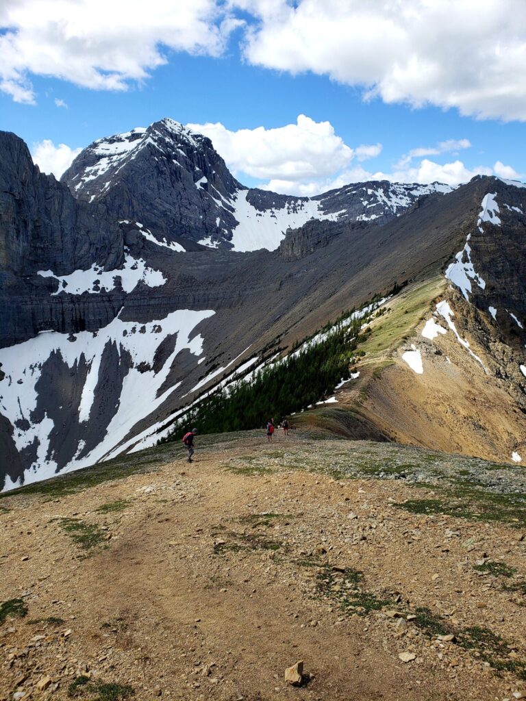
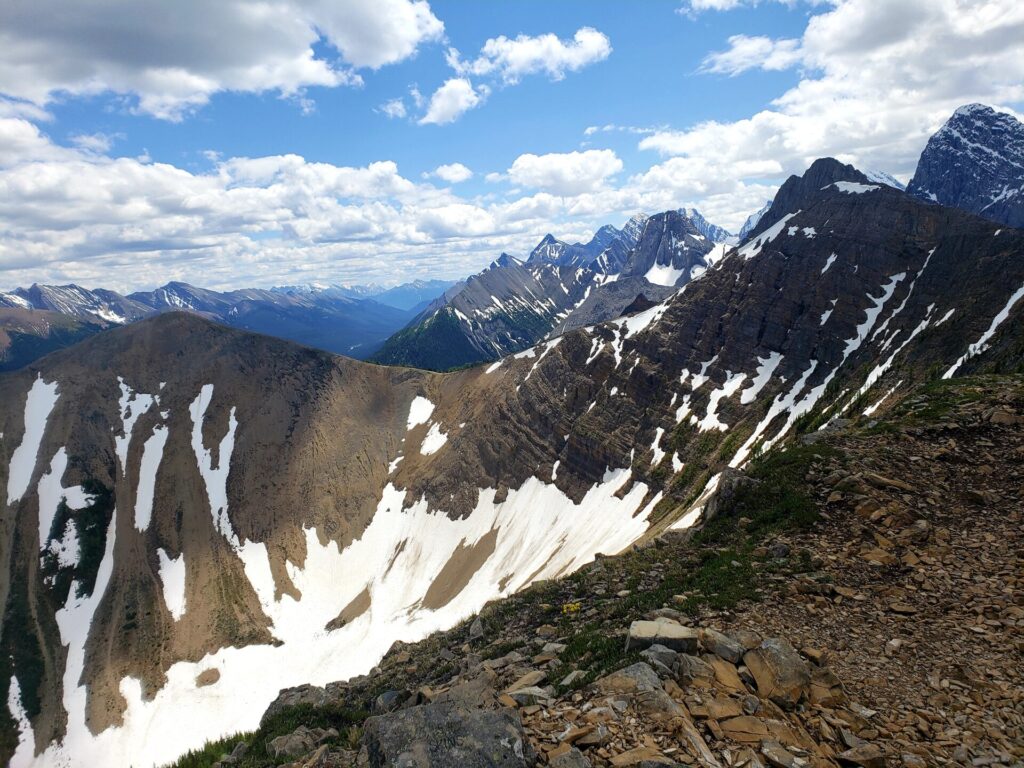
This next section of the horseshoe is very exposed and narrow. Granted this only lasts for about a quarter of the horseshoe section. Be extra cautious in this area, especially around other hikers. This section is probably not recommended for those who suffer from vertigo or have a fear of heights.
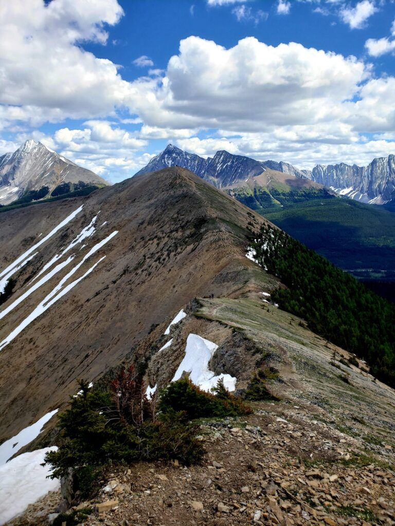
Past the exposed ridge, the trail will widen again and become less rocky. Large patches of soft grass cover the ridge and make for a warm welcome after the rocky narrow path. This trail slowly plateaus out for the remainder of the ridge walk.
Leaving the ridge, the descent back down into the forest can become a huge challenge. During my visit, I had to navigate myself through deep snow, some areas being waist deep. Tree branches and other debris from the avalanche were scattered throughout the path, making for difficult navigation.
I saw several hikers attempt to climb up this way (they chose the counterclockwise route) and called it quits halfway through the ascent.
Back on solid ground and into the woods, the path meets up with a logging road before leading back towards the main road and parking area.

I would definitely love to explore this area more. I grew up in Southern Alberta but haven’t developed a love of hiking until recent years. Lots of great hiking in Colorado if you ever get a chance to visit.
Amazing photos! I would really love to explore this area.
Tent Ridge Horseshoe looks like awesome and very scenic hike. Your pictures are stunning reflecting excellent views to the mountains. Thanks for sharing!
What a gorgeous area! I used to live in Calgary, and miss the beauty there.
What a beautiful place this looks like to hike. Adding it to my list.
What a fantastic area for hikers, you can’t so no to those epic views! I would love to see it during fairer weather when the ground is dry.
The experience looks amazing and you really can’t beat these views. I can only imagine a sunset around these gorgeous landscapes.
Wow Deirdre, these views are absolutely breathtaking! Thank you so much for sharing!
Gorgeous! Sounds like clockwise is definitely the way to go, though it seems like it’s a difficult one no matter which way you go. Thanks for the tips!
What a beautiful trail! Great advice on going clockwise – thank you for that!
I never even knew this hike was here! This is perfect as I’m getting ready for a road trip out that way this summer, I’m definitely adding it to my list! Thank you!
This post brought back some great memories for me. So beautiful and relaxing to be out there. Makes you realize how small you are in the grand scheme of things. Thanks for sharing!
Wow! These views are amazing! I need to go!
This looks like an amazing hike! Your pictures are stunningl, I would love to go hiking here.
Incredible! The world has such amazing places! I definitely want to visit some day!
I still haven’t done this hike after all these years! It’s some of my friends’ favourite hikes in Alberta. I’m hoping to finally accomplish it when we’re back home this summer! So much hiking to do in Kananaskis.
Tend Ridge Horseshoe looks like such a brilliant hike. Look at those views!! I’m wowed.
How wild and beautiful it looks! I’m not much of a hiker but I don’t mind walking. Thanks for sharing the lovely photos. It looks so peaceful!
It’s on my radar!
wow your pictures are amazing! I love this post, honestly. So informative! I have to add this trail to my hiking trails bucket list!
Woww these photos are gorgeous! Would love to do this one day 😍
Your photos are EXTRAORDINARY! Definitely adding this to my bucketlist STAT 🙂
Squeeee this one looks incredible for later in the summertime. It’s quite a lot of elevation gain but wooooow it looks worth it for those views. It looks like Marc and I need to spend more time in Kananaskis country!