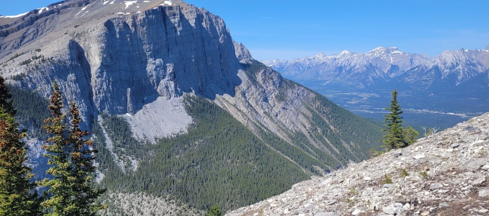
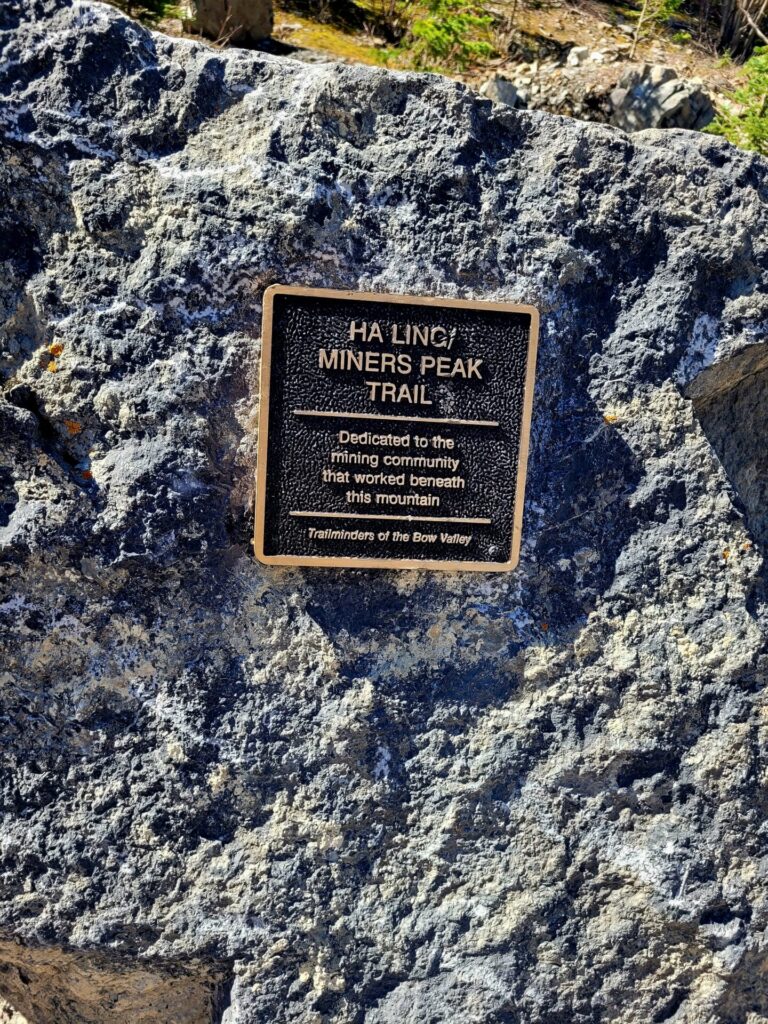
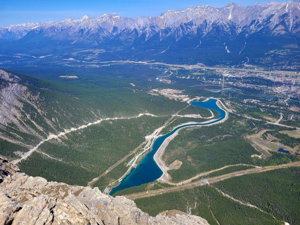
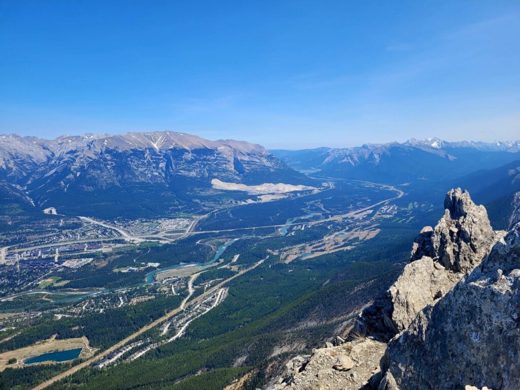
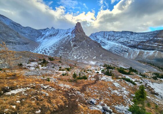
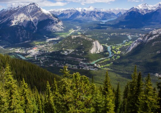
Ha Ling Peak is one of the most popular and challenging short hikes in Alberta’s Rocky Mountains. Located in the Bow Valley Wildland Provincial Park just outside of Canmore, Ha Ling Peak offers stunning views of the neighboring mountain ranges, the valley below, and townsite.
This well-maintained trail has been upgraded in the past few years, which has made reaching the peak more accessible for a wider range of hikers, including both beginner and intermediate levels. This guide will provide you with all the information you need to plan your hike, including tips on when to visit, precautions, and what to expect during the route.
Ha Ling Trail Information
- Distance: 7-8km
- Elevation: 800m
- Trail Type: Out & Back
- Difficulty: Moderate/Hard
- Facilities: Washrooms at parking lot
Best Time of Year to Hike Ha Ling Peak
As with most hikes in the Canadian Rocky Mountains, the best time of year to hike is during the summer months of June, July, August, and early September. Temperatures will be in the 20s and 30s, mountain roads will be open, and the trails at higher elevations will be clear of snow.
Hiking during the winter and spring is generally not recommended, as Ha Ling (and other mountains) are prone to avalanches. Snowpacks in the mountains can be waist deep (or higher), making for an uncomfortable slog and incredibly dangerous trek.
Alberta had a particularly warmer spring this year and I was able to hike to Ha Ling Peak in mid-May. The trail was a little muddy but otherwise snow free.
Conservation Pass
A Kananaskis Conservation Pass is required to park in Kananaskis County and the Bow Valley Corridor. The purpose of the pass is to help with the preservation of the land and facilities.
Passes can be purchased online or in person and can be bought for daily or annual access. This pass grants access for the vehicle, it does not matter how many people are travelling in the vehicle. Passes are not needed if you are biking into the region or passing through.
It’s highly encouraged to purchase your passes ahead of time, especially during peak season. For more information about the passes and purchasing your pass in person, click here.
A daily pass for 1 personal vehicle is $15 and yearly is $90 (includes registration for 2 vehicles).
Purchase your pass online here
Trail Difficulty
The trail to Ha Ling peak underwent significant improvements in 2019, with the addition of three wooden staircases along the route. The trail was also closed in 2022, for the parking lot expansion.
I’ve hiked Ha Ling before and after the trail upgrades. Overall, I think the wooden stairs made the hike less intense and more accessible for others. The three sections replaced by stairs were originally a muddy, rocky, and vertical path. This section in my opinion was the most intense prior to the stairs.
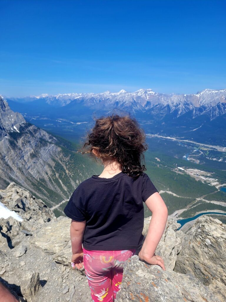
My young daughter was able to ascend the stairs and climb to the peak but needed some assistance on the return trip.
Despite the stairs, the trail itself still has its challenges. The route is a constant grind upwards, gaining 800m in elevation over 8km. The final climb to the peak is exposed and requires mild scrambling. The terrain is very rocky and loose scree is all around, making for a slippery descent.
There are also certain areas on route that fall in the avalanche zone. Signs are posted and inform hikers to not stop for obvious safety concerns.
How to Get to The Trailhead
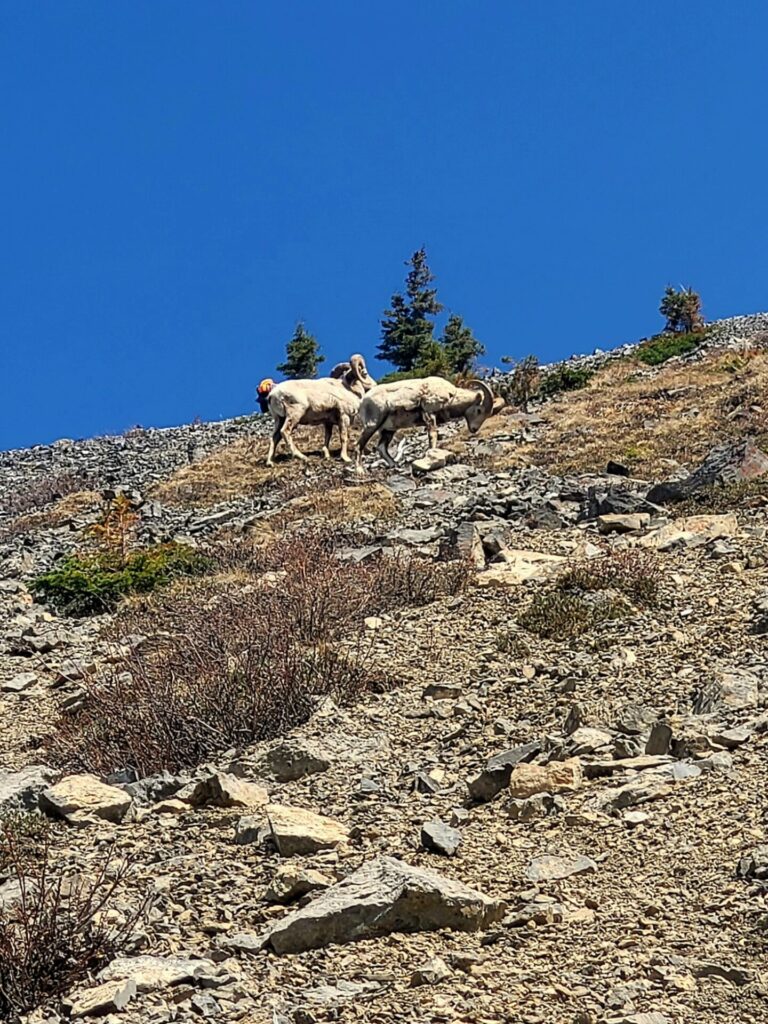
A car is necessary to visit Ha Ling, as public transit does not venture that far into the mountains. I’d recommend a vehicle with AWD or 4X4 capabilities as the final stretch to the parking lot is along a curvy gravel mountain pass. Be wary of wildlife on the road, as mountain goats, deer and big horn sheep frequent the area.
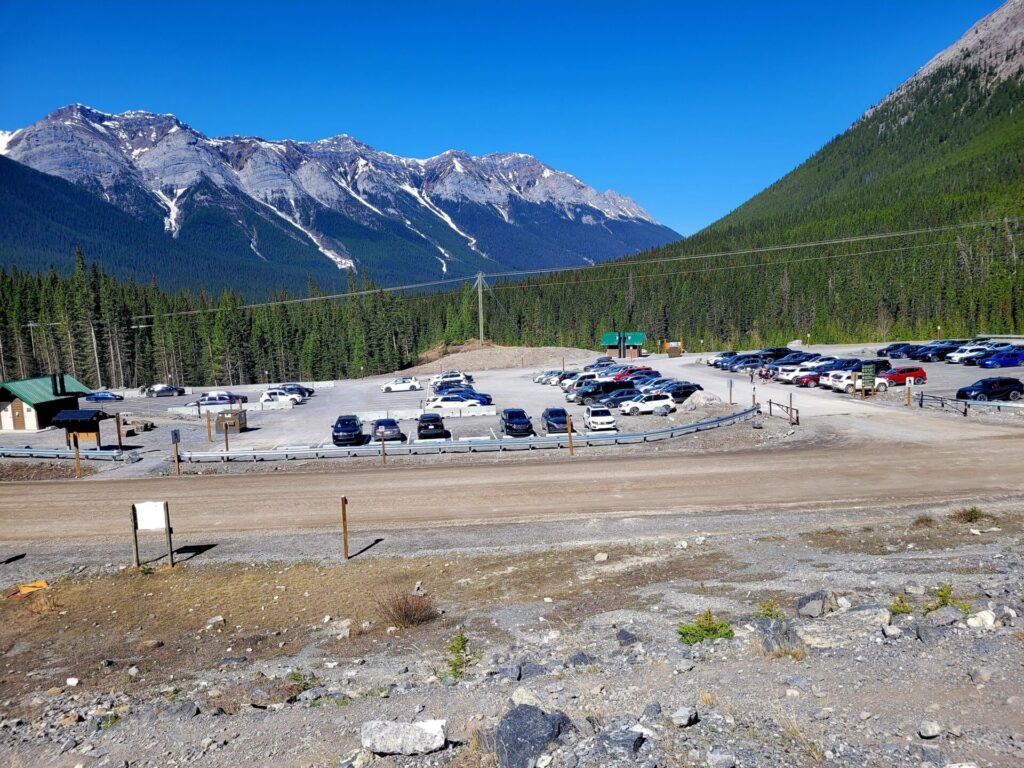
The trailhead for Ha Ling begins across from the Goat Creek Parking Lot, 10km south of Canmore along highway 742.
Find your vehicle rental here
Driving directions from Canmore can be found here
Driving directions from Calgary can be found here
There is one other option to reach the trailhead without your own vehicle. Three Sisters Taxi offers shuttle services to and from Ha Ling and other mountain peaks. This company is based in Canmore and can arrange other transfers if requested. Check out their services here.
Route Overview-Forest to Stairs
The trail starts across from the parking lot and proceeds up a gravel road towards Spray Canal. Crossing the bridge and passing by turquoise waters, the path will lead into the woods, where the slow climb begins.
The trail follows the forest for most of the time, with plenty of shade covering. The terrain is mostly soft ground, with the occasional rocky bit. Manmade rock stair slabs have been constructed throughout the forest as well, making it for an easier climb, especially during wet weather conditions.
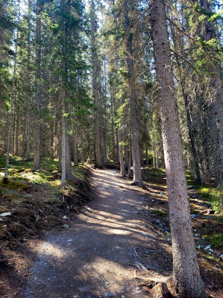
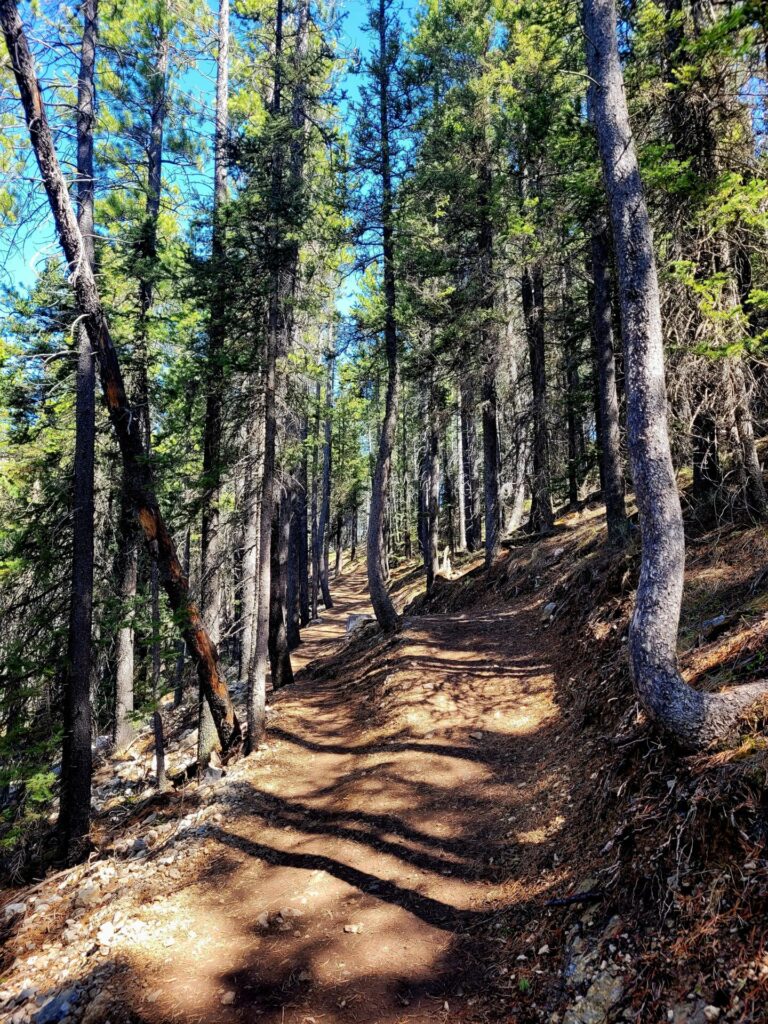
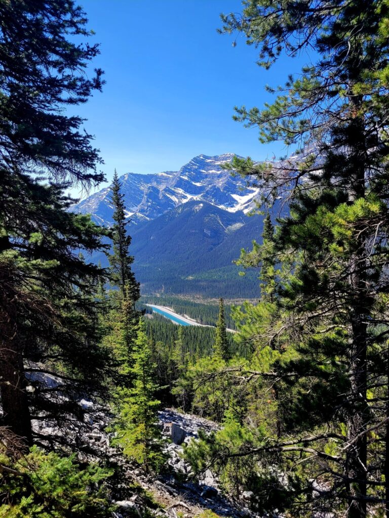
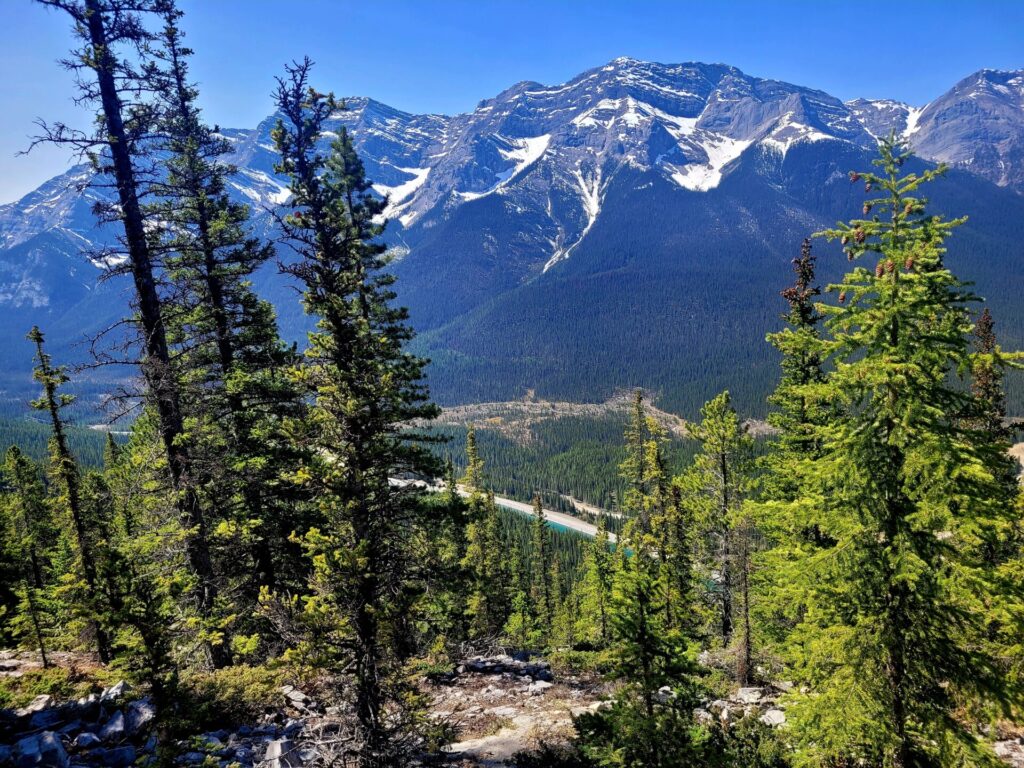
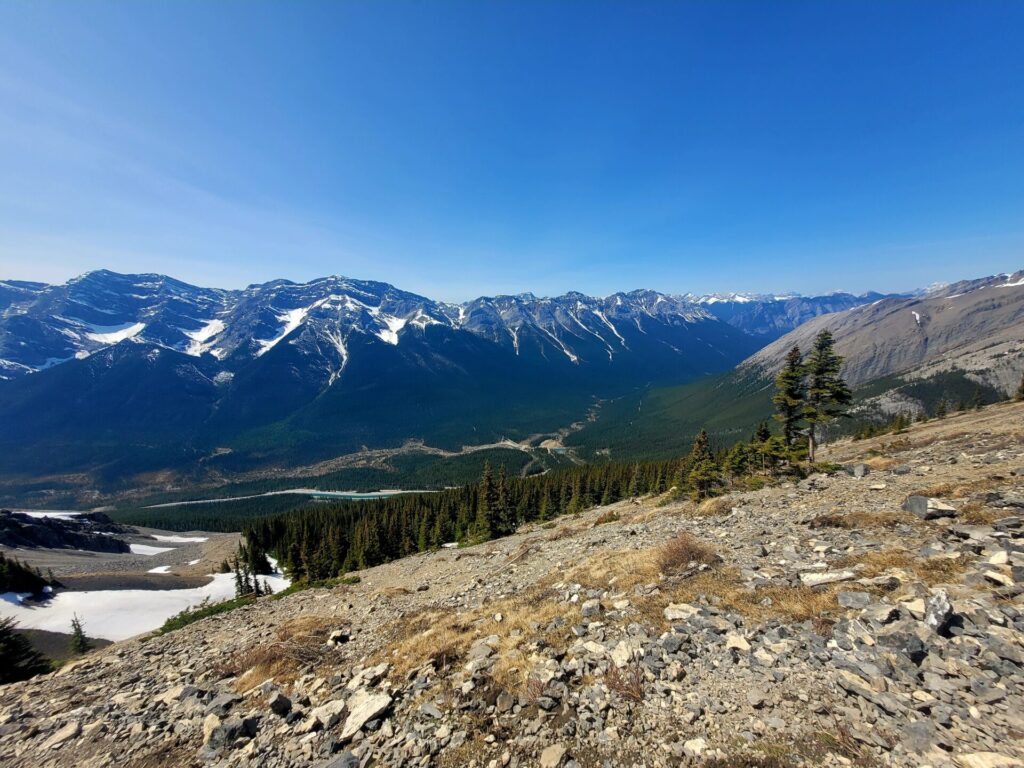
There are several viewpoints along the way, with gorgeous views of neighboring mountain ranges.
Stairs to Saddle
The first set of stairs will come into view shortly before the 3km mark. Take caution when accessing the stairs, as they are just planks of wood and do not have any risers. Small children, dogs or anyone for that matter could potentially fall between steps and injure themselves.
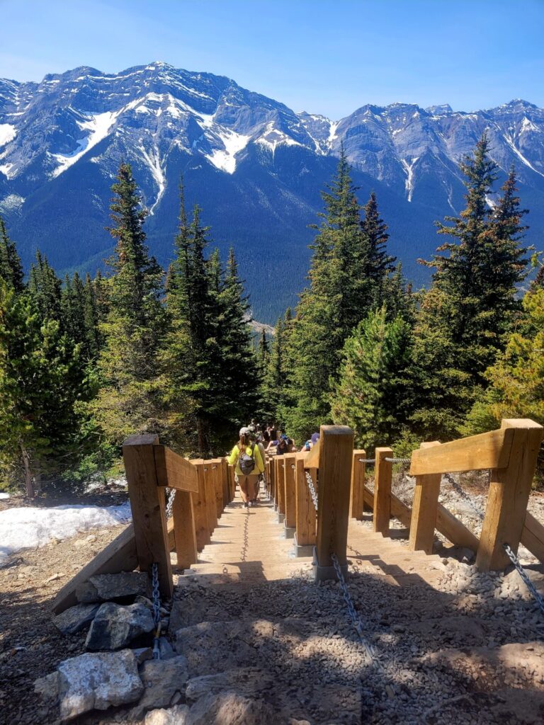
The stairs are divided, allowing people to ascend and descend without congestion. There are three sections of stairs. Be prepared to have a real workout.
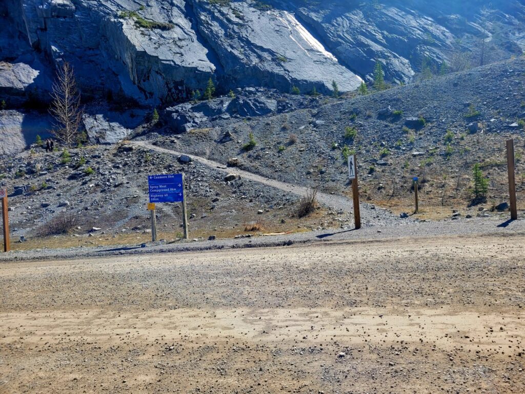
The trail will continue out of the treeline and reach the saddle. Here, the trail splits into two. Heading right will lead to Miner’s Peak and the left will lead to Ha Ling Peak. If the summit is inaccessible due to snow or skill level, the saddle is a good place to stop, as it still provides lovely views of the valley below.
Saddle-Peak
The last 500m to Ha Ling Peak is not maintained and requires some scrambling over small boulders and scree. The path is not as defined as the forest trail, but the trail itself is popular, so it’s easier to spot the correct route to the peak.
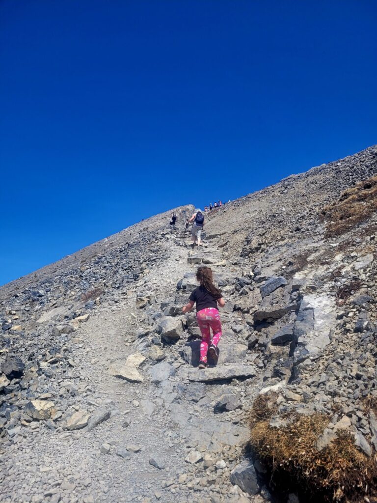
Loose scree can be very dangerous, so be careful and wear the proper footwear when accessing the peak. Hiking poles will also aid in the journey to the peak. The peak does not have a plateau, making it a somewhat uncomfortable experience to sit.
The most difficult part of Ha Ling Peak is the return trip down towards the saddle. This steep descent is loose gravel, scree and rocks. Every step you take can potentially create a mini rock slide.
Be extra careful and allow for sufficient space between hikers. It can be quite easy to loosen the rocks and terrain, and risk having them roll down at the hikers below you, I found going down via the larger boulders made for a slightly easier and stress free descent.
The views look amazing and I am glad that they added the wooden steps making it more accessible for everyone.
Stunning photos, this looks like an absolutely incredible hike – especially on a sunny clear day! 🙂