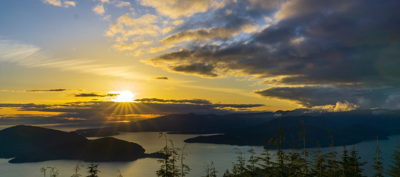
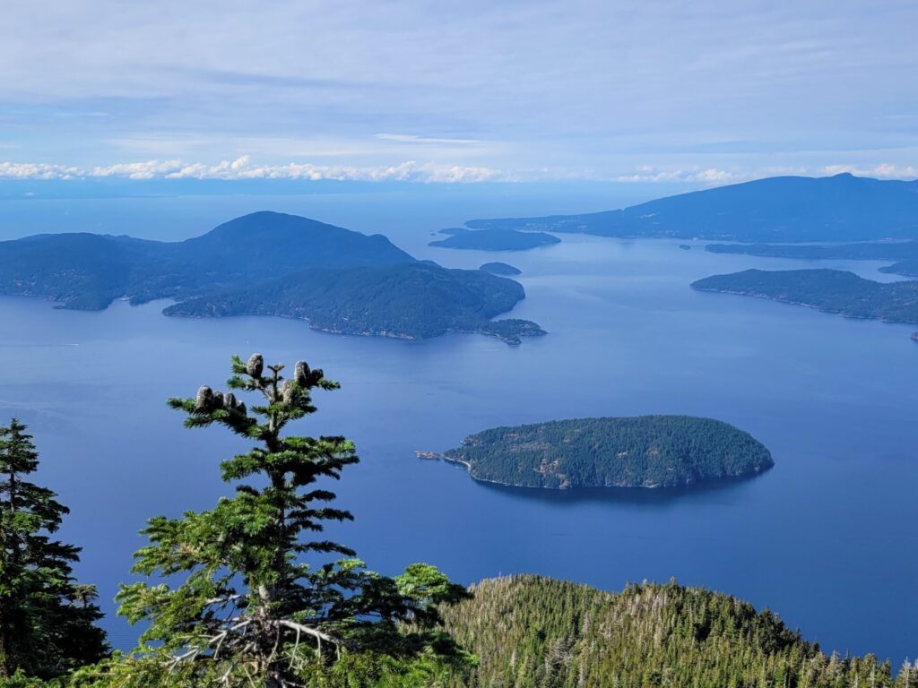
St. Mark’s Summit is a spectacular hike located a short drive from West Vancouver. Primarily a shaded walk through an old growth forest, the summit provides panoramic views of Horseshoe Bay and neighbouring islands of Howe Sound. This hike is part of a multi-day trek along the Howe Sound Crest Trail.
St. Mark’s Hiking Trail Information
- Distance: ~12km
- Time: 4.5 hours
- Elevation Gain: 600m
- Route: Point to Point
- Difficulty: Moderate
Best Season to Hike St. Mark’s Summit
Being a ski resort, Cypress Mountain gets a significant snowfall each season, so hiking during the winter is not recommended, especially with the higher elevation gain. Snow can remain on the summit until late June and the trail can become very muddy.
St. Mark’s Summit should be completed during the summer months to early autumn (late June to October). The terrain is rocky and has the potential of being slippery during wet conditions, especially near the summit.
Where is the Hike Located
St. Marks Summit is one of the most popular hiking trails found within Cypress Provincial Park. This park boasts an area of approximately 30km2 which is quite a bit considering its proximity to the city.
During the Summer, visitors are drawn to the hiking and back country camping and biking trails. The Winter months offer plenty of opportunity for skiing, snowboarding and other downhill activities.
The park is opened all year, with free entrances and parking throughout.
Facilities and Services
There are two lodges located at the provincial park: Black Mountain and Cypress Creek.
During the summer months, services are limited within the lodges, including the closures of restaurants and cafes. The Black Mountain Lodge remains open all season and has washrooms available to the general public to use.
Hiking Safety
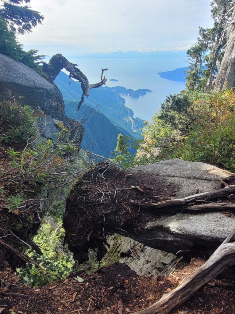
Hiking in remote areas always comes with a risk, especially those with higher elevation gains. This trail has a very exposed summit with no protective barriers. Caution must be taken and avoid getting close to the edges. The trail is also very narrow, with some sudden steep drop offs throughout the forest. Be cautious of your footing and surroundings during times of high congestion.
While the majority of the hike is a slow incline, the last 2-3km switchback is a little steep and passing over rocky and rooted terrain.
Recommended Hiking Equipment
- Hiking boots
- Poles
- First Aid Kit
- Food and plenty of water
- GPS or map
- Cell phone for emergencies
- Daypack
- Extra clothing
Wildlife Safety
Wildlife is a huge safety concern for any hiker and many trails in and around Vancouver are known for coyote and bear sightings.
We encountered a black bear within seconds of passing the trailhead and delayed the hike until we could tag along with a larger group. I recommend going with a group of a least 3-4 people, carry your bear spray and make yourself known on the trail.
How to Get to the Trailhead
Trailhead Address: 6000 Cypress Bowl Rd, West Vancouver, BC
While Vancouver is known for its great public transit, this region is unfortunately not serviced as frequently. While only located a 40 minute drive from downtown Vancouver, Cypress Mountain feels very secluded and tucked away. Here are some options for reaching the trailhead within the national park.
Car/Vehicle Rental: The easiest and quickest way to get to the trailhead is to drive. Bringing your own vehicle is the most cost effective way to get there. There is plenty of free parking located near the Cypress Creek Resort and Black Mountain Lodge.
If you are only in the city for a few days and do not own a car, vehicles can be rented. Typical rental prices range from $85-150 CAD per day (depending on the season).
Taxi/Uber: This trail is possible to hike however without a vehicle of your own. Taxis and other ride sharing services like Uber can be available for the drop off. Drop off to the trailhead via Uber usually costs around $40 CAD.
I would suggest using a taxi service like North Shore Taxi on the return trip. They can be booked ahead of time and service both west and north Vancouver. With traffic, a return trip can cost around $60-70 CAD.
I attempted to use an Uber on the return and was unable to find any drivers in the area willing to come to Cypress Mountain.
At the time of visit, Cypress Creek’s washrooms were closed to the public.
While cell phone service may drop off on the road leading to the national park, you should not have any issues while on the trail or near the lodges.
St. Mark’s Summit Trail Route
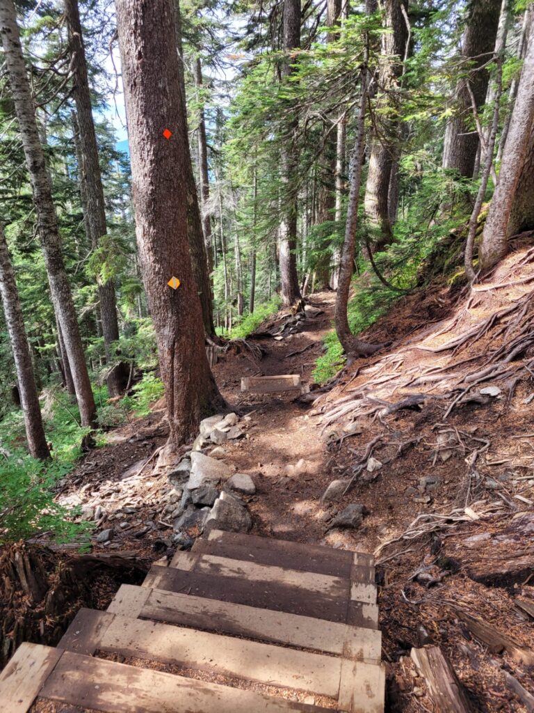
Markers: At most junctions or intersections, signage and markers are present. Continue following the orange diamond markers to reach the summit
There is no official signage for St. Mark’s Summit trail. Instead, follow the path marked Howe Sound Crest Trail. This longer trail runs approximately 30 km from Cypress Bowl to Porteau Cove and covers multiple mountains including The West Lion, Unnecessary Mountain and Saint Mark’s Summit.
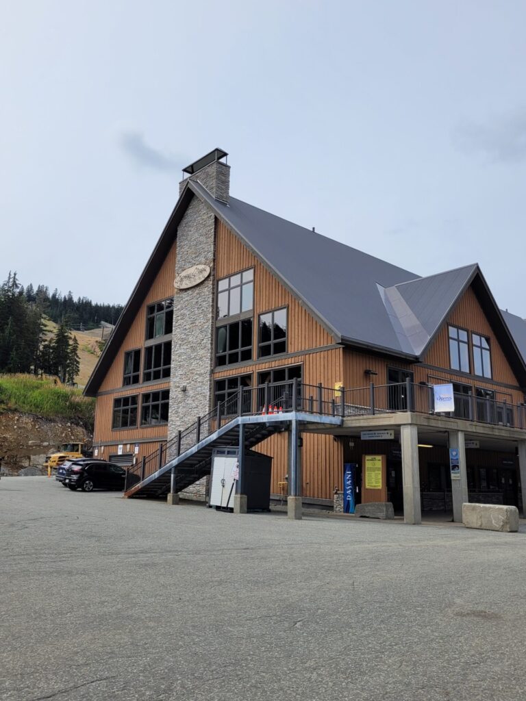
From the parking lot, pass alongside the Cypress Creek Lodge and the Olympic Rings Statue. Head north and take a slight right towards the path leading into the woods.
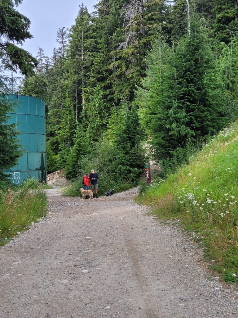
There will be a green water tank shortly up the path and a trail sign on the right hand side. This is where several paths start, including the Howe Sound Crest Trail.
Taking the path behind the water tank to the left (west) will lead you to the Bowen Lookout and eventually reconnect to the Howe Sound Crest Trail at the Lion’s Lookout.
The trail to the right (east) ventures into the forest and slowly begins the climb to the summit. As we were following a larger group, we chose the eastern path. Either path is a great option and both lead to the summit.
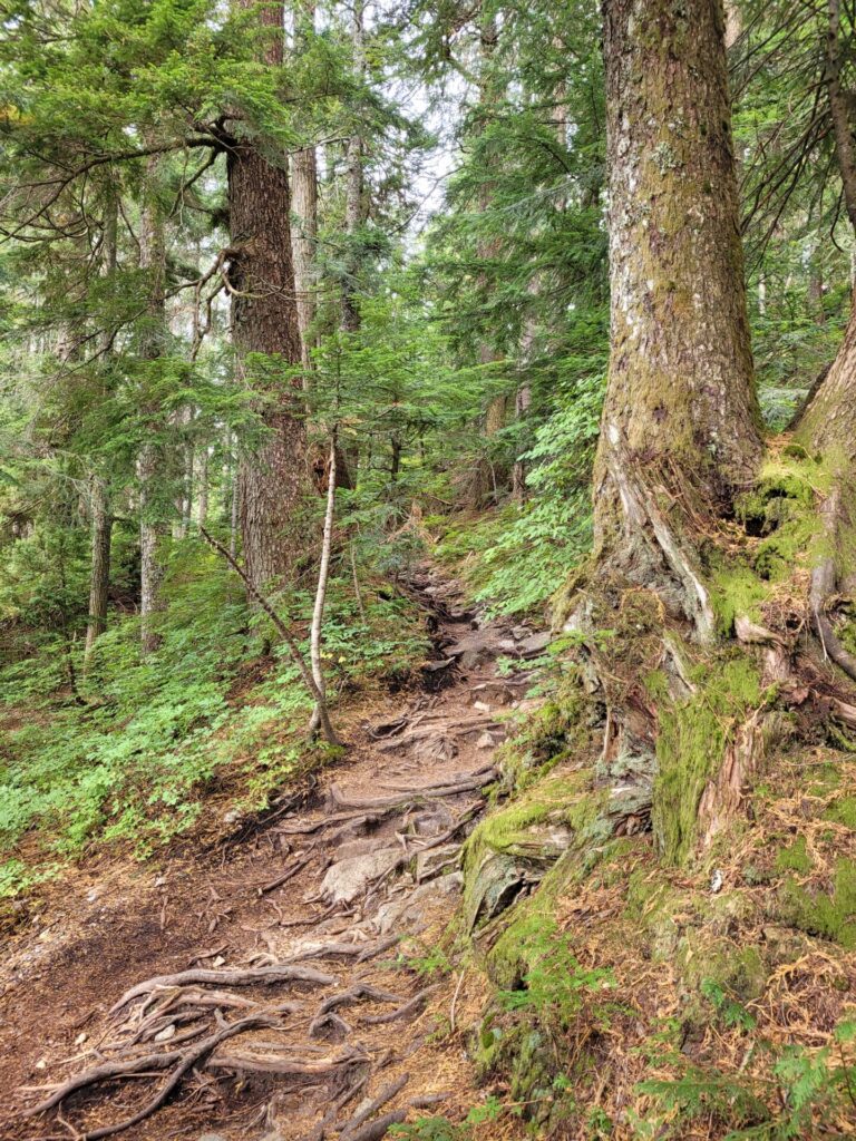
The eastern trail begins through a narrow passage into the forest. The roots act as makeshift stairs throughout the duration of the hike.
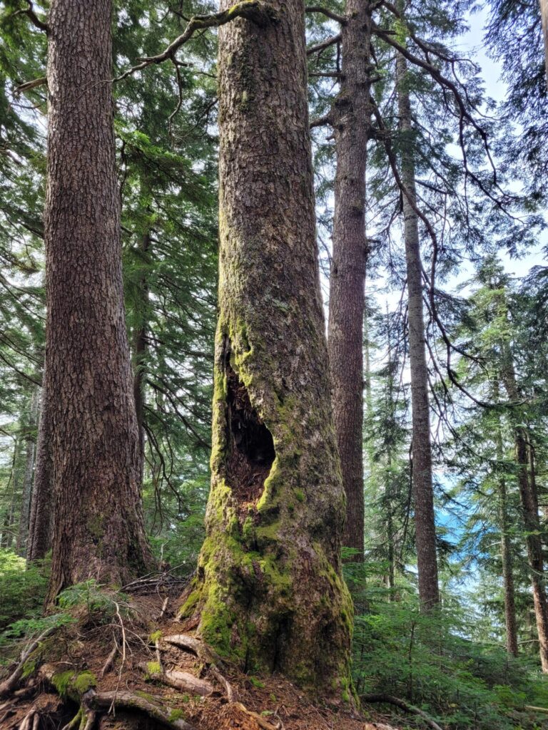
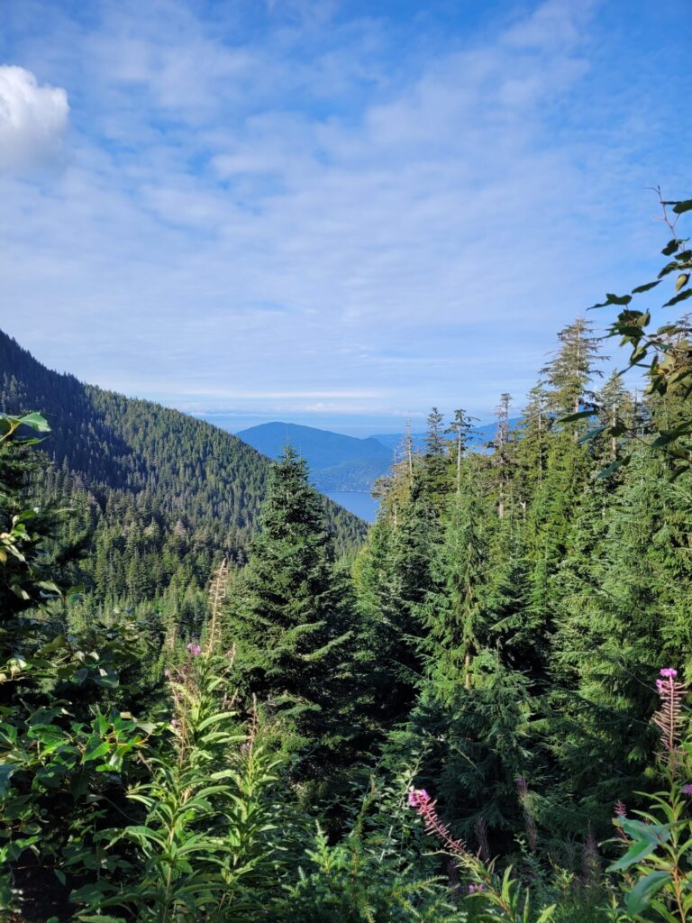
The stunning old-growth forest is home to a variety of different plants, trees and scrubs. Moss covered trees, ferns and mushrooms cover the dense forest floor.
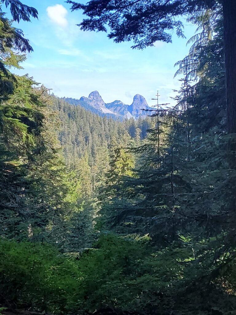
When both east and west paths reconnect, there is a gap in the woods and the Lion’s Lookout can be viewed. Continuing further on the Howe Sound Crest Trail will lead you over another mountain pass, West Lion.
The final 2-3km through the forest weave back and forth, along steep rocky passes and roots. The trail recently underwent some maintenance, including the addition of stairs, which makes it easier to ascend and descend the steeper terrain.
Once at the summit, enjoy the panoramic views of the bay on the left hand side. If you continue on the path, it will lead to an additional view point. Keep in mind this path is very narrow and exposed.
Head back down the way you came towards the parking lot or continue your adventures further along the Howe Sound Crest Path towards West Lion, Brunswick Mountain, and Deeks Lake.
>


Those views are gorgeous! Thanks for the reminder about wildlife in the area and your safety tips. I’ve never hiked in Canada before; I know there are a ton of gorgeous trails to be discovered, but I would definitely be nervous my first time mainly because of the wildlife. I hope to hike here one day though! Xx Sara
The views from the hike are gorgeous Wow!!! Thanks for also providing an overview of hiking safety and things to keep in mind, etc.
I usually am a bit reluctant to hike for such long distances. However, the views are so spectacular that it changed my mind.
Wow this looks incredible! What a view.
Woot woot! I am so glad you found St Marks while you’re in Vancouver – it really is a lovely trail isn’t it!? I really like the rooty sections (even if they are tough to hike up…) When we visited last time, we kept going on to the Lions…so I didn’t spend enough time soaking up the views at St Marks – you have reminded me that I need to go back to enjoy those views. 😀
I absolutely love summit hikes and this one sounds so cool (although challenging)! I’ll definitely be adding Howe Sound Crest trail to my bucket list.
WOW! The views are just INSANE! This seems worth the long distance, too.
I’ve never heard of this hike but it looks spectacular! Vancouver has been on my list for quite some time, I will definitely be pinning this for later! 🙂