
Moose Mountain is a moderately challenging day hike located in Alberta’s Kananaskis Country. Covering 15 kilometers, the trail winds its way through a dense forest before ascending to a fire lookout, atop Moose Mountain. The hike provides excellent views of the foothills and neighboring Rocky Mountains.
This comprehensive guide will provide essential information on trailhead location, trail safety, park passes and a general route overview.
Moose Mountain Trail Information
Distance: ~15km
Time: 5-6 hours
Elevation Gain: ~750m
Route: Out and Back
Difficulty: Moderate-Hard
Best Season to Visit: Mid May-October
Where is Moose Mountain
Moose Mountain is located near West Bragg Creek Provincial Recreational Area, Alberta, Canada. The park is approximately 40 minutes west of Calgary and has hundreds of pathways to hike, bike, camp, and fish. While not in the heart of the Rocky Mountains, Bragg Creek provides an excellent network of trails for every fitness level and a perfect introduction to mountain hiking.
Compared to Banff National Park, Bragg Creek is significantly quieter and less crowded.
Best Season to Hike Moose Mountain
The hiking season begins earlier near the West Bragg Creek area, as the mountains are lower in elevation. The official season kicks off in mid-May and goes well into October or November.
While the trail may be open in mid-May, the potential for snow at the summit is still possible, making for a difficult trek. I attempted this hike once in May and was unable to complete it due to the presence of knee-deep snow at the false summit.
With that knowledge, I’d recommend hiking Moose Mountain during the summer (June-August) or autumn (September-October). By June, the snows should have disappeared from the summit, allowing for an easier trek. I’ve since hiked this trail in July and September and found both months to be beautiful.
The mountainous road to the trailhead is closed annually from December 1st to May 15th. While the trail is still open, walking up the 7km road is not recommended or ideal.
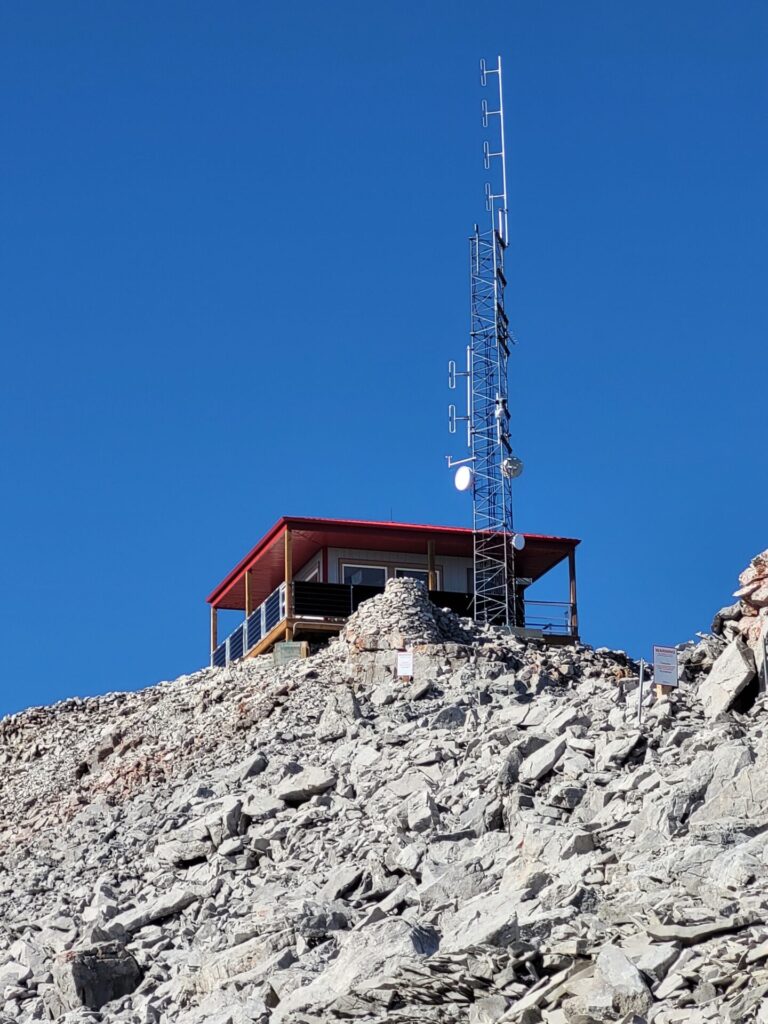
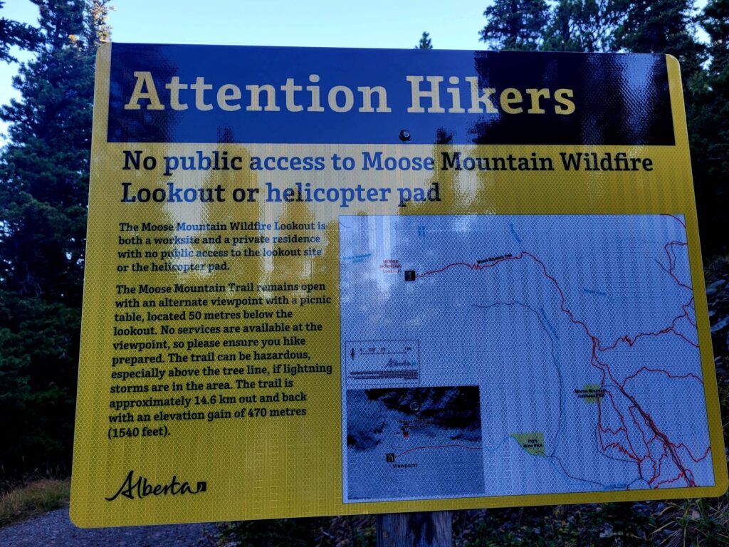
Moose Mountain Wildfire Lookout
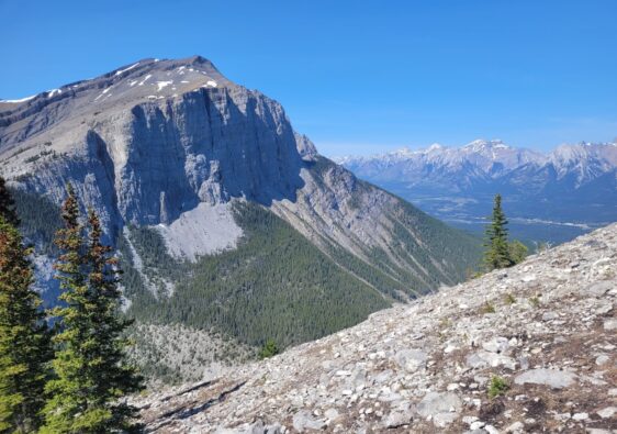
At the summit of Moose Mountain is a wildfire lookout and helicopter pad. This fire station and staff members are responsible for detecting, reporting, and mapping fires in the area. Years ago, hikers would be able to access the lookout and surrounding area at the summit.
I had the pleasure of being invited into the station a few years back. The employee educated me on his daily roles and duties.
In recent years though, the public are no longer permitted to access either location.
Required Park Passes
As of 2021, a daily pass must be obtained in order to access trails in Kananaskis and Bow Valley. This area covers the Moose Mountain Trailhead and surrounding areas. Daily passes cost $15 CAD per vehicle and help with the preservation of the parks. Alternatively, a yearly pass can be purchased for $90 CAD and includes 2 vehicles.
They can be purchased online through Kananaskis Conservation Pass, by phone (Alberta Parks Contact Centre at 1-877-537-2757) or in person at various locations including the Canmore Nordic Centre Day Lodge.
The first Wednesday of every month is free and known as Wilderness Wednesdays. Other free days include public holidays like Christmas, Parks Day (3rd Saturday of July) and Family Day (3rd Monday of February).
Fitness Level Required
While the 15km return trip and elevation gain might deter people, Moose Mountain can be completed by various ages and fitness levels. While it is not generally an easy hike, it’s a great introduction to the mountains and can be used as training for future summits.
I’ve encountered hikers (and dogs) from age 3-65 years completing the trail. One particular visit I brought my 4 year old who was able to complete the entire hike. Another time, my 19 year old brother in law at the time, managed to get up to the summit in a pair of Vans (though I wouldn’t recommend doing it in those shoes).
Having trekked Moose Mountain four times over several years and seasons, I can confirm that while it’s a long hike, the elevation gain is slow and manageable. The most difficult part of the trail is the final 5km back up the rocky forest.
Hiking Safety
While the elevation gain isn’t as high of some of the other mountains in the Rockies, there are still some risks associated with this hike. There are two summits to reach on this hike. Both are very exposed to nature, including wind and sunshine. A winter hat may be encouraged at the summit, even during the middle of the summer.
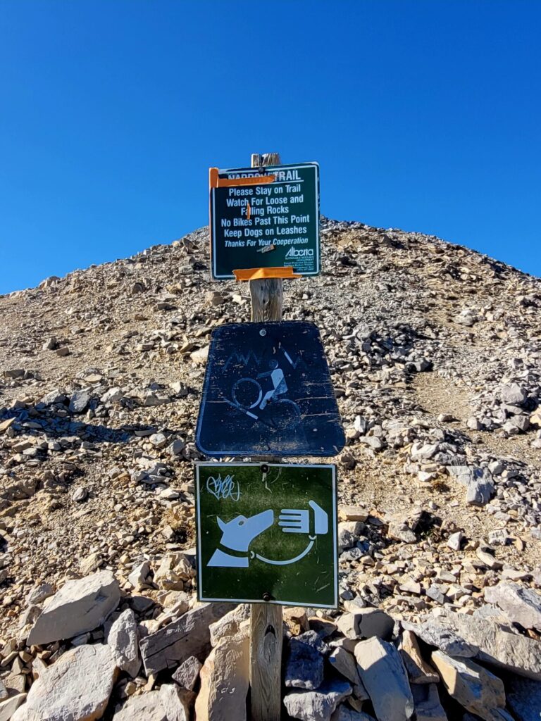
The rocky terrain through the forest can make for an uncomfortable and long walk. The exposed summit is also narrow, especially near the end, with no safety guards in place. Cling close to the right hand side while advancing up the mountain, to avoid the strong winds and slipping down the loose shale rock.
As with any hike in and around the Rocky Mountains, caution should be taken around wildlife. Check the trail reports and bear safety before heading to the route.
Facilities and Services around Moose Mountain
There are no official washrooms located at the trailhead or on the trail.
There are however several areas on route to Moose Mountain that have designated washrooms. Station Flats and Fullerton Loop are located within a 4 minutes drive of the turnoff to the trailhead.
How to Get to Moose Mountain Trailhead
From Southern Calgary, head west on Hyway 22x towards Priddis.
Continue on AB-66 W, past Paddy’s Flat Campground. Turn right onto Moose Mountain Road and continue around 7.2km up the winding road. This road will pass by many mountain biking routes and additional parking lots.
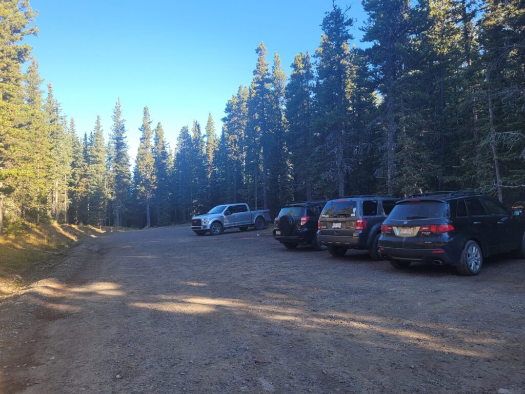
The road is not well maintained so I recommend using a vehicle with AWD or 4WD capabilities. Watch for the trailhead signs and turn right to access the angled parking lot.
Moose Mountain Trail Route
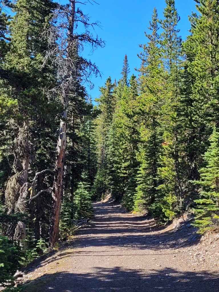
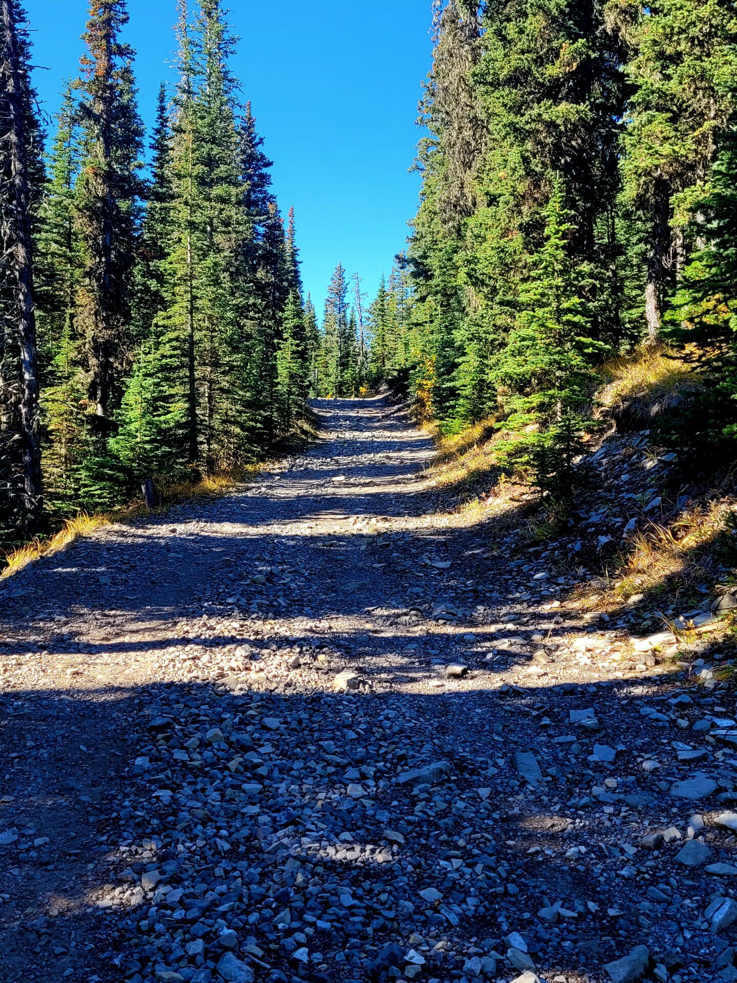
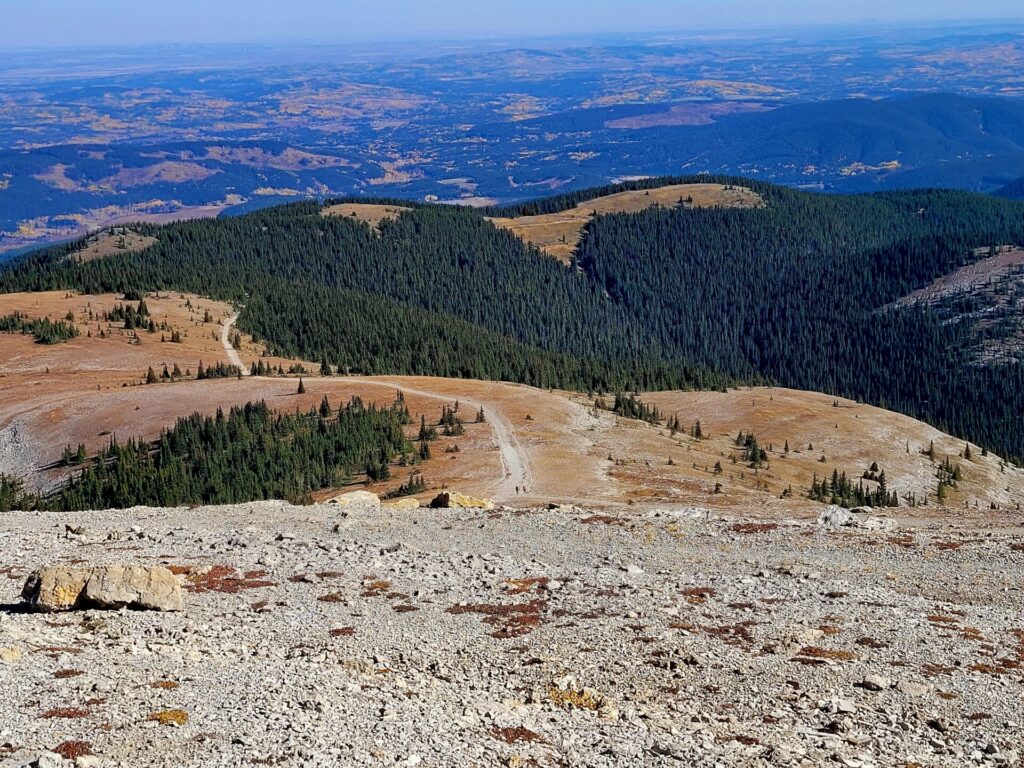
Heading to the right hand side of the parking lot, the trail will climb up into the forest. Alternating between dirt and rocky pathways, it continues through the forests for the next 5kms. Most of the route proceeds downward or a slight hill.
The occasional break in the trees provides views of the mountain summit and wildfire station. Before you hit the small open meadow, there will be a fork in the path. Stick to the left side to continue along to the summit.
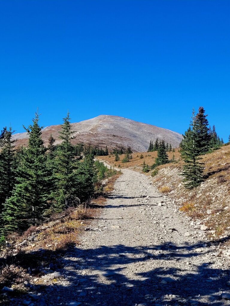
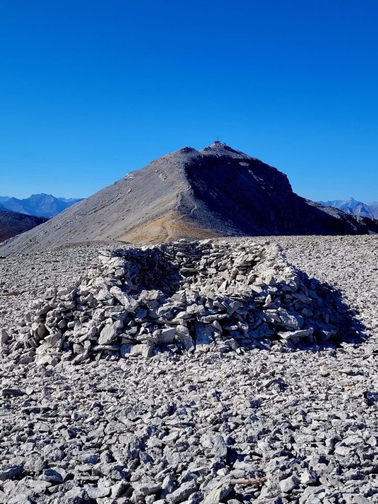
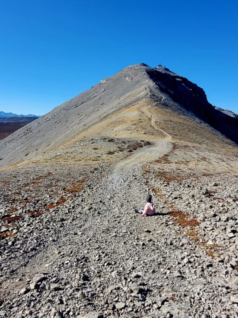
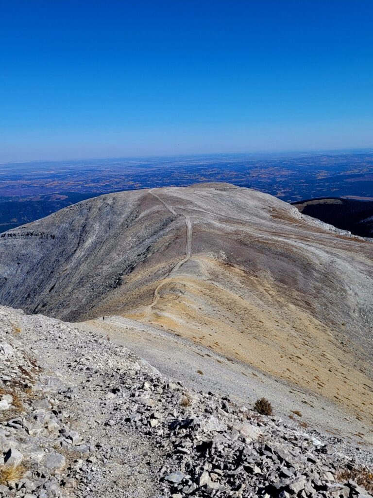
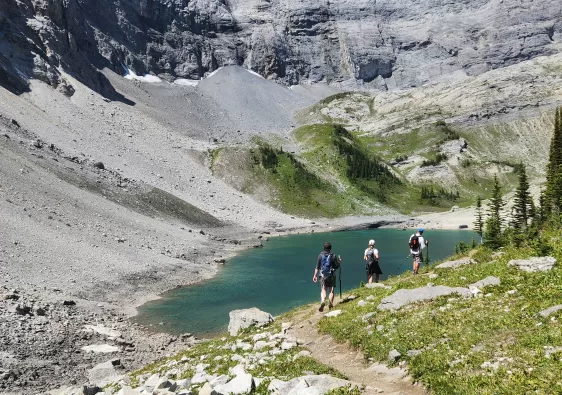
The real adventure begins when you finally make it to the plateau and base of the mountain. Don’t be fooled by the first peak, as it’s the false summit and there is a higher one behind it. Both summits can be very windy, so stopping at the plateau for a break before the ascent is recommended.
There are two ways of ascending to the first peak. Those who are unfamiliar with the path and want a slower approach, should take the switch-back paths. While technically longer, this path is a safer option, especially for younger children. These trails are easily to follow and wide.
The second way is straight up the mountain and makes for a steeper but quicker approach. I don’t believe this is an official trail, but there are many hikers and cyclists accessing these routes. The trail is narrow and is harder to find. There is also the potential for more loose rock. To be safe, stick to the main trail.
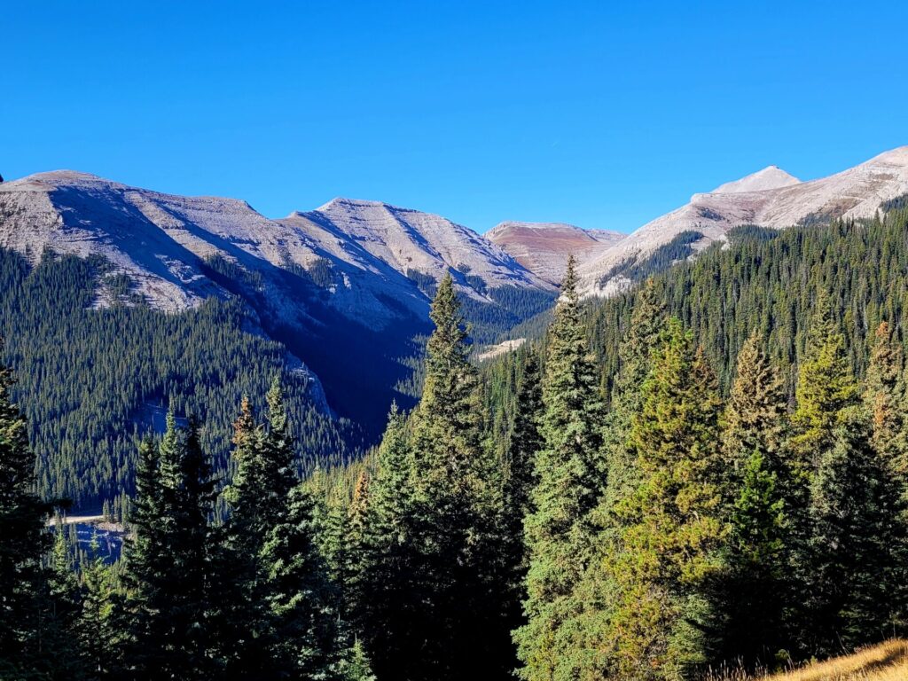
After the false summit, the final route will be revealed. At this point, views of the foothills and even Calgary can be seen in the far distance.
Caution needs to be taken on the final ascent, as the path is loose rock and more narrow than the previous trails. The path looks daunting, but it’s alot easier and not quite as steep as it looks. For some perspective, my four year old daughter managed to lead the way up to the summit with no assistance.
Mountain bikers frequent the area and neighboring paths. They are however no allowed on the final summit trail.
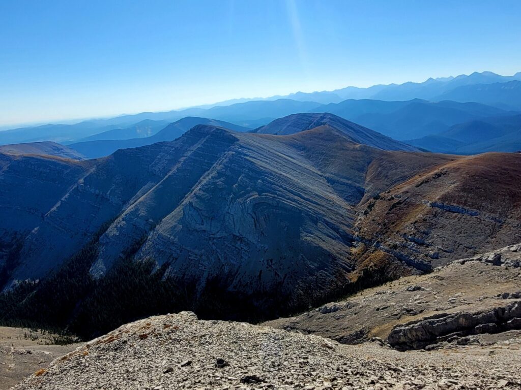
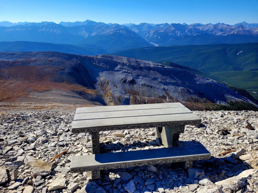
The summit provides spectacular views of the Rocky Mountains. One a clear sunny day, you can see for miles and miles. There is a picnic bench at the summit to rest your legs.
Once again, keep your distance from the helicopter pad and residence, as hikers are no longer allowed to access the area.
The return trip down is a long but well marked. The area is extremely windy but manageable once you get past the summit.
The once easy path through the forest becomes more of challenge as you climb slowly pack up the rocky trails.

This is so beautiful, I’ve love to hike it. The final ascent would probably make me super nervous though!
The trails looks spectacular. The photos literally took me to the sets of some sci-fi movie.
I bet your daughter slept well after that hike. Kudos for starting her hiking young. The trail looks like something I would enjoy hiking.
She sure did 🙂
I’d love to do this hike it really looks breath-taking! Thank you for sharing!
You’re very welcome
I am definitely going to be doing this hike if I am ever in the Area. Thank you so much for sharing this detailed blog with us!
The views from the top of Moose Mountain look beeeautiful! I LOVE seeing the geological formation of those layers in the surrounding mountains.
I would be tempted to take the steep route up, then have an easier time with the switchbacks on the way down.
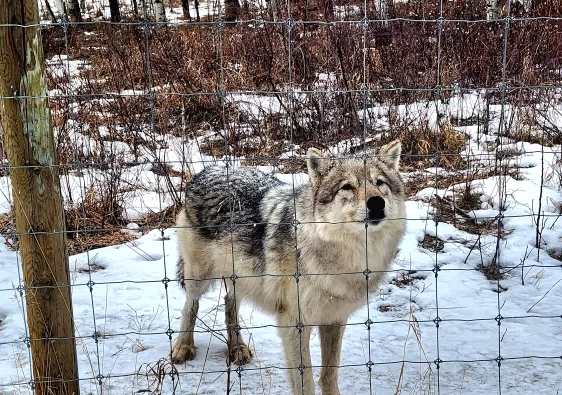
p.s. Are there moose in the area!?
Hey Josy,
I’ve taken both routes before. It’s definitely easier to go down the switchbacks with a kid on the return trip. I have not seen any moose in the area unfortunately. Google says the name is derived from it looking like a “resting moose on the horizon”. Ha! I do not see that.
Ha! That is awesome! I was thinking it didn’t look like particular moose-friendly for vegetation!
WOW, those views are incredible! Canada has such a wild beauty, and this looks like a great trail to see the Rockies.
I love hiking on vacation and this looks like a good hike to add to my Canada list! The trail looks rewarding with the spectacular views!
Wow! The view of the Rockies is absolutely incredible. I would love to hike this trail. Slow ascent doesn’t typically bother me.