Hiking Refugio Frey in Bariloche, is the most popular hike in the lake district of Argentina. This stunning hike is in the Nahuel Huapi National Park and passes alongside lakes, through forests, before ending at a refuge deep in the mountains. Suitable for all fitness levels, this long, yet rewarding hike is a must if visiting this spectacular region. This hike can be done in either a single day or a multi-day adventure, staying in the mountains overnight.
This detailed guide will provide you with all the information you need to complete the single day hike to Refugio Frey via the Villa Cerro Catedral route.
Refugio Frey Trail Information
- Distance: 21km
- Elevation Gain: 783m
- Trail Type: Out and Back
- Difficulty: Easy/Moderate
- Washroom Facilities: None on route
Best Time to Visit Refugio Frey
The best time to plan your hike is in the early spring to fall, between the months of October to April. While it is possible to visit year-round, the probability of snow coverage on the mountain and trails is much higher in winter, causing the trail to become more hazardous.
I visited in late spring, in the month of November. While the temperatures were pleasant (around 10-15 degrees Celsius), there was some snow at the top of the refuge, along with a partially frozen lake.
For a snow free experience, I would suggest hiking around mid December to February. The trail will become more crowded, but the temperatures will be warmer and the route will be less muddy/snowy.
How to Get to the Refugio Frey Trailhead
The Refugio Frey trailhead is situated in the small skiing village of Cerro Catedral, approximately 20km distance from Bariloche.
There are multiple ways of getting to the trailhead, including car, taxi, or public transport. The most affordable of the options is using public transit.
Bus Route: Bariloche Centro to Cerro Catedral
- Bus Company: Mi BUS
- Bus Stop Location: (CENTRO) Francisco Pascasio Moreno 460, San Carlos de Bariloche
- Bus Number: 55 (55x Av Bustillos)
- Bus Schedule here
- Duration: 35 minutes
- Price: 592 ARS roundtrip (~$4.75 CAD)
Bus 55 has 2 early scheduled departures from Bariloche (Centro) at 7:15am and 9:15am. This bus only runs every 2 hours, so plan your return accordingly, especially if you are completing this hike in one day.
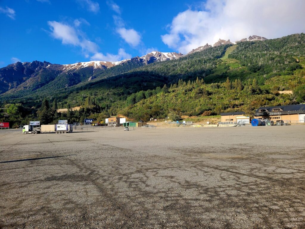
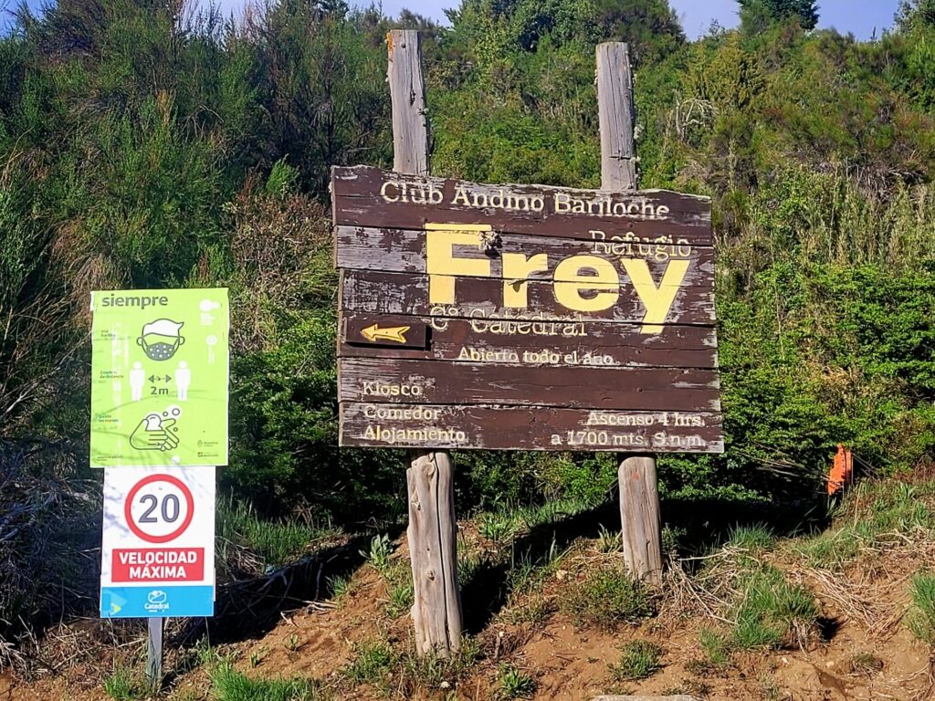
Take the bus to the end of the route at Catedral, which is usually around a 35-minute journey. The bus will drop you off in the village, in front of the massive parking lot, the cable car, and several shops. The trailhead is across the parking lot on the gravel road, with signs indicating “Frey”.
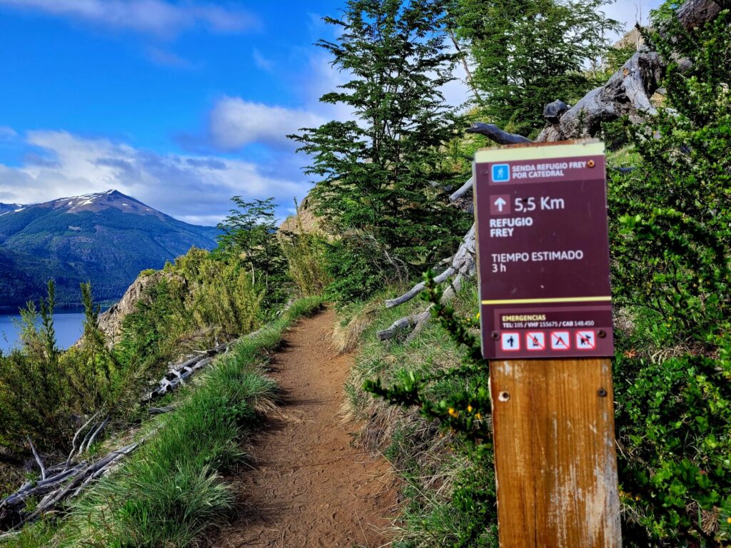
Refugio Frey Route
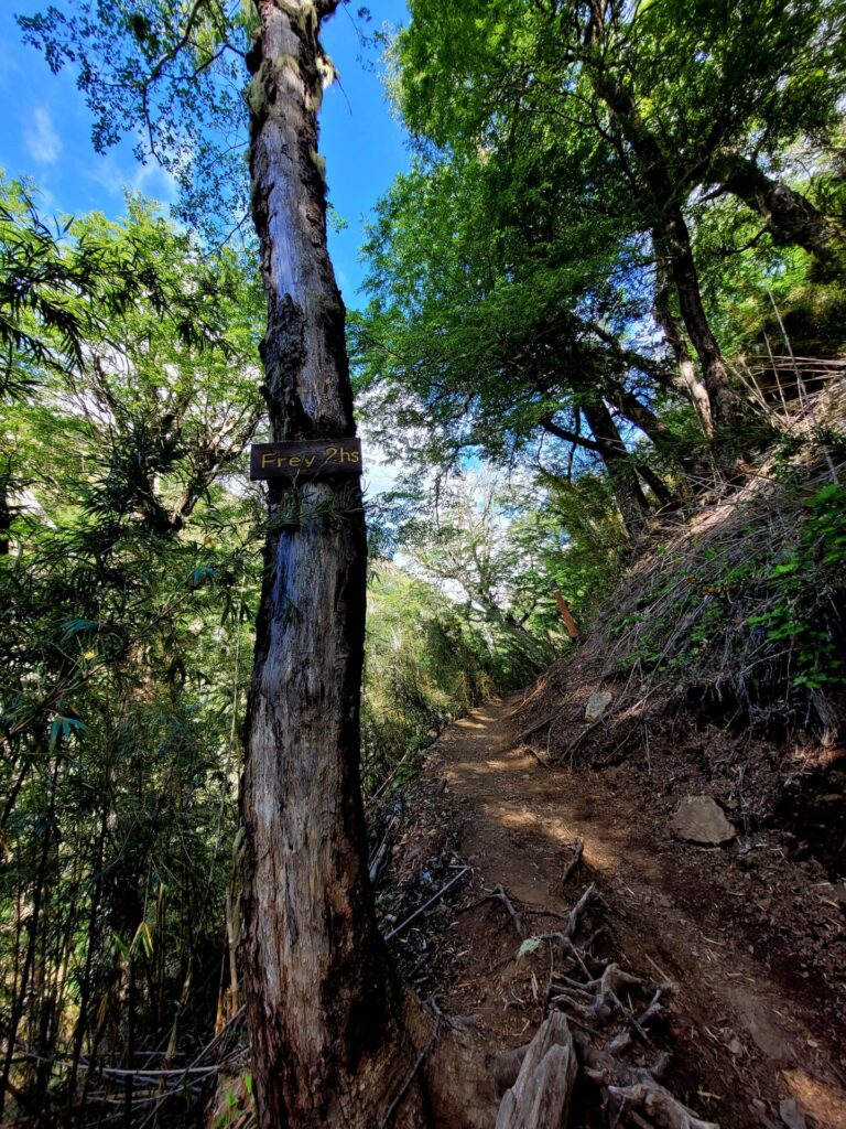
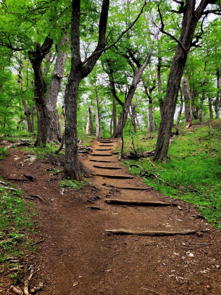
This hike can be divided into three sections: mountainside, forest, and final ascent. Each section has their own unique landscape and challenges associated with it.
Section One: (km 1-4)
As you leave the parking lot, the trail begins moving south, at the foothills of Cerro Catedral. During the springtime, the low-lying brush can be covered in wildflowers and butterflies.
The trail begins to loop around the mountainside, passing over many small bridges. The trail passes by at least 4 waterfalls.
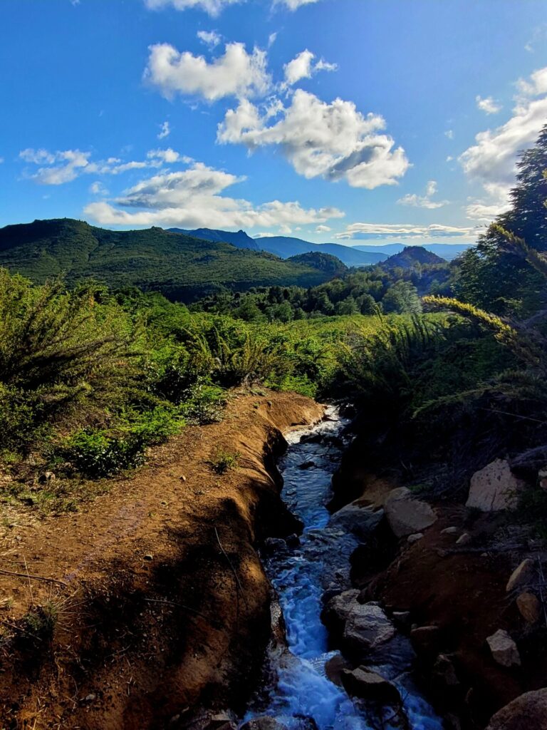
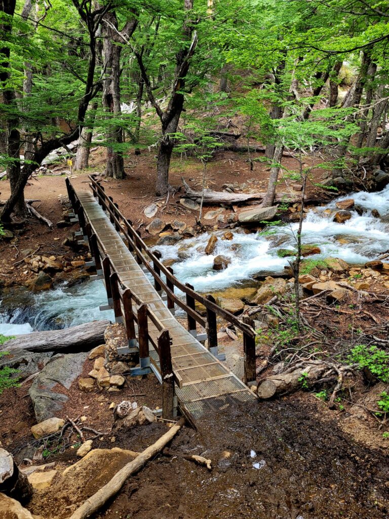
Some of these bridges have weight restrictions, so it’s best practice to walk over them one at a time. The path for the next 4kms is often narrow and requires hikers to walk single file.
There is a definite change in terrain, as most of the views are obstructed by trees in the first 2kms.
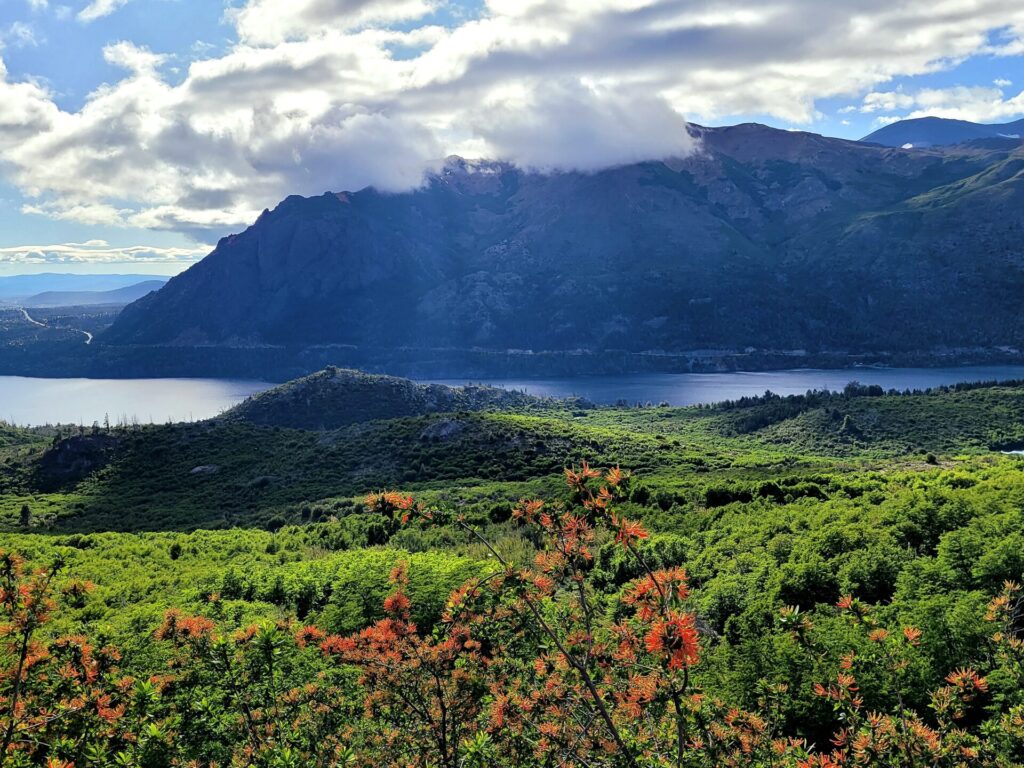
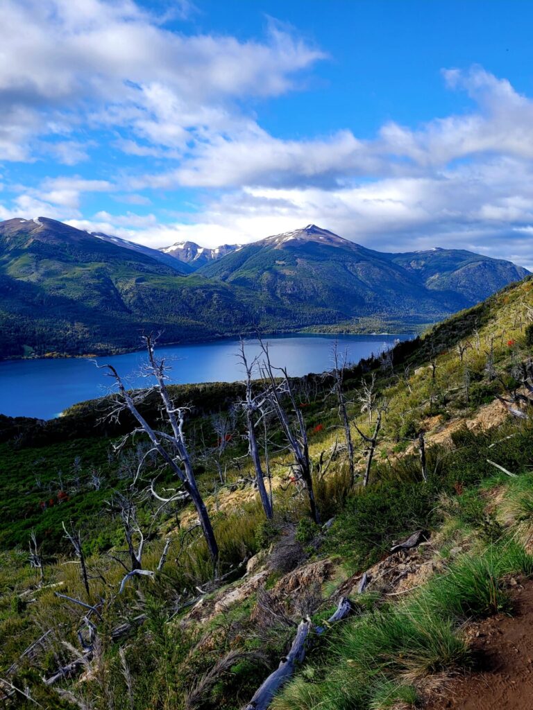
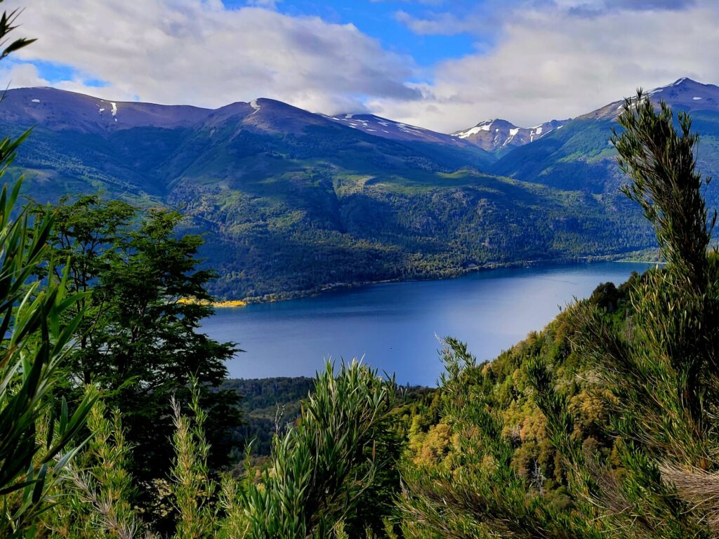
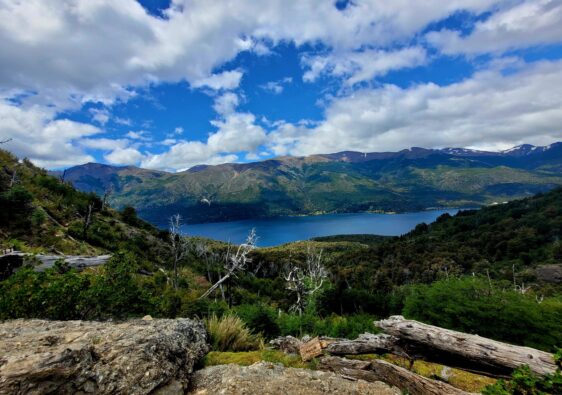
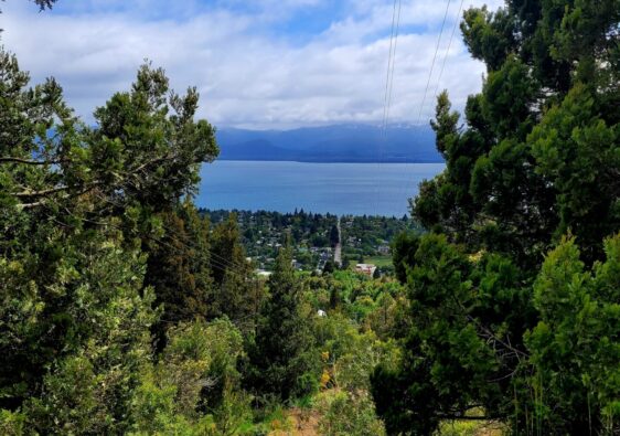
Around the 3km mark, the trees begin to disperse, and beautiful views of Lake Gutiérrez can be seen on the left-hand side.
The trees become sparser, terrain rockier and requires some mild scrambling over rocks.
Section Two: (km 4-7)
Leaving the open scenic views behind, the trail moves into a dense forest. This is the part of the hike where the climb begins. It’s not very steep, but rather a gradual climb through the wooded area.
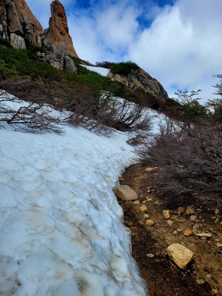
Depending on the time of year, don’t be surprised to see some snow remaining in these parts.
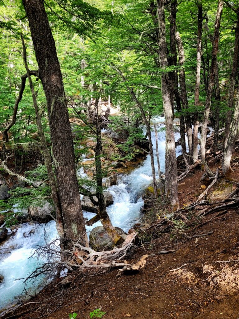
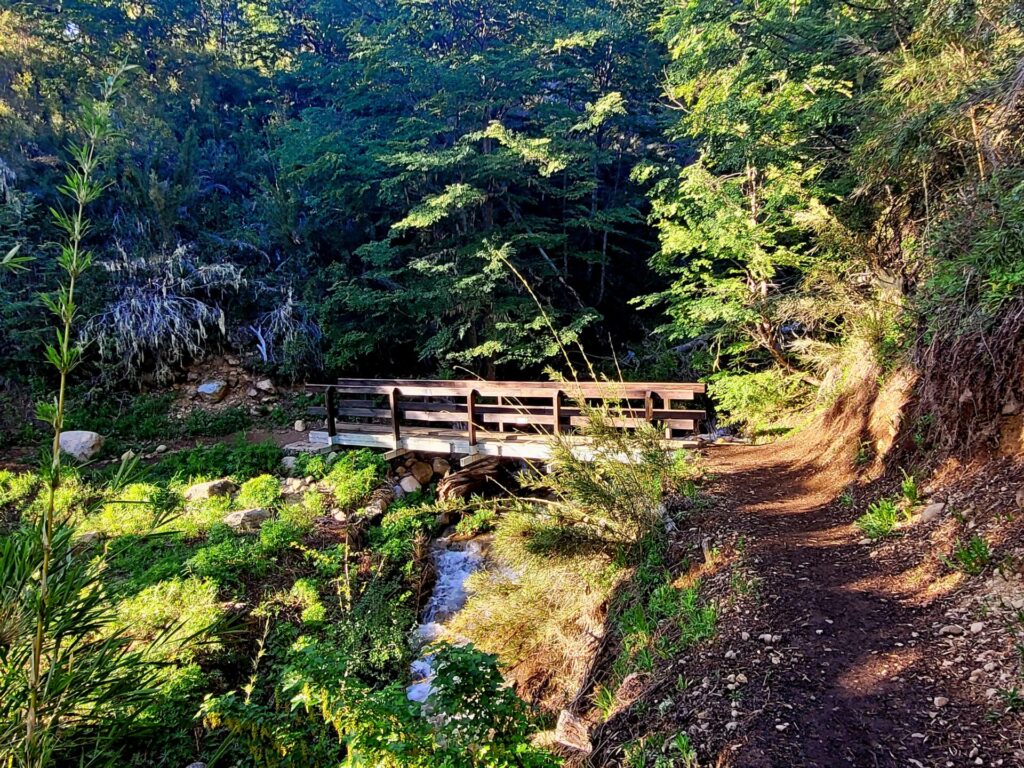
The trail leading through the forest becomes wider, making it easier for multiple people to share the walkway. Several waterfalls and raging rivers can be viewed in this portion of the hike.
There is one river crossing over a bridge (also weighted to hold no more than 8 people at a time). The path again begins to climb again past the bridge, this time a little steeper.
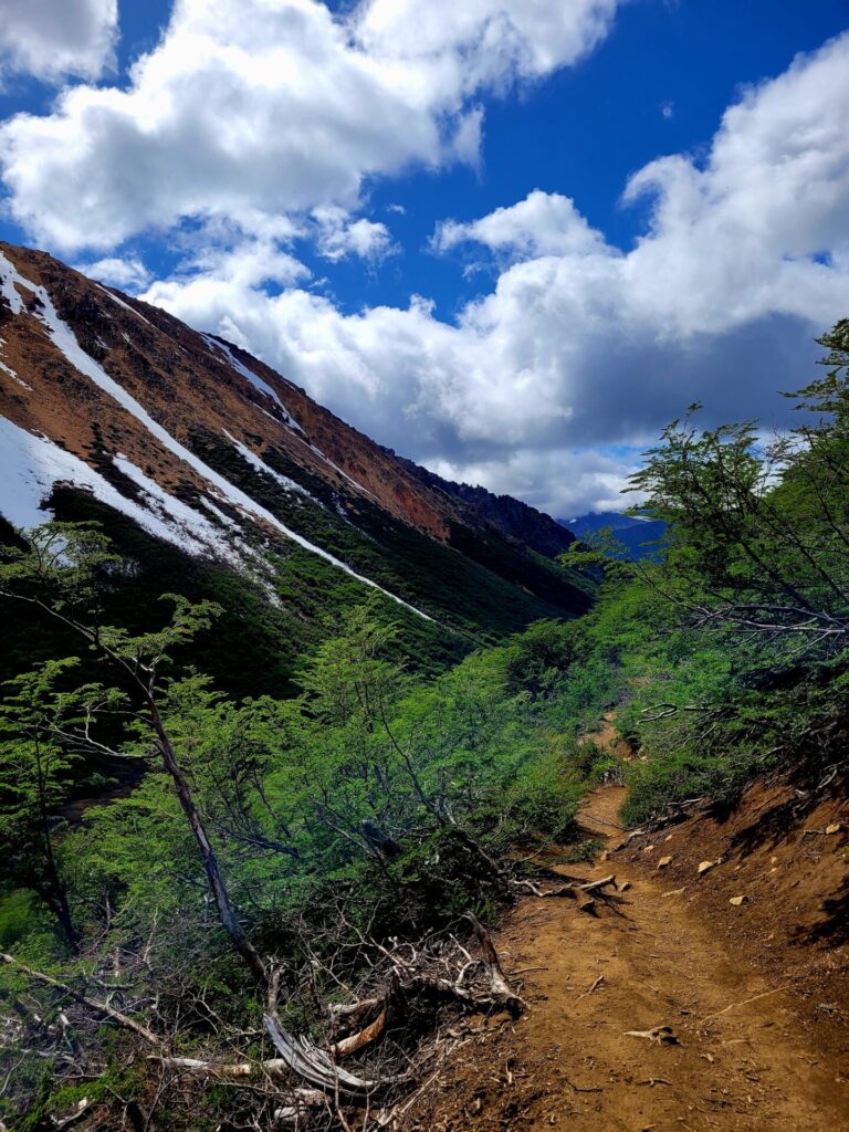
Section Three: (km 8-10)
The final ascent up to Refugio Frey begins out of the forest. The path once again becomes exposed to the elements and provides gorgeous views of the mountains and valleys.
This is also where the trail becomes narrow once more. During the spring, this area can become very muddy and wet.
The path begins to climb again, around the last 1km, this time around larger boulders. Again, some mild scrambling is required but nothing too difficult.
I witnessed 20 school ages kids returning from their trip and they did not encounter any issues while traversing this area.
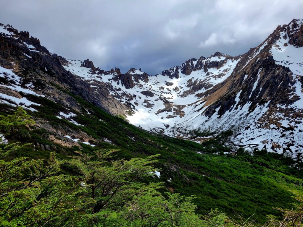
The final 100-200m of the trail was covered in snow. Luckily several people had been in the area and the path was easy to follow. While slippery in parts, I was able to get through in regular hiking boots.
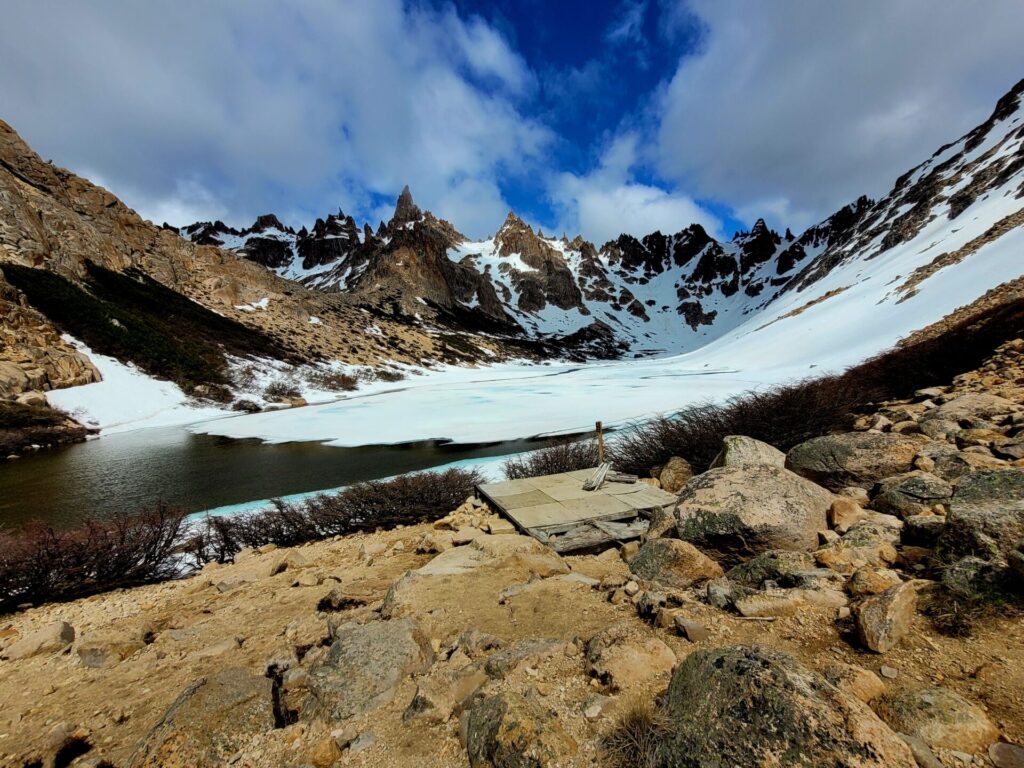
If snow is present at the time of visit, I would recommend following the footprints and don’t venture off path. At the summit, there is a lake and stream flowing down the mountain.
The snow and stream were partially melted but the trail was not entirely present. Going off path could have resulted in wet boots or worse, falling through deep water.
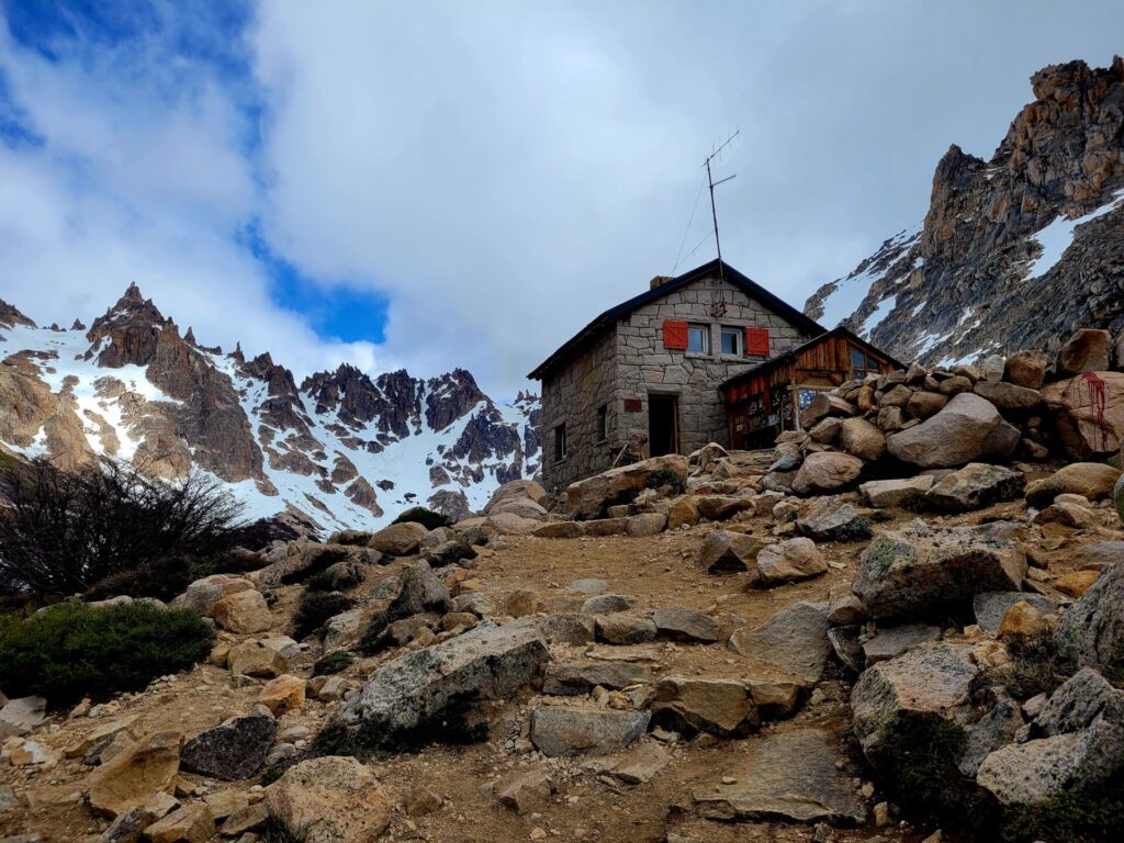
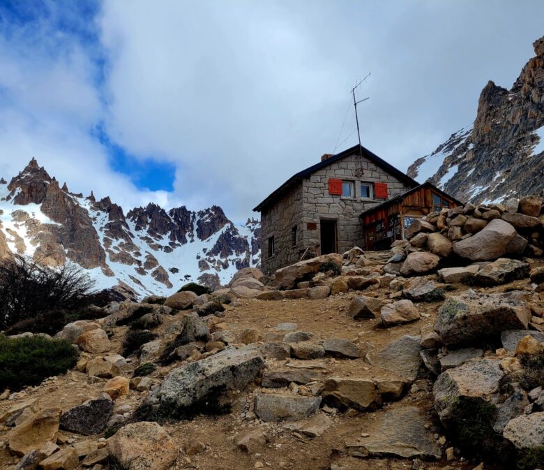
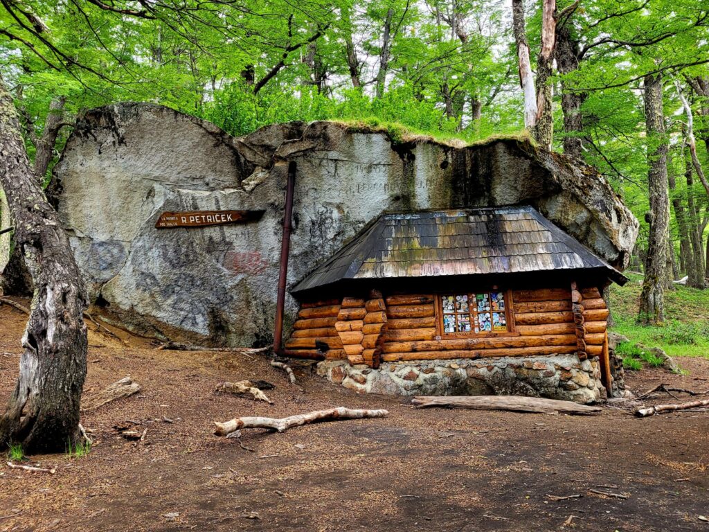
Once at the top, you will come across the little mountain refuge, Refugio Emilio Frey. The cabin is set between mountains and the beautiful Laguna Tonchek. It can hold 35 people, has a kitchen and washrooms, and provides hot meals as well.
If you wish to extend your hike and spend an evening at the refuge, nightly rates are 5000 ARS ($40 CAD), half board 12,500 ($100 CAD), or full board 14,500 ARS ($116 CAD).
Camping is free of charge. It is encouraged to book your spot online and ahead of time, to ensure space.
Once you have had your fill of Refugio Frey, head back down the way you came and catch the same bus back to Bariloche. Buses depart from Catedral every 2 hours, starting from 8:10am until 8:10pm. The journey back to Bariloche is around 30 minutes.
Further Exploring in Bariloche
Cerro Otto is a strenuous climb in Bariloche, with beautiful views of the town and surrounding mountains.
Looking for an easy, yet rewarding hike near Bariloche? Try the lake walk to Cerro Llao Llao.
Such a beautiful hike! Love your photos. Thanks for sharing!
This looks like such a refreshing hike. The photos are absolutely inspiring.
This looks gorgeous!
This sounds like a great day hike, although camping at the Refugio looks great too. I love that you provide all the necessary details to do this hike!
We are actually headed back to Argentina in the new year. But have already booked our itinerary. Hiking Refugio Frey in Bariloche is something we will have to consider if we make it back for another trip and visit the Lake District. Always love that you can get to a trailhead with public transit and don’t have to worry about driving. The scenery looks stunning when you visit. The little bit of snow on the peaks added to the view. But probably a bit surprising when you hit snow on the trail.
I agree! I love using public transit to get to the trailheads
Beautiful photos! I would love to do this hike one day.
Wow, this hike sounds fantastic, the water looks so clear.
Oooh I would LOVE to stay up in Refugio Frey! When there is snow on the ground and a partly frozen lake I’d prefer to stay inside rather than camp! This trail (like the others you’ve written about recently) looks fantastic! I guess you know it’s going to be steep when the sign says 5.5km is going to take 3 hours! The last section, up high near the snowline looks incredible!
It was much easier than AllTrails described it. I was quite relieved
I absolutely LOVE refugios, and this one looks INSANE. I need to make my way down here, because the views are out of control.
I didn’t get to do this hike when I was in Bariloche – looks like I really missed out 🙁
Wow, how beautiful – I have never heard of the Lake District in Argentina, and this hiking area almost looks like something out of the European Alps! Definitely saving this for my Argentina trip!
Thanks heaps for this guide, I love hiking but can struggle to find such detailed information on a trail, and never like to go in completely unprepared. This is so helpful
I’m happy it could help!
Very good information. Lucky me I recently found your website by accident (stumbleupon).
I have bookmarked it for later!