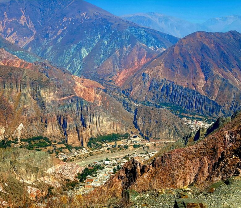
Hiking to Mirador del Cóndor, Iruya, is one of the best hikes in the region, with spectacular views of mountains, valleys and condors. Iruya, located in northwest Argentina, is an often-overlooked hiking destination in the country.
Many visitors head to Patagonia in the south, to experience the snow-capped mountains and lake districts. Yet the north, holds something distinctly different from the rest of the country. Mountains over 4900m tower over small, isolated towns and massive canyons add to the dry arid like environment.
This hiking guide provides you first hand experience, tips, and specific route details for a successful, stress free hike in this fantastic region.
Mirador del Cóndor Trail Information
- Distance: 10.2km roundtrip
- Elevation Gain: 559m
- Trail Type: Out and Back
- Difficulty: Hard
- Washroom Facilities: None
Best Season to Visit Iruya
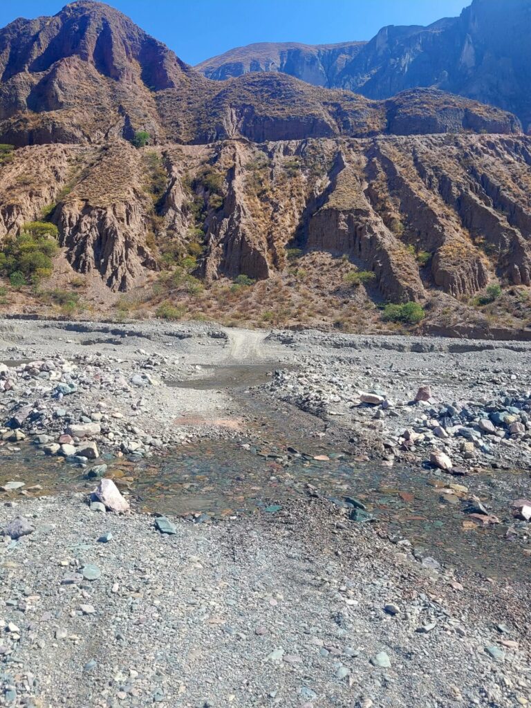
April to November is the best time of year to visit Iruya. The temperatures remain almost constant year round, however the risk of flash floods is very common in December, January, and February. While it’s possible to visit outside this time frame, Iruya is very isolated and there is only one road going in and out of the town. There are many river crossing, which could be inaccessible with high rains.
I visited in November and had nothing but sunshine throughout the day. It did rain the night before, but only for a few minutes, causing insignificant changes to the trail terrain.
Mirador del Cóndor Trail Precautions
This trek is not a walk in the park. There are several factors to consider before attempting this hike.
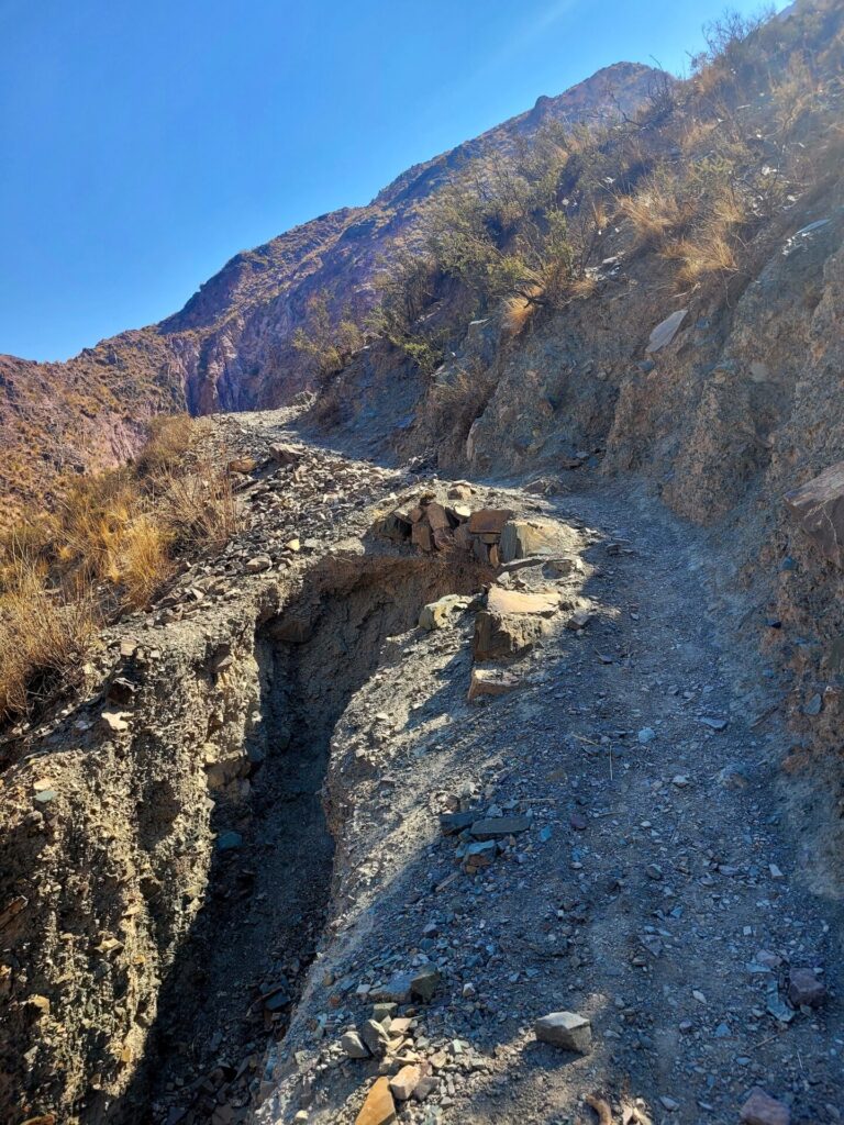
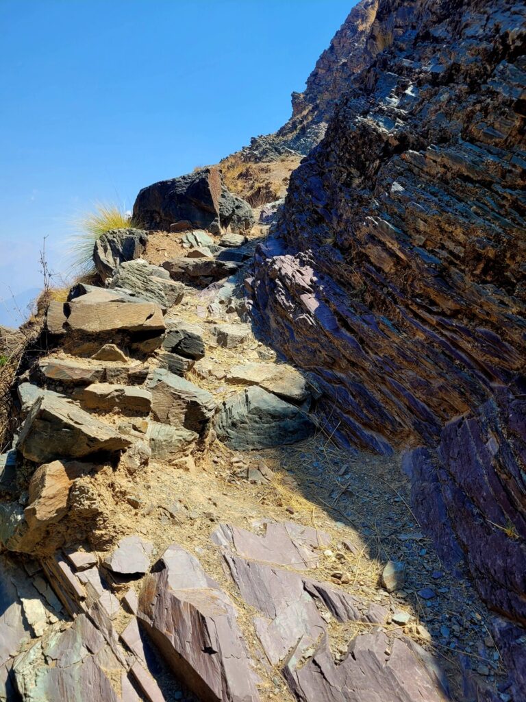
Exposed terrain: Not only does the trail have no coverage from the sun, but there are also some narrow passages along loose gravel. These trails hug the mountain but are exposed on the left side to some death defying drops. Use extra precaution when walking through tight corners and turns. With loose gravel, use appropriate footwear and hiking poles.
Altitude: Iruya sits at just above 2700m above sea level. This trek reaches elevations of 3200m. Altitude sickness can become present at levels above 2500m. Mild symptoms can range from head pressure, headaches, and nausea. Know your limit and try to acclimatize beforehand, especially if you are not accustomed to higher elevations.
Make sure to drink lots of water, take your time and bring altitude medications with you. Locals also swear by chewing Coca leaves to help reduce symptoms.
Lack of Signage/Markers: This trail can be rated as hard for the sheer lack of signage or markers along route.
Getting to the Trailhead
A walking route can be found here.
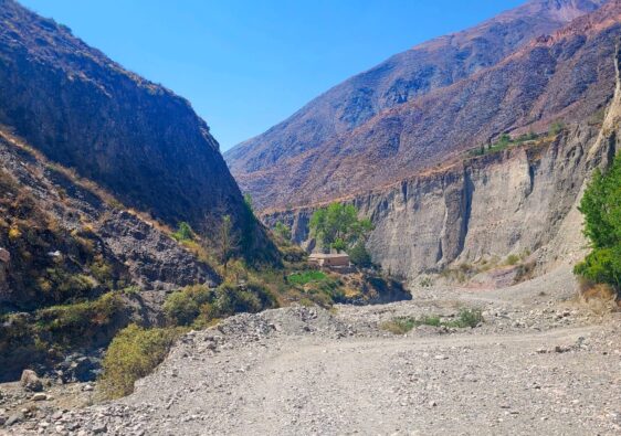
There are no official markers or trailhead for this hike. However, the trail to the initial climb is located about 1.4km from the center of Iruya. From Gral. San Martin (main square), head south head out of town along the RP133.
This road will run parallel with the Iruya River, which could be a dry trickle, or a roaring river depending on the time of year you visit.
Turn left onto the pedestrian bridge, crossing the river and onward towards the mountains and neighbourhoods.
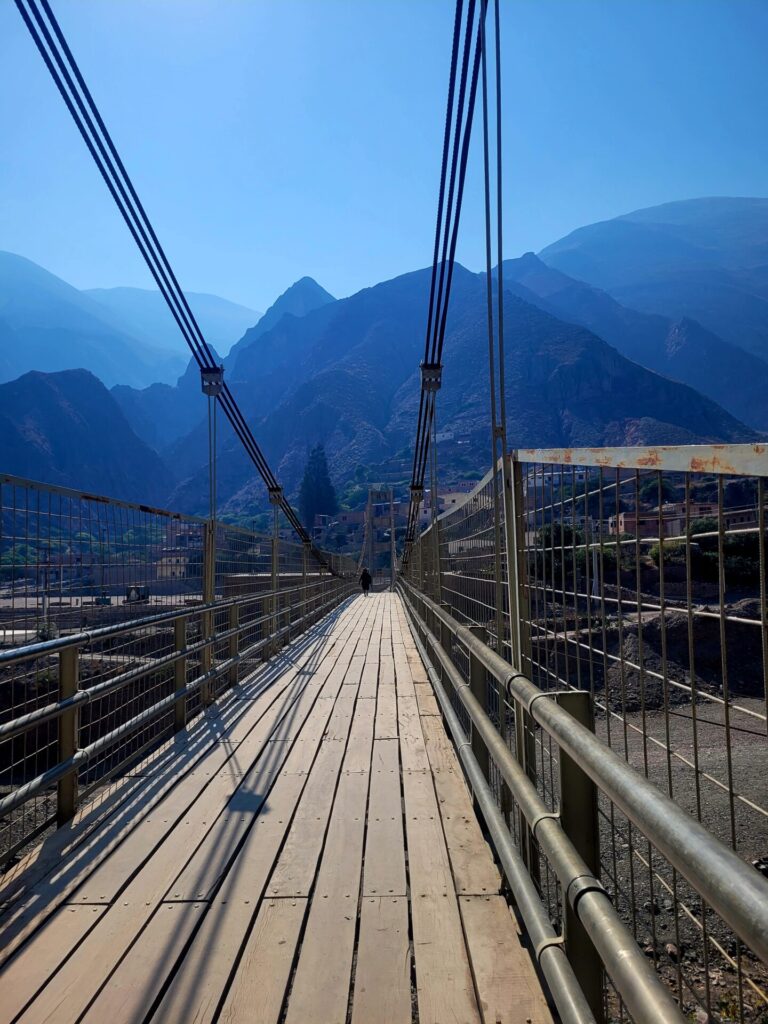
Once you get off the bridge, turn right and continue following the road up. As long as you proceed upward, you are on the right path. Once you pass by the church, turn right, and make your way up the long cobblestone street.
This street is around 400m and can be quite strenuous and tiresome as it’s straight up the entire time on uneven terrain and little shade coverage. There are some shops scattered along the way, selling drinks and fruits, should you need to stock up before the hike.
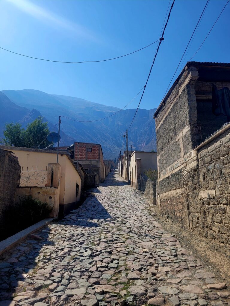
The cobblestone street will abruptly end and turn into a dirt, rocky pathway. Pass the small shrine (on the right hand side) and follow the path left up the mountain.
The Route: Hiking to Mirador de los Condores
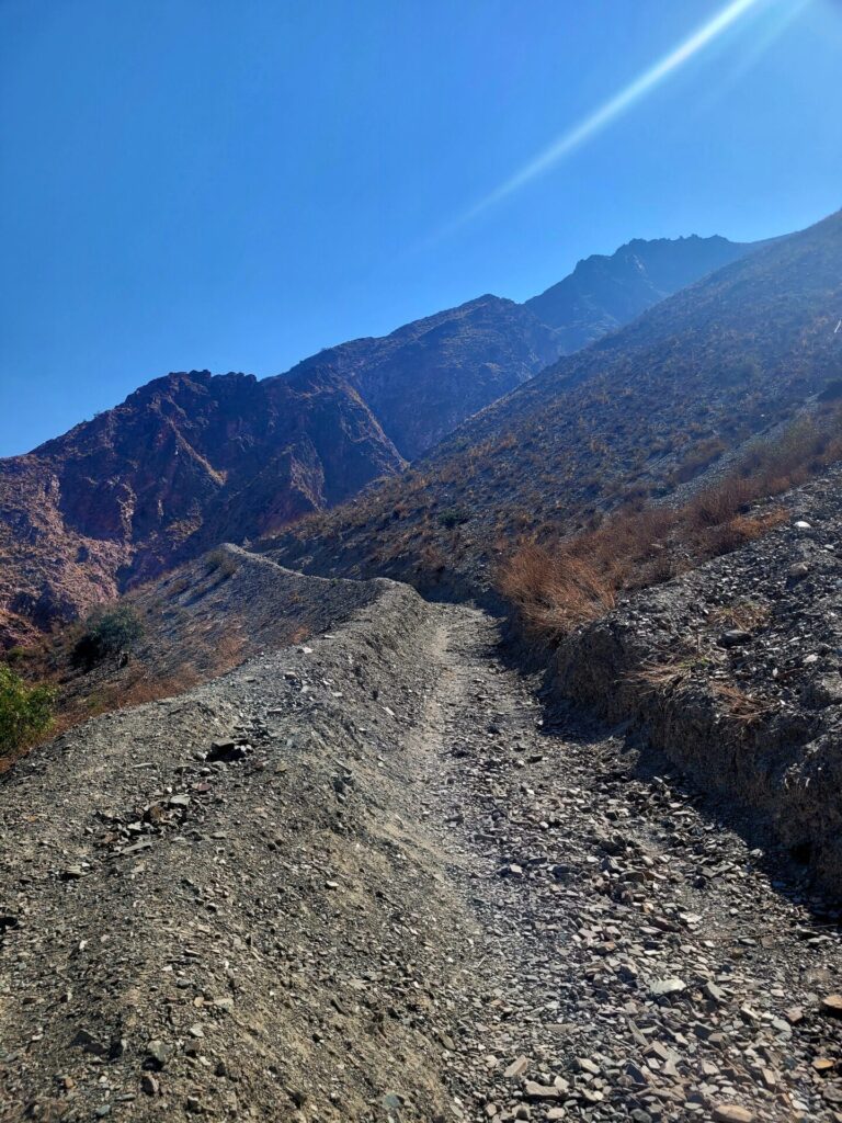
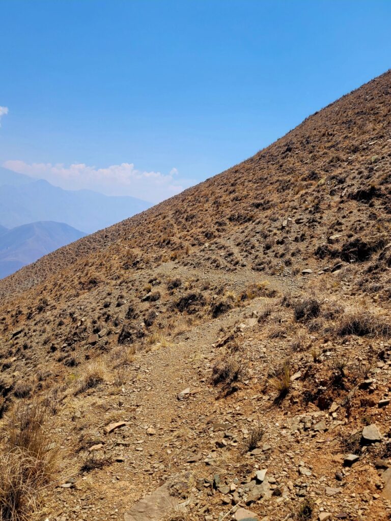
The initial climb to the first lookout point, Mirador de los Condores, is a steep grind up a series of switchbacks. The path is clear and easy to navigate but very tiring in the heat. This section lasts around 1km and gains around 375m in elevation. Other than the gain in elevation, there is nothing technical or particularly challenging about this portion of the hike.
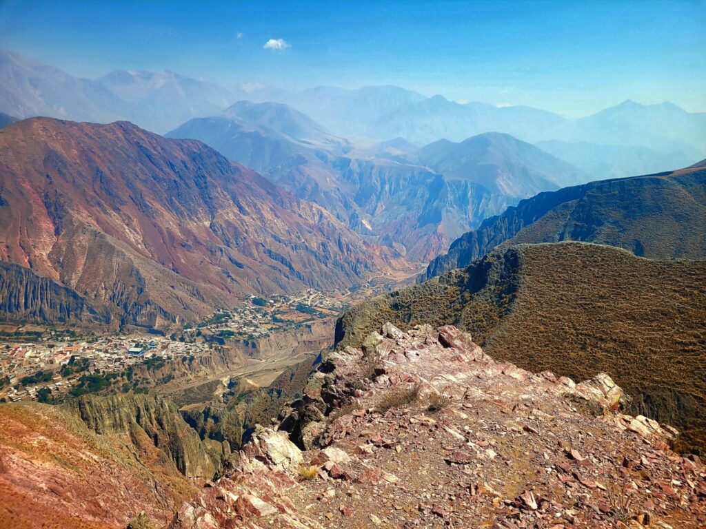
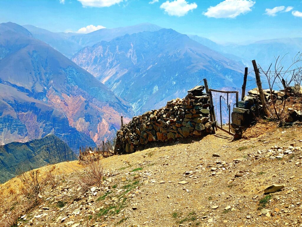
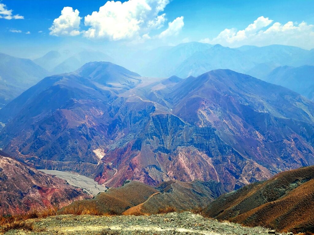
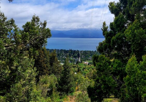
At the top, climb through an abandoned structure which was originally built as an animal enclosure, to reach the viewpoint. This stunning viewpoint showcases the true beauty of Iruya and the valleys below. Most people call it quits and head back down the way they came. However, they would be severely missing out on more stunning views if they stopped there.
The Route: Continuing to Mirador del Cóndor, Viewpoint
If you are feeling gutsy, continue along the trail for another 3km, towards the second viewpoint, Mirador del Cóndor. This path begins flat and heads east further into the mountainside. Again, at this section, the trail is very easy to navigate.
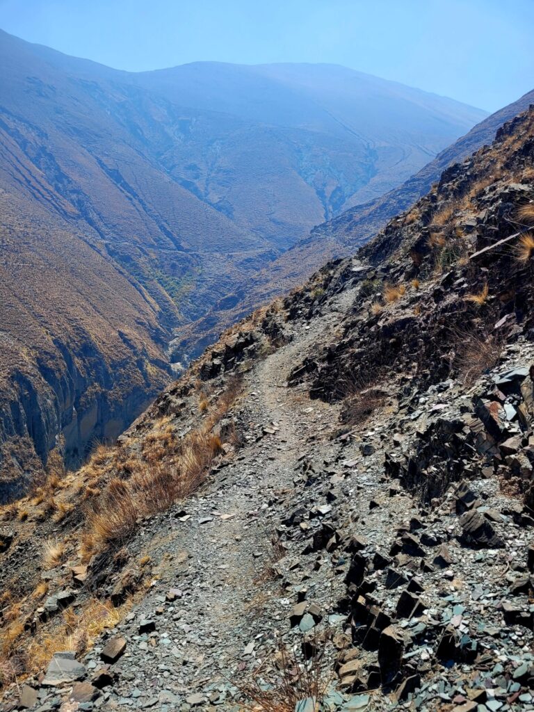
There are multiple little twists and turns scattered along this portion of the trail. The path became very narrow and tightly hugged the mountainside. One misstep and someone could easily sustain injury or fall to their death. That being said, I saw lots of horse hooves, so if a horse can access the trail with no issues, a human can also do the same with some precaution.
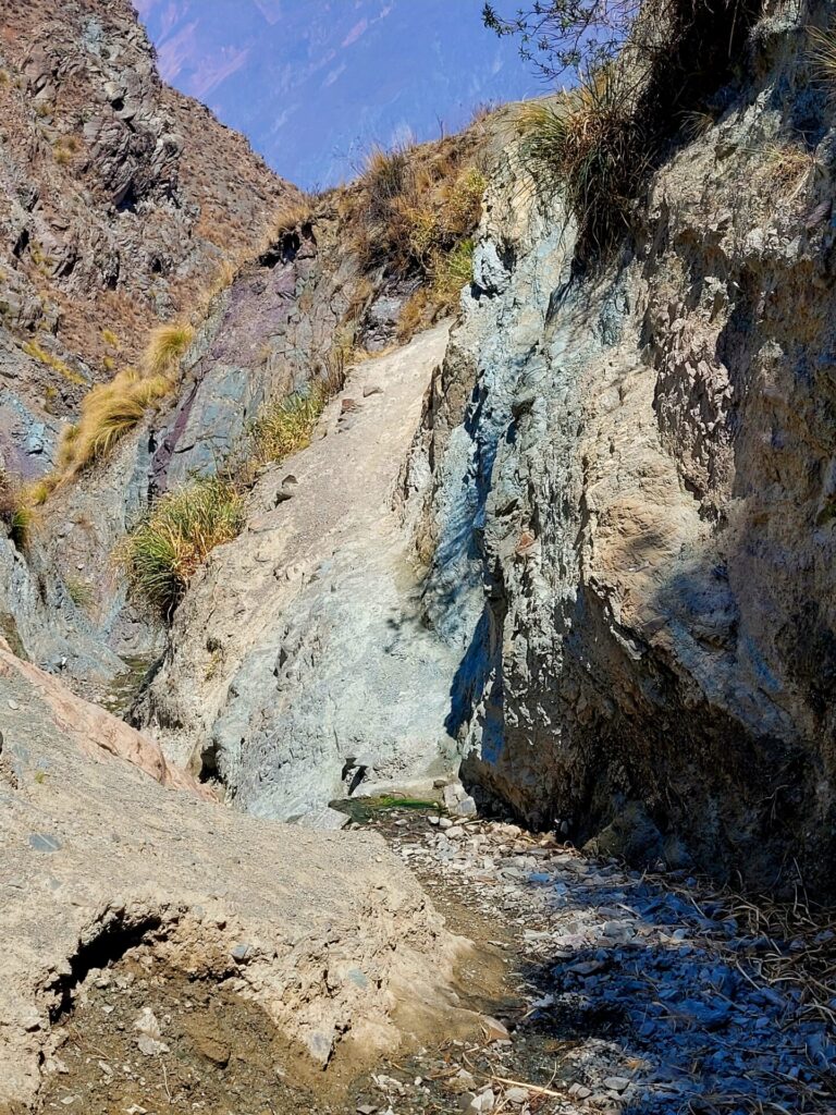
Before long, the trail starts to turn north along the mountainside. From a distance, some passes seem impossible to climb or traverse, but do keep in mind the path reveals its true colours once you are closer.
There were several moments where I thought I was going to turn around because it looked too steep or narrow and at a closer position the path was easier than expected. Having previously sustained an injury on similar terrain, I was very anxious hiking this trail on my own.
After looping around the mountain, the path will straighten up again. Passing by a small stable, hang to the left side of the fence and rock wall. Here is where the path becomes a little less clear. The trail will lead towards a small house, head to the right hand side.
After passing the house, the trail becomes even less distinct and often splits into different directions. I would suggest sticking to the lower path and followings the rocks covered in yellow. I stepped off path several times and ended up having to climb down on loose gravel, which is never ideal, especially in dry conditions.
There is no official end point for this hike, as the trail continues further along the mountain ( I believe to the Titiconte ancient ruins). But after swinging by the mountain, there is a clearing with fantastic views of the valley and mountains. Here is the viewpoint of Mirador del Cóndor. If you are lucky enough, you may even get a glimpse of the magnificent condor.
After catching your breath and soaking up the views, head back the way you came. I found the route back easier to overcome. The wind picked up in the afternoon, reducing the heat and making the trek back more enjoyable in the exposed environment. Other than a few anxious moments along some narrow and steep paths, I did not encounter any issues on this hike. Luckily, I was spared the altitude sickness.
Additional Hiking in Iruya
If Mirador del Cóndor is a little intimidating to attempt, a lesser intense hike around Iruya is sure to get your heart pumping. The half day trek from Iruya to San Isidro is a popular route for tourists and takes you through mountain passes and river beds. This 15km hike is rated as easy/moderate and can be done with or without a guide.
What a stunning view! Pretty sure I’d break my ankle doing this hike, but I’m glad I was able to see it thanks to your photos!
The views make the trek so totally worthwhile.
Wow it looks like an insane place for a hike! The mountains seem so impressive, would love to visit this place one day 🙂
Wow! Looks so beautiful, definitely a hike we’ll want to do at some point. I love the AllTrails map.
This trail looks beautiful and sounds really intense–when you described it as hard you aren’t kidding! The distance and incline are manageable but flash floods and exposure to sun up the challenge. I kinda want to do it 🙂
Those views are so so worth it. I am not very sure If I would be able to hike for so long one day, but people who do these activities are people who I look up to.
It looks absolutely stunning there! Adding it to my list for my next WHV there *w*
What an incredible hike. It seems like every step give you an awesome view!
Amaaazing views! The desert mountains look just as beautiful as the snow capped peaks in the south- just different. Those blue skies are gorgeous too.
I always find it funny with hikes like this where people stop at the first viewpoint. If I’ve done the hard work gaining that elevation, I’d want to go the extra 3km to the even more epic views!
I totally agree. It’s better to just challenge yourself and go the extra mile
Beautiful beautiful views!
I would have to get my fitness up to undertake this hike. At this time, I will just have to enjoy your fabulous photos. Thanks for the inspiration!
Wow! These views look spectacular. I’d love to hit this trail. Saving for a future trip to Argentina!
This looks like a beautiful place to go on a hike. I would love to explore parts of Argentina on foot.
That view is stunning! I loved my trip to Argentina and cannot wait to make it back there someday. I will definitely be keeping your travel tips in mind.
Incredibly informative and interesting! Looks like a beautiful place to hike.
Thanks
Enjoyed reading the detailed trail and hiking in Argentina! I have not been to this country yet, but is in my bucket list. The hike looks quite challenging and fitting for a seasoned hiker through rough terrain. But the view at the end is totally worth it. The colors of the mountains and landscape are awesome. 🙂
I know that Argentina has some pretty amazing mountains but I didn’t know about Mirador del Condor! I would definitely love to visit! This guide is so thorough and detailed, saving it for later!
Thank you