The stunning hike to Galatea Lakes in Alberta’s Kananaskis Country is a crowd pleaser and one of the best hikes suitable for all experience levels. With a variety of terrain, waterfalls, cirques, and three impressive alpine lakes, the Galatea Lakes hike is sure to keep you entertained and your heart pumping.
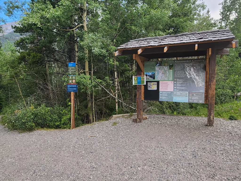
Galatea Lakes also offers one of the largest and well-maintained parking lots and washroom facilities, making this hike rank extremely high on accessibility. For those looking to take a plunge into the icy glacier waters, this hike provides three opportunities for you to put your bravery to the test.
This trail guide will provide details on various routes, trailhead information, and difficulty rating.
Galatea Lakes Hike Trail Information
- Distance: 16-18km roundtrip
- Elevation Gain: 850m
- Trail Type: Out and Back
- Difficulty: Moderate (due to the distance)
- Washroom Facilities: At the parking lot for trailhead and Lillian Lake Campsite
- Permits Required: Kananaskis Conservation Pass
This trail is typically completed as a simple out and back (16km). Hike the defined path up as far as you like until reaching the third lake at the end and retrace your steps back to the parking lot.
There is some slight variation in the trail spanning between Lillian Lake and the Upper Galatea Lake. This alternate trail spans from the western side of Lillian Lake Backcountry Campsites by the washrooms, leads up into the hills and connects to the main trail between the Lower and Upper Lakes.
This alternate section is significantly steeper than the rest of the trail but provides a stunning view of the backside of Lillian Lake to the South. I could not find this route on my AllTrails app, however, there was clear evidence of a trail that was well trodden.
Best Time of Year To Visit
Galatea Lakes Trail is closed from May 1 to the end of June every year for trail restoration. The intention of this closure is to allow for the trail to dry and prevent further damage.
As with most trails in the Kananaskis region, the best time to hike is during the late summer months to early autumn (July to early October). During the summer, the pathways will be clear of snow (mostly) and the water slightly more suitable for swimming.
If you wish to stay at the Lillian Lake Backcountry Campsite, you can only do so during the end of June to November 30th.
The pathway along the lower and upper lakes is exposed and narrow, making for potentially treacherous conditions during the winter months. Avalanches are also a real risk in the mountains during the late autumn to early spring.
How to Reach Galatea Lakes Trailhead
The trailhead to Galatea Lakes is located approximately 1 hour from Calgary, 32.8km south along Highway 40. The trailhead parking lot is the start of many hikes including Terrace Trail, Ribbon Lake Campground, and Guinn’s Pass Summit.
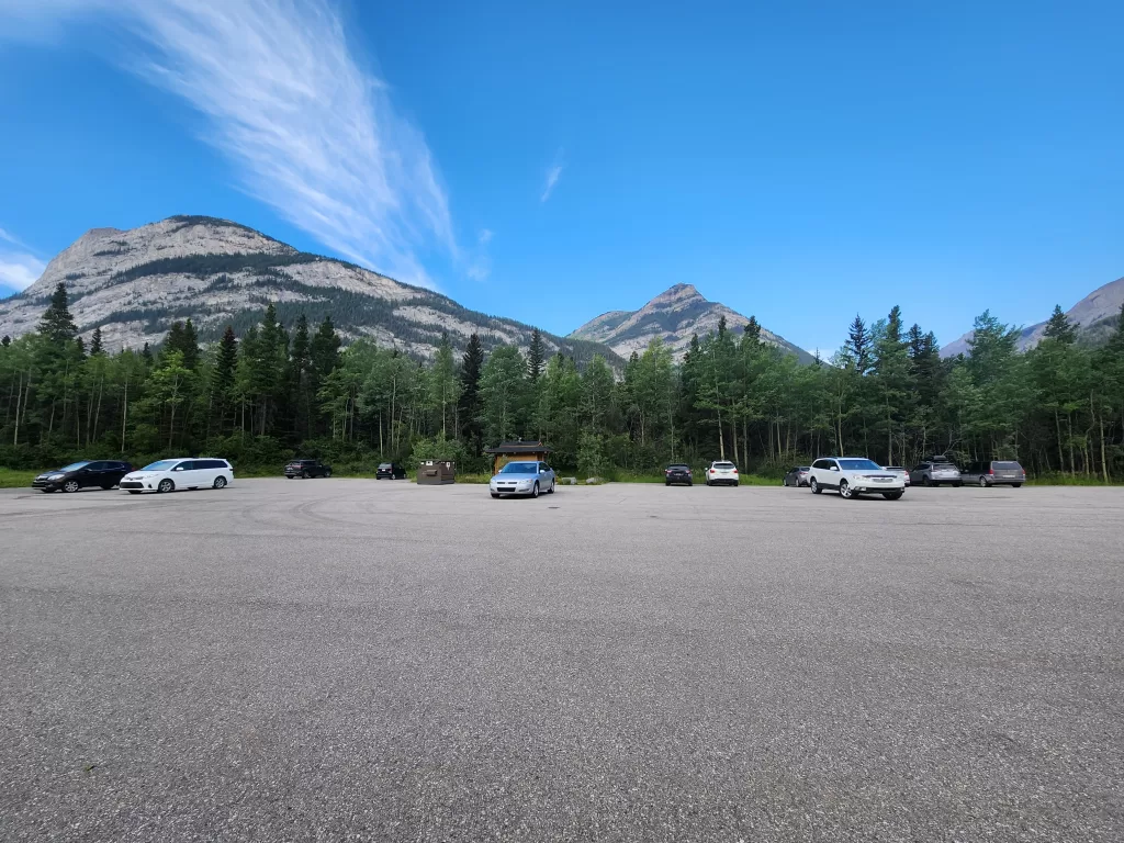
This parking lot has a tendency of filling up early. I’d highly recommend getting to the trailhead before 9am to secure a parking spot during peak season.
Difficulty Rating
The hike to Galatea Lakes is not technical and does not require any serious scrambling or route finding. AllTrails states the elevation gain is over 800m, taking place over a longer distance as a gradual incline as opposed to a steep ascent.
I’d rate this hike as moderate, simply due to its length. There are by no means any difficult sections, it’s just the distance that will test your endurance. It’s best not to rush this trail, as its often crowded with visitors, especially to the first lake (Lilian Lake).
Overall, our group of six with varying experience levels, spent a total of 9 hours making our way to the upper lake and taking the alternate path from the lower lake to Lillian Lake. 7 hours was spent actually moving and 2 hours’ worth of rest stops, lunch, snack breaks and swimming.
The Hike to Lillian Lake
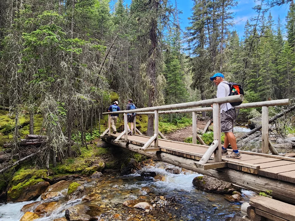
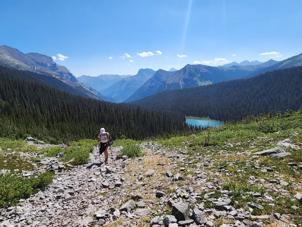
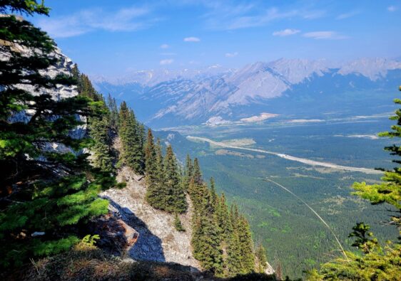
The first section of the trail from the parking lot leads through the thick, forested slopes of Mount Kidd South and Guinn’s Peak. Within the first few minutes the trail crosses a very cool suspension bridge and continues upward along the river.
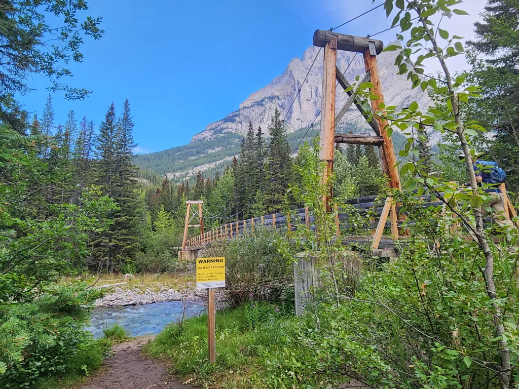

There are several less advanced bridge crossings within the first few kilometer, which is one of the features that makes this hike to accessible and family friendly. Over the next 6km, the path gains around 450m in elevation, as it slowly climbs through narrow wooded trails.
This section of the trail is heavily wooded and while there is plenty of shade and coverage, there are sections of the trail that break out of the treeline and run close to the canyons edge. As you progress higher, the drop into the river canyon becomes much steeper and dangerous. You can see sections where piles of trees have fallen into the canyon due to a rockslide or avalanche.

There are many quiet wooded areas that are great spots to sit on a fallen log and take a breather in the shade.

If you were going to encounter wildlife, this is the section where it would happen. So be prepared, loud, and bring your bear spray in the event of an encounter.
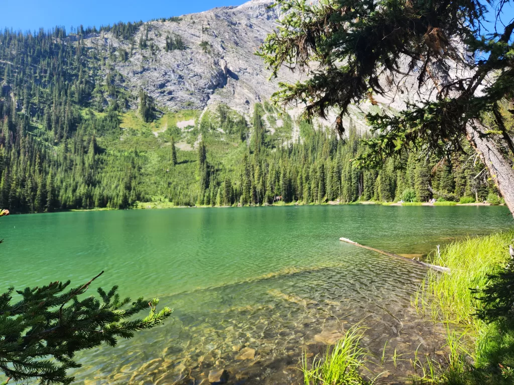
Just past the 6km mark, the emerald shores of Lillian Lake will finally come into view. This would be a great place to rest your legs or head for a swim if you can find a section of shore that is free.
The Lillian Lake Backcountry Campsite has 17 campsites available and costs $12/person per night.
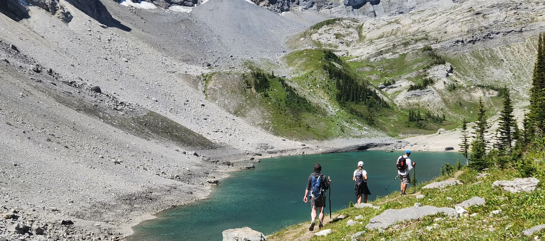
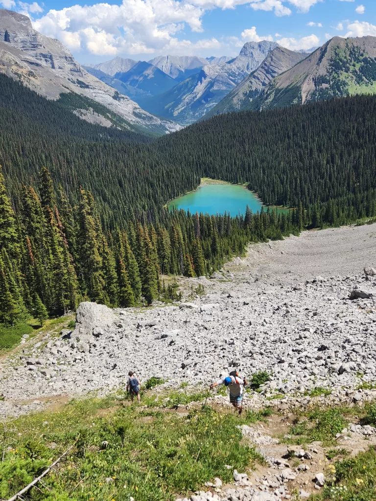
Lower Galatea Lake
The trail hugs the edge of Lillian Lake before turning sharply northeast just as the campground begins. The next section of the ascent is generally regarded as the most difficult portion due to several changes that occur.
From here it is only 1.1km to the Lower Galatea Lake but the trail will ascend at a rate far steeper than anything up to this point. The forest coverage disappears almost entirely, and the path turns from dirt to loose rock.

This is a bit of a slog, especially if the outside temperature is hot, as there is a lot of sun exposure in this area. Once over this climb, the trail settles out, before descending towards the first of the Galatea Lake.

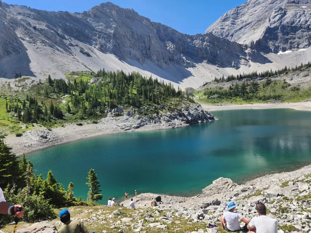
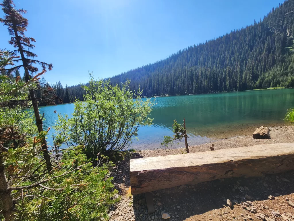
The Lower Galatea Lake is a good rest stop to have lunch, there’s quite a bit of shade and lots of places to sit.
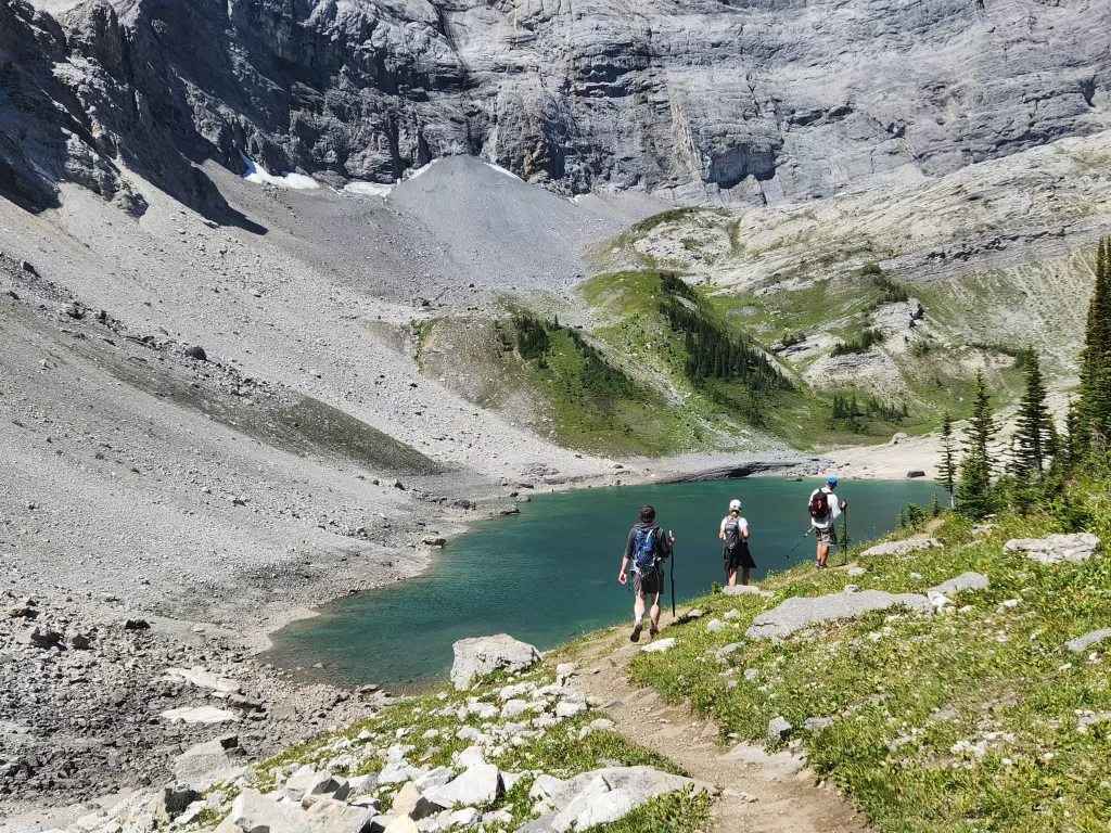
If you feel like pushing through for another 20 minutes you should be able to make it to the even less crowded upper lake.
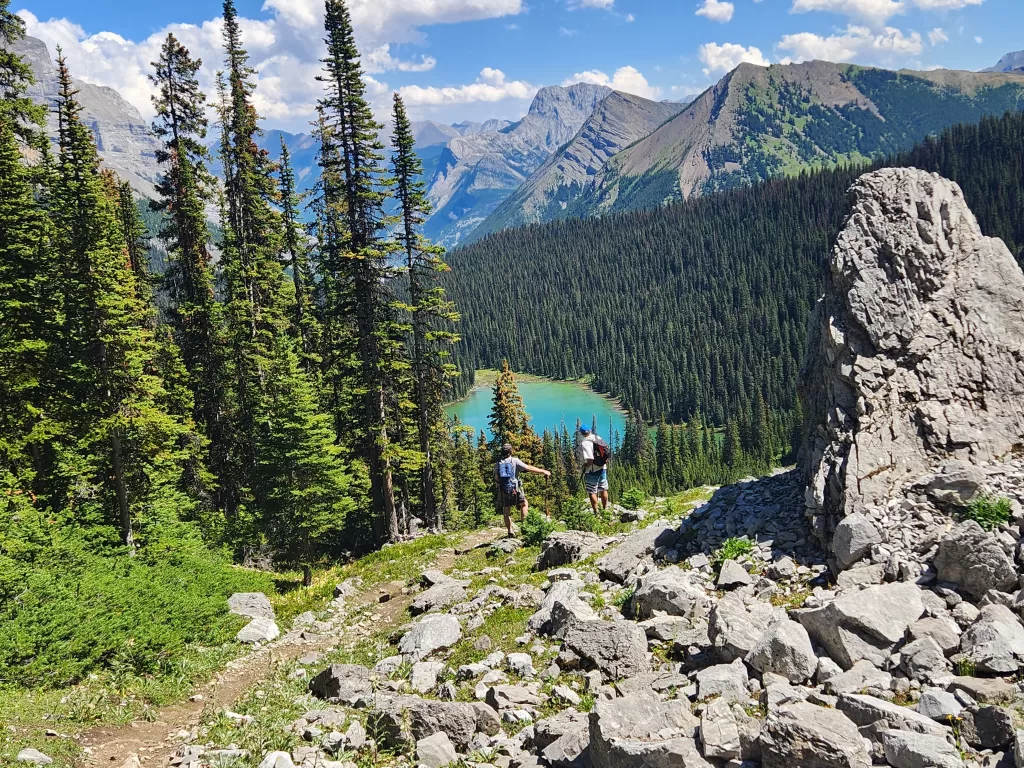
Upper Galatea Lake
Continuing along the perimeter the path will lead to the final alpine lake, The Upper Galatea Lake. Not as many hikers venture this far, as most stop at Lillian or the Lower Lake.


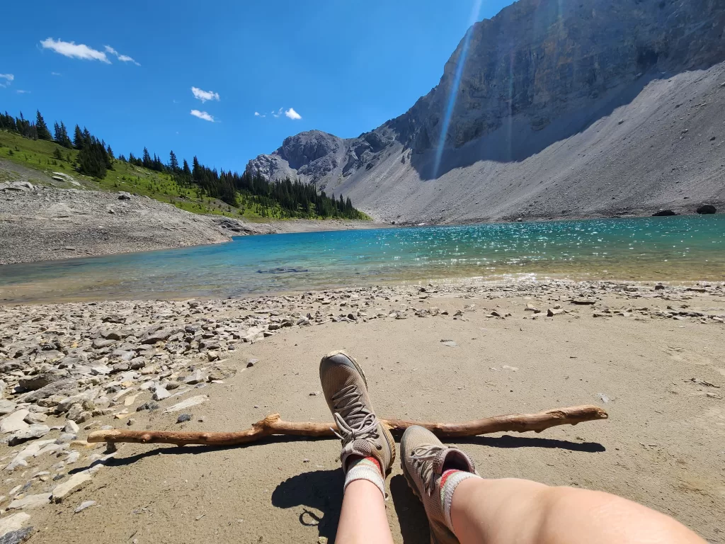
I found this lake had better access to the water and even had a larger beach area than the previous lakes. The water was freezing but refreshing on a hot summer day. We stopped here for an hour to rest our legs and enjoyed a picnic lunch.
Return to Lillian Lake
There are several ways of returning to the parking lot from the Upper Galatea Lake. The easiest route, is the out and back option, returning the way you once came.
The second route loops around the western side of the Lower Galatea Lake, before descending into the forest back towards Lillian Lake.


The path is clearly defined, though not marked on AllTrails apps. So be prepared to go in “blind” before descending. This route is steeper than I would have expected but thankfully the area was dry and easy to navigate.

If you take it slow, the journey down should be fine for most fitness levels. I would not recommend this route if it has recently rained, its just too steep for anything other than sufficiently dry conditions.
This route showcases the backside of Lillian Lake and some of the most beautiful views of the entire journey. The trail becomes very narrow as it meets up with the forests once again. The trail will come up beside the Lillian Lake Backcountry Campsite washrooms and reconnect with the original path.
While this path is completely optional, I would only recommend using it on the way down, as the views it provides are wasted unless you are heading south.

The views climbing the mountain take my breath away. What a stunning place to hike and meditate.
Galatea looks like a must-add to my hiking list. Absolutely beautiful photos.
Amaaaaazing trail Deirdre! You have really made me want to spend more time in Kanananskis as Galatea lakes look gorgeous (and camping at Lillian Lake looks pretty lovely too!)
It’s pretty cool that they close the trail when its super soggy/muddy in the spring. That must help to maintain the trails.
I cannot get over how beautifully you’ve captured the lake! Booking my ticket now lol
These are some really great gems you’ve uncovered – I could definitely use some of this Galatea Lakes air!