Arethusa Cirque is an easy, yet rewarding hike located in Kananaskis, Alberta, Canada. Despite a length on the shorter side at 5km, this stunning hike provides spectacular views and ever-changing terrain.
Suitable for all fitness levels, including children, Arethusa Cirque is a perfect half day adventure with varied landscapes, keeping you entertained with every turn.
This Arethusa Cirque trail guide will provide you with helpful tips to assist with your hike, including information on parking, facilities, best of year to visit and route details.
Arethusa Cirque Trail Information
- Distance: 5km (AllTrails says 4.5km)
- Duration: 2-3 hours with breaks
- Elevation Gain: 300m
- Trail Type: Loop
- Difficulty: Easy/Moderate
- Facilities: None on route. Use washrooms at Highwood Meadows parking lot
- Required permits: Kananaskis Conservation Pass
Best Time to Visit
Arethusa Cirque can be enjoyed during the summer (late June-August) and autumn (September to October). Temperatures in the summer will be warm, in the 20s and 30s degrees Celsius, and the lingering snows will have disappeared by that time.
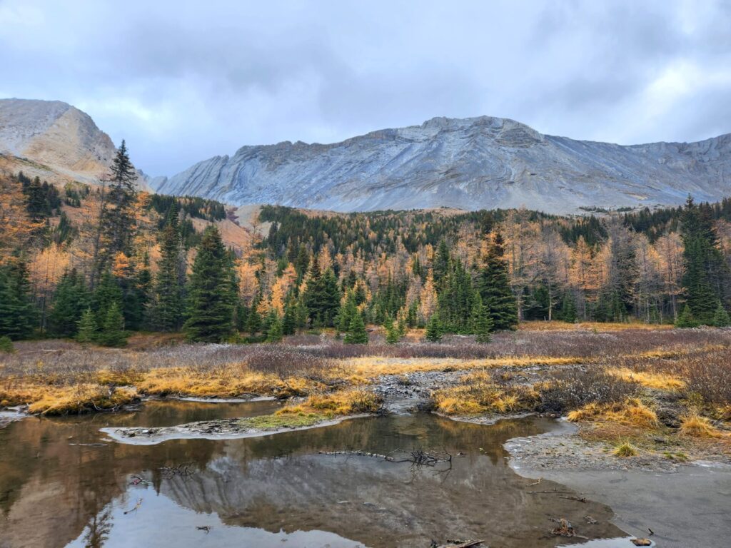
Larch season, which occurs for a few weeks during September and October is an excellent time of year to plan your trip, as the valley below will be transformed from green to golden.
Autumn temperatures can vary, ranging from low 20s to 5 degrees Celsius. Snow can hit the mountains anytime between September and October, cutting the hiking season short.
This time of year, does however draw in the crowds, as the larches are stunning. Autumn also increases your chance of encountering wildlife, which is something to be aware of.
We hiked Arethusa in mid-October. The needles had fallen off the larches, but the area was still beautiful with the fall colours.
Annual Road Closures
There is a seasonal road closures along Highway 40, which runs through Kananaskis, including Arethusa Cirque.
This road closure begins at King Creek and extends to Highwood Junction and is closed from December 1st to June 14th each year.
How To Reach the Trailhead
The trailheads for Arethusa Cirque, Little Arethusa and Mount Arethusa can be found at the same location, 62km south from the Kananaskis Information Centre along Highway 40.
This area is very popular with day trippers from Calgary since it is under a 2-hour drive from the city.
There are two main ways of reaching the Arethusa Cirque trailhead from Calgary: Trans-Canada Highway or Millarville/Longview.
The Trans-Canada Highway is often under construction but is straight forward before reaching Kananaskis Trail (Highway 40).
The Millarville/Longview route is shorter for those living in the south of Calgary and offers plenty of beautiful views along the way.
Calgary-Kananaskis via Millarville/Longview route here
Calgary-Kananaskis via Trans-Canada route here
Trail Markers/Maps
There are no trail markers for the trailhead or on route for Arethusa Cirque, Little Arethusa, or Mount Arethusa. The trails are not maintained, so do not expect markers other than rock cairns to guide your way.
I highly recommend downloading an offline map before venturing to this area. We took a wrong turn within the first 10 minutes of the trail, as the forest section is a little misleading with many veering paths.
One very cool feature about this hike is that you are able to see the entire loop from almost any point through it. It’s thanks to this layout that the lack of trailer markers isn’t as much of an issue.
It’s incredibly easy to maintain a good sense of direction and the distinct geography of the area will tell you where you are at all times.
Clockwise or Counterclockwise
Arethusa Cirque trail is a loop. Hikers have the option of going either clockwise or counterclockwise. Unless you want a steep climb, I would highly recommend going counterclockwise on this loop.
Once through the cirque, the trail is easy to spot going down, as you pass through a rocky field. This area would be more challenging to find is going clockwise. While it’s not impossible, the path just doesn’t appear to be as visible from the clockwise direction.
Most visitors I encountered while hiking went clockwise. My family and I took the advice of the AllTrails reviews and went counterclockwise. We did not regret it.
Washrooms/Facilities
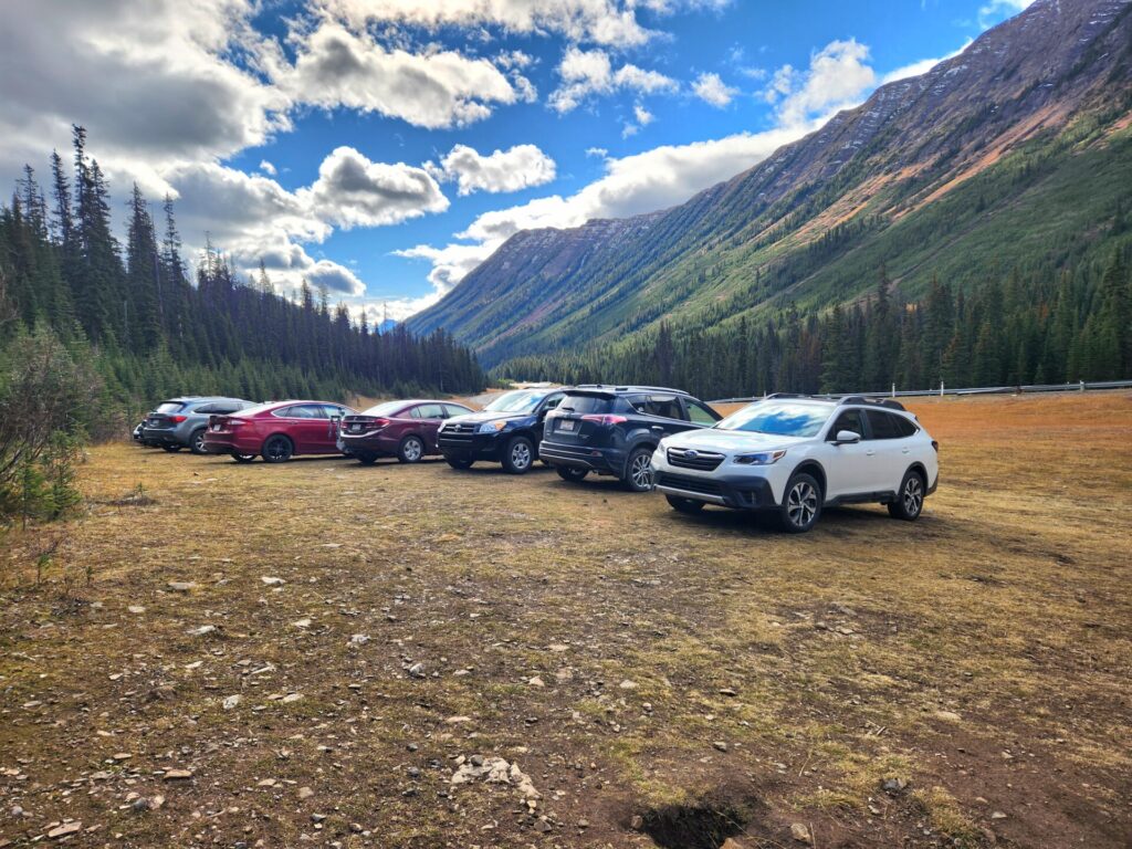
The parking lot for the Arethusa Cirque trailhead is a small patch of land off the main highway. The terrain is rough, so a vehicle with off road capabilities is recommended.
There are no washroom facilities at this trailhead and no internet service, so plan accordingly.
The nearest washroom (drop toilets) is located at the Highwood Meadows Parking Area, which is the trailhead for Pocaterra Ridge and Cirque and is only 1.6km north on highway 40.
The Forest
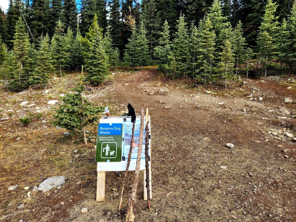
The trail begins on the left-hand side of the parking area. There is a small sign that informs hikers of the wildlife in the area and to dispose of dog waste. The path immediately starts in the forest for 1km.
The terrain has a lot of roots and is on a slight incline, as you make your way towards the meadow. The entrance to this meadow is the actual beginning of the loop.


Taking a moment to survey the surrounding hills it’s very easy to visually map out where the trail will take you. As mentioned before, you can see the whole loop from almost any point, and the rocky meadow at its entrance is always in view.

At the meadow is where the trail splits off into many directions. As previously mentioned, if you want to avoid the steep incline, head to the right-hand side and proceed up the counterclockwise route.


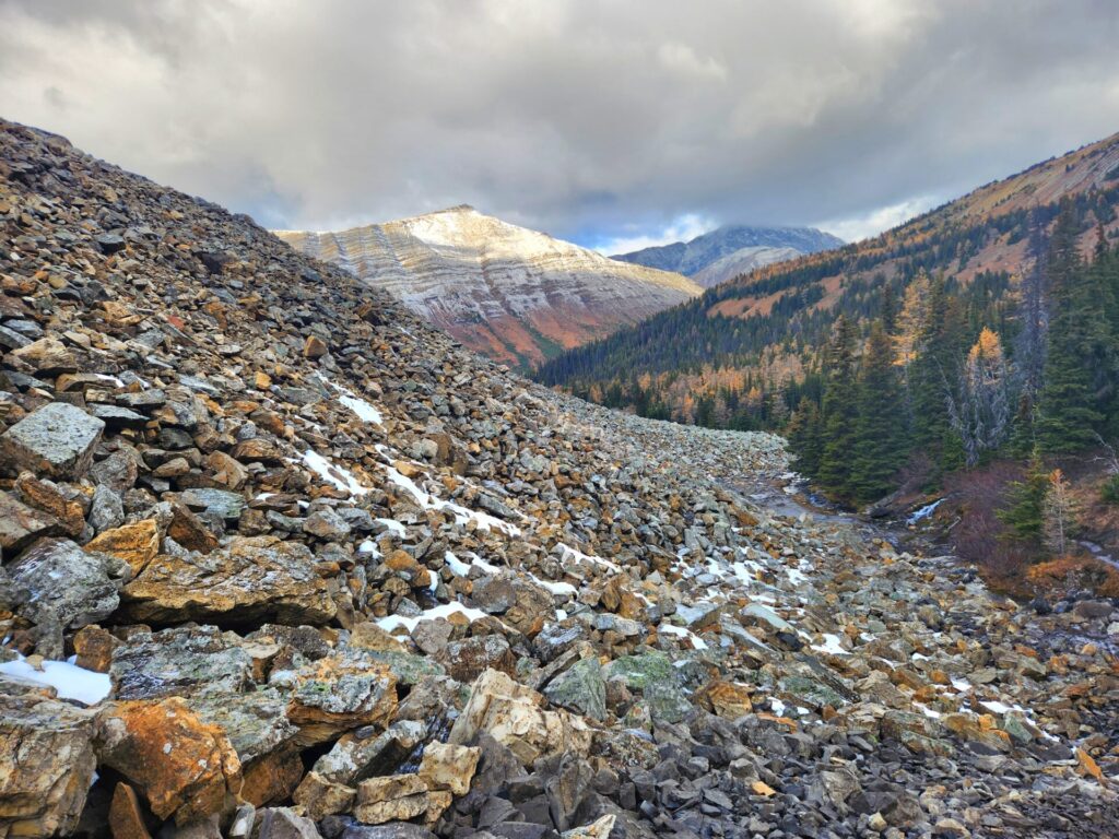
Leaving the forest and meadow, the trail will walk alongside a rock field and stream. There are several river crossings to be done, but each is manageable. This area becomes rockier, as you proceed up towards the cirque.

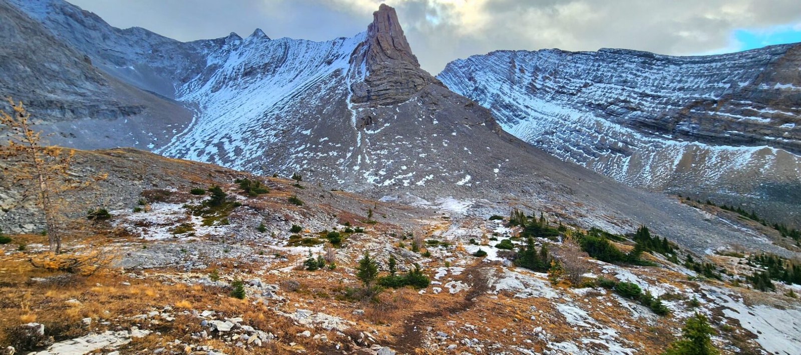
The Cirque
Climbing slowly up the mountain pass, the trail will lead between two rocks field. Extra caution should be taken in this area as it’s very rocky and there is a potential for rockslides in this area.
The path is not very defined here, so it may feel like you are going in the wrong area. Rest assured you are not.


Before the path curves into the cirque, there will be two small trails climbing up the rocky mountainside. I am not entirely sure where they lead, as they were not marked on AllTrails. Walk past the trails veering off and continue through the rock field.
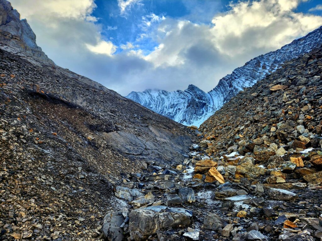

The trail will end at the cirque, before turning back up the hillside. This area is more defined, as it climbs up along the mountainside.

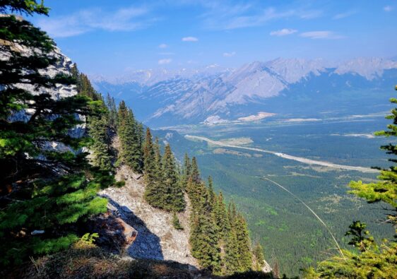
The Hillside
While technically not a ridgeline, this hillside walk provides excellent views of the valley below and cirque.
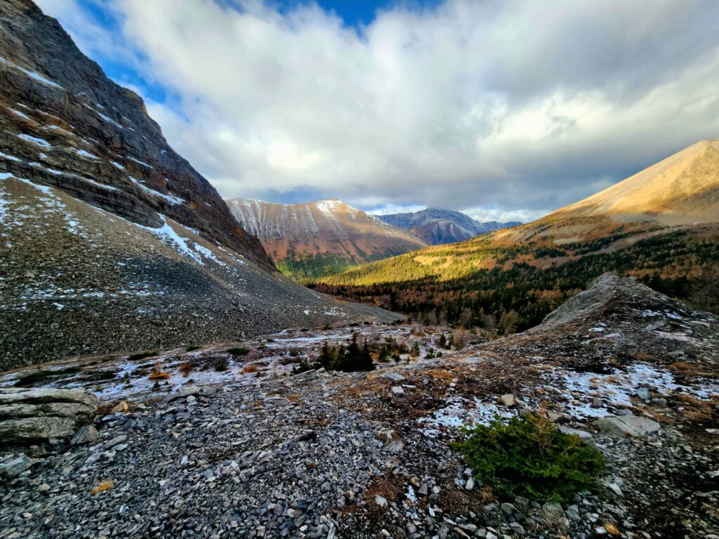


The terrain is like a ridge, with narrow gravel/rocky trails and boulders. During larch season, this would be the perfect area to see the golden valley below.


The trail is fairly flat along this hillside, with rocky mounds on the right-hand side. Before looping back down towards the forest, there will be a junction of trails. This is where you can venture further to Little Arethusa and Mount Arethusa.


The descent into the forest is steep, but manageable with proper footwear and some poles. This area receives far more sunshine than near the shadowed cirque, so the ground wasn’t as wet, making for an easier descent.

Once on flat round, the path continues to venture through a narrow forest before meeting up with the meadow once again. Here, take the original trail back through the forest toward the car park.


Your photos are breathtaking.