
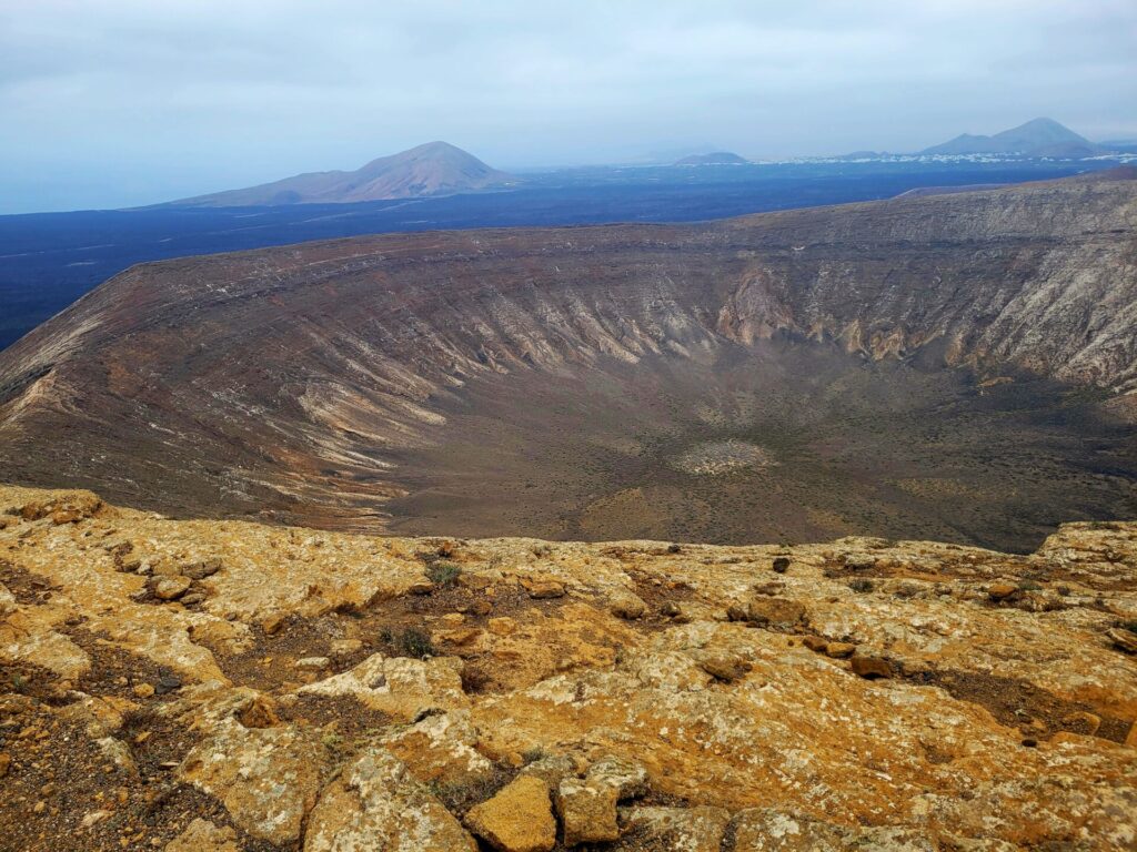
Caldera Blanca is a popular volcanic crater hike on the island of Lanzarote. This extinct volcano has a crater diameter of 1200m, making it the largest on all the Canary Islands. This unique hike is in the Volcanoes Natural Park (Parque Natural de los Volcanes) and showcases some of beautiful, rugged, volcanic landscapes of Lanzarote.
This guide will assist you in planning your hike and provides information on when to visit, finding the trailhead, and the route.
Disclosure: I only recommend products I would use myself and all opinions expressed here are my own. This post may contain affiliate links that at no additional cost to you, I may earn a small commission.
Caldera Blanca Trail Information
- Distance: 11km
- Time: ~ 3hrs
- Elevation Gain: 446m
- Route: Loop
- Difficulty: Moderate
- Washrooms: None
Tour or Self-Guided
The hike to Caldera Blanca can be done independently or part of a guided tour.
There are several information signage posts throughout the early stages of the hike, providing details of the area and volcanic formations.
For those not wanting to deal with the logistics of transport or feel more comfortable in a group, there are several tours in the area that visit Caldera Blanca and neighboring Timanfaya National Park.
Book your Caldera Blanca tour here
Book your Timanfaya National Park tours here
Best Time to Visit Caldera Blanca
Hiking the stunning Caldera Blanca in Lanzarote is an unforgettable experience, but timing your trip to coincide with the best weather conditions can make it even more enjoyable.
The best time of year to hike Caldera Blanca is from February through June or September through December. During these months, temperatures are mild and comfortable for hiking, and the scenery is breathtaking.
Hikers should note that July and August can be quite hot and sunny in Lanzarote, making a long hike on Caldera Blanca difficult.
I visited in the month of June and hiked Caldera Blanca in the early morning. While this allowed for us to find a parking space and avoid the heat of the day, the mist from the ocean made for a dreary looking atmosphere. The mist normally clears in the early afternoon, if you are looking for better photo opportunities.
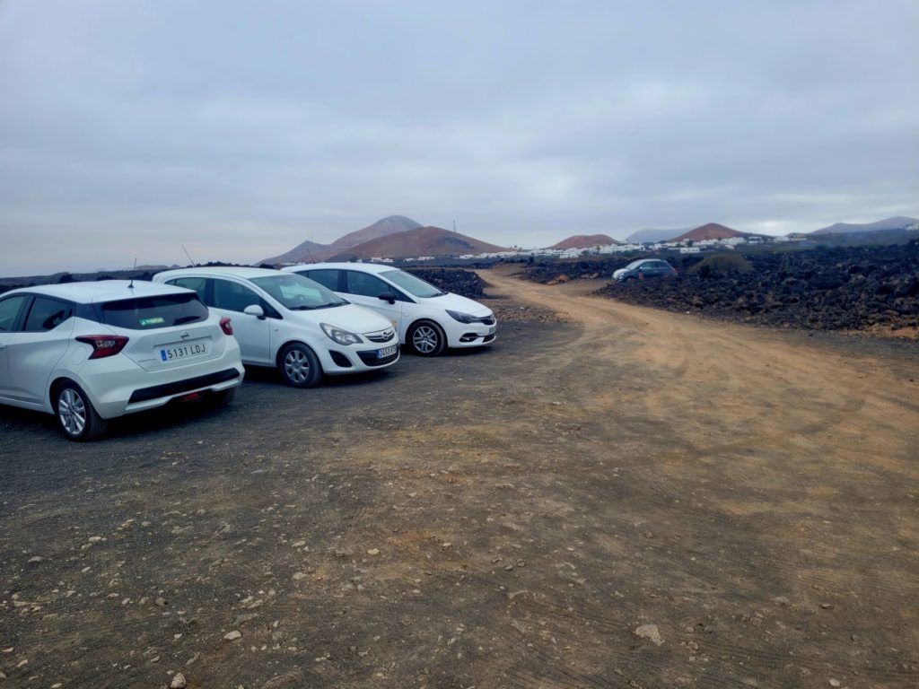
Caldera Blanca Trailhead/Parking
There are two ways of reaching the trailhead for Caldera Blanca: car or public transit.
By Car:
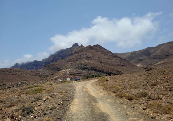
Caldera Blanca is located in the municipality of Tinajo. To reach this area from the capital city of Arrecife, drive north-west towards the village of Mancha Blanca.
Continue west on the LZ-67 until you come across the road Cam. a Crater. This single lane gravel road will lead you to the trailhead parking lot. There are plenty of spots available in the early morning and it is free of charge.
The entire journey usually takes around 25 minutes.
Plan your route here
Book your car rental here
By Bus:
Bus 16, 52 and 53 run frequently between Arrecife and towards the northwest of the island. All three routes make stops in Mancha Blanca.
There are two bus stops in Mancha Blanca: Mancha Blanca and Teleclub Mancha Blanca. From either stop, head west on Calle Chimanfaya. Before the road heads left (south), take the dirt road “Cam. a Crater” towards the parking area.
The trip will be around 30-40 minutes.
Lanzarote bus route/timetables here
Caldera Blanca Hiking Route
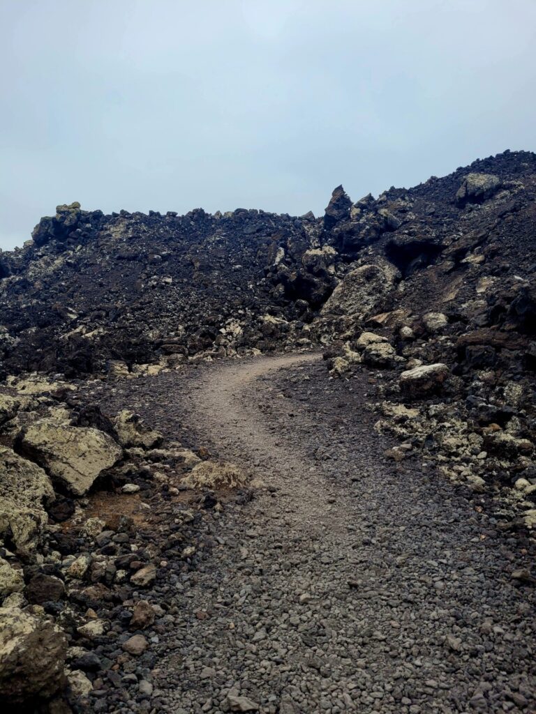
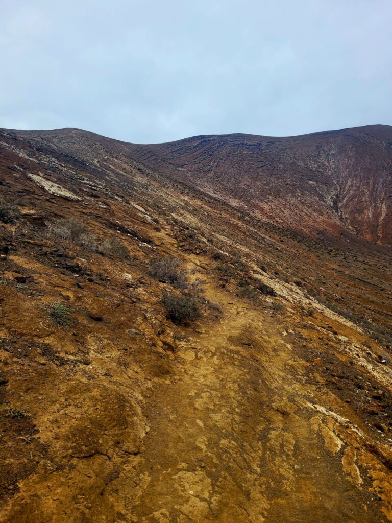
This path begins through a maze of volcanic rock for 1.5km. This initial route is flat, with no elevation gain.
Piled high, the rocks obstruct the view of the volcano and it can be quite disorienting as the path twists and changes direction frequently. The black rock generates a ton of heat, so it’s best to attempt this hike in the early morning. Along the trail you will come across information panels detailing the geology which shapes the area.
As you approach Caldera Blanca, there will be an intersection in the road. This trail is a loop, so either route will take you to the summit. The path that continues straight passes along the base of Caldera Blanca and climbs steadily to the crater on the north side of the volcano. This trail will walk counterclockwise.
The path to the left reaches the summit much sooner and walks clockwise. I’d recommend this route for those wanting to only see the crater and not explore the rest of the area.
I chose the counterclockwise route, as I wanted to experience the crater from the west side.
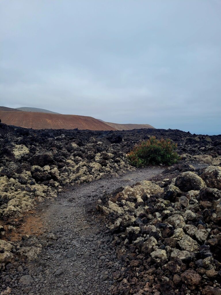
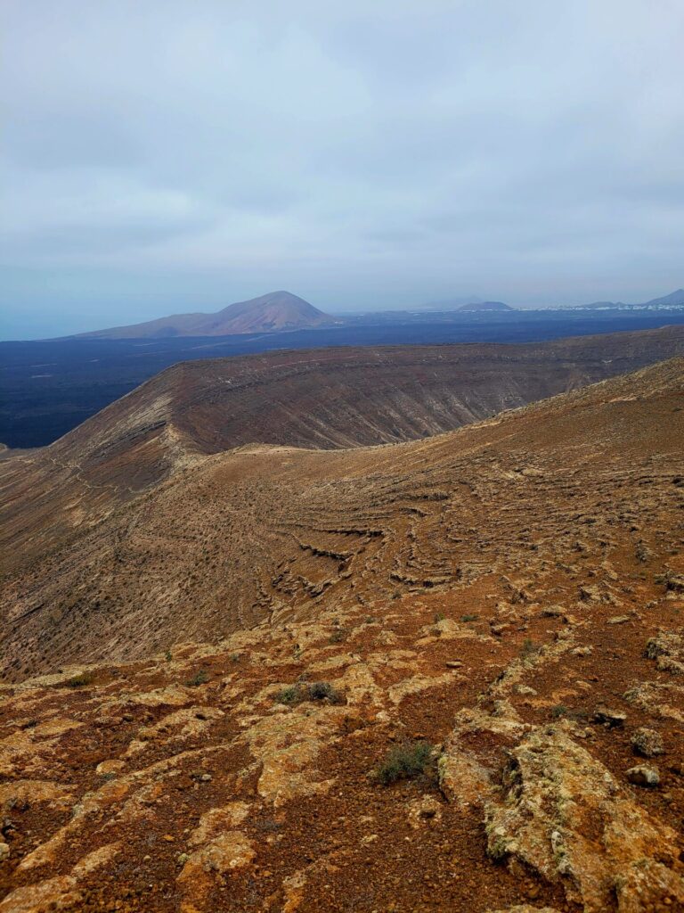
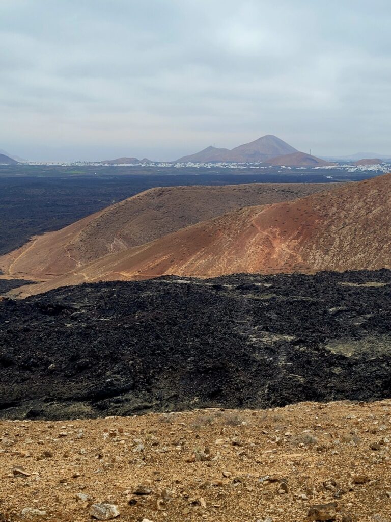
The trail hugs the extinct volcano for another 1.6km, slowly making its way to the northwest corner. The slow, rocky, climb up the north side not only provides views of the Atlantic Ocean, but also of Timanfaya National Park which borders Caldera Blanca’s western slope.
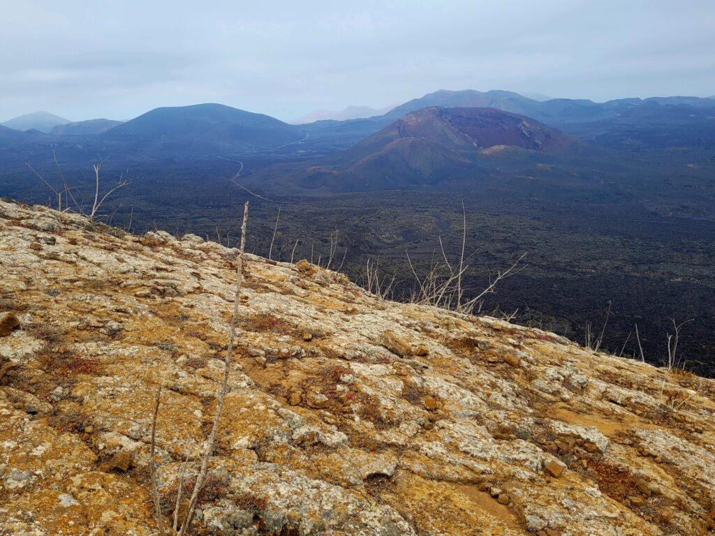
This park is barren yet beautiful. The onyx lava, mixed with deep red earth is a sharp contrast. Hiking and driving in Timanfaya is restricted to certain areas to protect the natural ecosystem of the national park. If you want the freedom to explore and still walk amongst lava flows, I would recommend Volcanoes Natural Park over Timanfaya. The park is free and just as beautiful.
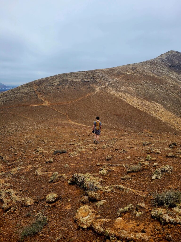
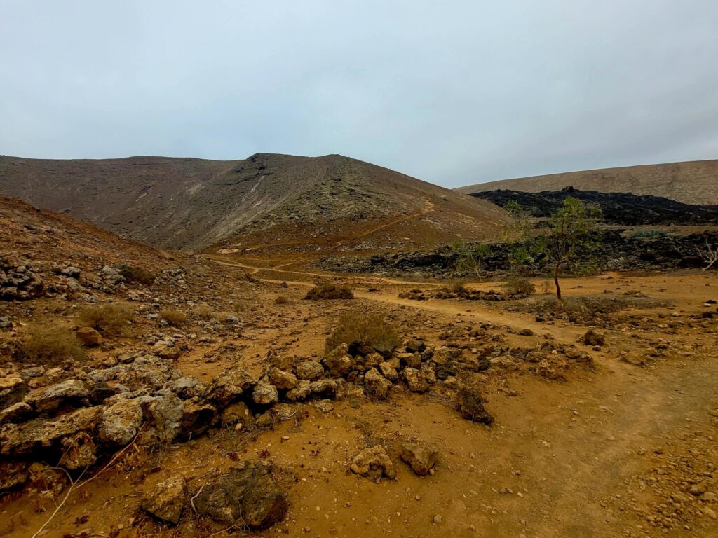
Over the next 1km, the trail will climb over 300m towards the crater. It’s not overly difficult but can be quite windy as you ascend.
Before heading south along the ride of the crater, take a slight detour north towards another viewpoint: Risco Quebrado. The path gains more elevation and heads west of the crater but is worth the views. This trail is a little tricky getting back down, as there is a lot of loose rock. The detour will add an additional 1km on your journey.
Head back down the steep slope and continue along the crater. If you are lucky to hike during the winter months with rain, there is a high chance you could see the crater lush and green. Unfortunately, I hiked this during June, so all I saw was an empty beige crater.
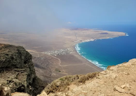
The initial route down the crater is a little rocky, but a gradual descent. Views of the village of Mancha Blanca and the lava fields can be seen for miles.
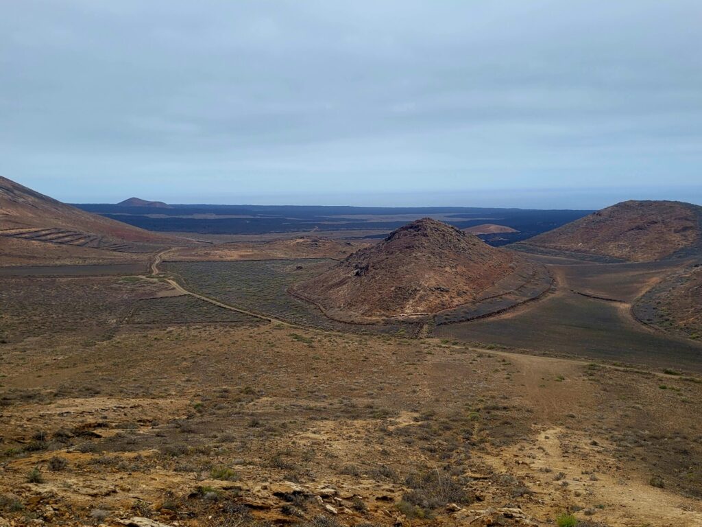
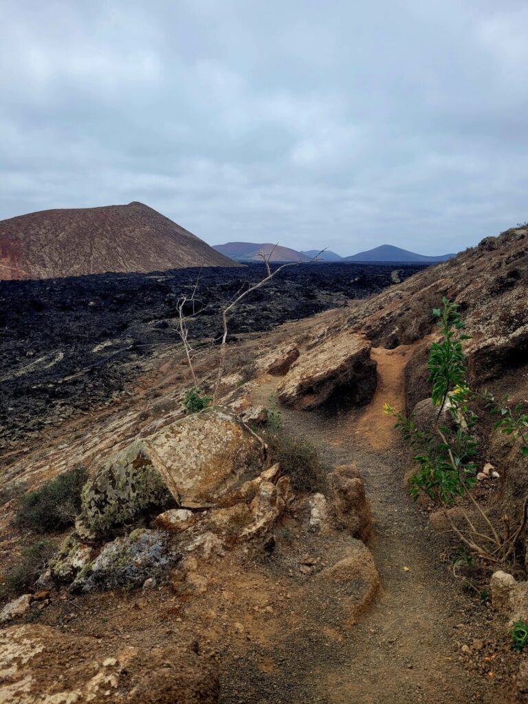
The trail meets back at Caldera de Montaña Caldereta. This is a small crater, but nearly as impressive as Caldera Blanca. The trail will reconnect back and lead back to the car park, through the lava fields.
Further Exploring
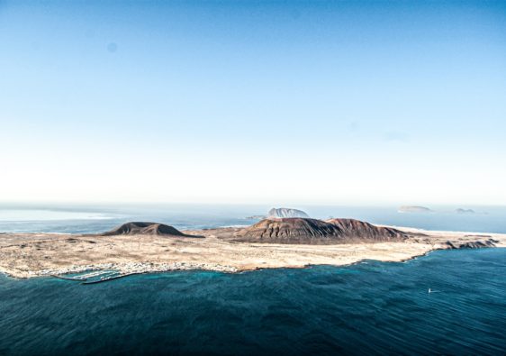
Lanzarote offers a wealth of unique and beautiful hikes to explore. Peñas del Chache and La Graciosa are just two of the many areas that you can enjoy if you’re looking for a unique outdoor adventure.
Both hikes offer stunning views of the volcanic island. Whether you’re an experienced hiker or just starting out, there is something for everyone in Lanzarote’s diverse hiking scene.
I absolutely loved the photos. They all are so pretty. You must have enjoyed a lot there fir
I felt like I hiked along with you thanks to your wonderful photos.
Oh my goodness, that trail looks so remarkable and unique! The photos make me want to transport there right now. Thanks for the great info!
I love hiking and hiking a volcano like this would be amazing! Very different from your typical trails.
It was quite the experience
Wow, I can’t get over those gorgeous cliffside views. They are stunning! The water is so blue. Thanks for sharing this gorgeous hike!
Thanks!
The trail to the crater and then El Golfo to Playa del Paso looks like an amazing hike. Thanks for sharing!
The step-by-step instructions and photos are so helpful. And WOW the crater at Caldera Blanca looks amazing!
I loved the very helpful information. The map is extremely helpful to get an idea of the route. Thank you!
That looks like an amazing hike, Deirdre. Loved reading about it.
This is a great post that details the important practical information needed for a trek like this. I’m glad you included lots of pictures to give a sense of Lanzarote’s landscape. It has to be seen to be believed! Thanks for sharing.
Hiking a volcano is on my travel bucket list, thank you for sharing such a detailed guide and the trail map too is very helpful!
What a gorgeous hike! Do you think beginners could do this easily?
Yes of course. If you chose the clockwise route, the climb to the summit is shorter. As long as you take your time and wear the proper footwear, this trail is suitable for all ages.
For beginners, I probably wouldn’t recommend taking the described route. But those who aren’t as experienced could definitely take the shortcut to the crater rim.
I love all the included photos, these views are really amazing! I didn’t know about this hike at all, but now I would love to see it in person.
Your photos are great. Canary Islands is still on my bucket list, and I have never heard of this hike so I am even more intrigued. thanks for opening my eyes. Will definitely get there in the next couple of years.
I love unique landscapes, and this place looks like it could be on a different planet! I feel like I went on the journey with you, thanks to your description and great photos. But like all great destinations, nothing compares to seeing it first hand! I hope to get here some day.
So cool! I’d love to get over to the Canary Islands for some hiking 🙂
I recently started hiking again and forgot how peaceful it is. This looks like an amazing one to add to my list. Thank you for sharing
Thank you for taking me along with you. An amazing experience and its barren landscape is beautiful.