Windtower Summit is a moderate/hard mountain hike located in Kananaskis. With panoramic views of neighbouring mountains and lakes, it’s no surprise this steep mountain is a fan favourite. This Windtower Summit Hiking guide will provide all the details on how to safely complete this hike.
Trail Information
- Route: Windtower Summit
- Distance: 10.8km
- Elevation Gain: 935m
- Total Height: 2688m
- Difficulty: Moderate/Hard
- Time: 4-5 hours
- Trail Type: Out and Back
- Washrooms: none on route or trailhead
- Best Time to Visit: Late June-Early September
Required Park Passes
As of 2021, a daily pass must be obtained in order to access hiking trails in Kananaskis and Bow Valley. Daily passes cost $15 CAD per vehicle and help with the preservation of the parks. They can be purchased in-store at the Canmore Nordic Centre Day Lodge or online through Kananaskis Conservation Pass. Alternatively, a yearly pass can be purchased for $90 CAD and includes 2 vehicles.
Mountain Hiking Safety
Hiking in the Canadian Rocky Mountains is not for the faint of heart, especially ridge walks and summits. While this trail does not require any technical climbing experience, exposure to screes and scrambles is essential.
Scrambling usually entails using your hands and feet to climb over ledges, onto rocks or over boulders. Windtower Summit has some mild scrambling in the last 2-3km.
Loose rock at the base of a mountain, also known as a scree, can be a fun and exhilarating way of descending down a mountain, if done correctly. On the other hand, it can feel like a death trap, with the ground literally sliding underneath your feet.
The final kilometre to the top is a grind and you will encounter a scree slope. Care must be taken on both the ascent and descent.
Once down the initial scree slope, I proceeded to go down the talus, which is a collection of scattered rocks large enough to walk on without shifting, I found my footing was much easier to maintain on talus than scree.
Wildlife is also something to be cautious of, as bears and mountain goats frequent the area. Read up on this bear safety before heading out to the trail.
Getting to the Trailhead/Parking
As with many trails in the Rocky Mountains, signage is lacking around the trailheads and designated parking areas.
Amenities and more importantly gas stations are nonexistent the further you go, so it’s important to make sure you have more than enough fuel and a GPS so you know where you are at all times.
Route from Calgary: Head west on the Trans-Canada Hwy AB-1 towards Canmore. Take exit 93 (Three Sisters Pkwy) and drive along the AB-742 through the outskirts of town for another 6km.
After looping around the Canmore Nordic Centre, the road will turn to gravel and begin ascending into the mountains. Continue for another 20km and you will reach the destination. There will be parking on the right hand side, next to West Spray Lake. Additional parking is located on either side of the road.
Drive Time: 1 hour 45 minutes

Route Details
This path is horribly marked in the first 1km. There are a few different hikes which all originate at the same point on the road. For the first kilometre or so, many of these paths criss cross each other and eventually branch out into their own distinct routes.
Its important to know which direction you are meant to be heading in, otherwise you may end up on a different trail altogether.

Luckily for us, someone had enough and decided to make their own markings to get you through the first forested area. Follow the signs and stick right.

For clarities sake, the first 20 minutes of the hike through a thick forested area will be the only portion where the trail can be confusing.
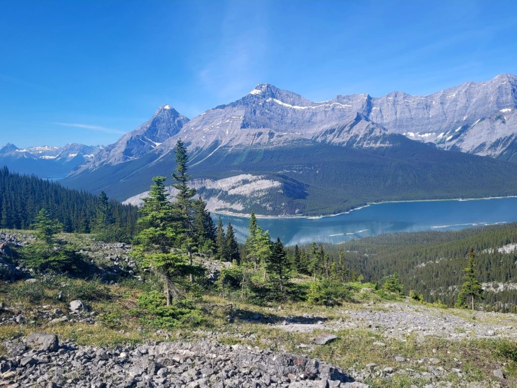
Windtower trail loops around the south east side of the first hill you start on. Once you begin properly ascending, you should have the forest on your left, and a steep drop into lower terrain on your right with the summit ahead and slightly to the right, as seen in the photo below.

Maintain the orientation of the summit, keeping it on the right and it will get you through the first section of the hike after which point the trail becomes very straightforward.

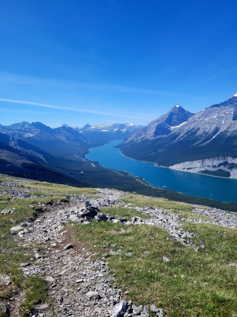
Around 3km the path finally begins to plateau. To the north, there is a short 5-10 minute detour which leads to a lookout, while the main trail takes a U-turn and begins heading south.
While you make your way around the perimeter of the mountain summit there are fantastic views of the spray lakes reservoir to the southwest. You can also clearly see the road you came in on, which does help maintain orientation and reduces the risk of loosing track of where you are.


At 4km, the route will switch gears and proceed to climb again. The trail goes up for the last 1km, on rocky terrain. Light scrambling is required.

Don’t be surprised if you come across wildlife while ascending Windtower. On my way up, I encountered a large group of mountain goats grazing.

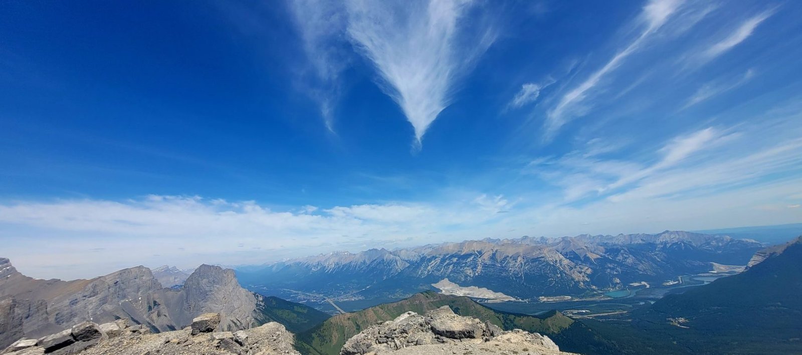
After the intense steep climb, the summit comes into view, quite abruptly. It provides panoramic views of Canmore and Dead Man’s Flats and the West Spray Lakes.

It’s called Windtower for a reason, as it is super windy.
If you are afraid of heights, stay away from the edges, as it is a straight drop down to a certain death. If you aren’t afraid of heights, stay away from the edge anyway. Safety first!


Safety Descending Down Windtower
The descent down 0.5km is fun if you can control yourself at the speed of a brisk jog. For a firm grip, dig your back heels into the ground and proceed down as if you are skiing. If you are not comfortable on a scree, take it slow and use hiking poles or a stick.
After the scree, I personally find it safer to walk along the talus, as it was more stable and less steep. This requires going off trail, but just a few feet.
I do not normally recommend going off path, but since having my own accident on Grizzly Peak, I tend to go towards which ever option gives me the best footing.
Additional Resources
Itineraries in surrounding areas: Calgary, Rocky Mountains
Hikes of Interest: Lake Agnes Tea Hut, Easy Hikes Kananaskis


What a beautiful hike – and such a short time for such extraordinary views. This is going on my bucket list!
This looks so amazingly beautiful! I haven’t been here before, but my two sisters live in Calgary so I’d love to come here soon!
Looks like you had an incredible day for hiking! Gorgeous pictures. I appreciate the warning for the way down the trail. The scree looks tricky.
This hike sounds like it’s quite technical and not a hike that I should be doing solo. The views are stunning though and I’m sure make it worth the effort.
This hike looks absolutely incredible. Challenging, for sure, but incredible. The views in the Canadian Rockies are simply spectacular. Glad you made it up and down safely.
I LOVE that people posted their own signage to help others find their way along the path!
This looks like an amazing hike!! Some of my favorite hikes I’ve ever done are in the Canadian Rockies and this looks like one that would definitely join that list. Saving this for future trips to that part of the world!
Wow! This hike and the lake view looks like a dream! I’ll save this for when I go to Canada. Thanks for this great guide.
Those are some stunning views – is it any wonder why tourists think Canada is one of the most beautiful countries in the world? I don’t think so lol.
Lovely post. I have heard that there is something called bear spray that many people have started using. I do not know if that is legal to use though.
Yup, bear spray is legal in Canada 🙂