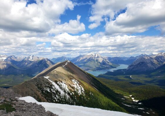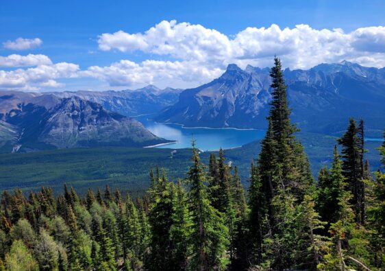
Wasootch Ridge presents a challenging yet rewarding ridge walk in Kananaskis Country, Alberta. This trail offers stunning 360-degree views of fantastic peaks including Kananaskis Peak, Old Baldy, and Porcupine Ridge.
Spanning 13.5 kilometers as an out and back route, hikers encounter multiple peaks, ascents, and descents, ensuring a dynamic and engaging experience.
This hiking guide provides essential information, including trail difficulty, trailhead location, and route details up to the sixth peak, preparing adventurers for an unforgettable journey in this scenic part of the Canadian Rockies.
Table of Contents
Wasootch Ridge Trail Information
- Distance: 13.5km return
- Type: Out and Back
- Difficulty: Moderate to Hard
- Time: 5-8 hours (with breaks)
- Facilities: Washrooms at trailhead
- Passes Required: Kananaskis Conservation Pass
Route Details
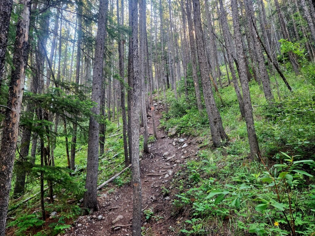
The trail begins with a challenging 2km ascent through a forest and rocky cliffside. This initial stretch is steep and can be tough, particularly if you’re not prepared for it. The first half of the terrain is dry earth with roots and trees available for support.
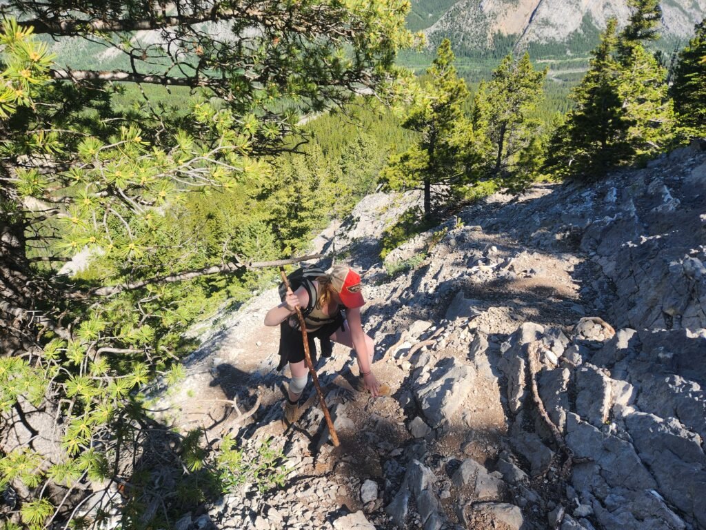
The second half becomes rocky with loose gravel and rocks. Despite being reasonably fast, it took us more than an hour to climb this incline in the heat of the day. Once past this strenuous section, you’ll reach the actual ridge and reach the first peak.
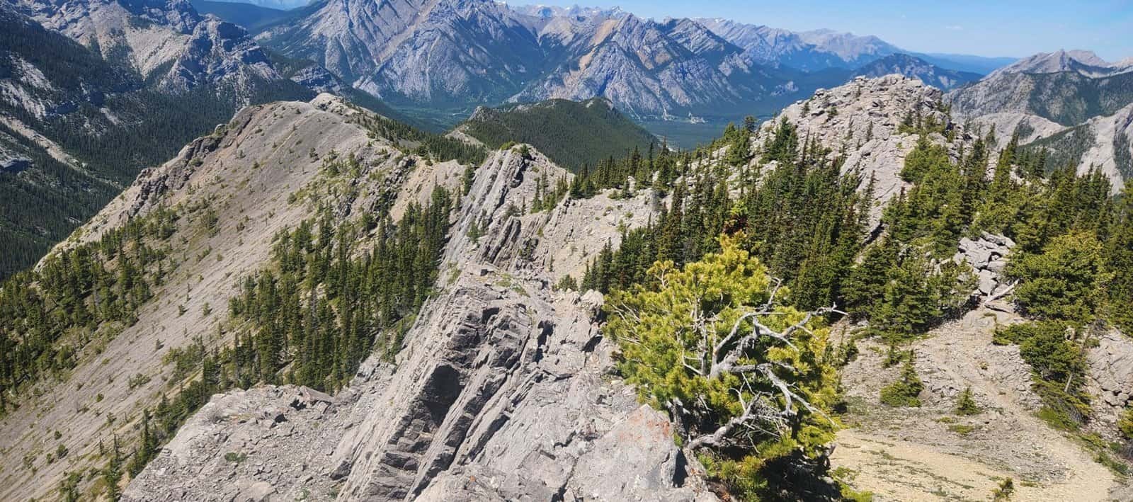
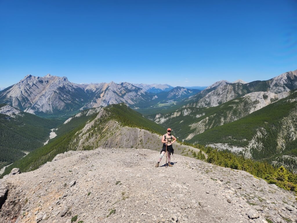
There are a total of 7 Peaks along this route. While there are some unofficial markers on the Alltrails map indicating these peaks, they can be somewhat inaccurate. Throughout the hike, the ridge features constant ups and downs, creating a bumpy terrain that slows descent on loose gravel.
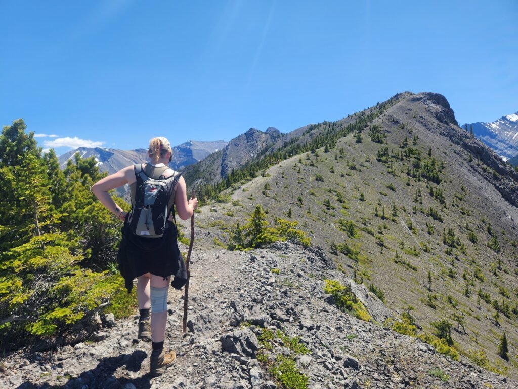
Despite not being overly challenging, this unevenness can affect pace. Generally, from Peak 1 to Peak 5, the ridge offers expansive views and minimal exposure. There are sporadic trees providing occasional shade along the way.

While not as intense as the first 2 kilometers, there are some notable ascents between Peaks 2 and 4. From a distance, they may seem much steeper, but as you approach, the inclines are more gradual and manageable.
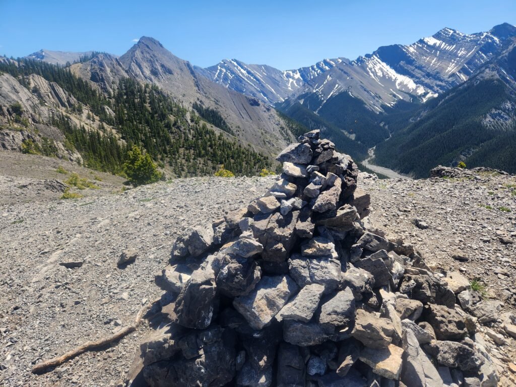
Peak 5 is the only one with distinct rock cairns at its summit; the others lack clear markers. Due to the increasingly difficult terrain and scrambling required, many hikers opt to conclude their hike at Peak 5.
We encountered several hikers who advised us that the trail beyond Peak 6 becomes particularly tricky, suggesting it might be best to avoid the final stretch altogether. After reviewing other hikers’ feedback, we decided to stop just beyond Peak 6.
From Peak 5, we spotted a cluster of rocks that we initially thought marked Peak 6. Heading from Peak 5 towards Peak 6 required some navigation due to discrepancies in the AllTrails map accuracy.
In my experience, staying on track can be challenging on ridges, even when near the trail, as it’s not always clearly defined.
Along the ridge’s left-hand side, there was a narrow dirt path close to the edge. Opting for safety, we chose to ascend over the rocks, crossing the top to rejoin the main trail. This portion requires some scrambling and is narrow.
From the rock cluster we climb up a small scree area and proceeded up to the top of Peak 6.
For those willing to take on the challenge, an exposed ridge route leads to Peak 7. The views from Peak 5 to Peak 7 are similar, so if you prefer to avoid exposure or are less comfortable with it, you won’t miss out on much by stopping earlier.
Difficulty Level
I would classify this trek as moderate to challenging. Although I didn’t experience breathlessness or severe discomfort, I had to descend very cautiously due to the loose gravel.
The 2km ascent is demanding, as is the descent, but it doesn’t require advanced technical skills, just steady footing and possibly trekking poles or sticks. The heat of the day made us prioritize safely navigating the loose gravel on the way down.

According to AllTrails, this trail is estimated to take around 5.5 hours. However, our actual moving time was 6.5 hours, and with breaks included, it totalled about 8 hours.
Trail Location/Facilities
Wasootch Ridge is situated in Kananaskis Country, accessible via AB-40. From Calgary, head west on the TransCanada Highway towards Banff. Take Exit 118 (AB-40) towards the Stoney Nakoda Resort & Casino and continue for approximately 17km.
Look for a sign indicating the Wasootch Picnic Area on the left-hand side. Turn left here and drive for about 750 meters to reach the trailhead.
There are two parking lots available: one smaller lot closer to the picnic area, and another larger lot located about 50 meters further away. Washrooms are conveniently located across from the trailhead.
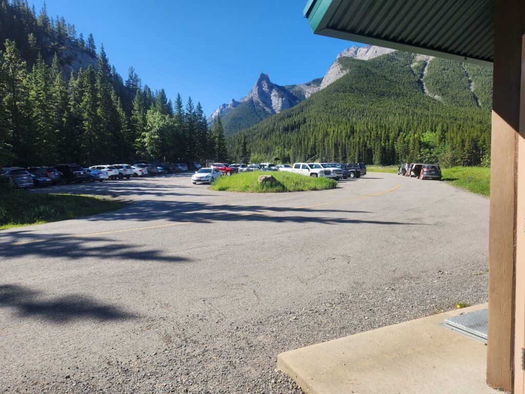
The trailhead is somewhat concealed among the trees, directly across from the washrooms and near the picnic tables. Look for the trail that starts ascending immediately; this marks the correct route.
Best Time to Hike Wasootch Ridge
Like many trails in the Canadian Rockies, I recommend waiting until summer and early autumn to hike Wasootch Ridge. During these months, the snow at higher elevations is minimal or gone, ensuring safer conditions.
Wasootch Ridge isn’t as high as other mountains in the area, allowing for hiking opportunities in late spring as well.
Winter hiking is possible but poses increased challenges and risks, particularly with avalanches. Crampons are crucial for winter or icy conditions.
I hiked Wasootch in July when all peaks were accessible and free of snow. The trail was dry, which made descending through steeper sections somewhat easier.