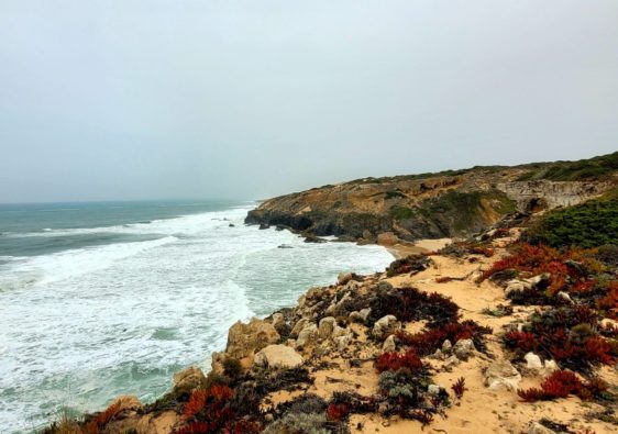
The Fishermen’s Trail is one of the most famous and enjoyable walks along the Rota Vicentina in southern Portugal. Starting in the Alentejo region in S. Torpes, the trail guides explorers along rugged coastlines, across untamed beaches, through quaint seaside towns, rural farmlands, and back-country roads, ultimately concluding in the Algarve region in Lagos.
This hike covers over 225 km of coastline, through the beautiful and protected Parque Natural do Sudoeste Alentejano e Costa Vicentina. It typically takes 13 days (stages) and can be walked in either direction, though the most popular route is north to south. Shorter versions of this trail also include the original route from Porto Covo to Odeceixe.
This detailed, step-by-step guide offers everything necessary to successfully navigate the 13 stages of the Fishermen’s Trail. Featuring comprehensive route descriptions, including details on beaches, dining options, and accommodations, this guide will be an invaluable companion throughout your journey.
Disclosure: I only recommend products I would use myself and all opinions expressed here are my own. This post may contain affiliate links that at no additional cost to you, I may earn a small commission
table of contents
- The Rota Vicentina
- Best Time to Plan Your Hike
- Luggage Service
- Accommodations Along the Fishermen's Trail
- Starting in S. Torpes
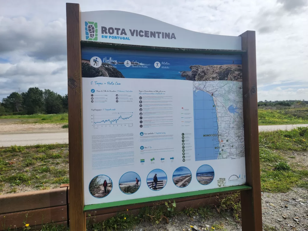
- Stage 1: S. Torpes to Porto Covo
- Stage 2: Porto Covo to Nova de Milfontes
- Stage 3: Nova de Milfontes to Almograve
- Stage 4: Almograve to Zambujeira do Mar
- Stage 5: Zambujeira to Odeceixe
- Stage 6: Odeceixe to Aljezur
- Stage 7: Aljezur to Arrifana
- Stage 8: Arrifana to Carrapateira
- Stage 9: Carrapateira to Vila de Bispo
- Stage 10: Vila do Bispo to Sagres
- Stage 11: Sagres to Salema
- Stage 12: Salema to Luz
- Stage 13: Luz to Lagos
- Essential Tips for Navigating the Trail
The Rota Vicentina
The Rota Vicentina is a series of trails along the southwest regions of Alentejo and Algarve regions of Portugal. These series of networked paths cover coastlines, historic villages and inland routes and make up over 750km of trails.
There are three paths that make up the Rota Vicentina.
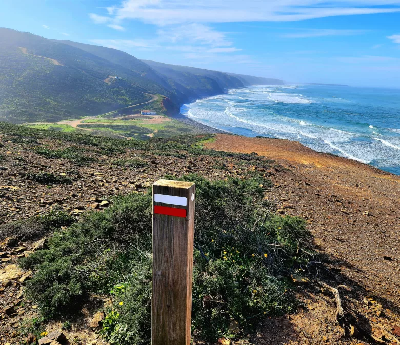
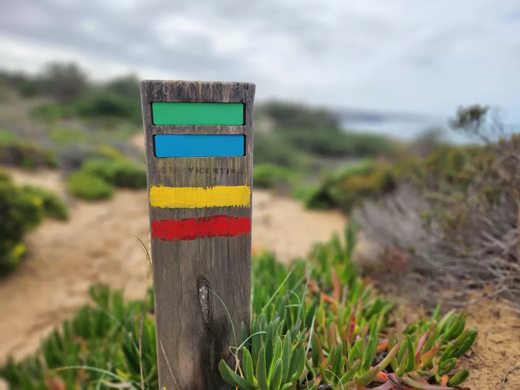
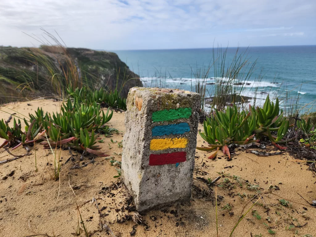
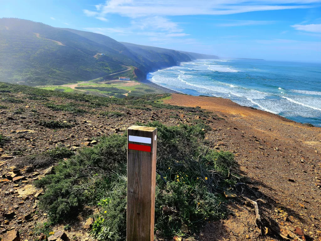
- The Historic Way: red/white
- The Circular Route: red/yellow
- The Fishermen’s Trail: blue/green
These paths often intertwine with one another.
The Historic Way predominantly winds through inland areas, venturing across rural landscapes, cork oak forests, and valleys.
With 24 Circular Routes of varying distances, these are perfect for individuals seeking day trips to explore the region.
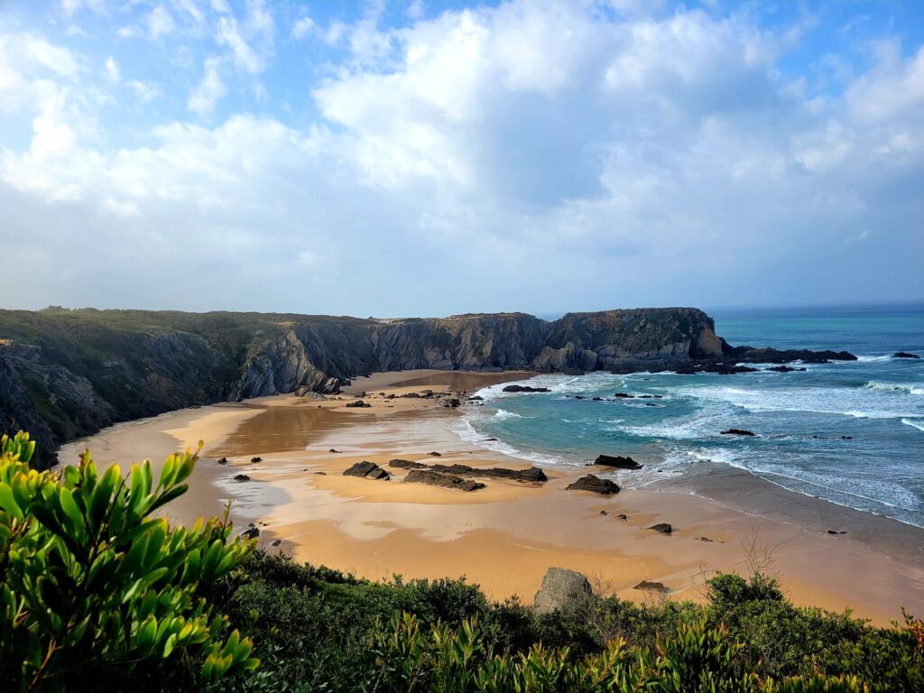
Contrarily, the Fishermen’s Trail closely follows the coastline throughout its course, navigating over beaches, dunes, cliffs, and secluded rural roads
There are several versions of the markers, indicating which direction the trail leads. I found the Fishermen’s Trail markers were more abundant than the Historic Way , especially while trekking in the dunes.
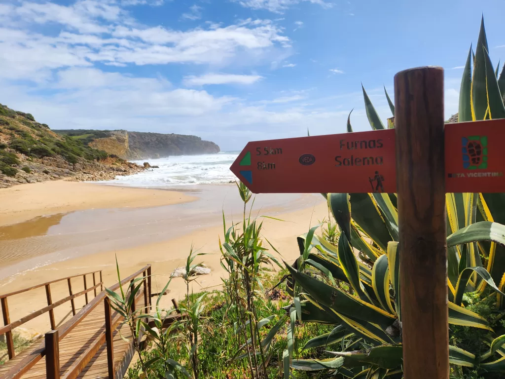
These markers can be found on trees, rocks, wooden posts, lamp posts, and collection bins throughout the trail.
Best Time to Plan Your Hike
The optimal seasons for hiking the Fishermen’s Trail are spring and autumn. During these times, temperatures typically range from 15 to 20 degrees Celsius, creating ideal conditions for hiking.
Due to the trail’s exposure to the elements and limited shade, hiking during the hot months of July and August is not advisable. Luggage transfers are only available from February to June and from September to November.
I’ve had the chance to trek the Fishermen’s Trail twice in March. The weather was a blend of sunshine with occasional short bouts of rain. Temperatures stayed comfortably above 15 degrees Celsius, allowing me to wear shorts on most days.
Springtime brings a burst of colour to the rugged coastline as flowers bloom, enhancing the scenic beauty. Additionally, visiting during early spring means lower prices and quieter trails and beaches overall.
It’s important to be aware that March is typically considered the low season for visiting. As a result, some accommodations and restaurants may not be operating at full capacity during this time. This is crucial to consider when planning.
I hiked from Porto Covo to Odeceixe in mid March in 2022 and S.Torpes to Lagos in early March 2024. As the month proceeds, the weather gets more stable.
Luggage Service
Despite having completed two long-distance hikes previously, I was initially convinced that I wouldn’t require a luggage transfer and could manage my large pack for the entire 13 days. However, after two days of walking along roads and sandy terrain, I relented and decided to ditch my bag; a decision I never regretted!
I opted for Vicentina Transfers (twice, actually). Their website is straightforward and easy to navigate, and their customer service is exceptional. They respond promptly within minutes, and their rates are fair, starting at 15 euros per segment.
Luggage is dropped off at your accomodation each night before 4:00pm
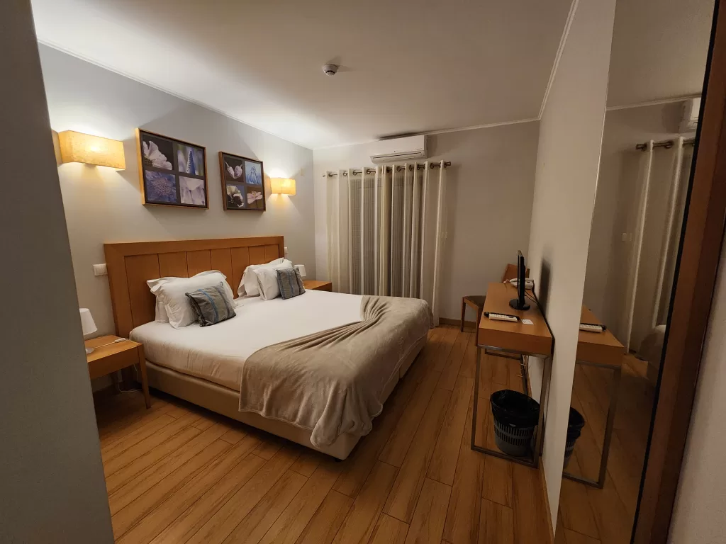
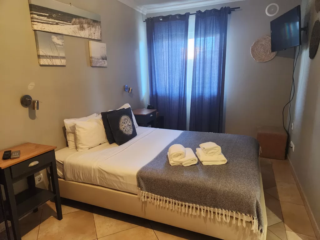
Accommodations Along the Fishermen’s Trail
Every stage of the Fishermen’s Trail conveniently concludes in a town, offering a diverse array of accomodation options. Along the route, you can find hotels, guesthouses, hostels, apartments with full-sized kitchens, and designated campgrounds. Please note that wild camping is not permitted on the trail.
Here’s a list of recommended accommodations based on my personal experiences while hiking the Fishermen’s Trail:
- Porto Covo: MUTE Hostel
- Vila Nova de Milfontes: Apartamentos Pátio Victória – by Portugalferias
- Almograve: Almograve Beach Hostel
- Zambujeira do Mar: Hakuna Matata Hostel
- Odeceixe: Sudoeste Guest House
- Aljezur: Vicentina Hotel
- Arrifana: Arrifana Destination Suites
- Carrapateira: Casa Sol
- Vila do Bispo: Hotel Mira Sagres
- Sagres: Sagres Sun Stay – Surf Camp & Hostel
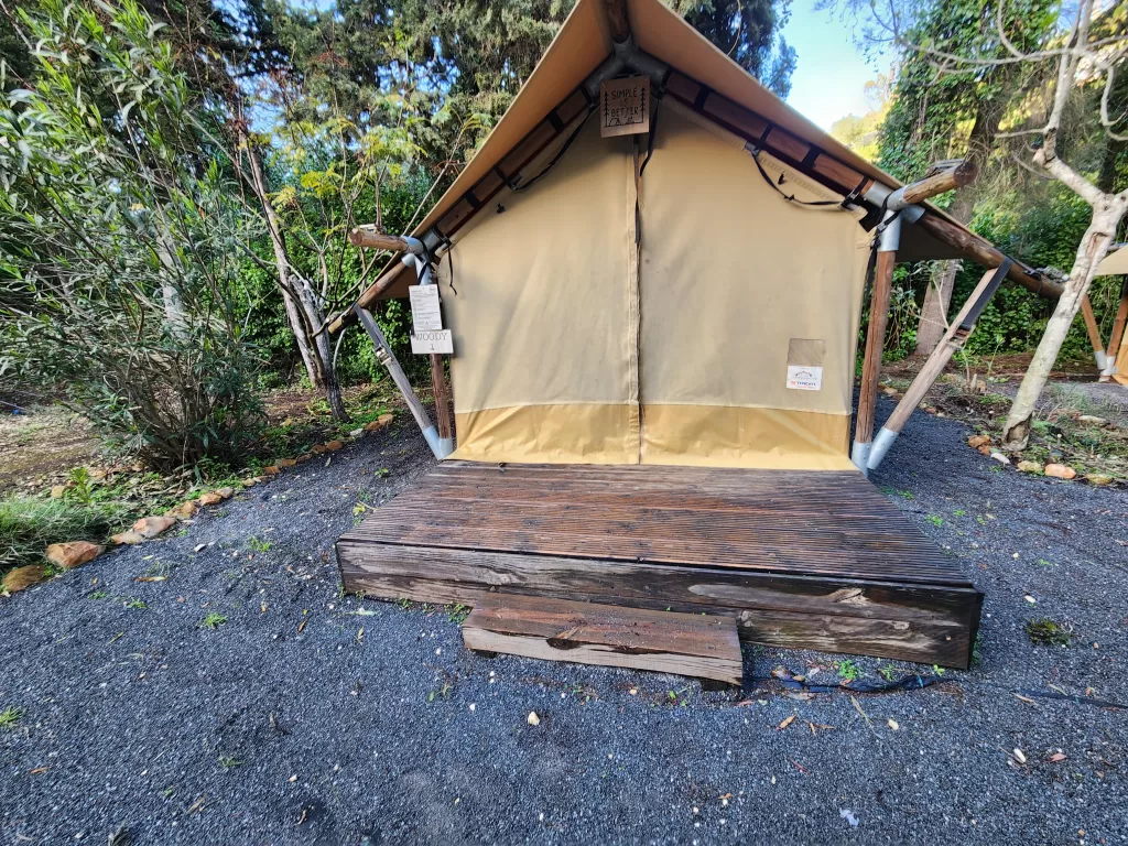
- Salema: Salema Eco Camp – Sustainable Camping & Glamping
- Luz: Luz Bay Hotel
- Lagos: WOT Lagos Montemar
These spots offer a range of options to suit various preferences and budgets, ensuring you have a comfortable place to rest after a day of exploring.
Starting in S. Torpes
The Fishermen’s Trail commences in S. Torpes, which is approximately 7km from the town of Sines.
To reach S. Torpes, you can take a bus (Rede Expressos) from Lisbon, which typically takes around 2.5 hours and terminates in Sines. The challenge lies in reaching the trailhead, located 7km from the bus terminal.
Initially, I had planned on using Bolt/Uber for transportation, but I was unsuccessful in finding a driver. Despite attempts, I couldn’t locate a taxi or arrange for one. Consequently, I ended up walking from the bus station to S. Torpes. While not ideal, the walk wasn’t the worst experience. In hindsight, I would have asked a local shopkeeper or restaurant to call a taxi for me.
The walk parallels a busy road, yet the shoulder is spacious, and the path occasionally veers away from the road. If possible, arranging for a ride to the trailhead will undoubtedly enhance the overall experience.
The official trail begins at the KALUX Restaurant Beach Bar and SURF.
Note: While many people commence their journey from stage 2 in Porto Covo, which is more accessible, starting from S. Torpes offers the opportunity to explore stunning beaches along the route.
Stage 1: S. Torpes to Porto Covo
- Distance: 11km (18km if walking from the bus stop)
- Time: 3-5 hours
Initially, the trail parallels the road for 2km. For those wishing to avoid traffic, walking along Praia Sao Torpes beach is an alternative. Beyond the initial 2km stretch, the path diverges from the road, leading towards the dunes and away from the bustling traffic.
As you continue, you’ll pass by Praia de Vale Figueiros before reaching the Magic Cactus restaurant. Although it may appear to be an exclusive lounge area for restaurant patrons, it is indeed part of the Fishermen’s Route. Navigate around the backside, as the trail descends to the beach and then winds back into the dunes.
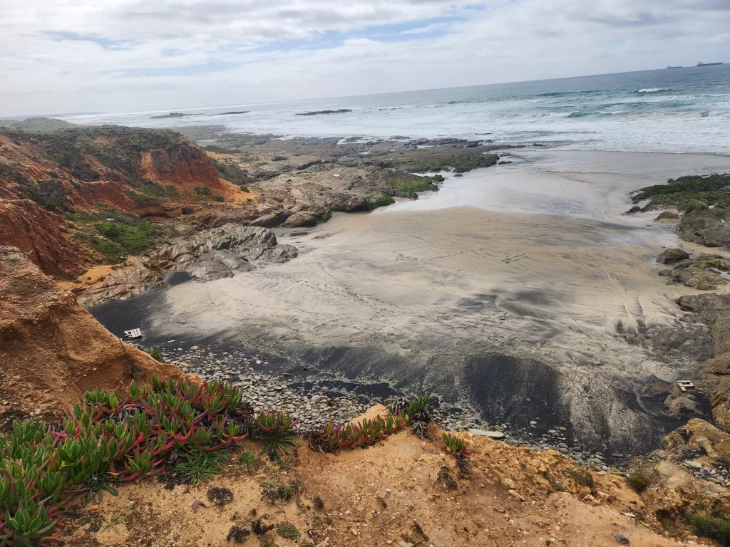
From this point onwards, the route follows the coastline until reaching Porto Covo. En route, you’ll encounter several stunning beaches, including Praia da Foz, Praia dos Canudos, Praia da Samoqueira, and Praia da Cerca Nova.
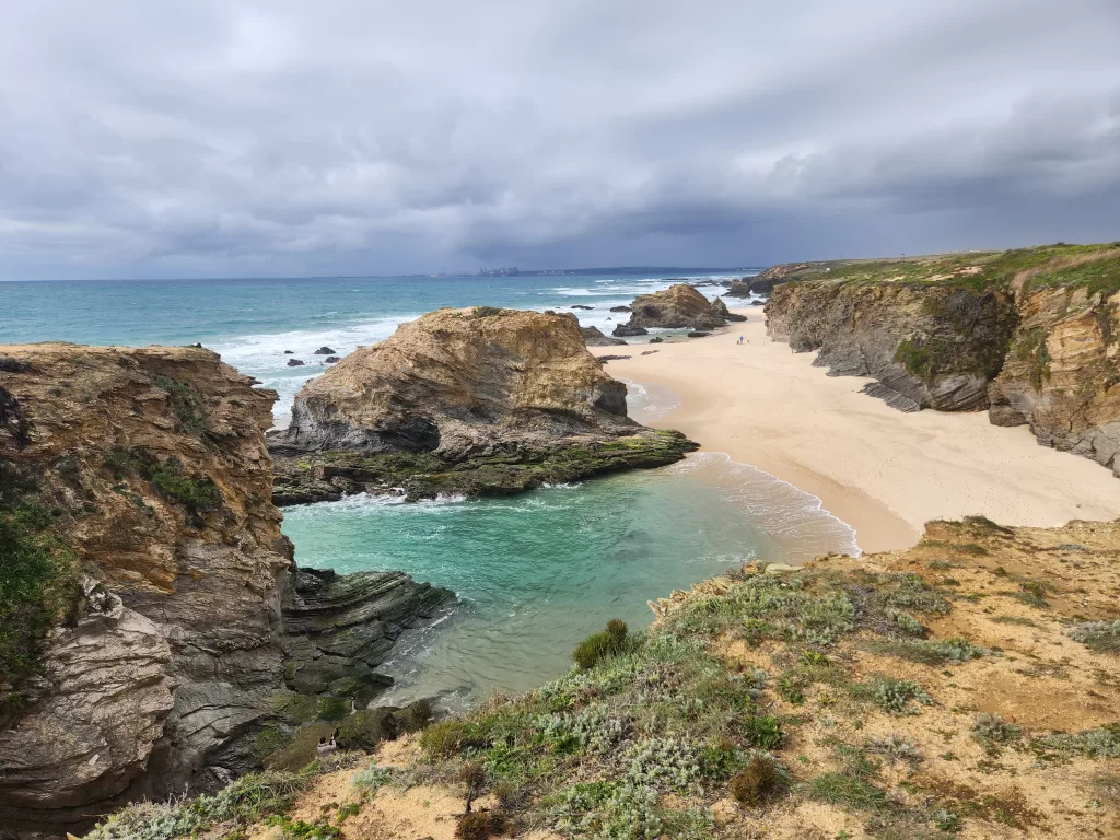
Wrap up your day by dining at one of the local restaurants in Porto Covo.
Stage 2: Porto Covo to Nova de Milfontes
- Distance: 20km
- Time: 6-8 hours
The trail starts southwest of Porto Covo, near Praia da Baia de Porto Covo, leading out of town and hugging the coastline for 19.5km.
Along the way, discover many beaches and hidden coves, including Praia da Ilha do Pessegueiro, about 3.5km from Porto Covo, featuring a 2km stretch of coastline and ruins on a nearby island.
Rest at Forte de Nossa Senhora da Queimada before continuing past four smaller beaches. At approximately 16km, find Porto das Barcas, a small fishing harbor and restaurant, perfect for a lunch break before the final 3-4km to Nova de Milfontes.
Stage 3: Nova de Milfontes to Almograve
- Distance: 15km or 11km (with ferry)
- Time: 4-5 hours
Starting from Nova de Milfontes, you have two options: take the ferry across Mira River to save 4-5km, or walk through town and cross the river via the bridge. More details about these two option can be found here.
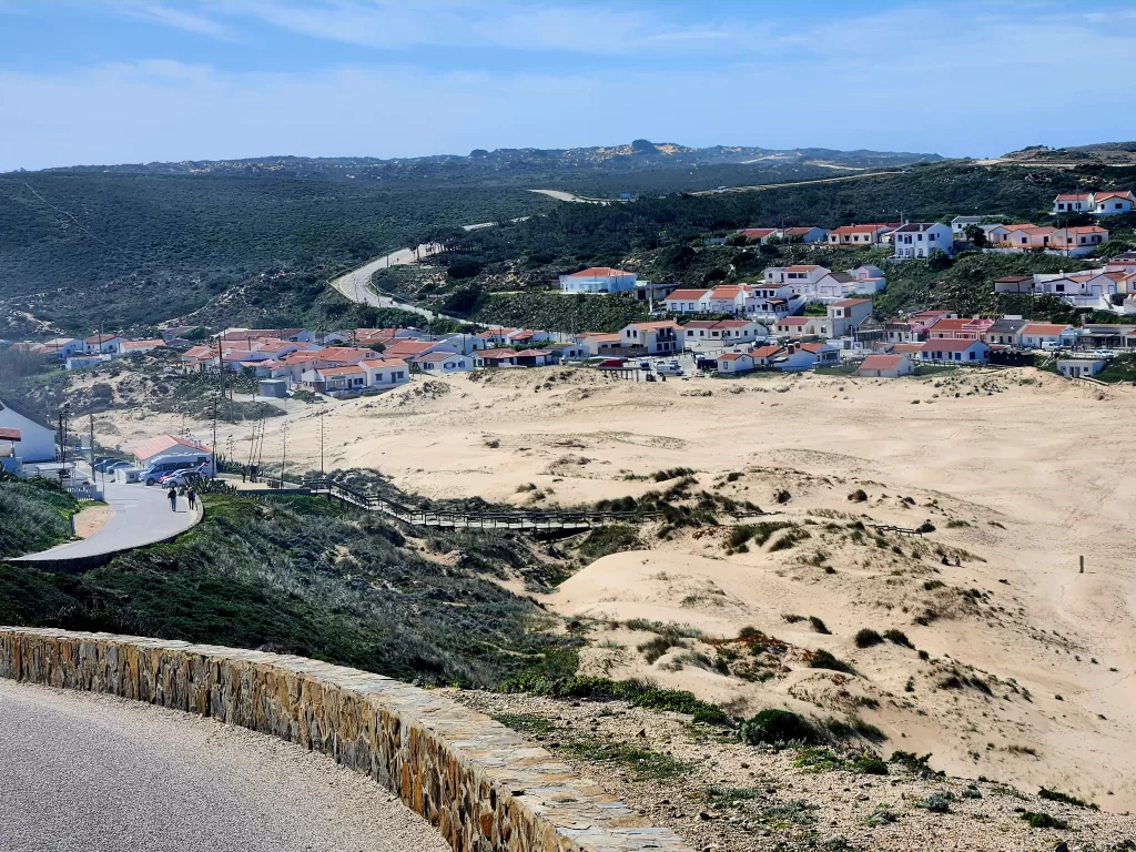
About 11-12km from Vila Nova de Milfontes, you’ll find a small detour to Praia do Brejo Largo, a serene beach perfect for peaceful relaxation. Exercise caution near the water, as waves can be high at times. Continue inland along back roads, then connect with Rua do Chafariz, leading you to the picturesque town of Almograve. Rest at Praia Grande de Almograve before retiring for the night at your accommodation.
Stage 4: Almograve to Zambujeira do Mar
- Distance: 22km
- Time: 6-7hours
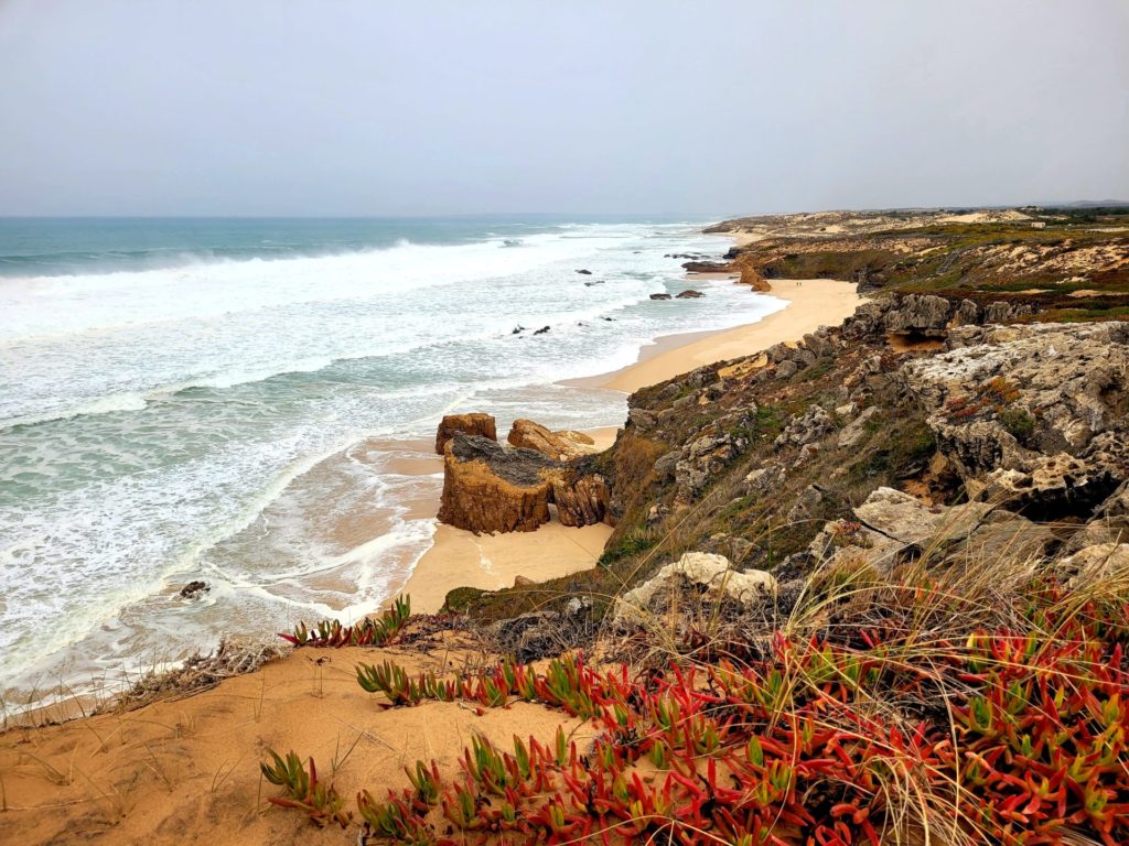
From Almograve, head north along Rua dos Moinhos, tracing the hidden bays and coves of the town. Afterward, turn south onto Estrada do Porto das Lapas das Pombas for approximately 2km, a gravel and sand road where cars may kick up dust.
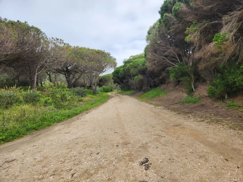
The trail then resumes along the coast for 2km, offering stunning views of the rugged coastline, before veering inland through pine forests to mitigate coastal erosion. This forested stretch provides welcome shade and a refreshing change from the exposed coast. Returning to the coastline, the trail briefly passes through the small town of Cavaleiro.
Follow the coast for 7km, passing by Praia da Lavaguiera and Praia do Tonel. The next 2km along CM1158 can be busy and monotonous, with hot asphalt and minimal scenery, making for a less enjoyable leg of the journey.
Stage 5: Zambujeira to Odeceixe
- Distance: 18km
- Time: 5-6hrs
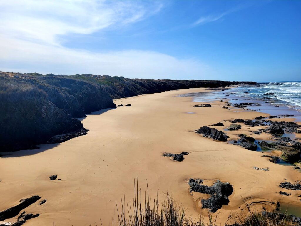
Departing south from town, you’ll ascend into the hills, traversing boardwalks and descending through beaches. Noteworthy beaches along the route include Praia dos Alteirinhos, Praia dos Machados, and Praia do Carvalhal.
Around 9-10km from Zambujeira, you’ll pass through the small town of Azenha do Mar, where you can stop for snacks before continuing on the trail. After Praia de Odeceixe, the final inland stretch begins, spanning approximately 4km along small roads until reaching the town of Odeceixe.
Stage 6: Odeceixe to Aljezur
- Distance: 22.5km
- Time: 6-8 hours
This leg of the trail traverses coastline, villages, and, in my opinion, a surplus of backroads.
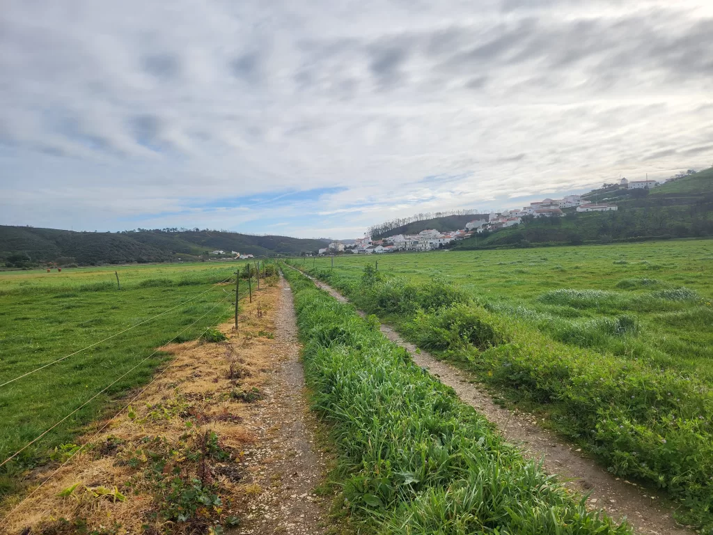
Departing from Odeceixe, the trail meanders through serene pastures for approximately 3km before ascending to the road’s summit, where Praia Odeceixe awaits. The subsequent stretch leads through the dunes, offering captivating views of the untamed coastline for another 3km.
The next 14.5km is a blend of road walking across diverse terrains, including backcountry gravel roads, urban areas, and pastoral landscapes. It’s a stark departure from the coastal scenery and somewhat underwhelming in terms of views.
Taking a lunch break in Rogil provides a welcome relief before embarking on the next lengthy stretch of gravel roads. Upon reaching Rogil, the Fishermen’s Trail markings disappear, but there’s no cause for concern.
Instead, the route follows the historic path, distinguished by red and white markings. While there are instances where it intersects with red and yellow or red and white paths, simply follow the red and white markers, and they will guide you to Aljezur.
Aljezur offers a delightful blend of old-world charm and modernity. The historic district boasts quaint buildings and small shops, while the newer area features larger supermarkets and four-star hotels.
Stage 7: Aljezur to Arrifana
- Distance: 17.5km
- Time: 5-6 hours
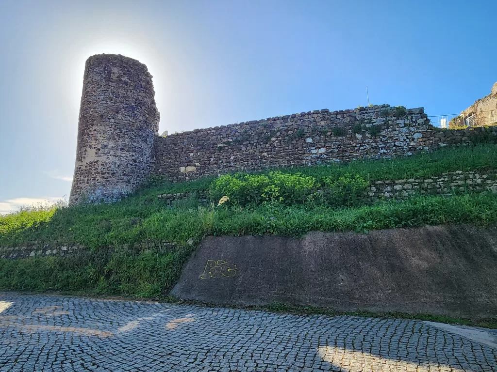
Before departing from Aljezur, take a brief detour to explore Castelo de Aljezur. Perched atop the highest hill in Aljezur, the remnants of this castle date back to the 12th/13th century.
Initially, this route follows the historic path for the first 4km (marked by red and white). The trail winds through the outskirts of Aljezur, traversing quiet roads amidst lush vegetation and valleys. There are some inclines and you’ll pass what appears to be a newly constructed gated community. Walking through this area may feel peculiar, but the path leads directly through it.
Afterward, the trail reconnects with a main road, where the Fishermen’s Trail resumes (marked by green and blue). This segment, spanning 4km, lacks remarkable features.
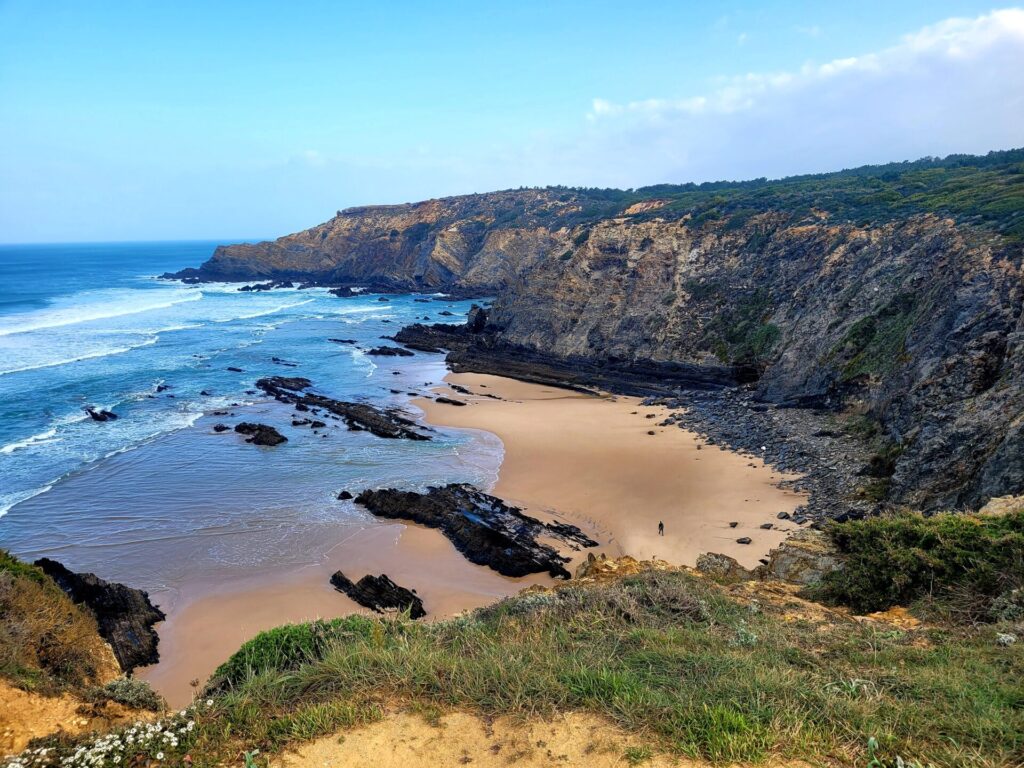
Around the 8km mark, the trail returns to the dunes, unveiling the magnificent Praia da Amoreira beach.
While access to this beach is limited from this side, you can visit the adjacent Praia de Monte Clerigo further down the road. It’s an ideal spot to pause, freshen up, or enjoy a leisurely lunch. The remaining trail hugs the coastline, offering glimpses of the rugged, untamed coast through the dunes. Keep an eye out for Ribat da Arrifana, nestled atop a hill.
Descend through bamboo forests towards Arrifana to conclude the stage.
Stage 8: Arrifana to Carrapateira
- Distance: 19.5km
- Time: 5-6 hours
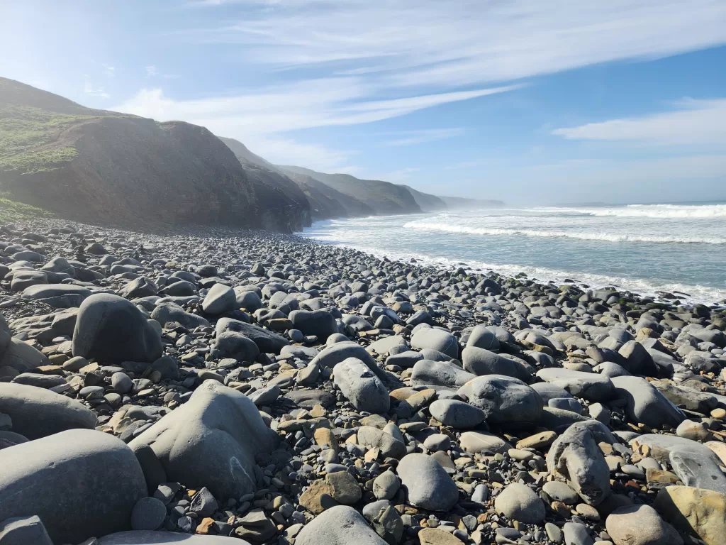
The initial 4km of this stage trace along the roadway as you depart from town, once again following the Historic Way. The trail then descends along a tranquil dirt road, leading to the coast and offering breathtaking views of Praia do Canal. In comparison to other elevation changes along the route, the descent to the beach is notably steep. Praia do Canal’s rocky shoreline is particularly popular amongst surfers.
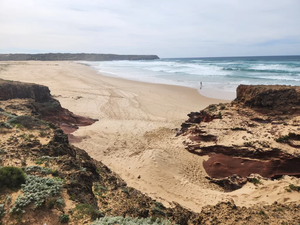
The trail continues along back-country roads inland for another 10km. There are no dining establishments along this stretch until you reach Carrapateira, so ensure you pack a lunch for the journey. The roads see sporadic car traffic, but otherwise offer a peaceful stroll. Winding through countryside and forests, the trail eventually returns to the dunes and coast, with vistas of Praia da Bordeira coming into sight shortly thereafter.
Upon reaching the dunes overlooking Praia da Bordeira, there are two routes to Carrapateira: the long way and the short way. A small crossing at Praia da Bordeira may or may not be accessible at certain times. An alternative route is provided, albeit adding an additional 3km to your journey.
During my walk, the markers suggested using the alternative route, so I followed ,bypassing the beach. However, this decision proved to be a mistake as the alternative route was sandy and led back several kilometers, eventually meeting a busy road with minimal shoulders.
In hindsight, I would have opted for the route down to the beach and considered the water crossing. The presence of several people on the beach indicated that the passage was likely open at the time.
Stage 9: Carrapateira to Vila de Bispo
- Distance: 16km
- Time: 4-5 hours
Departing from Carrapateira, the trail leads through back roads before swiftly reaching the rugged coastline. Perched on the cliffs are the remnants of a 12th-century Islamic Fishing Village.
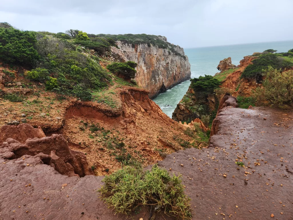
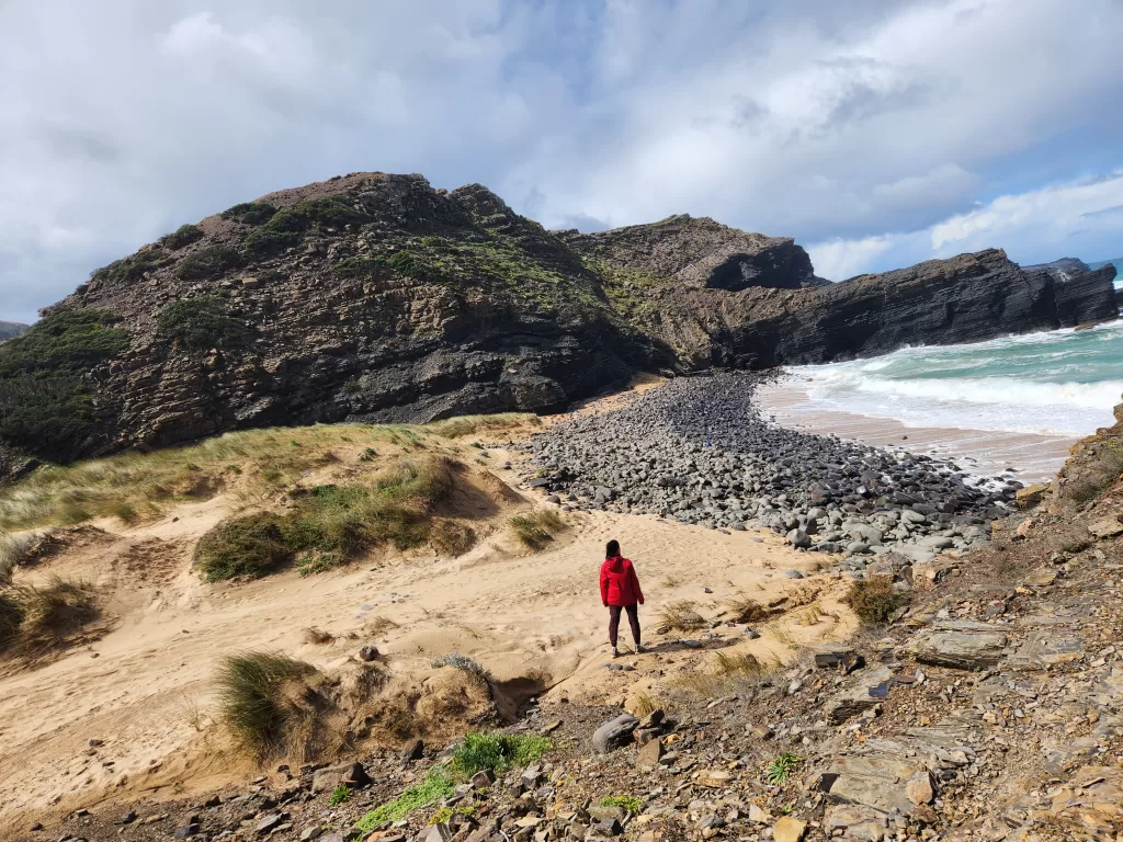
Continuing onward towards Praia do Amado, a vast and stunning beach becomes the focal point for the next few kilometers. As the trail ascends into the hills, it closely follows the cliffside, offering splendid views of the beach.
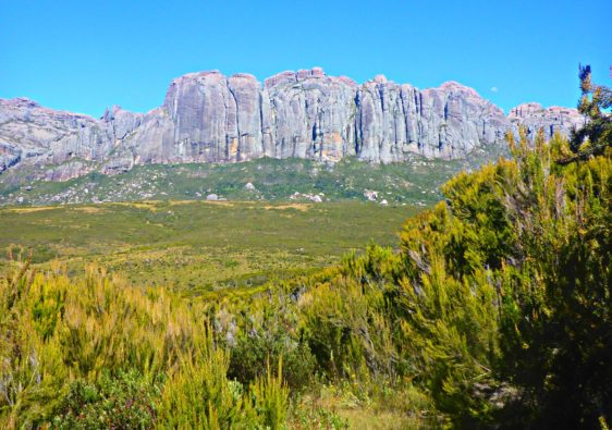
Be cautious of cattle grazing in the hillsides. A steep descent leads to Praia da Mante, where the rugged hills present a stark contrast to other terrains along the Fishermen’s Trail, reminiscent of the landscape in Ireland.
Upon returning to the plateau, the trail extends for another 5km along gravel roads, following the Historic Way.
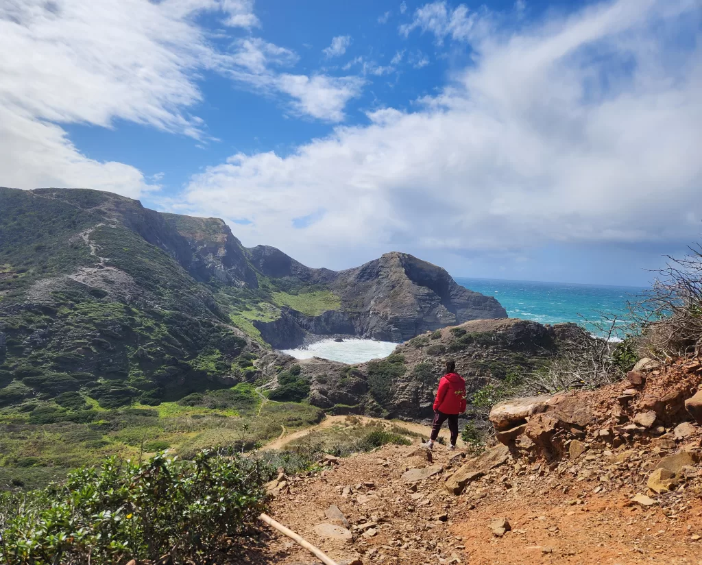
Stage 10: Vila do Bispo to Sagres
- Distance: 20km
- Time: 6-8 hours
The trail initially veers inland, leading out of the town through countryside and backroads for approximately 6km. As the trail approaches the coast, around 7km in, the vegetation begins to change. Pastures fade away and the coastal dunes and vegetation start to reappear.
At the 7km mark, there’s an optional detour to explore the small yet beautiful Praia da Ruiva beach.
Traverse through rocky dunes, keeping an eye out for rock cairns and markers to guide your way. It’s very easy to lose the trail in this area.
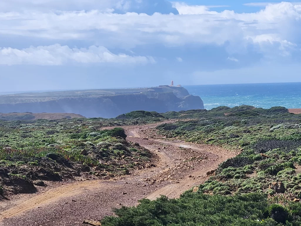
Around the 14km mark, you’ll encounter Fortaleza de São Vicente, a significant landmark marking the southwesternmost point of Europe/Portugal. At the time of my visit, the lighthouse was closed.
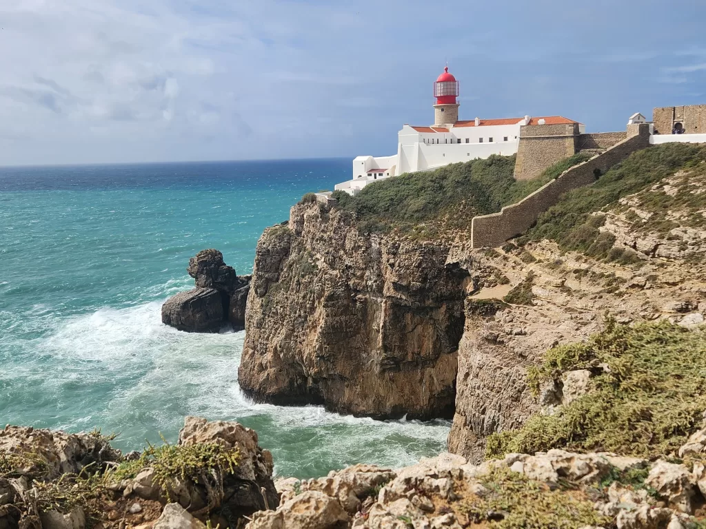
Continue along the cliffs and roadside for another 7km towards Sagres.
Stage 11: Sagres to Salema
- Distance: 20km
- Time: 6-8 hours
This leg of the trail offers numerous beaches to visit along the way.
Departing from town, the trail leads towards the hills, passing by Praia do Martinhal and Praia dos Rebolinhos. It closely follows the coastline until veering further inland, winding through pastures along dirt pathways.
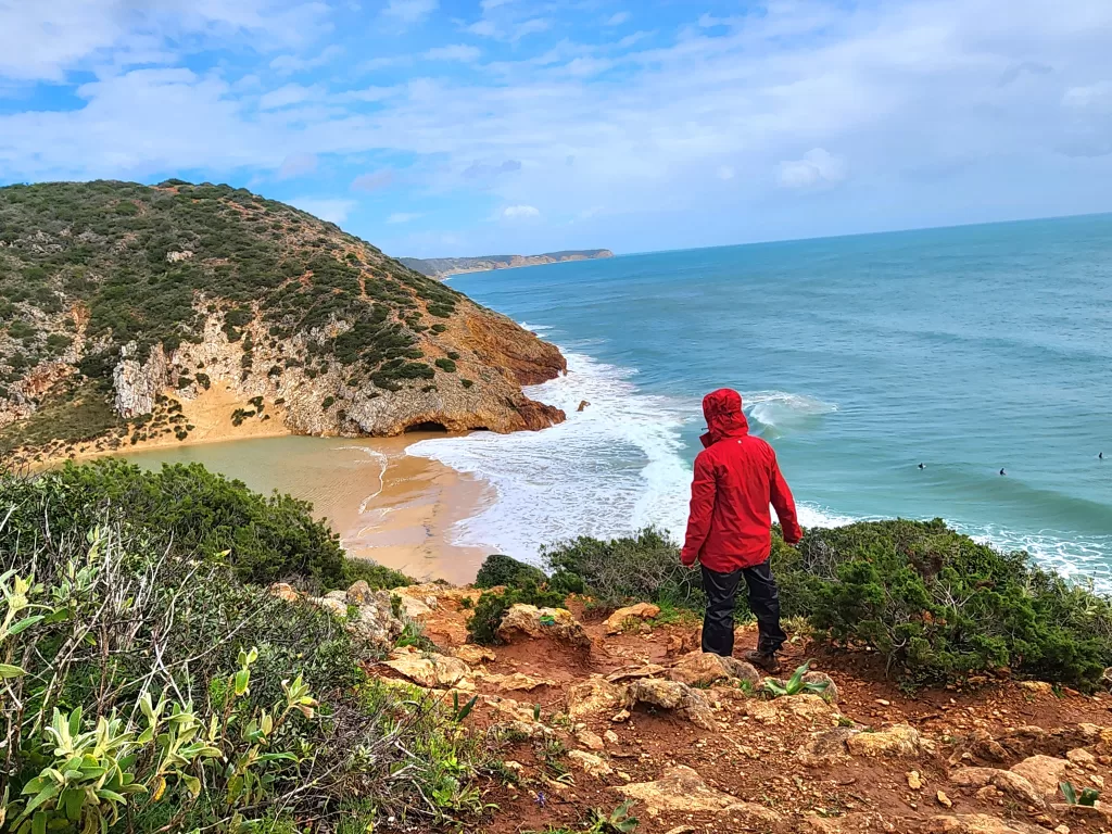
Significant elevation changes characterize this stretch of the trail, beginning with the descent to Praia do Barranco. This serene beach offers a peaceful retreat. Afterward, the trail ascends back into the cliffs, hugging the coastline until Praia da Ingrina.
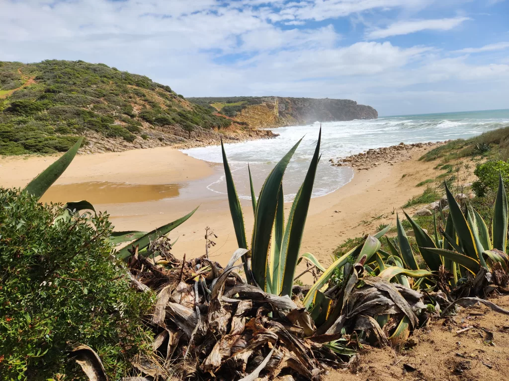
One of the more picturesque beaches, Praia das Furnas, features a steep descent. During my visit, the beach and trail were flooded, requiring me to hug the private property line and walking through some water to navigate through. Unfortunately, there was no alternative route I could have taken.
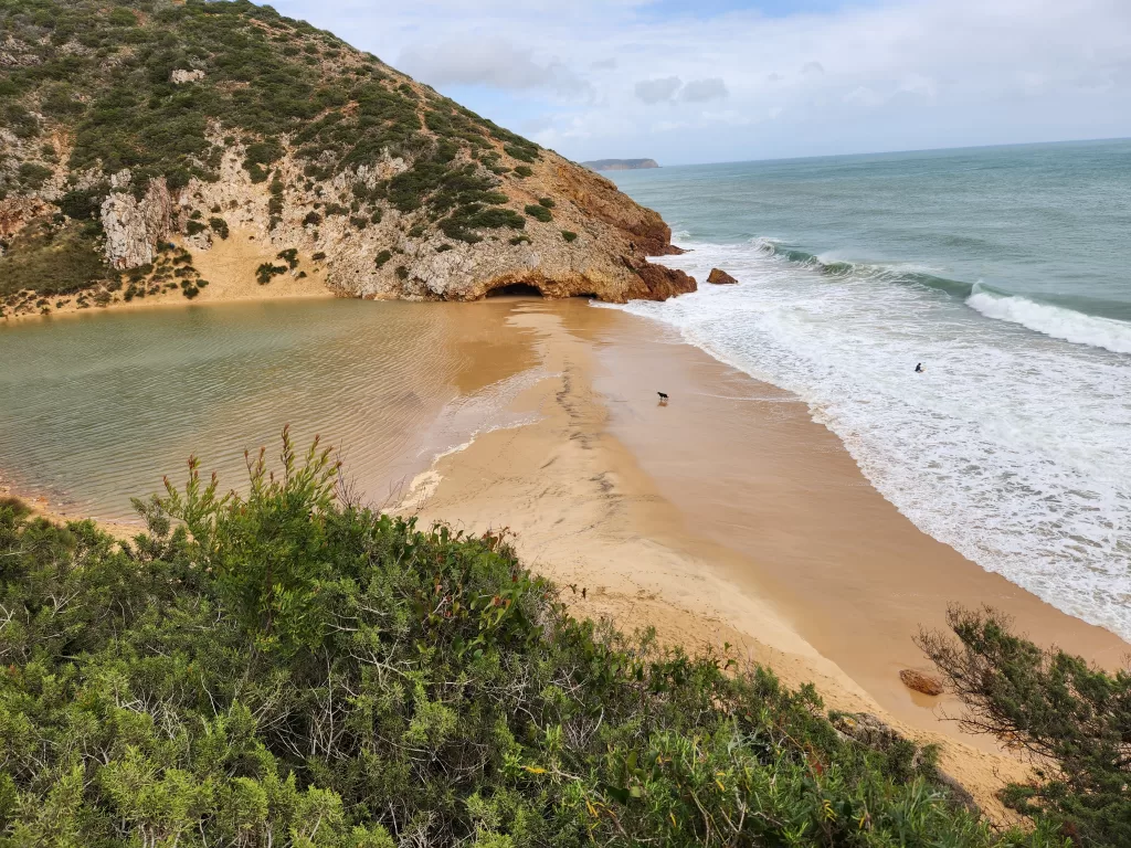
Before reaching Salema, there are two other wild beaches to explore: Praia da Figueira and Praia do Santa.
Stage 12: Salema to Luz
- Distance: 12km
- Time: 3-4 hours
This stage marks the transition to a more modern landscape, as quaint seaside villages give way to luxury townhouses.
Departing from Praia da Salema, the trail ascends into the cliffs and continues to hug the coastline throughout the journey, passing by Forte de Almadena.
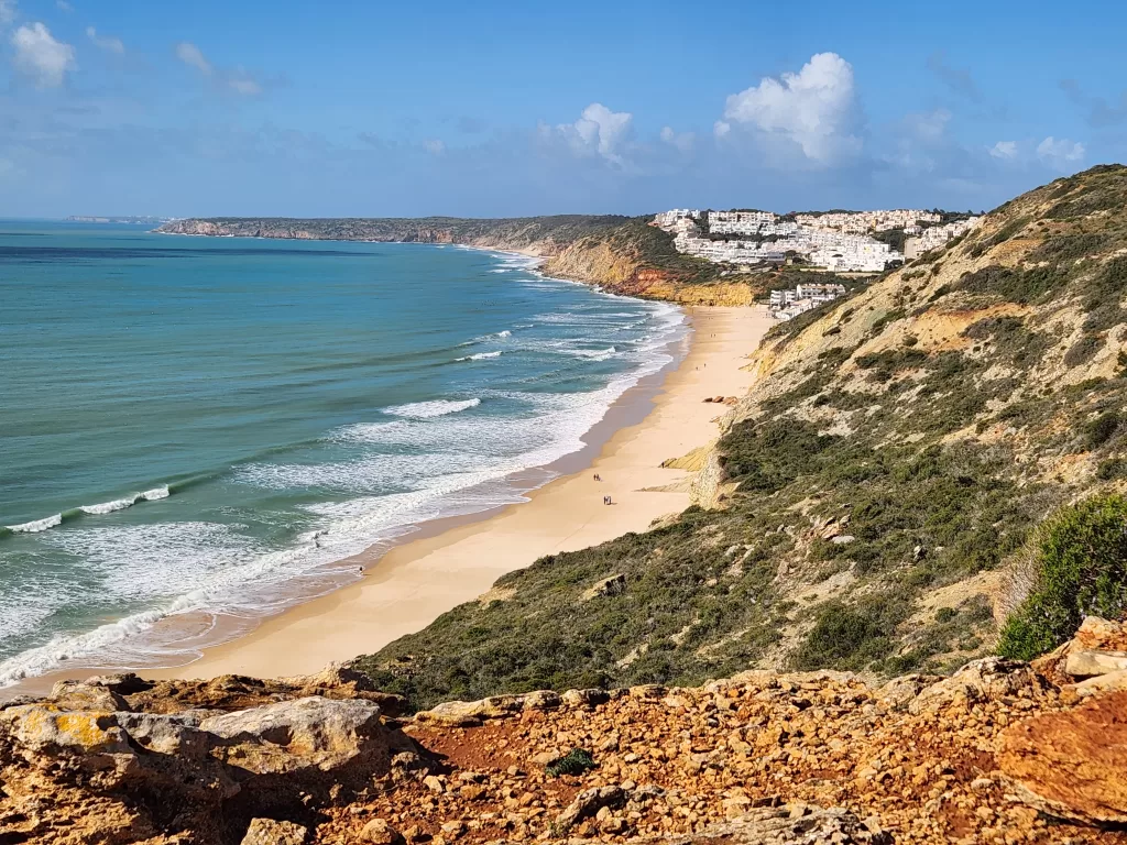
Burgau serves as an ideal halfway point to enjoy a meal or unwind on the beach.
Afterward, return to the cliffs and follow the coastline to Luz.
Stage 13: Luz to Lagos
- Distance: 11km
- Time: 3-4 hours
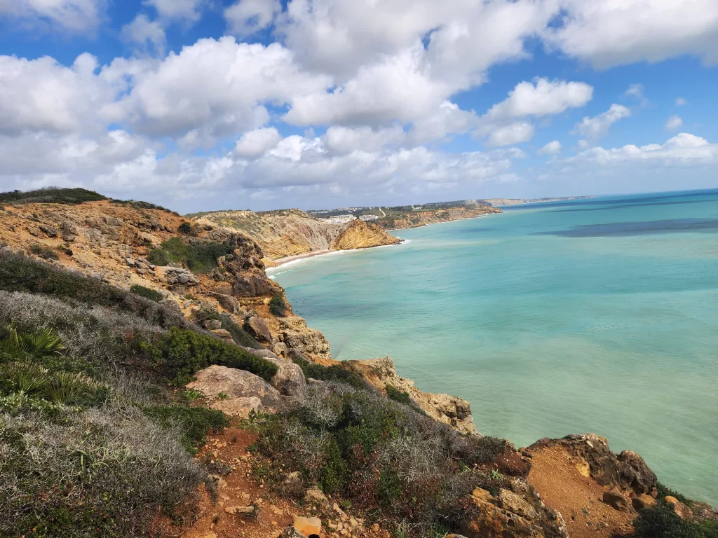
As the shortest leg of the journey, this stage takes you to the western side of town before ascending for a view of Praia da Luz. Follow the cliffside path before descending to the expansive Praia de Mos, renowned for its surfing opportunities and tranquil secluded spots.
The trail eventually veers back towards the cliffside, marked by a notable shift from previous stages as boardwalks replace sandy dunes. Notable sights along the way include the scenic Ponta da Piedade. Exercise caution on the stairs, as they can be slippery and covered in sand.
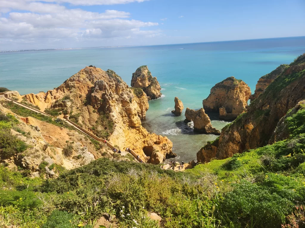
Upon reaching the bustling city of Lagos, pass by several small beaches before concluding the trek at the train station.
Essential Tips for Navigating the Trail
- Check-In Times: Most places to stay offer check-in between 3-5 pm.
- Accommodation Tips for the Off-Season: It’s wise to choose accommodations that include breakfast, as you might find many cafes don’t open until after 9 am. Alternatively, stock up on essentials at a local grocery store.
- Environmental Care: While navigating dunes and trails, please remain on designated paths to protect the delicate ecosystem.
- Vertigo Caution: This trail may not be suitable for individuals prone to vertigo due to its heights and drops.
- Sand Trekking: Walking on sand can be challenging and time-consuming, so plan for additional trekking time.
- Self-Sufficiency: Some segments of the trail don’t pass through towns, so bring enough food and water to sustain yourself.
- Camping Restrictions: Wild camping is not permitted along the trail.
- Public Transit Access: In case you’re unable to complete a section, the towns along the trail are accessible via public transportation.
- Cash is King: Carry cash for transactions, as not all dining spots accept credit or debit cards.
- Trail Endings: The start and end points of the trail are simply that; the trail just stops, so temper your expectations.
- Dressing for the Weather: The trail is open to the elements, so dress appropriately. Be cautious near cliffs, especially on windy days.
- Post-Rain Caution: Trail descents can be particularly tricky after rainfall, with muddy and rocky paths becoming slippery.
- Respect Private Property: Remember, crossing private land is allowed by the owners only for walking purposes.
These tips should help you navigate the trail more comfortably and safely, ensuring a rewarding experience.