The Canary Islands are home to some of the most beautiful beaches and unique volcanic landscapes. Lanzarote; the fourth largest of the islands, is particularly stunning and has an array of hiking opportunities. Ranked amongst the most beautiful hikes on the island, Peñas del Chache, is a challenging day trip that takes you from sea to sky.
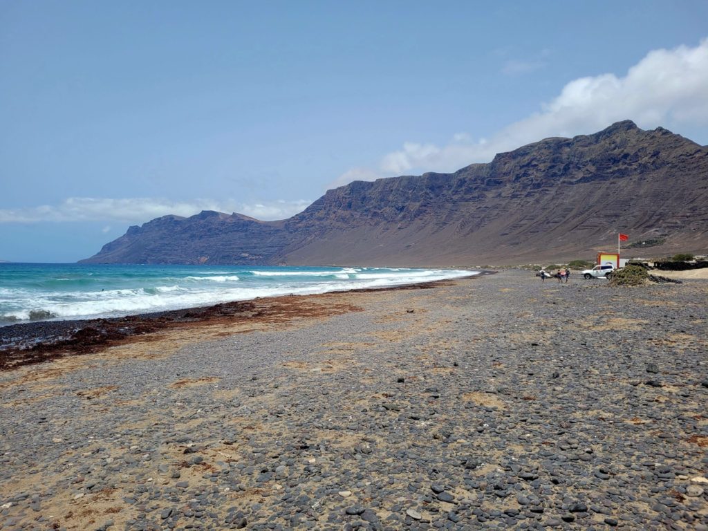
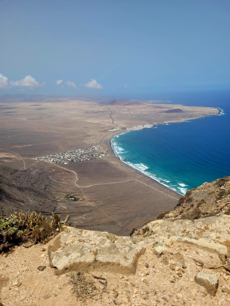
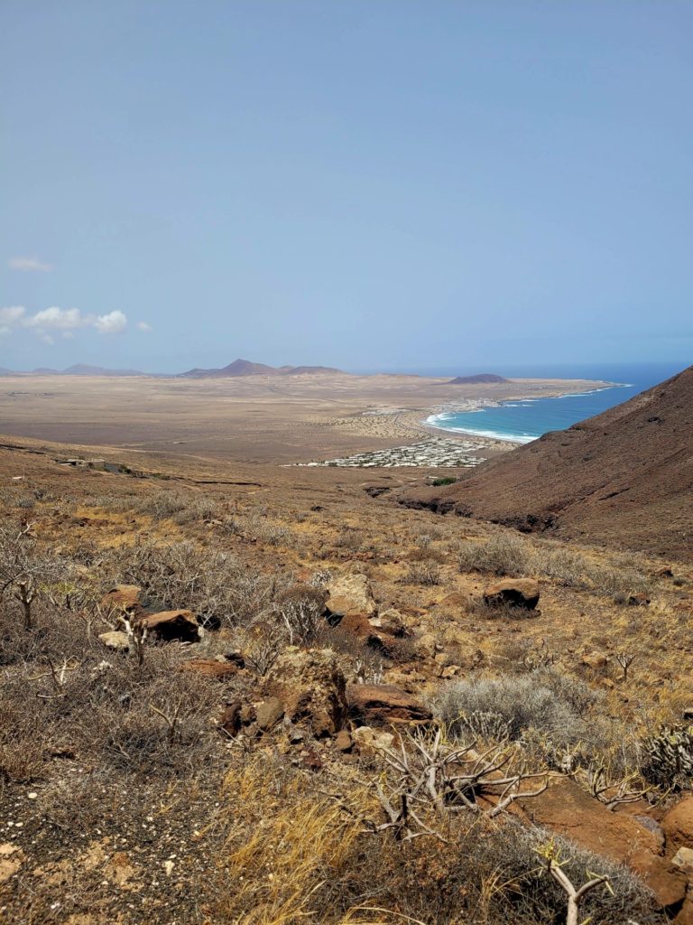
Located on the northwest corner of the island, near the municipality of Teguise, the tallest peak in all of Lanzarote stands towering over the coast. Clouded with mist, the massive cliff stands over 600m tall and provides views of neighbouring island La Graciosas and beaches including Playa de Famara and Playa de San Juan.
This guide will provide you with the essential information to successfully and safely complete this beautiful hike.
Peñas del Chache Trail Information
- Distance: 10.5km
- Time: ~3.5hrs with breaks
- Route: Out and Back
- Elevation Gain: 600m
- Difficulty: Moderate
- Washrooms: No facilities on route
Best Time to Hike Peñas del Chache
Lanzarote is an island that can be enjoyed all year round. Day time temperatures rarely fall below 20 degrees Celsius, even in the winter months. Sunshine prevails during the summer months between June and September.
As winter progresses, the chance of rain becomes higher. This may not be the best time of year to hike Peñas del Chache, as your views may be obstructed with mist. Peak summer might be avoided as there is little protection from the sun.
I visited in the month of June and had pleasant temperatures throughout. Early morning clouds were present for most days, but faded by early afternoon. This allowed for the initial hard ascent to be done under cool cloud coverage. The clouds and mist dissipated once I reached the summit.
Hiking Precautions
Being a volcanic island that receives little rainfall each year, precautions should be taken while hiking in Lanzarote and Peñas del Chache.
- Temperatures can rise quickly in the area, pack plenty of water and sunscreen.
- During the summer, hike in the early morning while the mist is still present and the sun hasn’t peered through the clouds (between 6-11am)
- There are no areas that provide shade coverage
- Wear appropriate footwear, as the terrain is rocky and steep
- The summit is exposed and windy, avoid walking to close to ridges
- The trail lacks signage, bring a GPS or map
How to Get to Playa de Famara
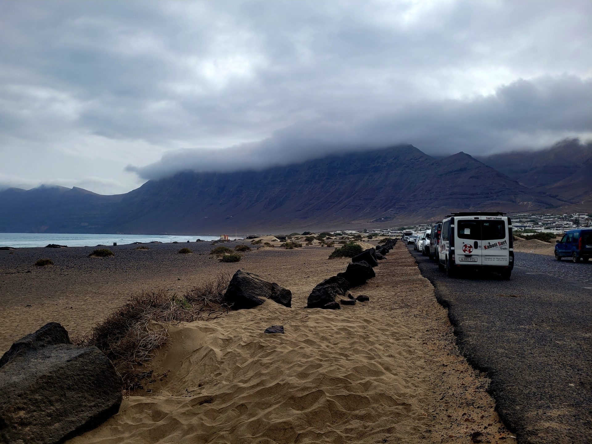
The trailhead for Peñas del Chache is located a short distance from Playa de Famara. This beautiful beach and area is located approximately 23km from the capital city of Arrecife and can be reached by car or public transit. Starting at the beach will add an additional 1km per way to the overall hike.
By Car
Famara Beach is a 25 minute drive from Arrecife. Head north along the LZ-20 for 9km. Take the LZ-30 east towards Teguise for another 4.5km. Turn left onto LZ-402 and follow for another 9.5km towards Caleta de Famara.
Trailhead Parking Location: Calle Brezo de Mar, 1, 35558 Urb. Famara, Las Palmas, Spain
There is plenty of free parking along the road parallel to the beach.
By Bus:
The bus journey from Arrecife will take around 30-40 minutes. Intercity Bus operates on route #20 to Famara Beach five times a day and only runs on weekdays. Tickets can be purchased directly on the bus. The route begins from Estación De Guaguas De Arrecife and ends in Caleta de Famara. The beach is a 800m walk from the bus stop.
Bus Schedule can be found here
Trailhead Information for Peñas del Chache
From the beach, head towards the mountain by walking along the main road of Calle Brezo de Mar. The route will continue past a gated community for approximately 1km.
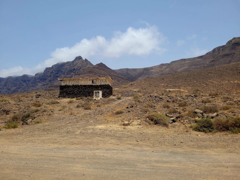
At the end of the road, turn right onto LZ-403, passing by an abandoned building. Follow the gravel road left, that leads behind the building. This is the official start of the trailhead.
The Route: Hiking to Peñas del Chache
Continue along the gravel road for approximately 1km towards the backside of the mountain. Be aware that two homes are situated along this road, so cars may be present in the area.
You may feel off path or uncomfortable walking so close to the homes, but don’t worry, it is the correct route. Beyond the second house, you will loop around the left side and begin your climb into the mountains.
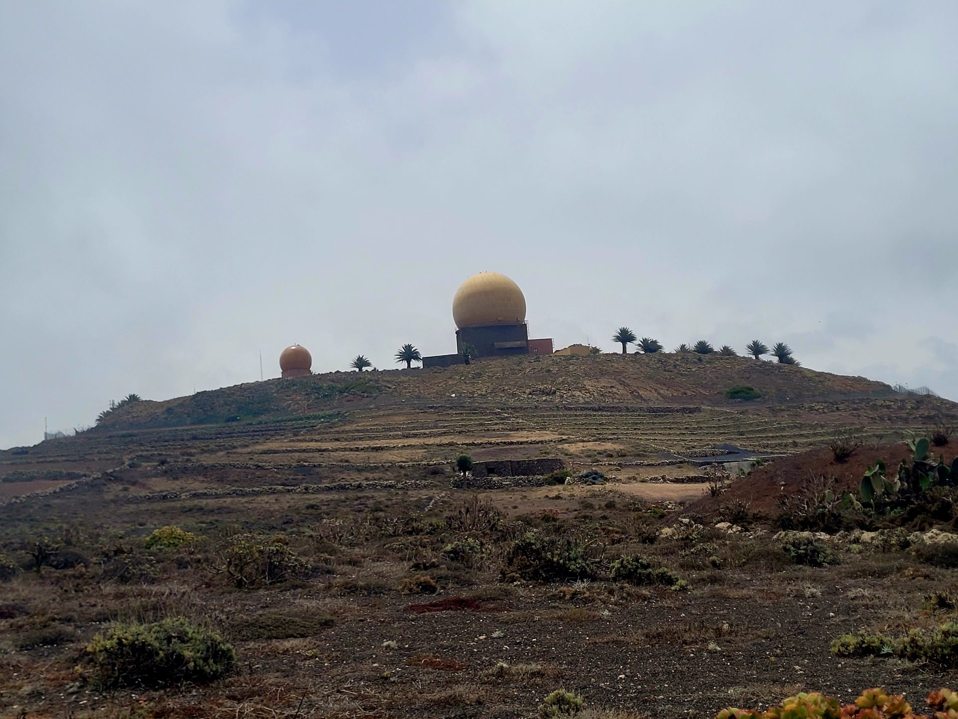
On a clear morning, you may be able to see the observatory between the mountains ranges.
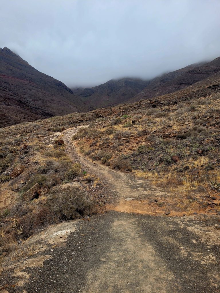
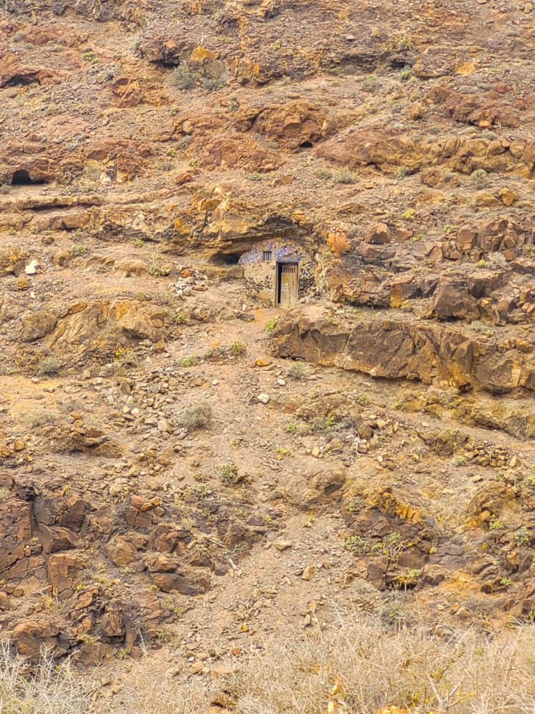
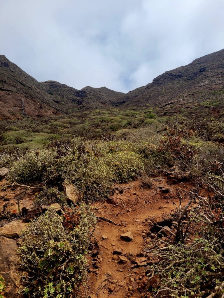
The trail remains wide and straight forward until you pass a small door built into the left hand side of the mountain.
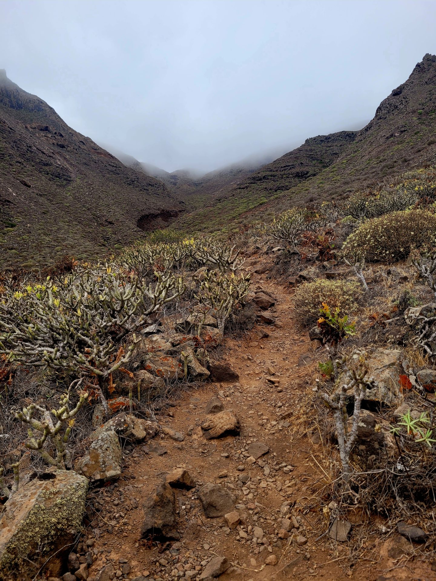
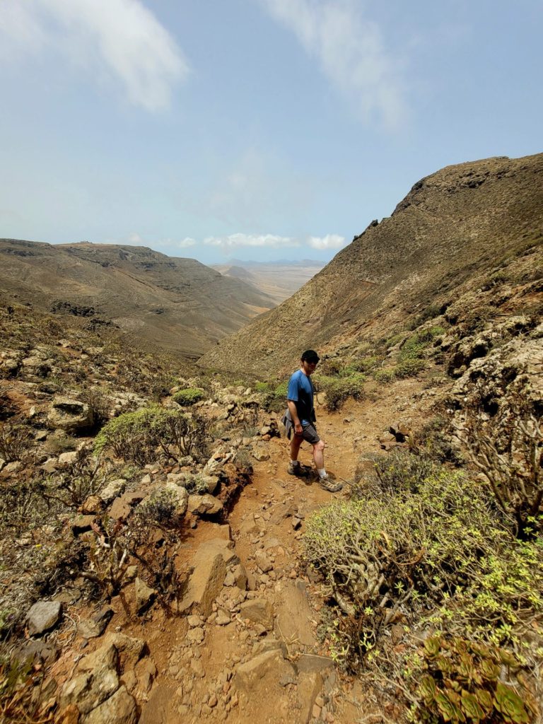
At this point, the trail becomes more narrow and rocky. The dense low brush makes it surprisingly difficult to determine the correct path. A couple times we accidently veered off onto another route.
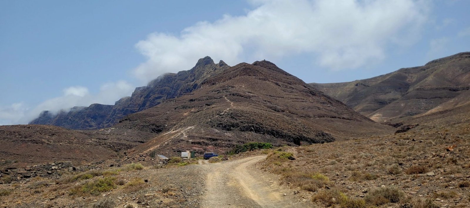
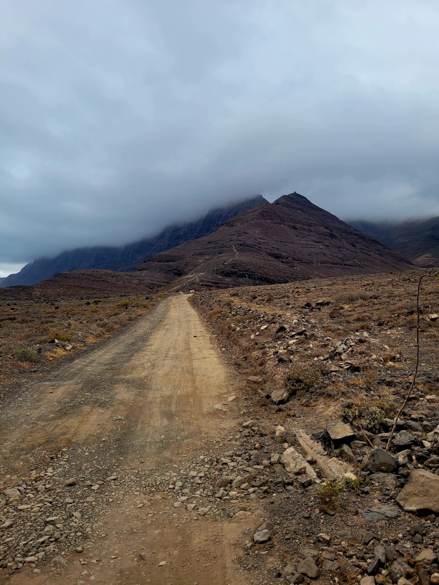
The trails zig zags through the valley and onto the steep mountains. Around 3.5km, it begins to seriously climb, gaining over 300m over the next 2km. The rocky terrain and heat can make it uncomfortable to navigate.
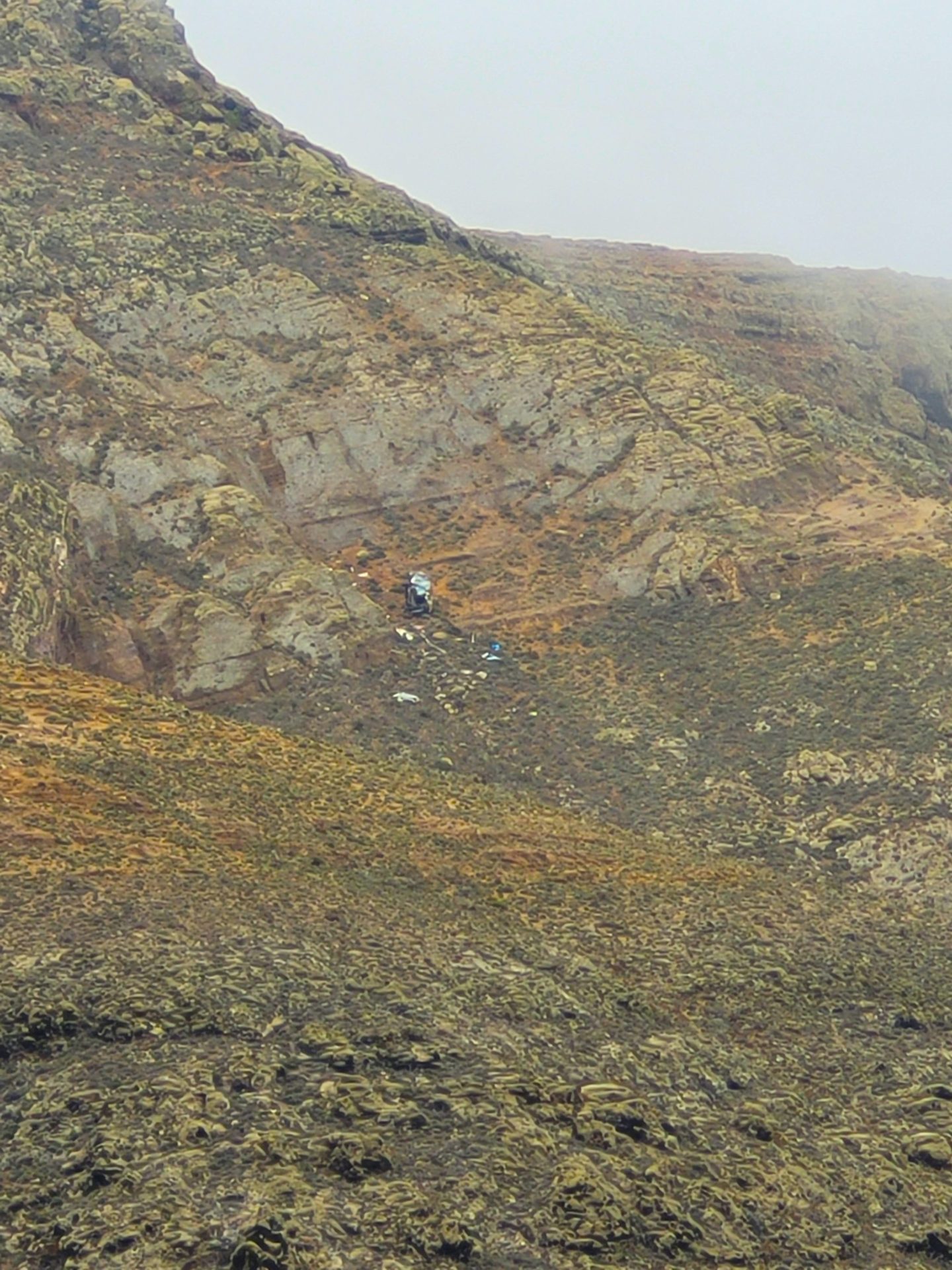
The mist clouded our vision of the summit and the nearby road that passes along the ridge of the mountain. With the steep cliffs and insufficient lighting, it’s no surprise the number of debris found within the cliff side.
Tires and car wreckages were scattered between the mountain ridges. It was an unfortunate site to see.
The trails landscape changes as you continue climbing the mountainside. The barren desert springs to life, with lush green vegetation the higher you climb. The ascent is steeper than it appears and very rocky, though no scrambling is required.
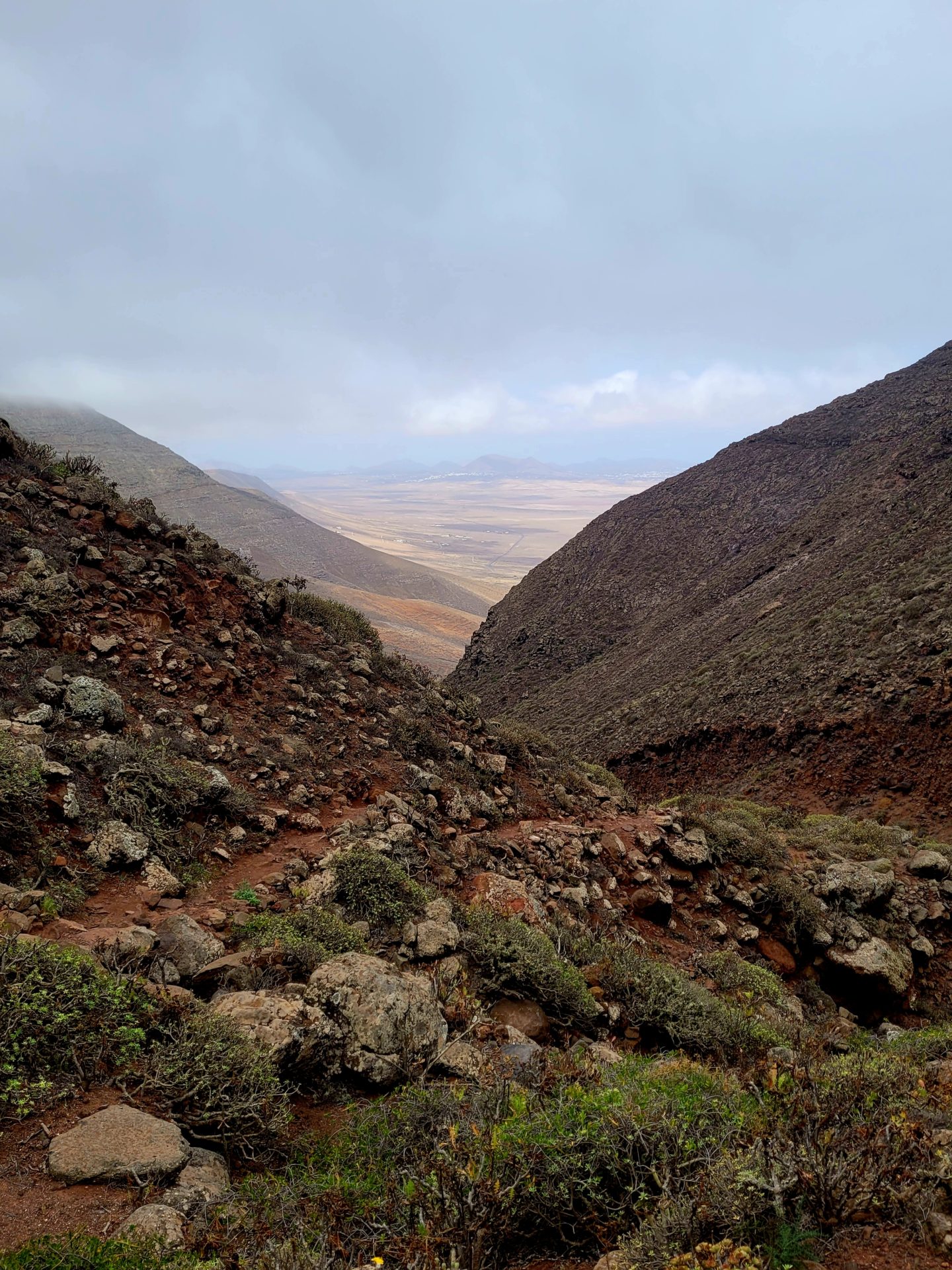
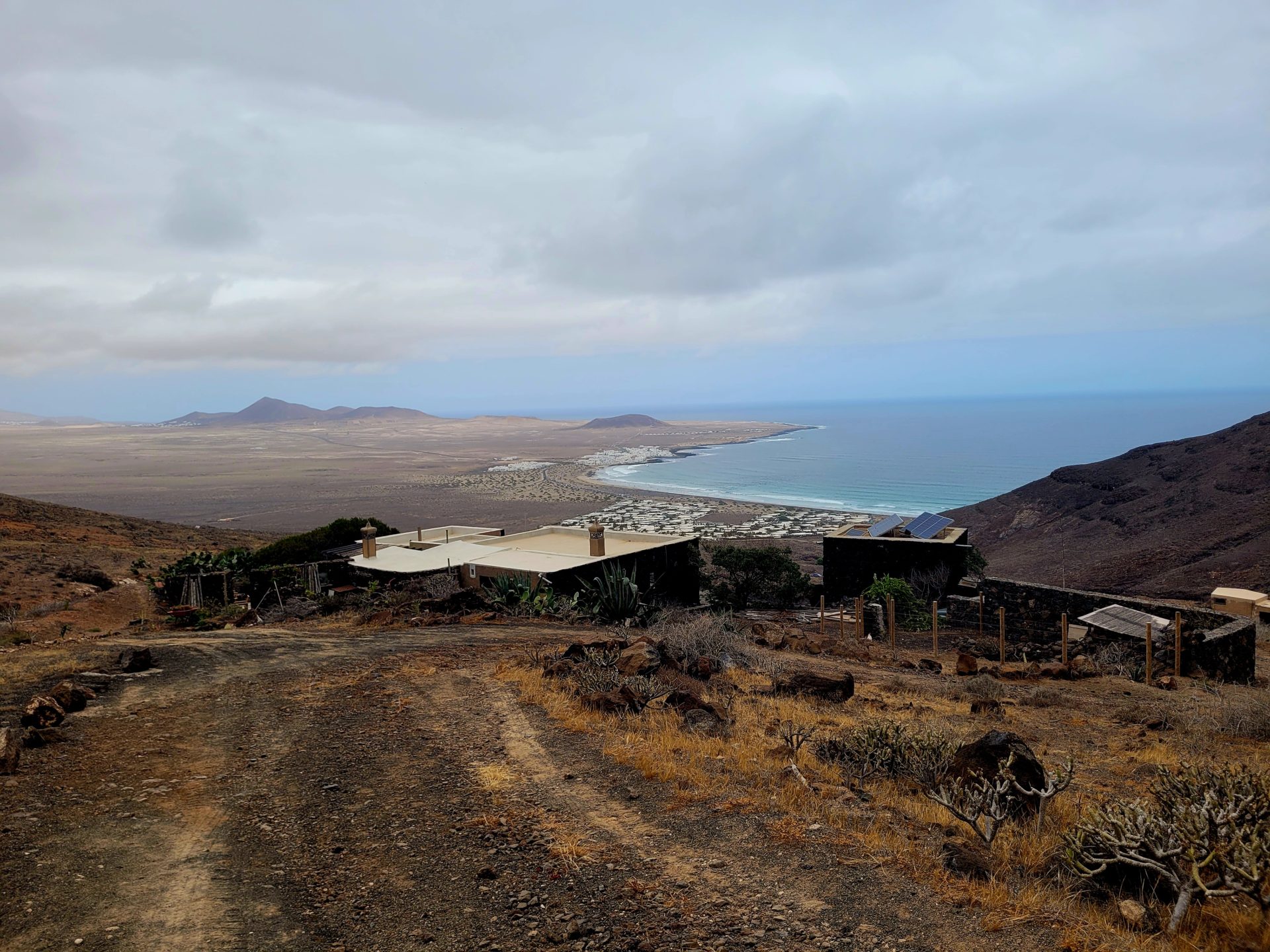
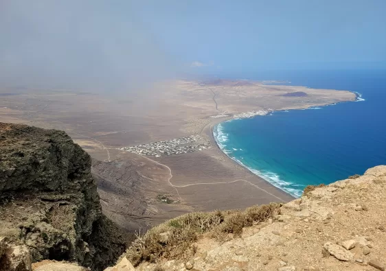
If you timed your summit correctly (after 11am), the mist and clouds should dissipate, and your final views should not be obstructed. The dramatic views of the flat volcanic island, with the turquoise water is well worth the steep ascent and hot temperatures.
Sitting at the top of the summit on the right hand side is an observatory for stargazing and a military base. If you wanted to avoid the hike all together and just get the views, there is an option to drive around the area. The scenic route on the LZ-10 towards the small town of Haria will provide fantastic views of the cliffs, sea and charming villages.
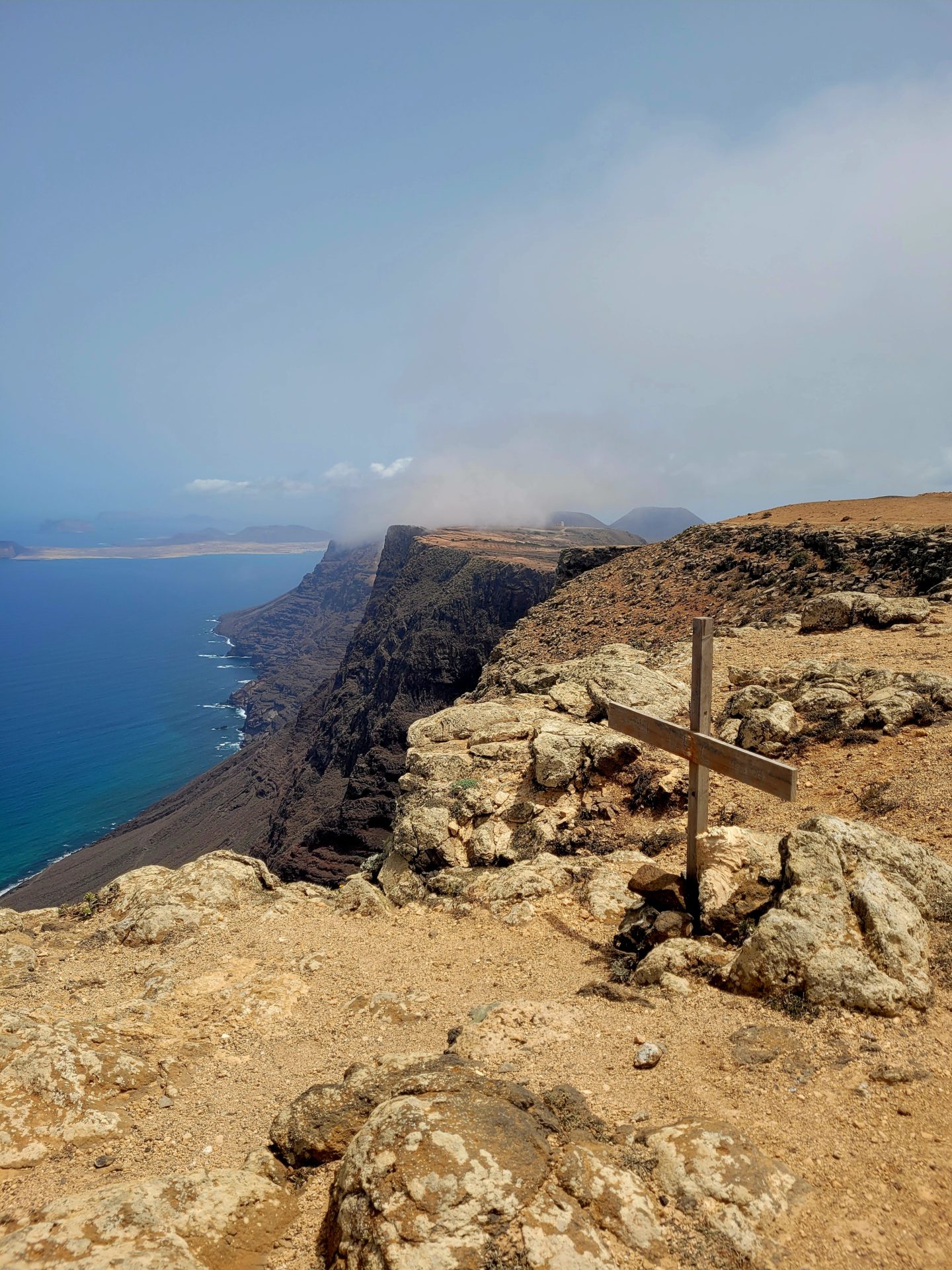
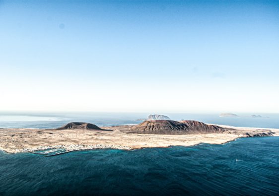
Further along the summit, on a clear day, the island of La Graciosa can be seen across the sea. This island is a perfect day trip away from Lanzarote and offers some additional hiking options as well.
The route back down to the sea is easier to navigate. Just keep in mind loose rock is present and take your time descending. It’s not for the faint of heart or those who suffer from vertigo.
Additional Hikes in Lanzarote
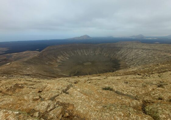
Caldera Blanca: Spectacular hike to a 1200m wide volcanic crater in the Volcanoes Natural Park
El Golfo: An easy hike around the small town of El Golfo and surrounding areas, including the famous green lagoon, Laguna de Los Clicos
=1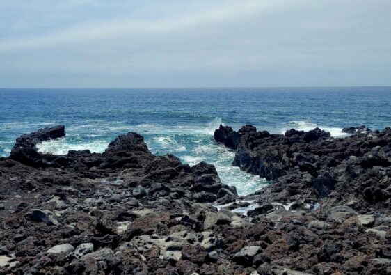
Honestly, it doesn’t look like an easy hike, but I would love to do it, because the views are stunning 😍 Thanks for sharing!
It was definitely a challenge in the heat
We have been to Lanzarote twice and had some fun experiences. But we have not yet had a chance to hike on the island. Hiking Penas del Chache sounds like a great treat. How great that the mist cleared when you got to the summit and you had such a great view.
What a great hike to go on! I love the view of the sea you get from the top.
This looks like a great hike to do when in Lanzarote. Your description and pictures make me want to go there.
I would never be able to gather courage to go for a hike like this. It is too difficult for me. Nevertheless, the hike looks beautiful.
I’ve enjoyed hiking on Tenerife so it’s wonderful to read about other places in the Canary Islands to hike. This is definitely one I’d love to do. There is something eerie and fascinating about volcanic rock.
Those views are amazing and hopefully, I’ll get to do this hike one day.
That is a very barren hike. You’d have to hike early in the day to avoid the heat!
This hike would be worth it alone for the view form the summit! The water looks incredible, what a great hike.
These pictures are GORGEOUS! My gosh, I want to try out this hike. Good tip on planning the hike out to avoid the mist :).
The heat would make it tough but those views are incredible! Thanks for the hike idea
Surely, I am not the only one who wants to know what is behind that door in the rock! This looks like an interesting trail of discovery 🙂
The views are stunning and the landscape looks so mystical. Will definitely have to give this a go when I visit!
Looks like an incredible hike ! I love the Canary Islands and how unique each one is!
I learned surfing on that beach – a wonderful part of Lanzarote. Pictures of the walk look wonderful, but I stay on the ground…
Lovely photos! The view of the sea is absolutely stunning! Thanks for sharing!