Located in the heart of Kananaskis Country, Alberta, Mount Smutwood offers a challenging full-day adventure through the stunning Canadian Rockies. Featuring waterfalls, diverse terrain, alpine lakes, and rocky scrambles, this trail is ideal for intermediate hikers seeking a rewarding experience.
Although demanding, the hike provides significant rewards in the form of breathtaking vistas and a sense of accomplishment. This trail guide includes essential details on trail information, difficulty level, wildlife safety, route overview, and helpful tips for a successful journey.
Table of Contents
Mount Smutwood Trail Information
- Distance: 20km roundtrip
- Elevation Gain: ~900m
- Difficulty: Hard
- Time: 6-9 hours (with breaks)
- Permits required: Kananaskis Conservation Pass
Trail Difficulty/Safety
I would rate the hike to Mount Smutwood as difficult. Although AllTrails lists the trail as 17 km, my GPS showed it to be closer to 20 km roundtrip. The first and last 5 km of the trail are flat and easy, but there are some significant steep inclines throughout.
The terrain is varied and challenging, featuring bogs, scree, rocky sections, and snow crossings
This trail is located in Peter Lougheed Provincial Park along the Smith Dorrien Trail. The trail and road are not regularly maintained. The road is wide but covered in loose gravel, so a 4×4 vehicle or AWD is advisable.
Although not impossible with a 2WD, it’s not recommended. On dry days with heavy traffic, the dust can be so bad that it becomes almost impossible to see the road.
There is no cell reception in the area and no nearby facilities, such as washrooms. This is prime grizzly bear country, so carry bear spray and keep it readily available, not packed away in your backpack.
For safety, travel in groups of four if possible. While some may prefer the quiet serenity of the mountains, it’s advisable to play music and talk loudly on the trail.
This reduces the chances of surprise and often dangerous encounters with wildlife, as they will hear hear you coming from a distance. Safety comes first.
Trail Overview
Forest to Meadow
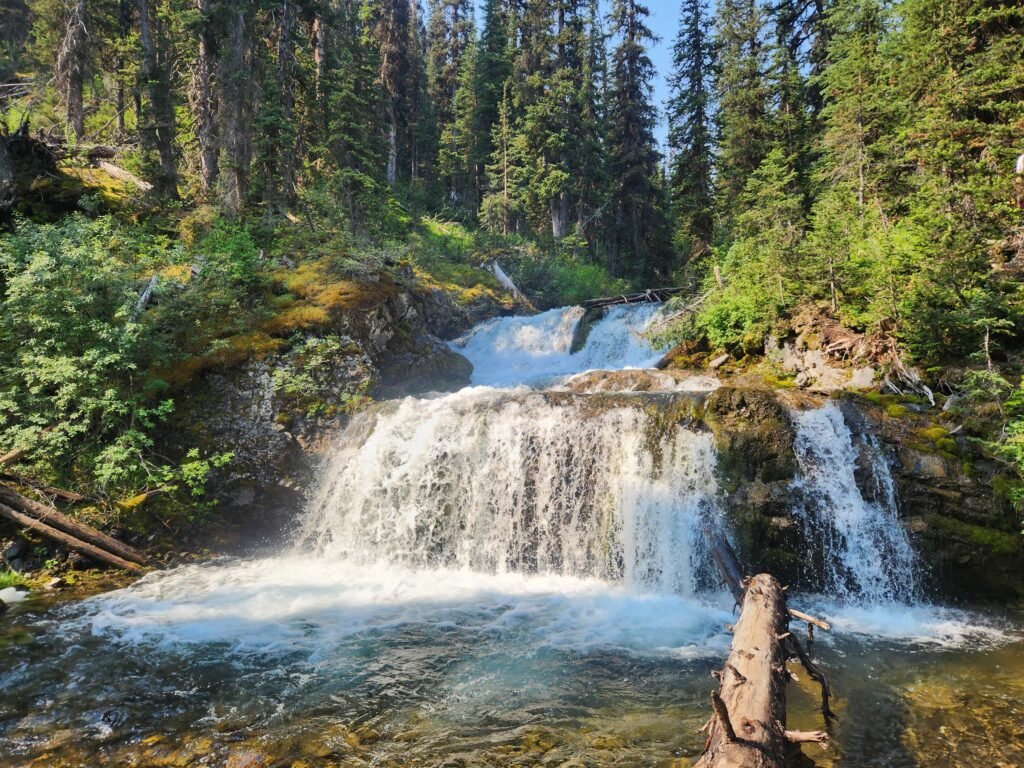
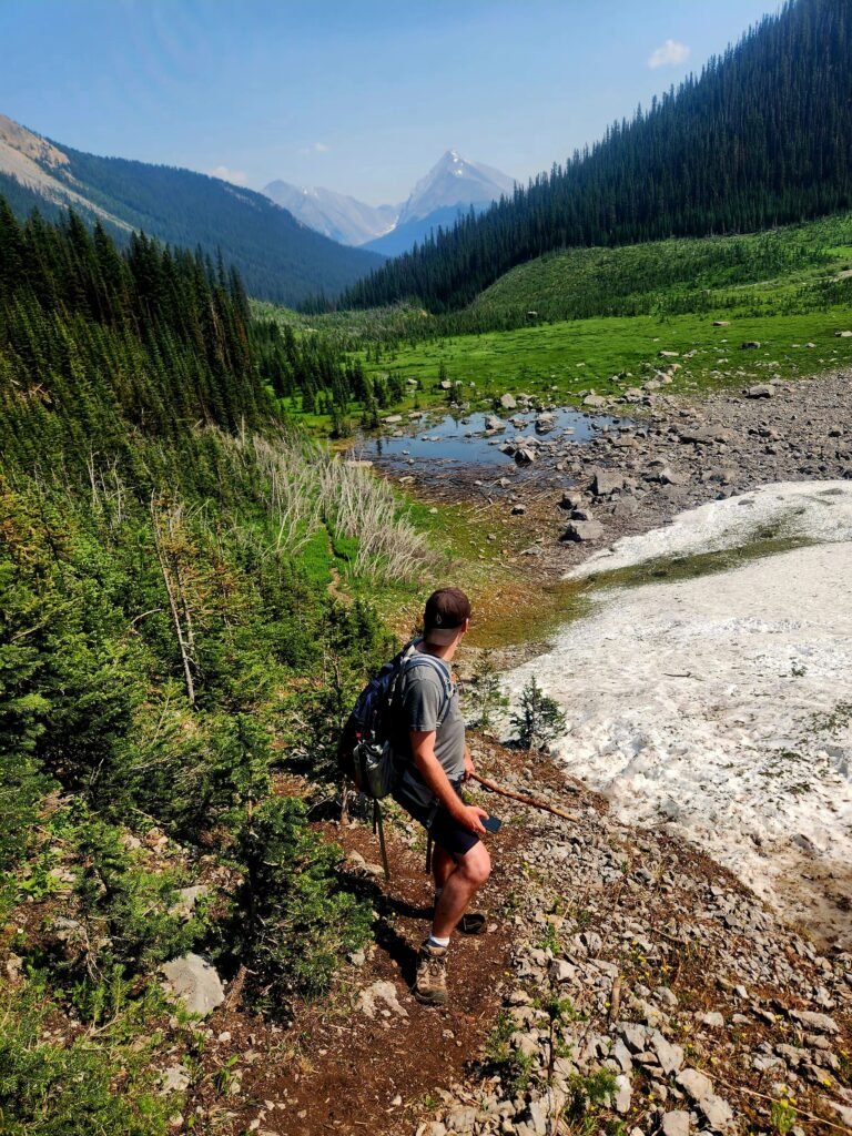
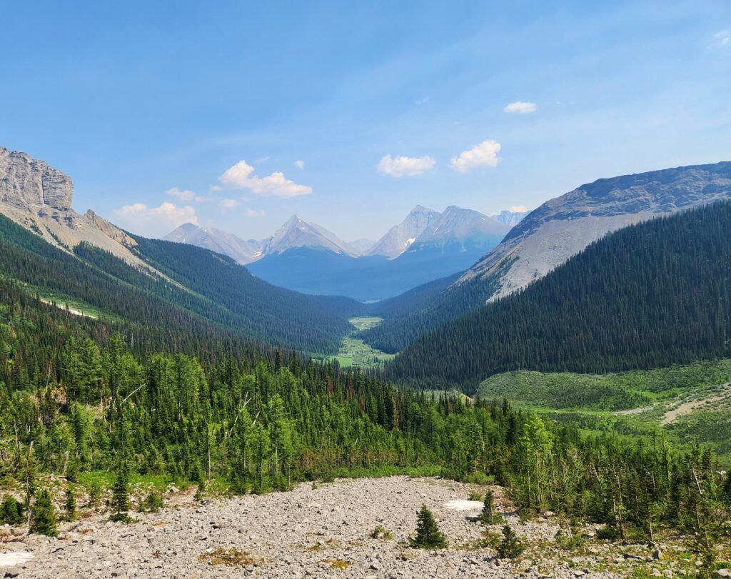
The first section of the trail is quite easy, starting with a wide, flat path through a wooded area for about 3 km. After this, the trail veers into thicker woods and runs alongside Commonwealth Creek. This shaded section offers many beautiful views of waterfalls and the rushing creek.
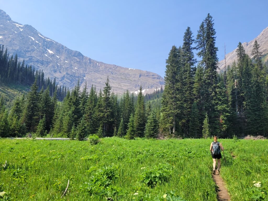
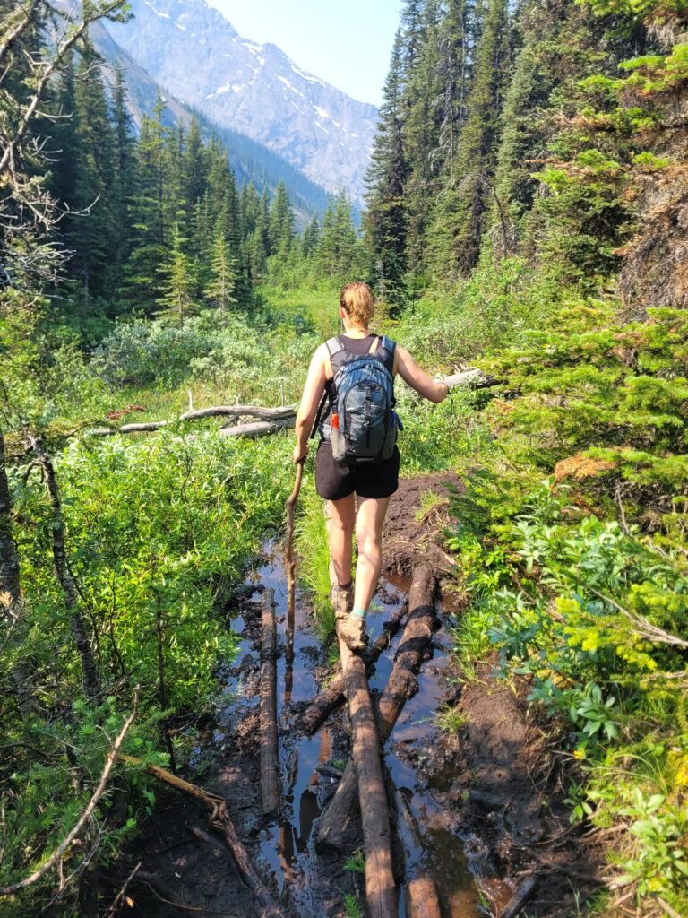
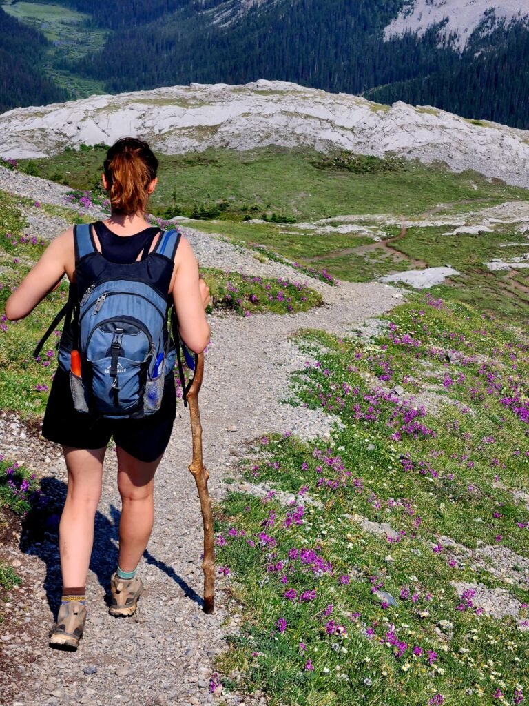
Around the 4 km mark, you leave the wooded area and enter a meadow for the next 3 km. The meadow is utterly beautiful but can be quite boggy and muddy. A small, narrow trail runs along the edge of the woods, offering a significantly less muddy route.
While beautiful, this area is where you’re most likely to encounter wildlife if you’re not careful. On our return trip, we almost ran into a young grizzly bear.
Other hikers at a junction ahead flagged us down, warning us about the bear on the trail. We veered off the path to join the other hikers, and moments later, we saw the grizzly on our trail. Our group of two became a group of eight, and we stayed together for the last 5 km of the hike for safety.
Steep Incline Up
Around the 6 km mark, the meadow ends and gives way to a flat, boggy area with giant rocks. This is the final section before the elevation starts to climb over the next 2 km.
The climb can take anywhere from 30 minutes to 2 hours, depending on factors such as weather, fitness level, trail conditions, and comfort. Although there are no technical aspects to the climb, it is very steep and involves a gain of around 400 meters in elevation.
This section begins with a climb through low brush, followed by a rocky area on a narrow path. In late July, we encountered two snow-covered areas. If you’re not comfortable with snow crossings, I highly recommend using microspikes to reduce the risk of slipping.
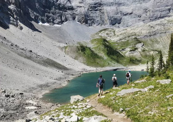
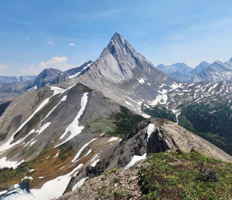
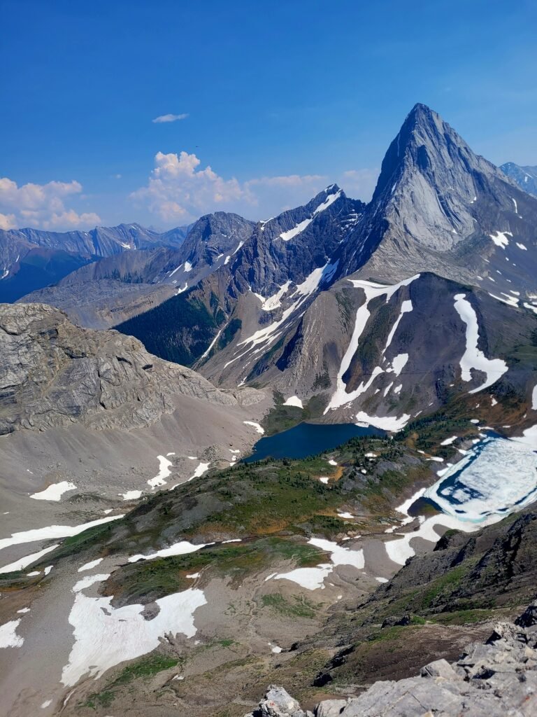
Alpine Lakes
The final push up the 2 km stretch rewards hikers with not one, but two beautiful hidden mountain lakes. The smaller lake was still frozen, but the larger lake was accessible and wide open.

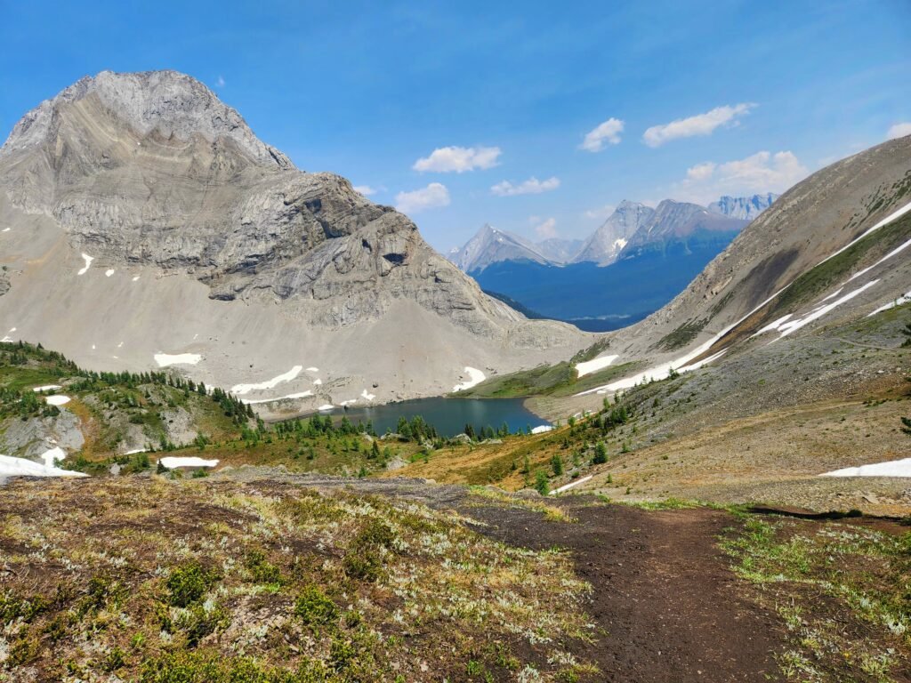
The trail then gives hikers a break, remaining flat for another 1 km as it hugs the side of the mountain. This section is narrow and rocky, with some areas covered in snow. Again, microspikes and poles would be helpful here. Once past the snow, the trail begins to climb again, but not as intensely as before.
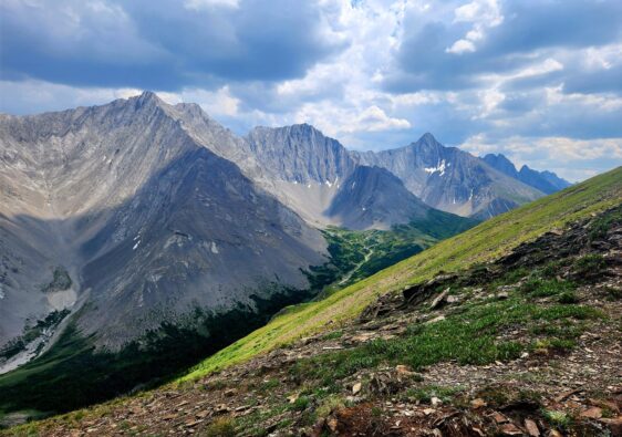
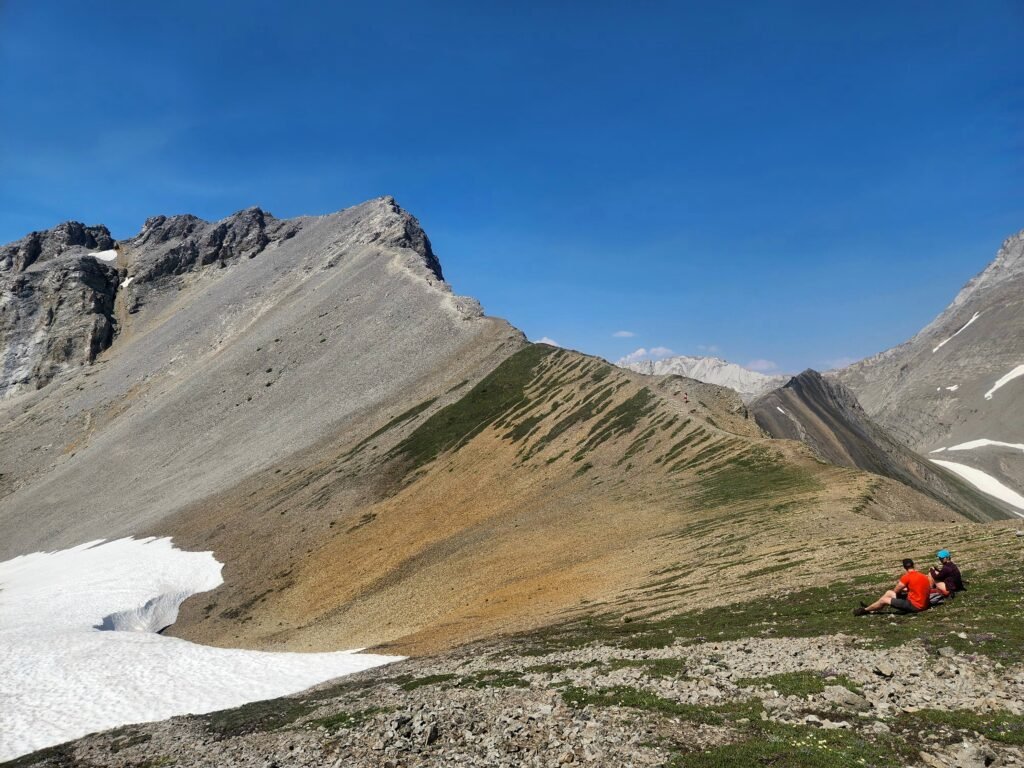
False Summit
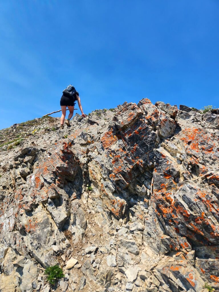
This is where the real scramble begins. Several sections require using your hands to climb up or down small rock walls. Although it’s a scramble, nothing in this section is too difficult. As long as you take your time on the narrow paths with loose rocks, you should be fine.

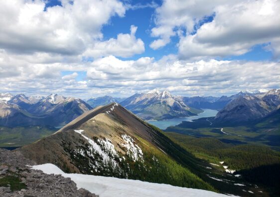
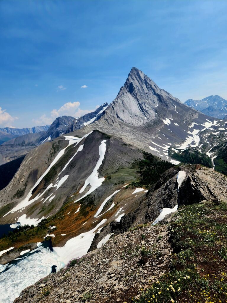
One you pass over the scramble sections, you will make it to the saddle and the false summit. The false summit offers the best views, in my opinion, showcasing spectacular vistas of the two alpine lakes and Mount Smutwood and Mount Smuts.
Summit of Mount Smutwood
For those feeling adventurous, you can attempt to hike the remaining half kilometer to the true summit.
The trail starts off rocky with loose gravel and soon becomes a steep incline that requires scrambling up sheer rock. It’s a bit of a “choose your own adventure” to reach the top of the ridge.

If you’re uncomfortable with exposure or scrambling, I’d advise against it. My husband and I got about 20 feet from the top before turning back for safety reasons. We couldn’t find a safe route that didn’t lead to a sheer drop-off and there were simply too many people at the summit at that time.
Ditching the backpacks and hiking poles is almost a necessity at this point as crawling up on your hands an knees seems to be the only way to reach the top.
While climbing up wasn’t the issue for us, the descent was incredibly sketchy. Trust me, the views from the true summit are no different from those at the false summit.
Return the way you came, taking extra care on the descent due to loose shale and scree in some areas.
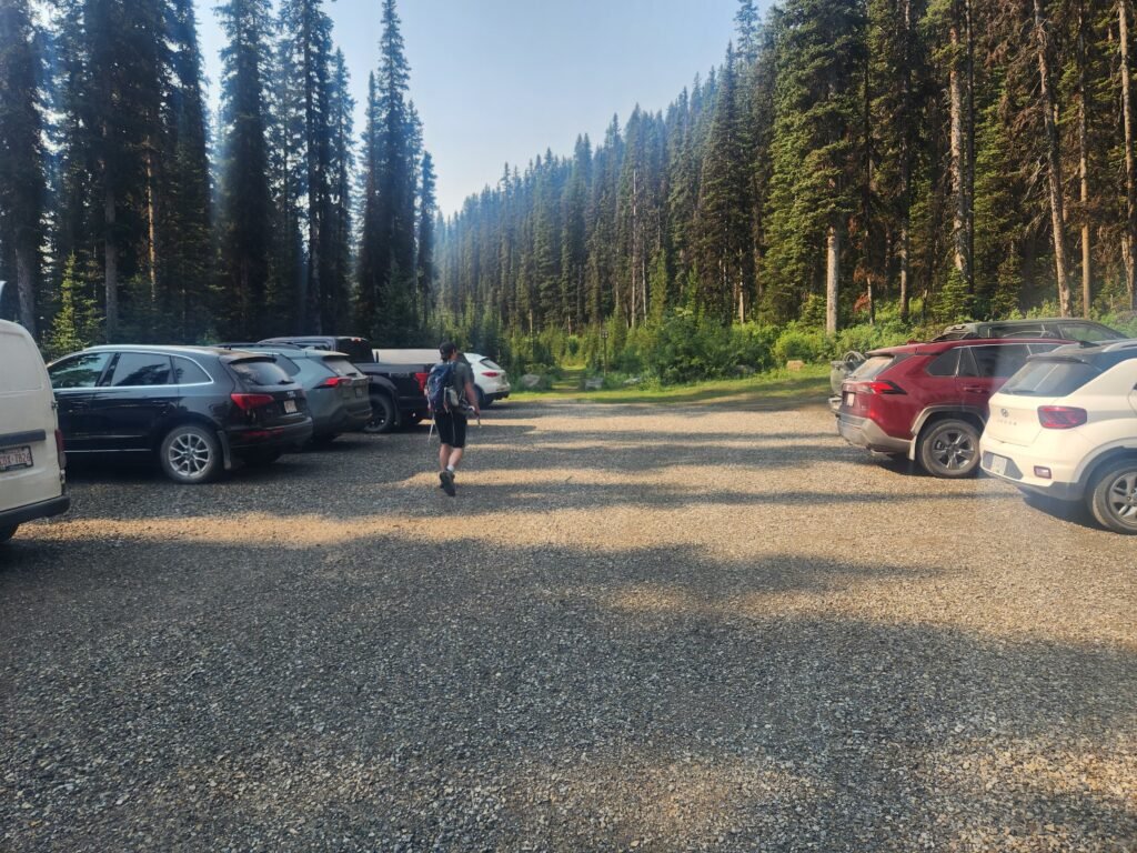
How to Reach Trailhead and Parking
Mount Smutwood and Mount Smuts trail begins in the same parking area. just off of Rummel Pass. There is plenty of parking spots but no facilities.
Mount Smutwood is not accessible by public transport, so having a car is essential. To reach Mount Smutwood from Calgary, it takes about 2 hours. Head west on the Trans-Canada Highway, take the Highway 40 (Kananaskis Trail) exit, and continue on this route for 50 km.
Turn right onto Highway 742 and follow it for 2 km until you reach Smith-Dorrien Trail (turn right). Continue on this road for another 26.5 km, then turn left onto Rummel Pass. The trailhead is another 950 meters down this route.
From Canmore, the trail is approximately 1 hour and directions can be found here.