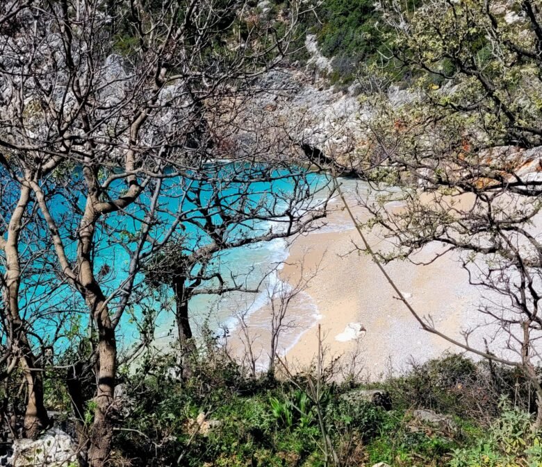
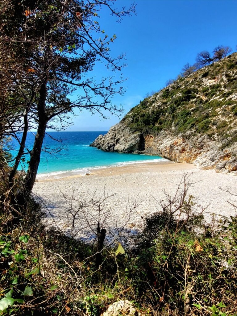
Saint Andreas Bay is a gorgeous beach located in the beautiful Albanian Riviera. With its white pebbled stone beach and quiet, remote atmosphere, it’s no surprise this little slice of paradise is becoming ever more popular.
Hiking to Saint Andreas Bay is a challenging but worth the intense elevation gains and loses. This hiking guide will provide you with important information regarding routes, safety, and ways to access this amazing beach.
Saint Andreas Bay goes by many other names including St. Andrews Bay, Gjiri Shen Andreas, and Sant Andreas Bay.
Disclosure: I only recommend products I would use myself and all opinions expressed here are my own. This post may contain affiliate links that at no additional cost to you, I may earn a small commission.
Saint Andreas Bay Trail Information
- Distance: 20km
- Elevation Gain: 1500-1600m
- Trail Type: Out & Back
- Difficulty: Challenging
- Facilities: None on route
How to Visit Saint Andreas Bay
Reaching Saint Andreas Bay can be a little difficult as it’s very secluded and off the beaten path. There are currently two trails that lead to the bay, one coastal and the other through Llogara National Park.
Route 1: Route one begins in the small village of Palasë and runs parallel with the coastline for before reaching Saint Andreas Bay.
- Distance: 17km roundtrip
- Add an additional 4.5km each way if you want to visit Grama Bay
- Difficulty: Moderate
- Hiking map is located here
I’d recommend this route for anyone wanting to visit both bays.
Route 2: The route begins in Llogara National Park and descends to the coastline. This path has huge elevation gains/loses but has stunning views.
- Distance: 20km roundtrip
- Elevation gains/loses close to 1600m
- Difficulty: Challenging
Camping is available near Saint Andreas Bay.
This hiking guide provides details to Saint Andreas Bay via walking Route 2, through Llogara National Park.
Best Time to Hike to Saint Andreas Bay
Hiking to Saint Andreas Bay is best enjoyed during the spring and fall during the months of March- May and September-November.
While the summer is an idea time to visit the Bay for swimming, hiking to it during this time is not encouraged. The heat will make for an uncomfortable ascent. I would recommend using the ferry during the summertime or taking the alternate route.
I hiked to Saint Andreas Bay in mid April. The temperatures were ideal, ranging around 15-18 degrees.
Precautions on The Trail
Simply put, the hike to Saint Andreas Bay is not easy, especially if you plan on completing it in one day. On average, with breaks and time at the bay, the hike can take anywhere from 8-10 hours and vary greatly depending on the fitness level of the individual. It’s not advised to hike this in the dark, so plan accordingly. Plan to take at least 4-5 hours each way.
Elevation: The trail has some extreme ascents and descents. The main route descends around 1200m from the mountains to the sea and returns on the same trail. An additional 300m is gained just reaching the mountain area before the descent.
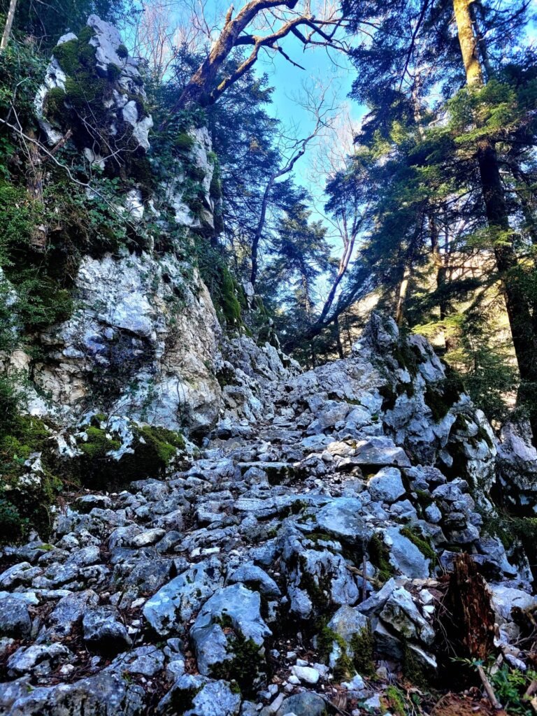
Terrain: The seconds part of the trail is very rocky, especially on the initial decent towards the bay. Its not uncommon to find the first section of the trail washed away in the early spring. Follow the markers and be careful while accessing the area.
The low-lying brush is not maintained and can become quite hazardous. I would avoid wearing shorts, as your skin will be exposed to the prickles and bristles. I wore leggings and discovered they had been ripped and my ankles were scratched by the bushes.
Access: This hike is very isolated and might be best to split into two days (if you plan on visiting the other bays).
Facilities: There are no washroom facilities on route or at the bay. Unlike in northern Albania, where fresh water sources are readily available, there is no place to refill your water. Make sure you bring at least 2-3L of water for your journey, perhaps even more if travelling in the summer. Pack a lunch and please pack out whatever you bring in. Albania unfortunately has a litter problem.
How to Get to the Trailhead
The trail to Saint Andreas Bay begins in Llogara National Park. This park is in southern Albania, approximately 36km from Vlore.
The trailhead is located 170m away from Hotel Sofo Llogara, making it also the perfect place to park a vehicle (if there is space available). Alternately, there may be space at the Llogara Tourist Village (400m away from Hotel Sofo).
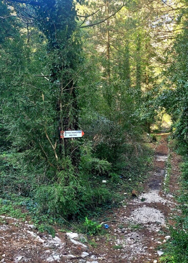
Head south from the hotel and proceed down the SH8 road. On the right-hand side, there will be a small path and a small red/white sign saying Bike Path (Shtegu I Bicikletave in Albania). This is the start of the trailhead.
Section One: Through the Forest
The trail begins on a flat, yet rocky path. This path will pass by an open camping area, before venturing deeper into the dense forest. This portion of the trail is cooler in temperature, as most of the trees are covered in thick moss, vines and sheltered from the sun.

This section takes around 5km, moving through different areas of the forest, with some mild elevation gains (around 300m).
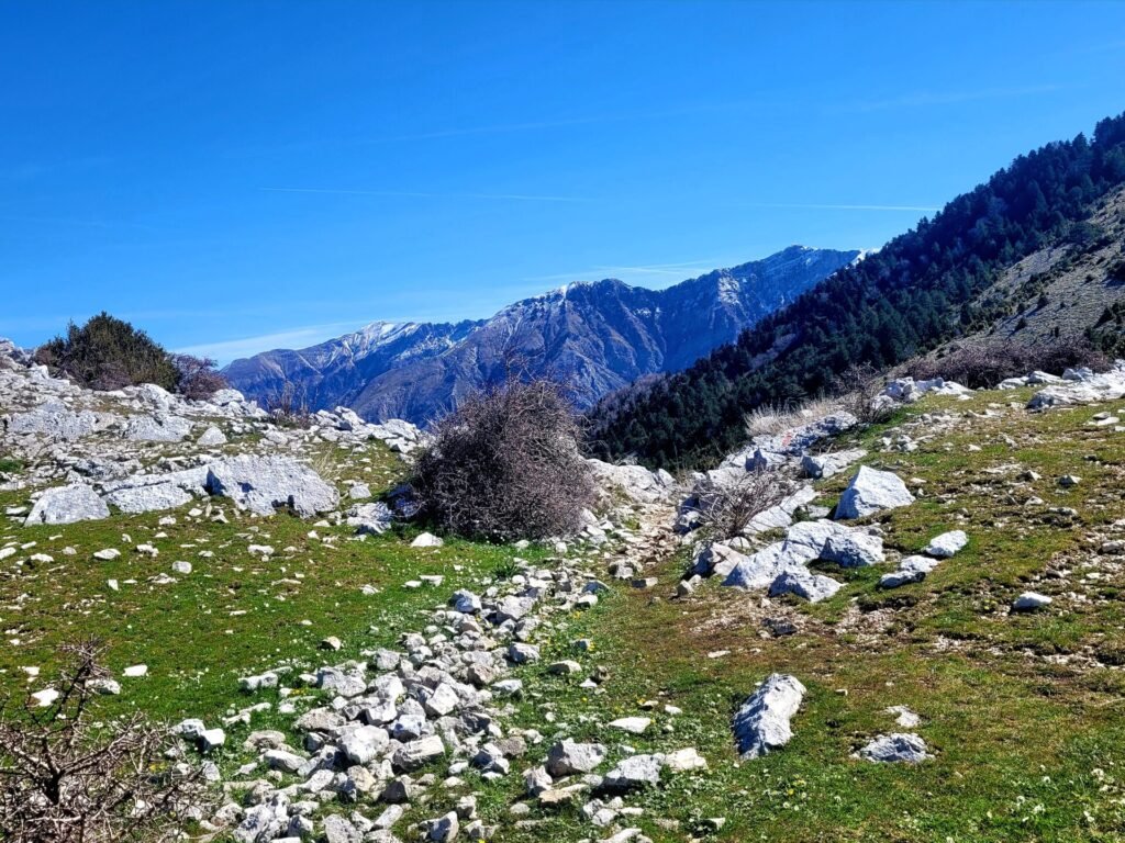
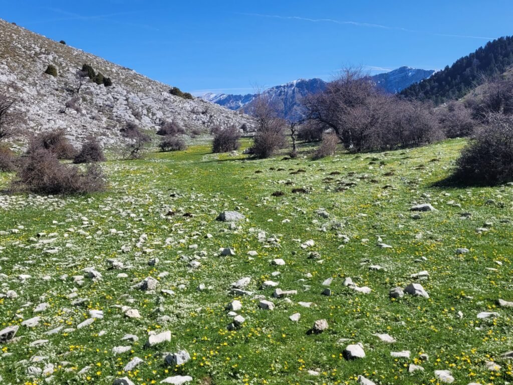
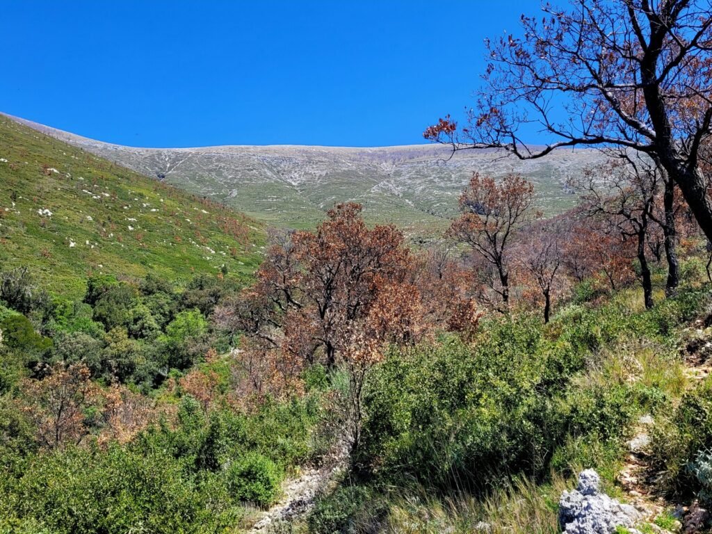
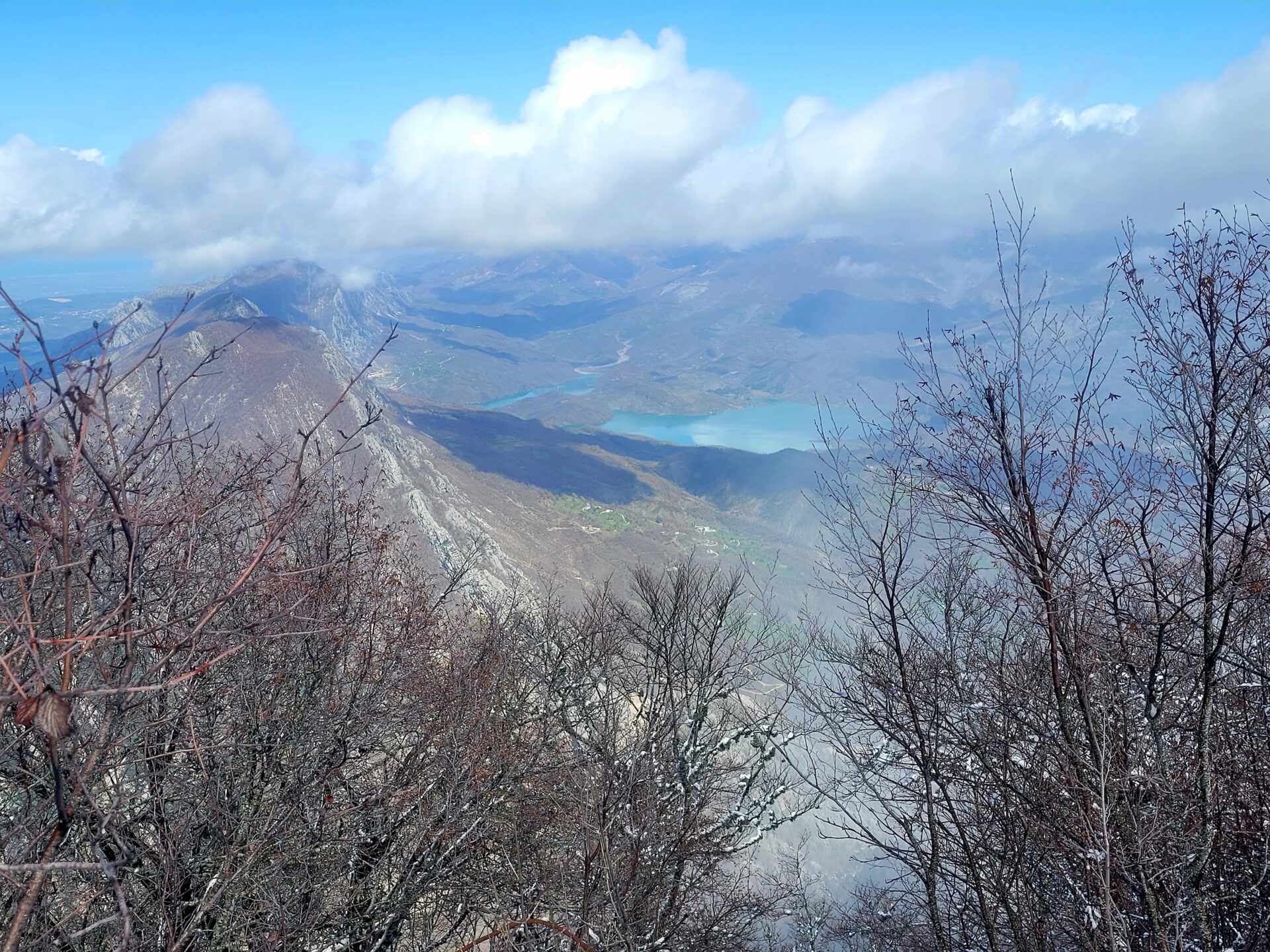
Before long, the trail will leave the forest. The landscape changes dramatically, finally resembling the Mediterranean, with rugged coastal cliffs and meadows. This low part of the ridge (saddle) is called Qafa e Thellë. A small reservoir is seen in this area, which provides water for wildlife and livestock during the summer.
Section Two: Saddle to the Coast
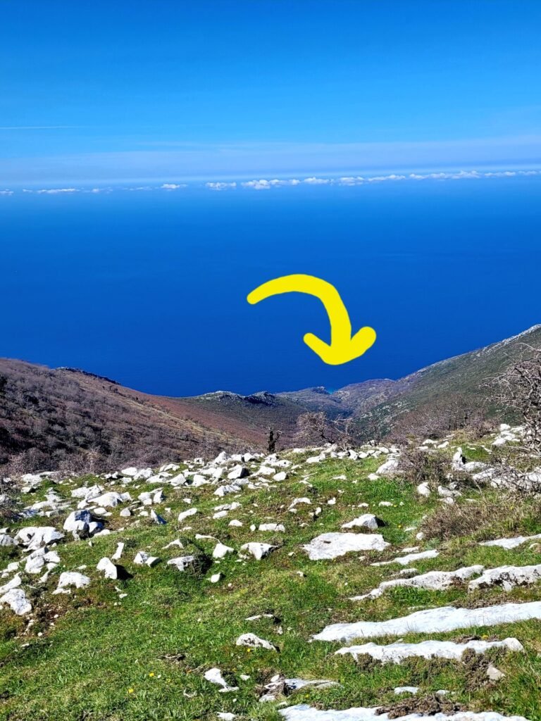
The second section begins at the saddle and descends towards the sea. On a clear day, some Greek islands and Italy can be seen in the distance. The light blue waters of the bay can be seen from the top of the saddle.
The initial route down can be a little tricky to find, as the area is prone to erosion during the winter. Be aware of loose rock in the area and proceed slowly down the trail.


As with many walking trails in Albania, red/white markers can be seen throughout the path, often on trees or rocks. The trail begins heading to the coast in a switch-back formation, making for a slightly easier descent.

As mentioned earlier, the low vegetation in the area is not maintained and often filled with prickles. This trail isn’t heavily trafficked, so don’t expect manicured paths and easy trail markers. This route is around another 5km to the bay area and will descend around 1200m.
Section Three: The Bay
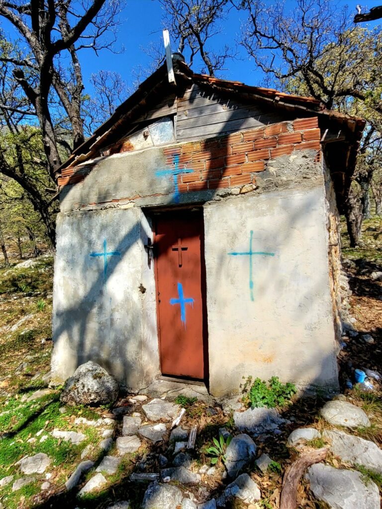
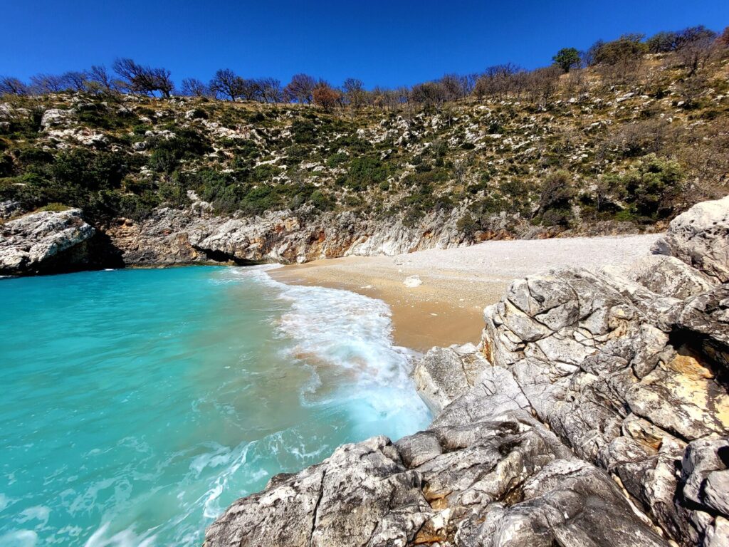
As you proceed through the route, the trail passes by another small reservoir and camping area. There is also a small church, where the bay gets its name from.
The beach can be seen from the last 100m, as it peeks its way through the trees and cliffs. The trail will emerge on the right side of the bay.
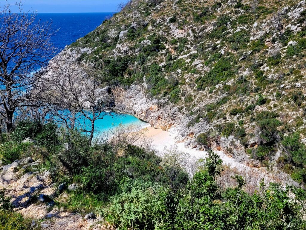
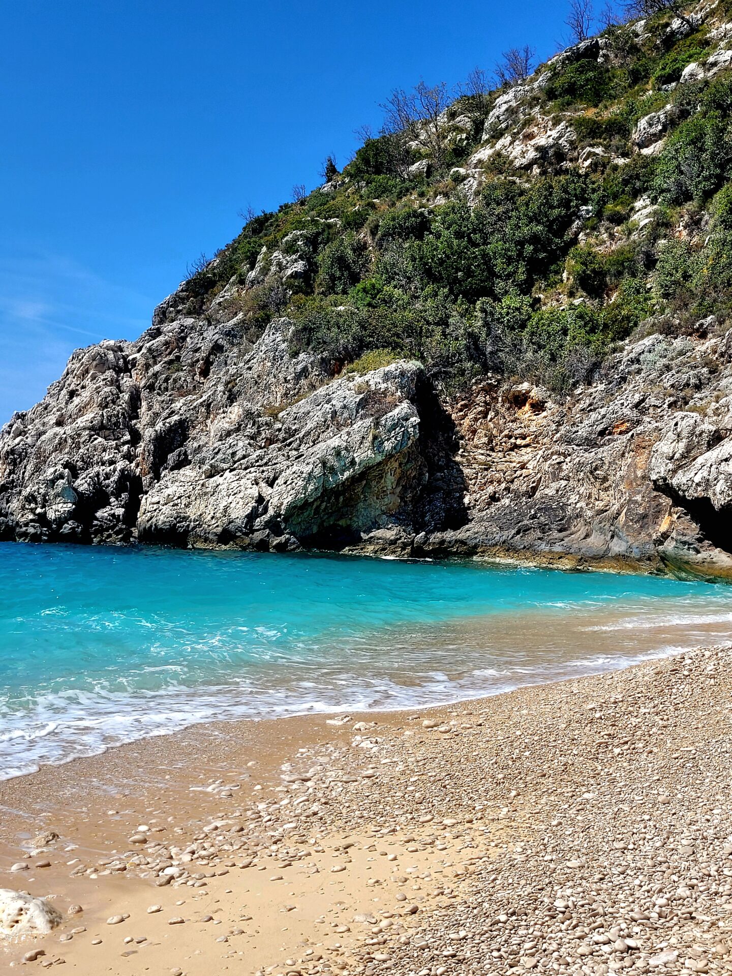
This beach may be small, but a perfect little piece of paradise. Relax your legs, go for a swim, or just enjoy the crashing waves.
In April the water was still very cold, so I didn’t go for a swim, but rather dipped my feet in.
On the back left side of the beach, there is another trail, which connects with the coastal trail that leads to the more famous Grama Bay.
The Return to Llogara
The hardest section of this hike is the return trip. As this is an out and back trail, you will need to return the way you came. The 10km trail leading back to Llogara is long and strenuous and will climb over 1200 meters from sea to saddle.
Be sure to take many breaks and drink lots of fluids. The switch back makes it less steep but still a challenge. This was the highest elevation gain I did and was tired. Once you clear the saddle, it’s down hill from there through the dense cool forest.
Additional Ways of Visiting Saint Andreas Bay
It’s possible to visit Saint Andreas Beach without having to hike there. Some boat tours in the area visit Saint Andreas Bay on route to other more popular beaches, like Grama Bay and Pirate Cave.
Both private and group trips can be arranged. Group trips are cheaper in price than chartering a private boat.
Tours departing from Himara:
Tours departing from Dhermi:
TOURS TO GRAMA BAY HERE
Further Exploring in Llogara National Park
There are many other trails located in the beautiful park of Llogara including Maja e Qores (Qorra Peak). This steep hike is a spectacular route with views of mountains and sea.


Great information especially if the paths aren’t well demarcated. It is so easy to get lost when there are no clear indicators where to go, or a map to follow.
What a gorgeous outdoor trail, and I loved the blue of the water at the beach. I marvel at people who can hike such long hours and distances. I love to walk in forests and green paths but the elevation and rough terrain prove to be too much for me. I have done quite a few hikes on Sunday mornings in the local forests around my home but I used to come back exhausted and drained. So after a while, I quit doing that and went for walks in the city forests that didn’t have the rocky outcrops or the elevations.
Inner city parks can be equally as beautiful and relaxing
I love all the information you give on the trails. As I’m not a confident hiker this is invaluable information. Thanks.
I’m hoping to visit the Albanian Riviera in the next year so this post couldn’t come at a better time. The Saint Andreas Bay hike looks challenging but when you have a beach like that as the halfway point, it looks worth it. Thanks for sharing.
Glad I could help. I have another article about a small hike to Dhermi beach that will be coming soon.
I always think of hiking in such forest-like areas, but, off late I have got some kind of weird allergy that causes itching in my body whenever my skin gets in touch with a wild plant/ grass.
You are not alone. I also get itchy anytime my skin comes into contact with long wet grass.
I was just reading another blog about Albania! It’s high on our list for 2024! We were supposed to go in 2020 but well, you know what happened! I really hope to get it back on our itinerary. This hike looks perfect for us…and I would t have known about it so thanks for the great info.
wow what a hike! Looks like some great views along the way as well!
This is such an amazingly detailed guide for an off-the-beaten-path gem 🙂 I was lucky enough to live in Albania for a few months and solo travel for the first time there when I was 19, and it seemed almost criminal very few seemed to know about the beautiful coastline. Thank you for sharing this!
What breathtaking views! Your tips are so helpful for safety reasons, too. I would love to do this hike — not sure I could due to the challenging level but I want to!
Albania has been on my wish list for years and this hike will be added! The views are so beautiful, as well as you pictures!