Hiking to the Selca Waterfall (Ujevara e Selcës) in Albania is a must for all nature lovers! This waterfall is in the stunning Shkodër County, which is known for its canyons, breathtaking mountainous scenery, natural springs, and hiking. The Selca Waterfall stands at just over 30 meters high and takes on average 1-1.5 hours to reach. This hiking guide will provide all the necessary details on how to reach the trailhead and some tips along the way.
Selca Waterfall Trail Information
- Distance: 7km
- Elevation: 495m
- Trail Type: Loop
- Difficulty: Easy/Moderate
- Facilities: Washroom at parking lot
Where is Selcë
The Selca Waterfall (also known as Selcë) is located in the small village of Selcë (Selca) in northwest Albania. This village is about 1.5 hours from the city of Shkodër and 3 hours from the capital city of Tirana.
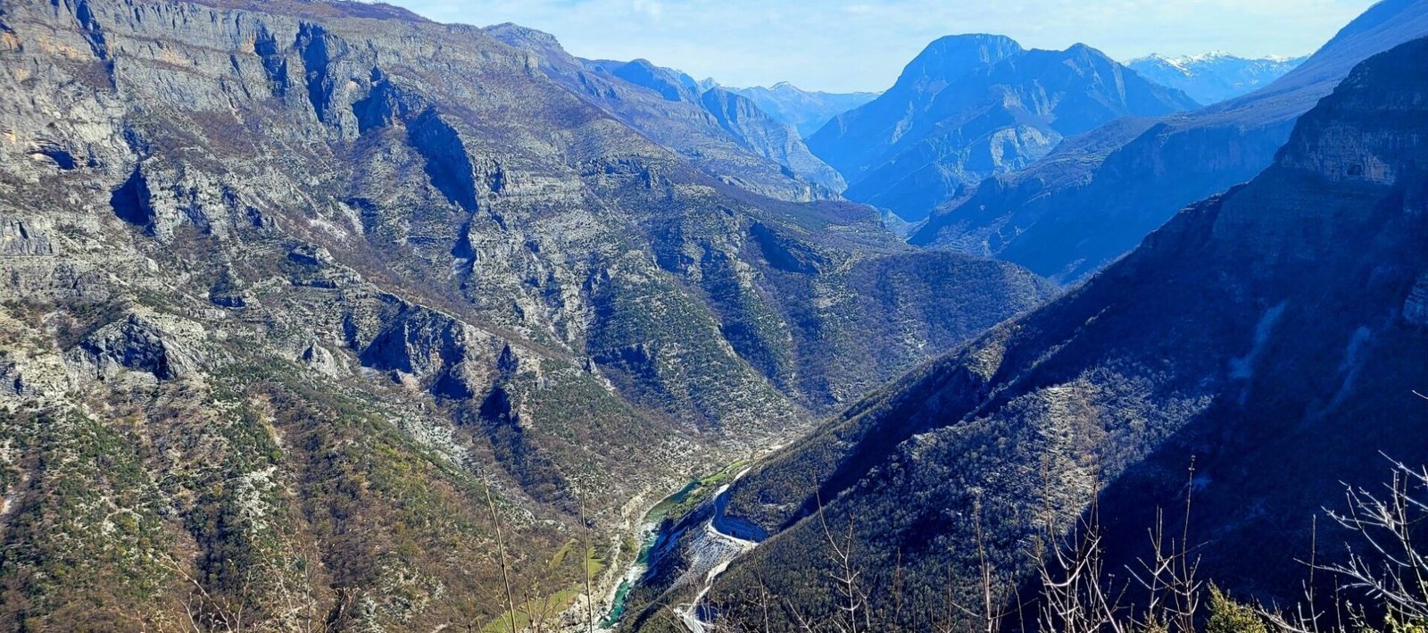
This area borders Montenegro and is one of the most scenic mountainous drives in Albania. The journey to Selca and beyond is through several mountain passes, terrains, and ever-changing climatic zones as well.


The village of Selca is situated in a valley between two limestone crags and sits around 400-500m above sea level, making it significantly warmer than other villages and towns along the mountain pass. For example, Vermosh, located 25km northeast of Selca, sits 1000m above sea level and sees significant snowfall into April.
Best Time to visit the Selca Waterfall
The most popular times to visit Albania is during the summer months of June-August. Temperatures are at their highest and the north roadways are open and free of snow. The valley and canyon will be lush and green. The natural springs along this hike are a pleasant surprise and a great way to cool down from the summer heat.
For cooler hiking temperatures, visiting in the early spring or autumn is also a great choice. While the landscape might not look as lush in the spring, the milder temperatures will make for a more enjoyable experience. I hiked to the Selca Waterfall in early April. The 15-degree temperatures were perfect for hiking.
How to get to Selca and the trailhead
Due to its remoteness, the best way to reach this area is by car, as information on public buses is often lacking.
It’s possible to catch buses from the main cities, but they don’t operate as frequently, and the timetables are not available online.
Joining an organized day tour is another way to visit the waterfall if you don’t have your own vehicle. Tours can be arranged from the capital city of Tirana.

Parking is available at the Bar Restorant & Camping Selca Cem. Here you can refill water bottles, buy some snacks or camp for the evening. The trailhead is 450m northeast of this location.
Walking directions to the trailhead can be found here.
As you proceed up the road, there will be a school and cemetery on the left side of the road. A red/white trail marker is painted onto a rock, marking the official trailhead to the Selca waterfall.


From Valley to Camp
Once you proceed up the trailhead from the school and cemetery, the terrain will become very rocky and a mix of loose gravel. Trail markers in red/white are scattered throughout the trail, indicating the route.
There is an elevation gain of almost 500m but it’s manageable for those with most fitness levels.


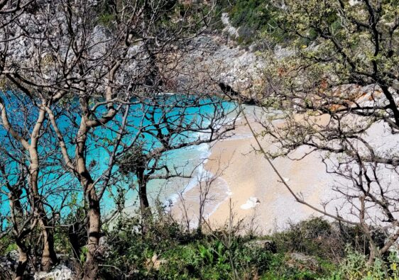
As you climb, the valley below will begin to fade. Several turquoise-coloured springs run alongside the right of the trail. These areas are popular to cool off during the hot summer months.


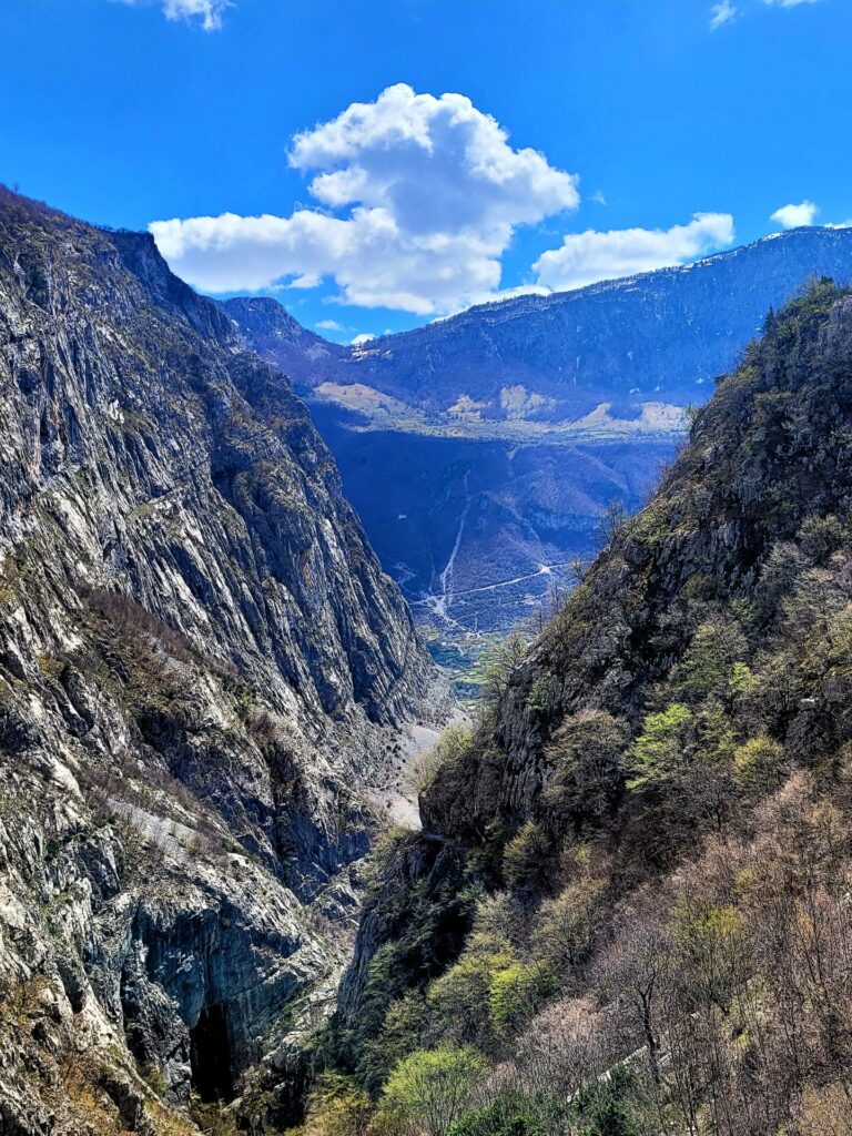
Hugging the cliffside, the trail will continue to climb along the rocky terrain. The narrow trail slowly ascends between the limestone cliffs, moving further away from the lush valley.


Before long, the path passes through some trees. On the right-hand side, the Selca Waterfall can be seen.

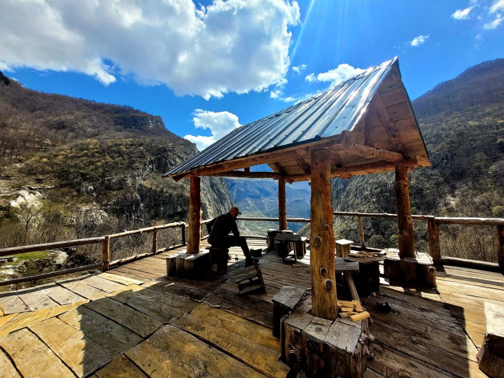
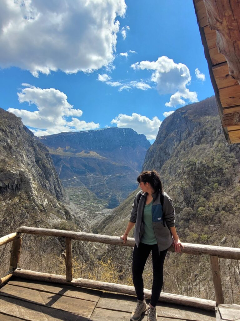
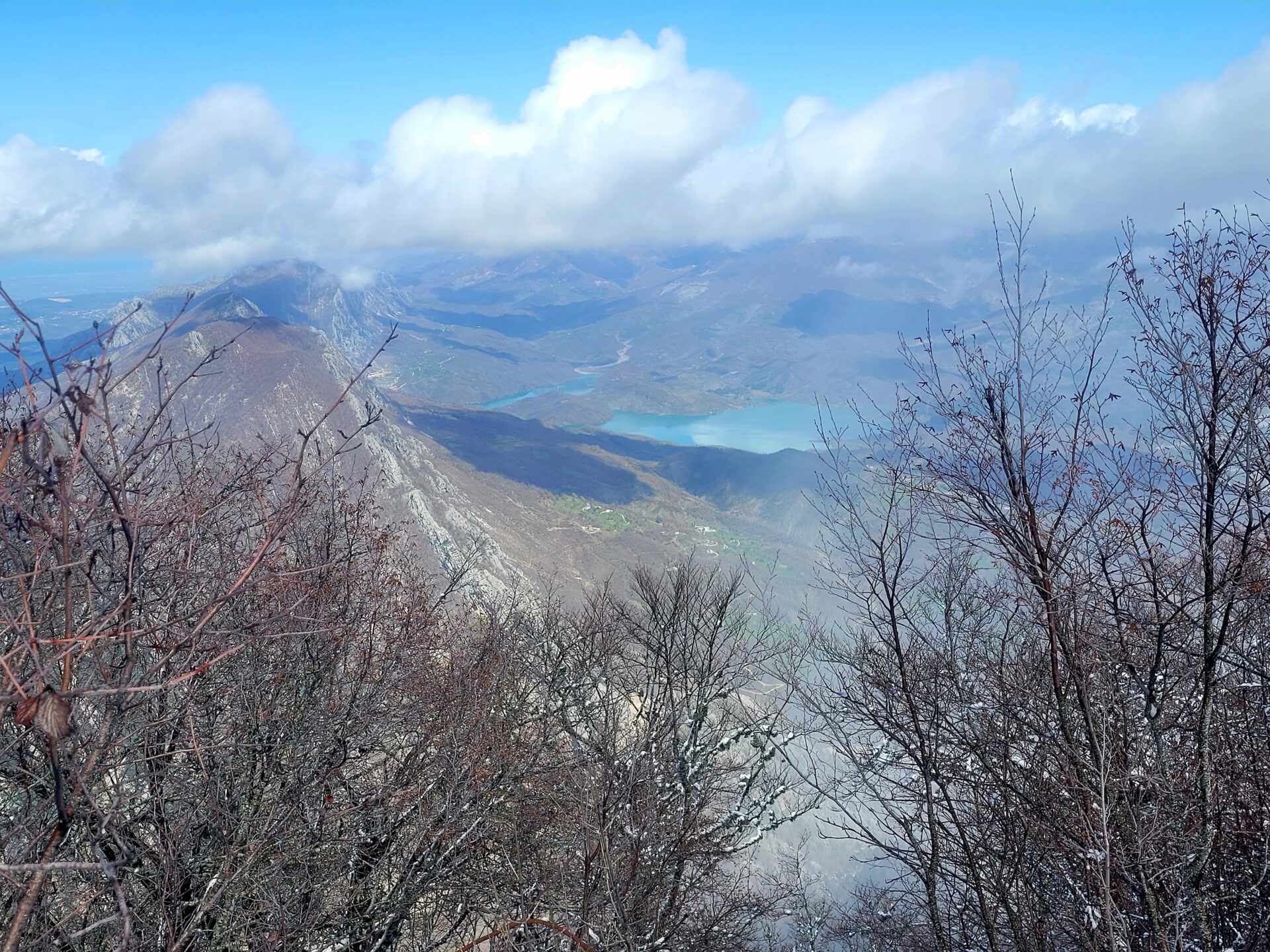
As you make your way through the trees and 3.3km from the trailhead, the path will lead to a camp and viewing platform. Under The Ledge Camp is owned by Anton, a local from the area. This secluded campsite has spectacular views of the valley below.
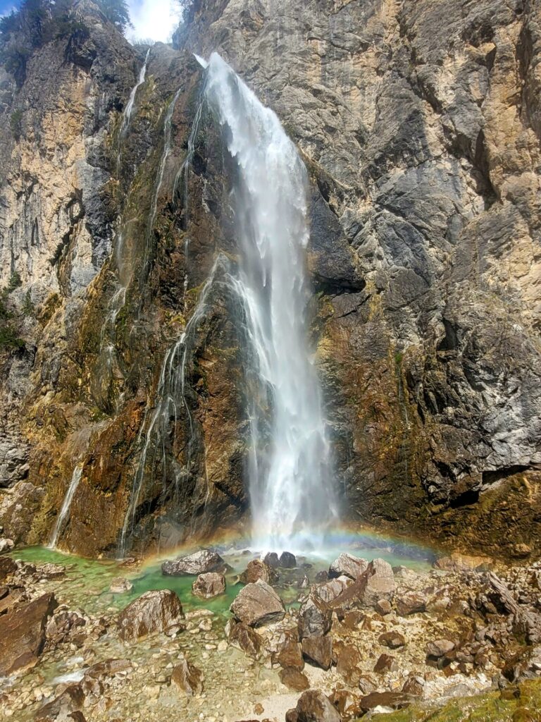
The Selca Waterfall
Continuing past the camp for another 100m, the trail will lead over some questionable wooden bridges. They will hold your weight, regardless of their appearance. The Selca Waterfall will now be in view.


The Selca Waterfall flows 365 days a year and stands over 30 meters high.
The trail down to the waterfall is quite slippery, especially around the moss and rocks. I’d recommend water shoes if you plan on swimming there. Unfortunately, I didn’t get a chance to swim, as the water temperature was too cold.

The Return Journey
To return to the road, retrace your steps along the trail. To avoid the steeper rocky terrain, opt to take the old 4×4 road instead of the path you travelled up on. Just before the 5km mark, there will be another path on the left side. Follow this trail towards the service road.


This road is much wider and follows a pipe down towards the valley. This path runs parallel with the previous path for the next 2km. The trail ends once again on SH20, 300 meters from the original trailhead.


Gorgeous country and the photos are a visual treat for sure. Love the detailed out step by step review of the hiking trail. I wish I had such trails near where I live
All the photos are so so pleasant to the eyes. Love each of them.
Beautiful photos. You give such great detail to your posts. I love them.
WOW, I’m totally adding this Albania hike to my bucket list! Those views are worth it alone and the waterfall is the cherry on top!
Wonderful photos, I wish I could take photos like that 🥲
Amazing photos! Thanks so much for sharing this, I’ll be adding hiking in Albania to my bucket list.
Stunning – not sure about that bridge though. It does look very sketchy!
Woooah what a gorgeous waterfall; I love the way the water cascades down the cliffs. It must look different in every photo. I had no idea hikes could be so fabulous in Albania. That campsite is incredible too!
Wow what an incredible hike. The views at every angle are just absolutely stunning. The curvy road is insane! I love having waterfalls on hikes, they’re always so relaxing to watch fall. Thanks for sharing!
Wow. This waterfall is lovely.