Kananaskis Country is a region in western Alberta that is made up of several parks, including Bragg Creek, Bow Valley and Sheep River. This area is well known for its mountainous landscapes and proximity to Calgary, and hundreds of hiking trails. While the region has a wide range of difficult hikes, this list of easy hikes in Kananaskis is suited for all ages, including children.
Kananaskis Conservation Pass
In order to help preserve the natural environment and wildlife, a daily visitor fee has been introduced to Kananaskis.
Two different types of passes can be purchased. Daily passes cost $15 CAD per vehicle and yearly passes can be purchased for $90 CAD and include 2 vehicles.
The easiest way to get a pass is online at Kananaskis Conservation Pass, or by phone (Alberta Parks Contact Centre at 1-877-537-2757).
Annual Road Closures
Winter can be harsh in Alberta, especially around the foothills and mountains. Every year, Kananaskis has road closures for certain areas. Most closures begin December 1st and can extend until mid May. Check out Alberta Parks for information on the latest public safety updates regarding closures.
Fullerton Loop
- Trailhead Location: Bragg Creek
- Distance: 6.8km
- Elevation Gain: 230m
- Trail Type: Loop
- Difficulty: Easy/Moderate
- Washroom Facilities: Located at parking lot
- Trail Map: Here
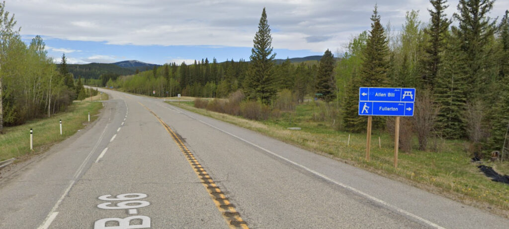
Parking: There are two parking areas. One location is at the Allen Bill Day Use Area (across the road from the trailhead) and the other is the Fullerton Day Use Area.
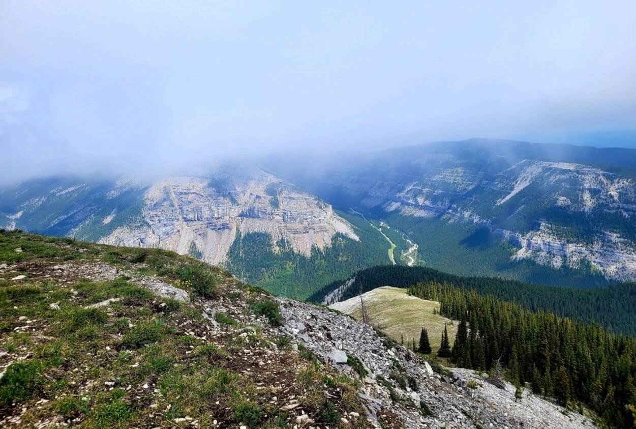
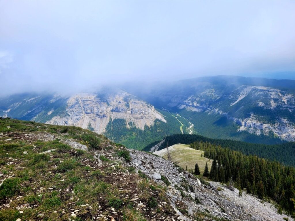
Fullerton Loop is an easy hike for all ages. Located in West Bragg Creek, this short trail can be enjoyed all year long. This loop can be completed in either direction, but most people opt for counter-clockwise to avoid a steeper climb in the early stages of the hike.
Proceeding counter-clockwise, the first half of the hike is a slow incline through forested areas, followed by a steeper decline on the second portion. The path down runs along a steep edge of the hill and outside of the treeline which provides views of the highway, river valley and neighbouring mountains.
This route is very popular with families and dogs.
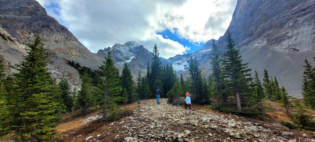
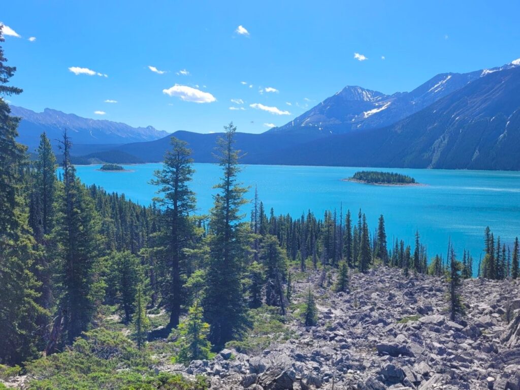
Rae Glacier
- Trailhead Location: Peter Lougheed Provincial Park
- Distance: 8.0km
- Elevation Gain: 462m
- Trail Type: Out and Back
- Difficulty: Easy/Moderate
- Washroom Facilities: Located at parking lot
- Map located here
Parking: Parking is found on AB-40, just after the Elbow Pass sign. Many routes originate from this parking lot, including Elbow Lake.
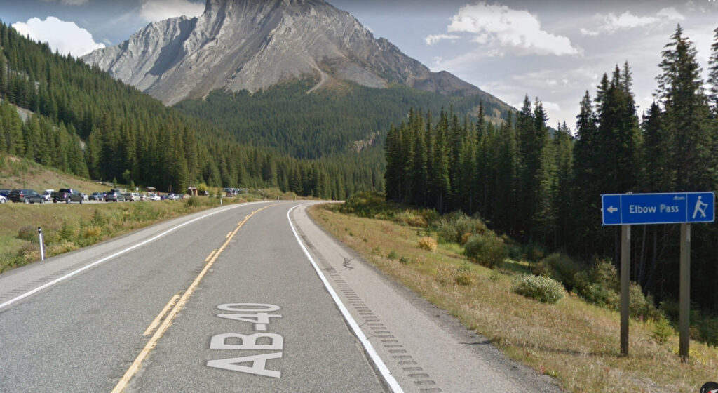
The trail starts with a short steep climb through the forest and ends at Elbow Lake. From the lake, head right and along the perimeter, where you will pass through the Elbow Lake Backcountry Camp. The markers for this trail are far and few once you are past the camp ground.
After walking through and along a dry riverbed, the trail begins to climb slowly up the side of the mountain. This slightly rocky terrain weaves in and out of sparse trees before leading towards the glacier lookout point.
Foran Grade Loop + Windy Point Trail
- Location: Milarville
- Distance: 6.9km
- Elevation Gain: 314m
- Trail Type: Loop
- Difficulty: Easy/Moderate
- Washroom Facilities: None
- Map located here
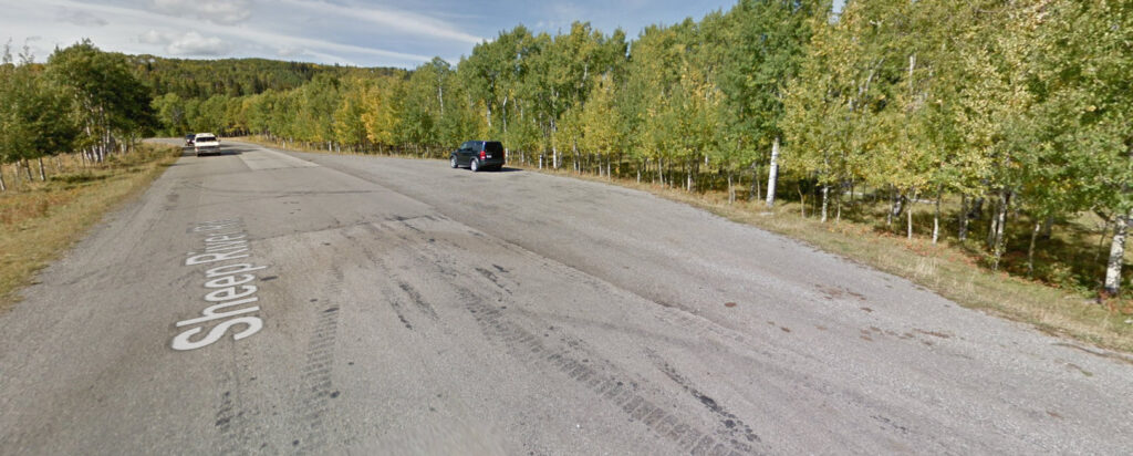
Parking: Off Sheep River Road there is a small roadside turn off on the right hand side, located 1.6km past Sandy McNabb Equestrian Campground.
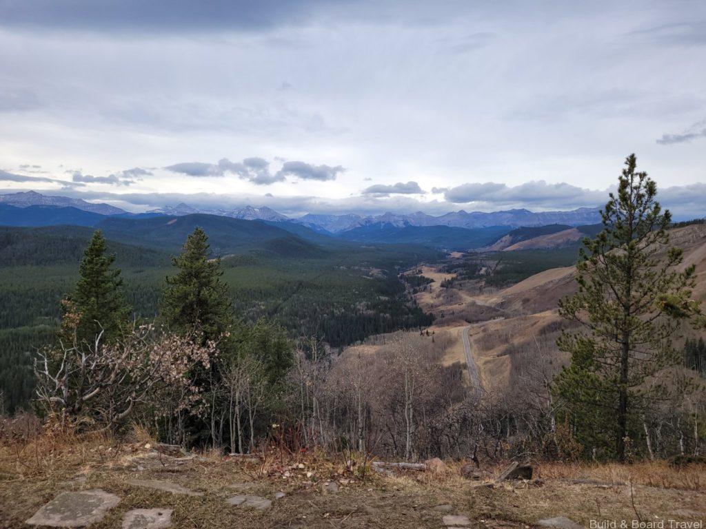
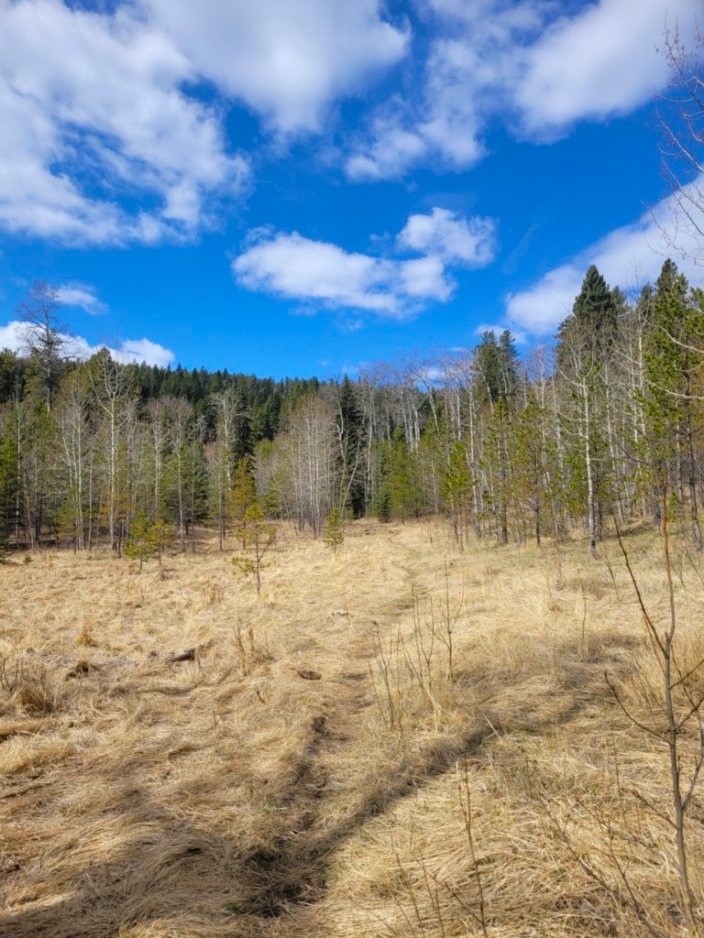
The trail begins off the side of the highway and passing through a meadow with livestock. It then proceeds up into the trees and cuts along a high ridge for the next 1.5hrs. Eventually the trail descends down into another meadow where several additional paths become available.
Heading north leads to Windy Point Trail and towards Death Valley. West will lead up a hill and up to a beautiful viewpoint on Windy Point Ridge Trail. South on Windy Point Trail will loop back through the forest and along the highway towards the trailhead.
The Point
- Location: Upper Kananaskis Lake
- Distance: 7.7km
- Elevation Gain: 494m
- Trail Type: Out and Back
- Difficulty: Easy/Moderate
- Washroom Facilities: At trailhead start and on route (through camp site)
- Map located here
Parking: Parking is located between the middle of the Lower and Upper Kananaskis Lakes.
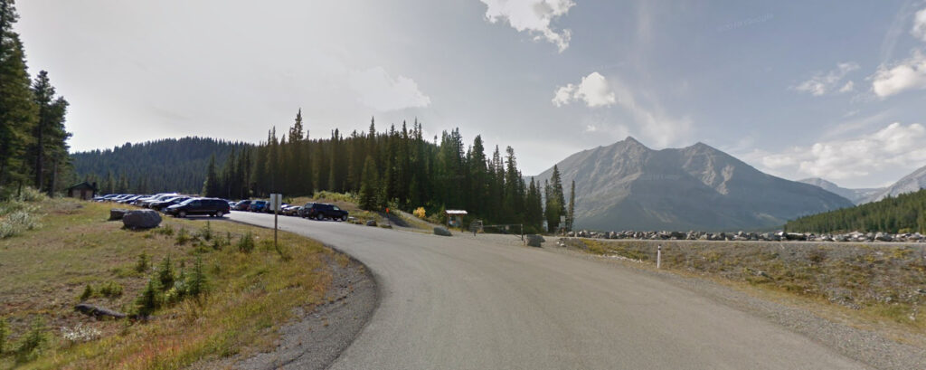
Head north from the parking lot and take the Three Isles Lake Trail. This trail leads through the woods along the base of the mountain. Head left into the rock mounds to continue towards Point Backcountry Campground.
This area has many beautiful views of the lakes and picnic areas. Head back towards the rocky mounds and stay towards the right hand trail along the waterfront. This trail is more scenic and less rocky than the original route.
Snowshoe Hare Loop
- Location: Bragg Creek
- Distance: 5.5km
- Elevation Gain: 167m
- Trail Type: Loop
- Difficulty: Easy
- Washroom Facilities: At parking lot
- Map located here
Parking: West Bragg Creek Day Use Area
This hike can be done in either direction. With little to no elevation gain, this path is perfect for children and dogs. Follow the main trail into the woods from the parking lot near Meeting Point E. This easy forest walk provides shade coverage for approximately 80 percent of the hike.
During the spring season, the trail can however get a little muddy. It’s also a very popular area to snowshoe during the winter.
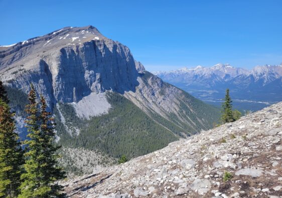
Prairie Mountain
- Location: West Bragg Creek
- Distance: 6.6km
- Elevation Gain: 666m
- Trail Type: Out and Back
- Difficulty: Moderate
- Washroom Facilities: None
- Map located here
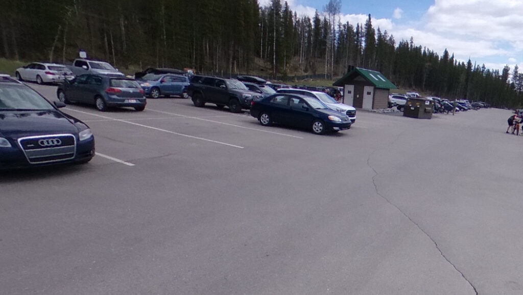
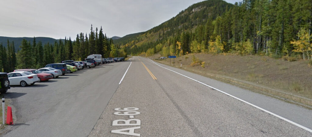
Parking: Roadside turn off on left hand side off AB-66, 260m before Powderface Creek Trail parking lot.
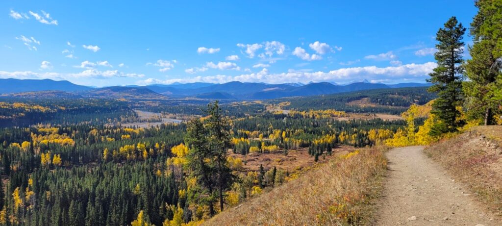
Prairie Mountain is probably not considered an easy hike, but it’s one that should still be attempted. This moderately challenging hike in West Bragg Creek is a fan favourite. While this hike may be short, the route is a constant uphill climb with very minor breaks in elevation gain. From the parking lot, cross the road and head right for approximately 100m to access the trailhead.
The slow, steady climb gets significantly steeper around the halfway point. The trail widens and disperses through the trees, allowing you to use the rocks and tree roots to your advantage and find the easiest path. The final ascent to the summit is less steep but exposed to the elements. Lacking a peak, Prairie Mountain instead has a large, flat plateau, which provides stunning views of the neighbouring mountains and valleys

It’s nice to hear the details of all the great pictures you post of your family adventures. Great work..
I’ve driven through Kanasakis but not done any hiking; I need to fix that ASAP! These all look beautiful, but the Snowshoe Hare Loop looks the most intriguing.
The Snowshoe Hare Loop looks like just my speed! There are honestly too many beautiful hikes. I pinned for later!
Your picture really motivate me to explore Canada. The lakes and glaciers look unreal.
Quite a nice assortment of hikes of varying difficulty levels, but all with some great scenery!
Some of them have incredible views! Definitely make me wanna go explore Alberta soon!
These all look amazing & always great to find easy hikes with fantastic views. Am heading to Canada next year…I may be able to do a couple!
The countryside is stunning. I wouldn’t mind a bit of hiking with these views!
The photos are simply amazing.
I love this! Thank you for such a practical guide to such a beautiful place! As someone who comes from a really flat environment I always appreciate the easier hikes!
I lived in Calgary from age 6-21. Really miss the kananaskis. Thanks for the article.
Great post! It’s quite amazing how many outdoor adventures can be found in the Calgary area. It seems though many people visit Banff and Lake Louise, and Kananaskis and other awesome places are often overlooked. So thanks for writing about it 🙂
It’s very true! Kananaskis offers better views of the mountains, hiking and adventures, all without the crowds.
I had no idea that Alberta was so beautiful! Adding it to my bucket list now!
Oooh this is so cool! I really need to spend some time in Kananaskis country and attempt some of these. It’s pretty amazing how good the views can be for such short hikes/adventures! I would be very tempted to purchase a yearly pass and get hiking!
Wow! All of these hikes look incredible. If I had to choose though, I think I would start with the Snowshoe Hare Trail. I found all of the information, especially the bullet points, extremely helpful. This is a great guide. I am saving for when I visit Canada with my family!
I love it when the nice views can be found even right from the start of the trail – it’s so motivating to keep you going!
I love all these pictures. What a beautiful area! I would love to visit!
Such a beautiful views and a great opportunity to enjoy nature on a hike with children.
[…] Calgary may be well known for its proximity to Kananaskis country and the Rocky Mountains, Fish Creek Provincial Park is one of the best natural green spaces for […]