Standing at over 2600m high, Pic Boby, also known as Pic d’Imarivolanitra, is the second tallest mountain in Madagascar and found in the stunningly beautiful Andringitra National Park. The trek to the summit and neighbouring trails takes anywhere from 2-4 days to complete and is moderately challenging. Elevation gains and loses of 500m are common throughout the trail.
This 4 day, 3 night Pic Boby hiking guide starts in Namoly and ends in Tsaranoro Valley. This route passes through many micro climates and showcases some gorgeous scenery including waterfalls, plateaus and one are that looks like it belongs on the moon.
Practical Information
- Where: Andringitra National Park, Madagascar
- When to Visit: Mid April-October
- How Many Days: 4 days
- Type of Hike: Point to point, Namoly to Tsaranoro Valley
- Washroom Facilities on Route: None on route, drop down toilets at camp sites
- Accommodations: Wild camping
- Entrance Fee: 45k ariary/day
- Guides: Mandatory
Best Season to Hike in Andringitra National Park
Madagascar has two main seasons: dry and rainy. The dry season begins in May and ends in October, Temperatures can range from 15-29 degrees Celsius, but drop significantly in the central highlands.
The rainy season runs from November until March. This also coincides with the cyclone season. Temperatures can rise to 32 degrees Celsius and rainfall is at it’s highest.
If you want to see the lush green landscapes and practically have an entire national park to yourself, I would suggest visiting in April-June.
Temperatures are comfortable throughout the day, flowers are in bloom and the landscape has not yet turned brown and barren (typically around October).
The nights in Andingitra can be very chilly during the dry season, especially since one of the camp sites is located at 2000m above sea level.
Tour Guides
In Madagascar, it is mandatory to take a guide with you in every national park. Some paths closer to the outskirts are able to be completed alone but any trails venturing into the heart of the parks require someone to be with you.
This is essential due a lack of definition to the rugged trails and a lack of signage. It also gives back to the community and country, as Madagascar relies heavily on tourism.
You can find everything you need at the park headquarters or arrange everything in advance.
I arranged to complete this hike is 4 days, 3 nights with Madagascar Mosaic. I was provided a local guide named Rolland, porters and my driver cooked our meals. Food, water and a tent were also included.
Rolland also provides his own tours and I highly recommend his services, as he was an excellent guide. He went above and beyond to make me feel welcomed and educated me on the local plants and wildlife.
ZANADRINGITRA TREKKING
E-mail: biavindrainyrolland@gmail.com
Facebook: Rolland Zanandringitra
Essential Hiking Gear
While this hike can be attempted by various fitness levels it’s always good to make sure you have the proper gear to have a safe and fun adventure.
What to bring
- Rain gear
- Sleeping bag (if not provided)
- Extra layers for the chilly nights
- Hiking shoes/boots
- Anti-malaria pills
- Extra water and food (guides usually provide)
- Sunscreen and bug spray
- First aid kit
Getting to Trailhead
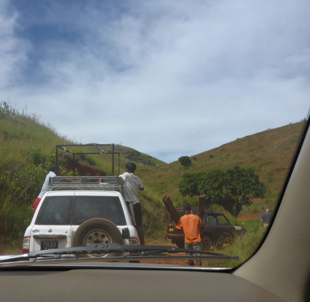
The village of Namoly is the start of the trail to Andringitra National Park. To get there, head south on the RN7, past Ambalavao. The road will veer off for around 40km which due to the quality of the roads, could take up to 2 hours.
This unpaved road is an adventure in itself. Giant pot holes, gorgeous views and broken bridges scatter the route.
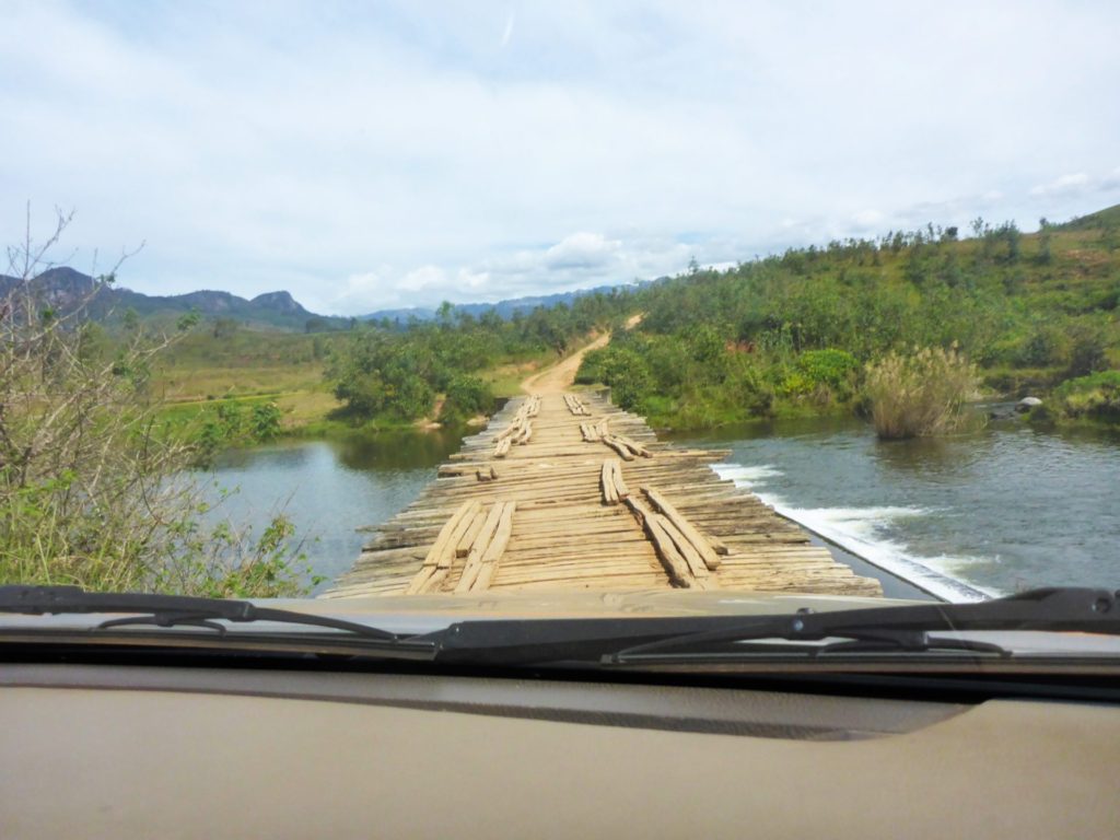
I was fortunate enough to be part of a SUV convoy that brought extra planks of wood to pass over some questionable bridges.
If you have successfully made it through the 2 hours without any vehicle or bridge related issues, your final destination will be at the park headquarters. Here, you can gather the guides, porters and pay your daily fees for the next few days.
Stage One
- Route: Namoly to Belambo
- Duration: 3 hours hiking
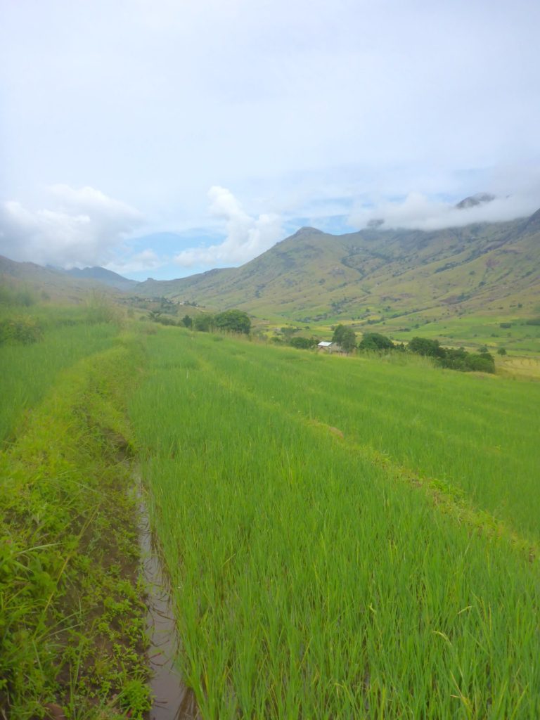
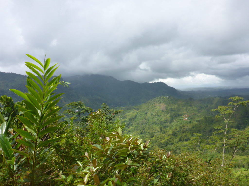
The hike begins near the small village of Namoly, Passing through the village, the trail starts to climb into the hills, revealing the lush green landscapes and rice terraces.
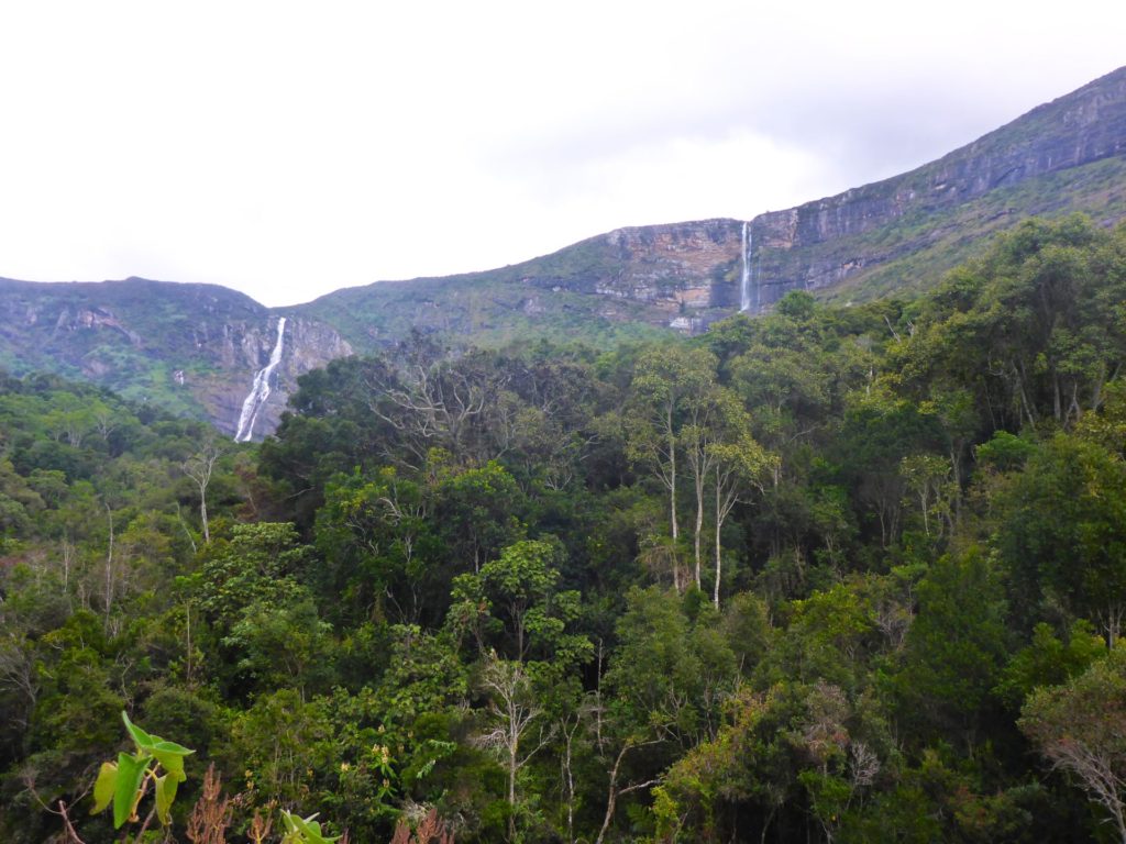
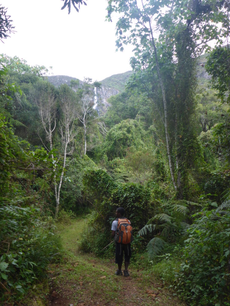
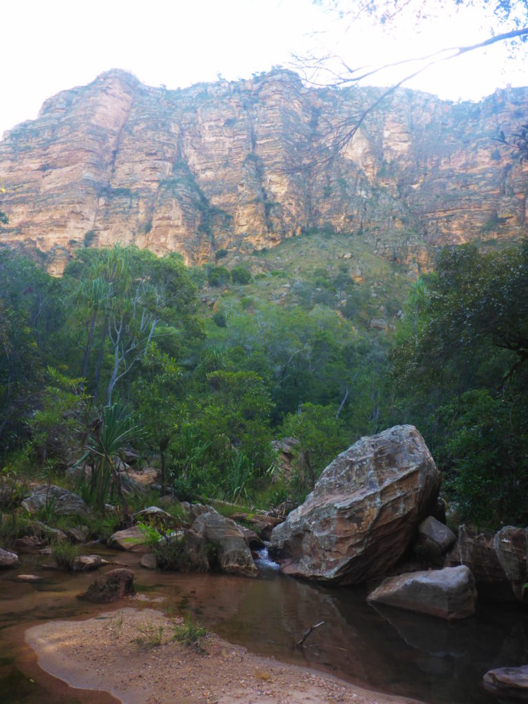
The trail ventures into a mossy covered forest, with views of two of the beautiful water falls: Riandahy and Riambavy.
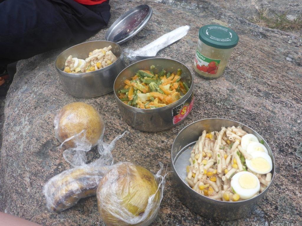
The hike was around 3 hours and we returned back to our campsite for the evening in Belambo. Hoby, the driver and chef, prepared afternoon tea before cooking a lovely zebu dinner with rice and veggies.
The evenings are very chilly and damp, it is strongly recommended to pack extra layers to stay warm.
This area was prone to spiders, so be weary when using the bathroom at night, as it is very easy to stumble through the webs.

Stage Two
- Route: Belambo to Andriampotsy
- Duration: 7 hours hiking
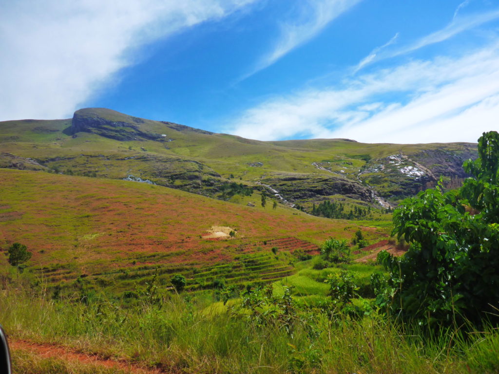
After a breakfast of tea, toast and fruit, the climb continues up the Andohariana plateau. Today was a bit warmer, but not overbearing. The elevation gain was 500m and the final campsite sat at over 2000m above sea level.
My guide educated me on the plants and their medicinal uses in the local communities. We even came across a passion fruit tree, with fresh fruit.
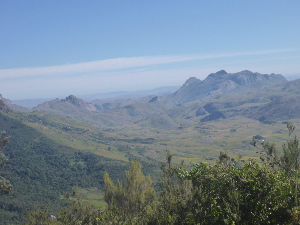
On the journey to the plateau, I passed by many chameleons basking in the sun. There was a distinct change in scenery. The mossy large forests were replaced with smaller scrubs and it was warmer and arid.


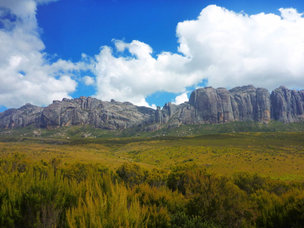
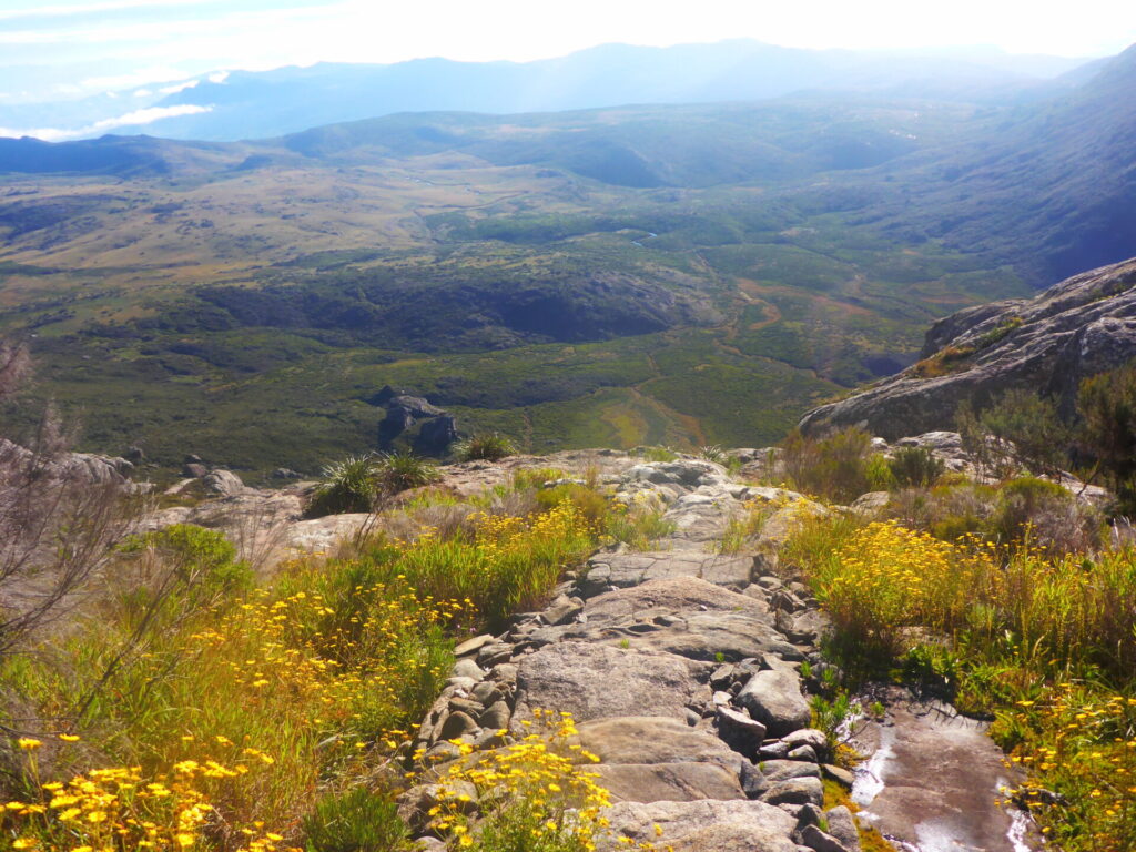
The plateau approach was my favourite part. Little flowers bloomed everywhere and the granite mountains were so unique and interesting looking.
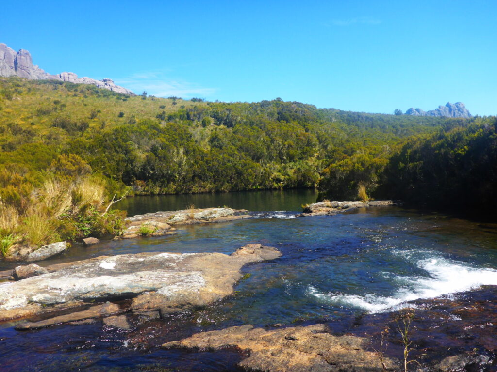
We stopped for lunch by a river and enjoyed a swim. The water was clear (otherwise I wouldn’t have gone in) but so cold! Even my guide only stayed in for a few minutes. But at 2000m you can’t expect it be to the temperature of a bath.
Around late afternoon we made it to Andriampotsy where the campsite for the evening was located. I had some free time to explore the area a bit more.
I cannot express the level of peace the silence of this place gave me. No traffic, airplanes or other tourists, only the wind.
At dinner, the guide taught some Malagasy and French, while I introduced him to Bejewelled on my phone.
There was a thunderstorm was off in the distance and the height of the camp provided a spectacular view of it. We were lucky enough to have it spare our camp and we were able to watch the light show from afar.
Stage Three
- Route: Andriampotsy/Pic Boby/Iataranomby
- Duration: 8 hours hiking
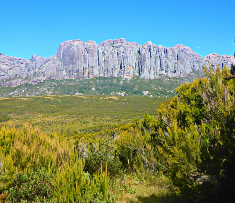
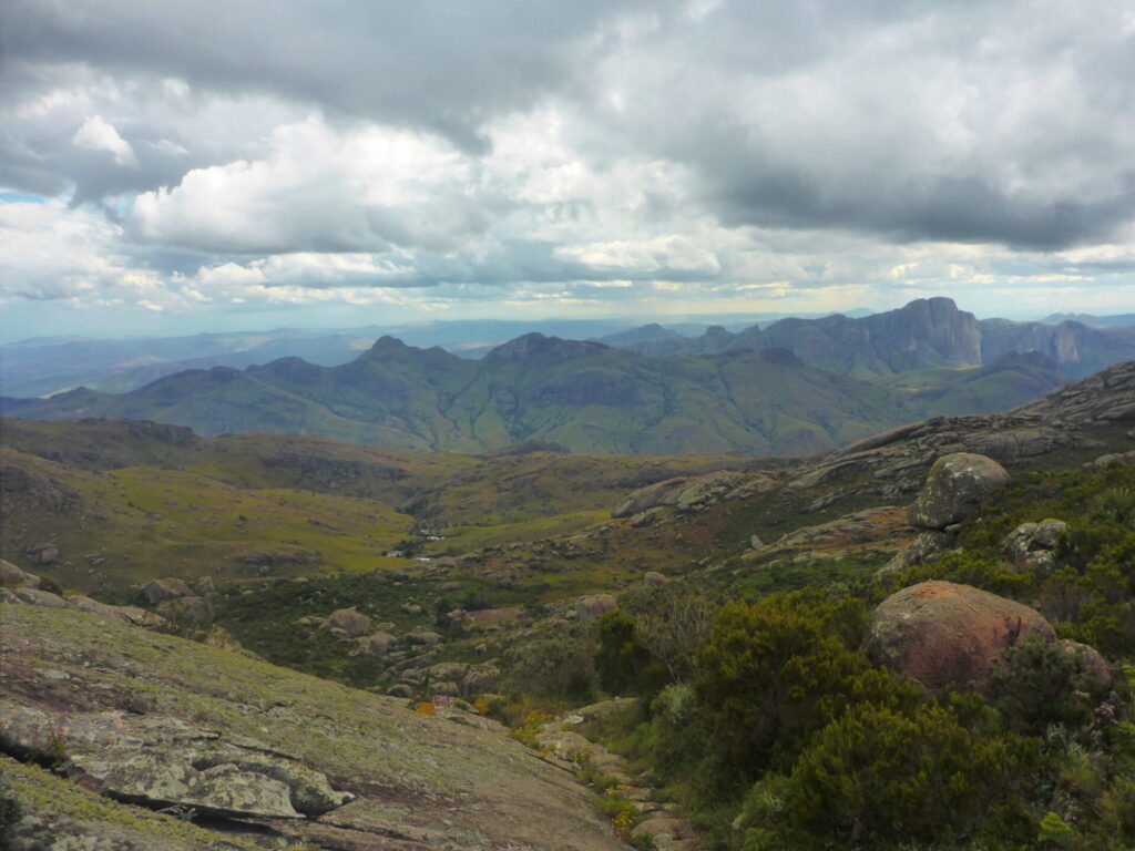
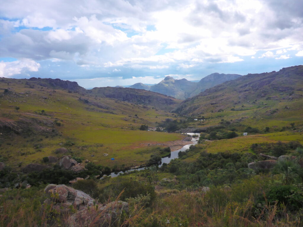
After an early breakfast, we starting our climb to the 2nd highest mountain in Madagascar. Pic Imarivolanitra, also known as Pic Boby, sits at 2658m and provides panoramic views of the below valleys.
We climbed over 600m in under 2 hours to reach the summit. I don’t recall it being overly difficult, but the route wasn’t marked clearly. As soon as I made it to the summit, the weather changed drastically.
What was a clear view became entirely obstructed as the fog rolled in. It was a little disappointing but I loved the scenery so far so I wasn’t too bothered by it.


I guess other travellers were upset with the views as well, as they left some funny notes at the summit. On the way down, I briefly passed by the only 2 other tourists I would come across for the entire 4 days.


We descended back down to our camp for some lemongrass tea and then continued onward. The clouds were moving in and sprinkled us with some light rain for a few hours on and off. The temperature was still in the 20s, so it was a warm light rain.
We ate a big lunch before continuing on to the next are of the trail. It’s ridiculous how much food its prepared. I could barely finish it.
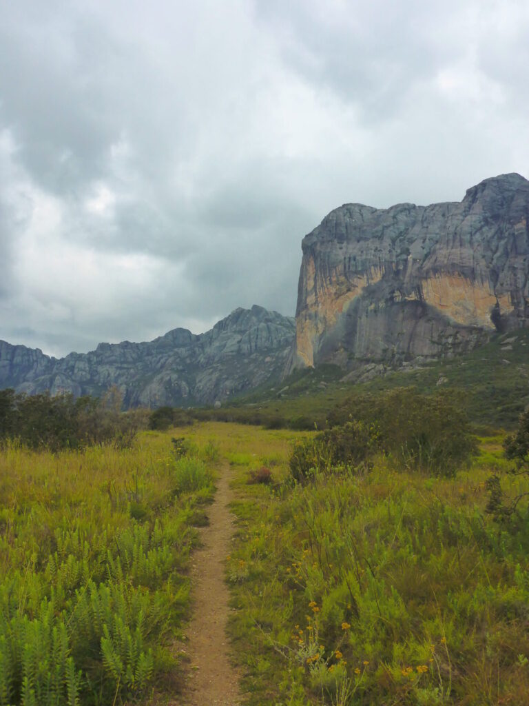
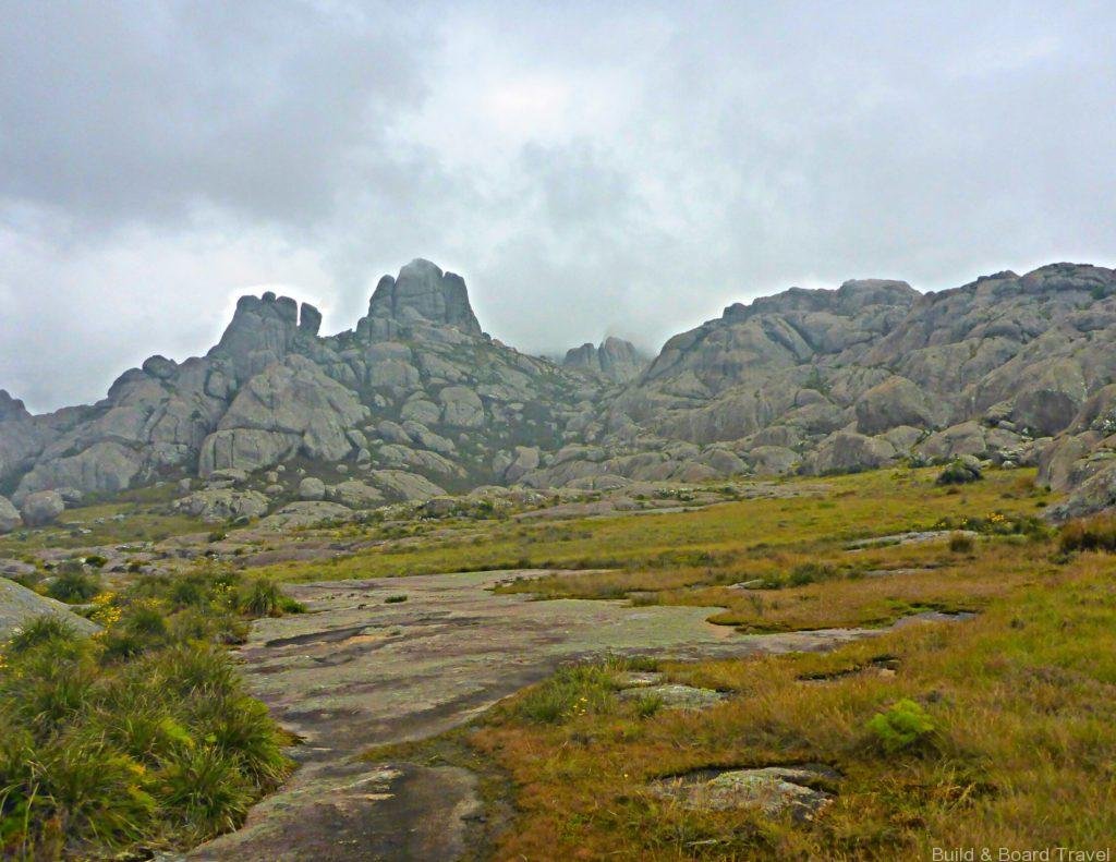
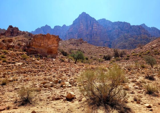
The next section of trail is known as the Alien Corridor. There is far less vegetation and wildlife and the terrain became more rocky and jagged.
It gets its namesake from the terrains similarity to the moon, it would not be a far stretch to imagine yourself on a moonwalk while making your way through this area. I was told this is where ring tail lemurs like to explore but sadly didn’t come across any.
On the decent down to Iataranomby, we came across palm trees. At an elevation of 2000m they seemed wildly out of place. This section of the trail was a little steep getting down.
The rain made the smooth rocks slippery. But like any mountain range, the weather can change at any moment.

And it did. As we saw our camp on the horizon, the sun came out and it was warm again.
That evening, it rained slightly but it was the warmest night by far. I ditched the toque and jacket.

Stage Four
- Route: Iataranomby to Tsaranoro
- Duration: 4 hours hiking
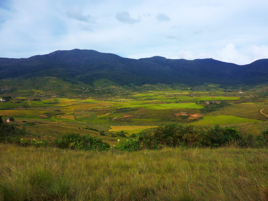
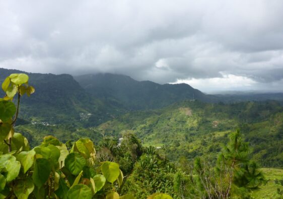
The final day of the hike started after breakfast towards the Tsaranoro Valley. The morning started off warm and quiet. The landscape reminded me of something from the English countryside.
As the mist cleared, the valley below was revealed. I was fortunate to have experienced this as it was completely breathtaking.


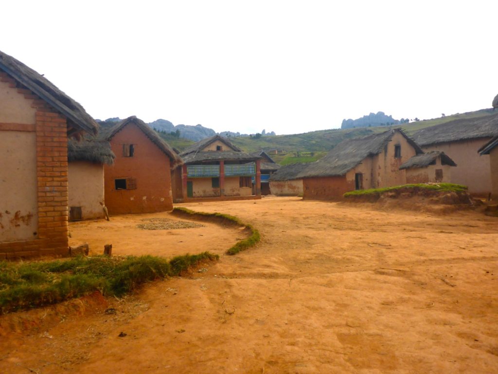
The route down towards the villages was a small switch back path. It took around 2 hours to descend down the mountain. We passed by Barabory villages and walked along the rice fields.
It was nice being on flat ground again. It’s incredible to look back and see how high we actually were up. The hike concluded at the small village of Morarano.
Accommodations
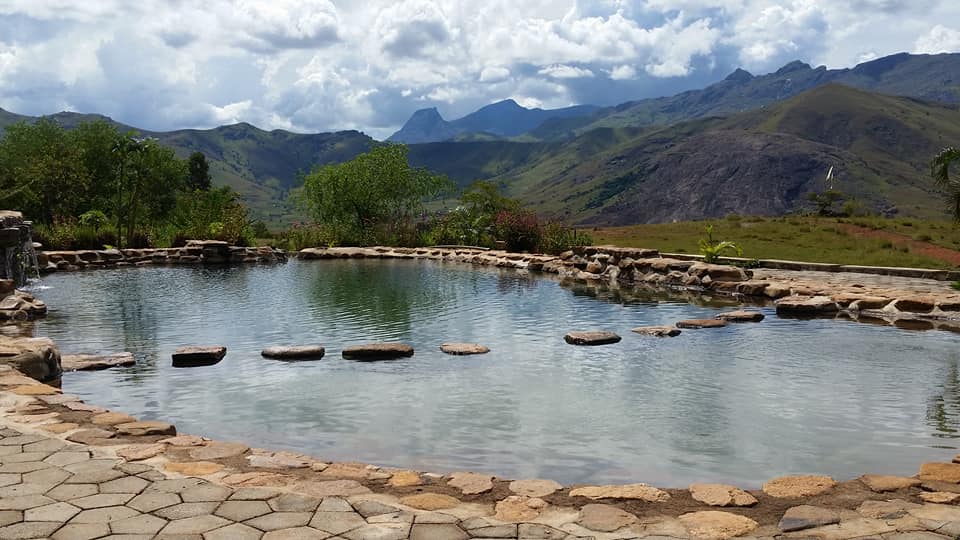
The only accommodations available while hiking is wild camping and the occasional hut (usually reserved for porters). That being said, there are some great options at the end of the hike, including Camp Catta. This eco resort has various lodges styles, a natural swimming pool and a restaurant on site.
It’s powered by solar energy, which activates in the evening. Charging stations can be found in the restaurant.
It is also home to several ring-tailed lemurs who enjoy sunbathing!
Further Exploring
Here are two additional national parks to add onto your next adventure
Isalo National Park
Located in southern Madagascar, Isalo NP is very popular with tourists. Natural limestone cliffs emerge on the dry plains, housing various lemurs, natural swimming areas and canyons. Guides are mandatory and hikes can be arranged for 1 hour or several days.
Ranomafana National Park
Ranomafana is located in the south east of Madagascar. This rainforest is known for beautiful views and scouting out lemurs. It’s a great alternative to Andasibe National Park. Guides can be arranged at the headquarters but no overnight camping/trekking is permitted.
Want more multi-day hikes? Check our some of my other posts including The Fishermen’s Trail and The West Highland Way
This seems like an incredible adventure! I love all the chameleons, and I would definitely appreciate the guides bringing extra wood for sketchy bridges!
I know right? It was crazy but so much fun
Squeee this looks like an amazing adventure! The scenery is incredible (and varied) plus it is great that the route is split into such manageable sections.
p.s. those notes at the top are pretty hilarious, but I feel bad that those other hikers were so mad at the top!
I definitely recommend opting for the 3 or 4 day itinerary. Some people try in 2 days, but that’s alot of elevation gains/loses in one go
Wow!I have never been on an overnight (or multi-day) hike before, but this one looks so amazing. The scenery is just stunning! It seems like a fantastic adventure!
My favourite adventure by far
Oof, hiking in an African sounds like my dream – thanks for sharing this wonderful guide, definitely saving it for later!
It was a dream come true for me for sure!
Wow! What an adventure! The notes at the summit other climbers left were funny but you’re right it’s all about taking in the scenery along the way sometimes too.
This looks amazing! And if you got the whole place to yourself the experience must have been even better. Those notes were funny!
I wish I had the courage to hike like this. But I’m scared of anything smaller than me that doesn’t say mommy 🙈 My husband however hikes in the mountains and hills here in the UK. I love your post and how much info you have given. Maybe one day I’ll bite the bullet and give it a go!
Wow, what a great adventure this sounds like. Glad you had a great time!
Wow, what an adventure! I’d never heard of this hike nor have I ever done a multi-day hiking trip; it sounds pretty intense, but it seems like this one was broken down into fairly manageable stages and is probably well worth the effort for those gorgeous views! Thanks for sharing! Xx Sara
I’ve always wanted to go to Madagascar! This is just so stunning, what an amazing adventure! Thanks for sharing 🙂
This looks amazing! I love hiking but never contemplated doing a multi-day trek. Your posts are inspiring me to do though!